Primaresburg: A Medieval Castle Site in Styria, Austria
Site at a Glance
- Popularity
- Medium
- Country
- Austria
- Primary era
- Medieval
- Eras represented
- Stone Age, Bronze Age, Medieval
- Civilizations
- Duchy of Styria, Habsburg, Holy Roman Empire
- Site type
- Military
- Remains
- Castle
On this page17 sections
History
Primaresburg was a medieval castle site on Franziskanerkogel in Styria, Austria, interpreted as the location of a Carolingian-period stronghold, from the era of the Frankish ruling dynasty, perhaps built around 800. The date of its first fortification remains uncertain. Archaeological evidence indicates a much longer history of activity on the hill, while the castle later served as a military position and a center of lordship and administration.
Early occupation and the proposed Carolingian fort
People occupied Franziskanerkogel from the Copper Age. A substantial settlement flourished there during the Urnfield period, a Late Bronze Age culture associated with burying cremated remains in urns, in the ninth or eighth century BCE. Finds also indicate Roman-period activity from the first century CE to the beginning of the fifth.
The hill’s first stronghold may have been erected around 800, but later construction has made it difficult to confirm this early fort archaeologically. The Eppenstein family probably fortified the hill from the early ninth century to protect routes linking their center near Wildon with their lands in the County of Judenburg. The site’s position on two trade routes also supported a military role. Tolls on goods crossing the Stubalpe are recorded, and the castle probably became a seat of lordship and an administrative and economic center, particularly for Piber parish. Local activity included farming, grain production, livestock, forestry, use of the Piber Alpine pasture and horse-keeping.
On 13 April 1000, Holy Roman Emperor Otto III granted Margrave Adalbero of Eppenstein 100 royal hides, a medieval measure of land, within his frontier territory known as the March on the Mur. The grant covered much of what is now Voitsberg district, including Franziskanerkogel. The name Primaresburg appears in a document from 1060 to 1066 as Primarespurch. The document places it at a boundary defining Piber parish’s sphere of influence in a settlement over tithes, church levies often paid from produce or income, between Archbishop Gebhard of Salzburg and Margrave Markwart IV of Eppenstein. It does not identify the castle’s owner, though Eppenstein control is considered likely. Primaresburg is among Styria’s earliest recorded seats of lordship and administrative centers.
Disputed ownership and changing lords
Count Heinrich III endowed the Benedictine abbey of St Lambrecht with Piber parish and nearby properties in 1103, but whether the grant included Primaresburg is unknown. When the Eppenstein male line ended in 1122, their principal heir, Leopold I of Traungau, received their lands and dependent service nobles, as well as the secular protection and legal authority associated with St Lambrecht. Primaresburg may have passed to the Traungau family at that time if it was not already monastic property. Its ownership from the twelfth century onward remains contested between Styria’s territorial rulers and the abbey.
Documents from 1185 and 1190 identify Starchant of Primaresburg as a vassal, or dependent noble, of Otto of Graz, who may have exercised authority over the castle. In 1202, Duke Leopold VI of Styria exempted the mountain of Primaresburg from a land transfer involving St Lambrecht and the Wildon family. The wording does not settle whether the site belonged to the abbey or the territorial rulers. Finds from this period may reflect occasional reuse of older structures rather than the presence of a newly built high-medieval castle.
By 1265 or 1268, the Wildon family probably held Primaresburg. In 1268, Hartnid III and his brother Herrand II of Wildon, together with Friedrich of Pettau, were accused of conspiring against King Ottokar II Přemysl, who was then also Duke of Styria. Ottokar had the men arrested and later freed them in exchange for their castles. He probably ordered Primaresburg dismantled, although the extent of the work is uncertain.
Fourteenth-century use and the site’s decline
Primaresburg remained in use during the fourteenth century. After Ottokar surrendered his possessions to King Rudolf I in 1276, the castle probably returned to the Wildons. Two years later, Rudolf resolved a dispute between Herrand II and Hartnid III over rights to the castle in Herrand’s favor. Around 1300, the territorial ruler probably granted it to the Stadeck family, whose male line ended in 1399. Documents from 1301 and 1320 use Primaresburg as a landmark.
In 1377, Abbot David Krall of St Lambrecht granted the Liechtenstein family land around Primaresburg. This is generally understood as a grant of the surrounding territory, though a short-lived transfer of the castle itself has also been proposed. After the Stadeck line ended, Gueta of Stadeck’s marriage to Ulrich of Montfort brought Primaresburg to the Montfort family in 1400. In 1403, Abbot Rudolf Lichtenegger granted the Montforts the Stadeck fiefs, including the castle site, which was probably already in ruins. Why the abbey, rather than the territorial ruler, made this grant remains unclear.
In 1415, Duke Ernst the Iron authorized the Gradner family to build a residence or fortress at a castle site near Lankowitz, which may have been Primaresburg. A Montfort record from 1420, however, describes Primaresburg as a deserted castle site belonging to the family. It is uncertain whether the Gradners started work. Their plans were abandoned when Georg Gradner began building Lankowitz Castle in the valley around 1440. Documents continued to use the name in the late fifteenth and sixteenth centuries, sometimes referring to a mountain rather than a castle. The lordship based at the new valley castle is considered the successor to the southern part of Primaresburg’s territory. The hill appears to have lost its earlier importance during the fourteenth or fifteenth century.
Rediscovery and archaeological work
By the nineteenth century, the location of Primaresburg had been forgotten. Karlmann Tangl proposed Premstätten in 1850; Joseph von Zahn later suggested Rüstkogel, where masonry probably belongs to the castle of Schaflos. Hans Kloepfer proposed Franziskanerkogel in 1912, and Ludwig Stampfer supported the identification in 1920, citing the hill’s former land-register name, Primaskogel, local farm references and the summit terrain. Robert Baravalle instead placed the castle north of the hill in 1926. Hans Pirchegger and Herwig Ebner challenged that proposal in 1955, after which Franziskanerkogel became the generally accepted location.
The State Museum Joanneum excavated at the site in 1984 and 1986 under medieval archaeologist Diether Kramer. In 2020, a University of Graz teaching excavation led by Levente Horváth and Iris Koch investigated four areas in the core castle and its neck ditch, a cut across a narrow approach to a hilltop. The excavated areas were taken down to bedrock and then backfilled. A forestry road cut through the site around 2000 and substantially altered the neck ditch; monument protection was subsequently put in place to prevent further ground disturbance. Timber hauling after a 2008 storm reshaped the upper slopes and exposed a wall edge south of the core castle. Southern walls were also exposed again after the 1980s work and partly rebuilt without distinguishing their original fabric.
Remains
Summit and overall layout
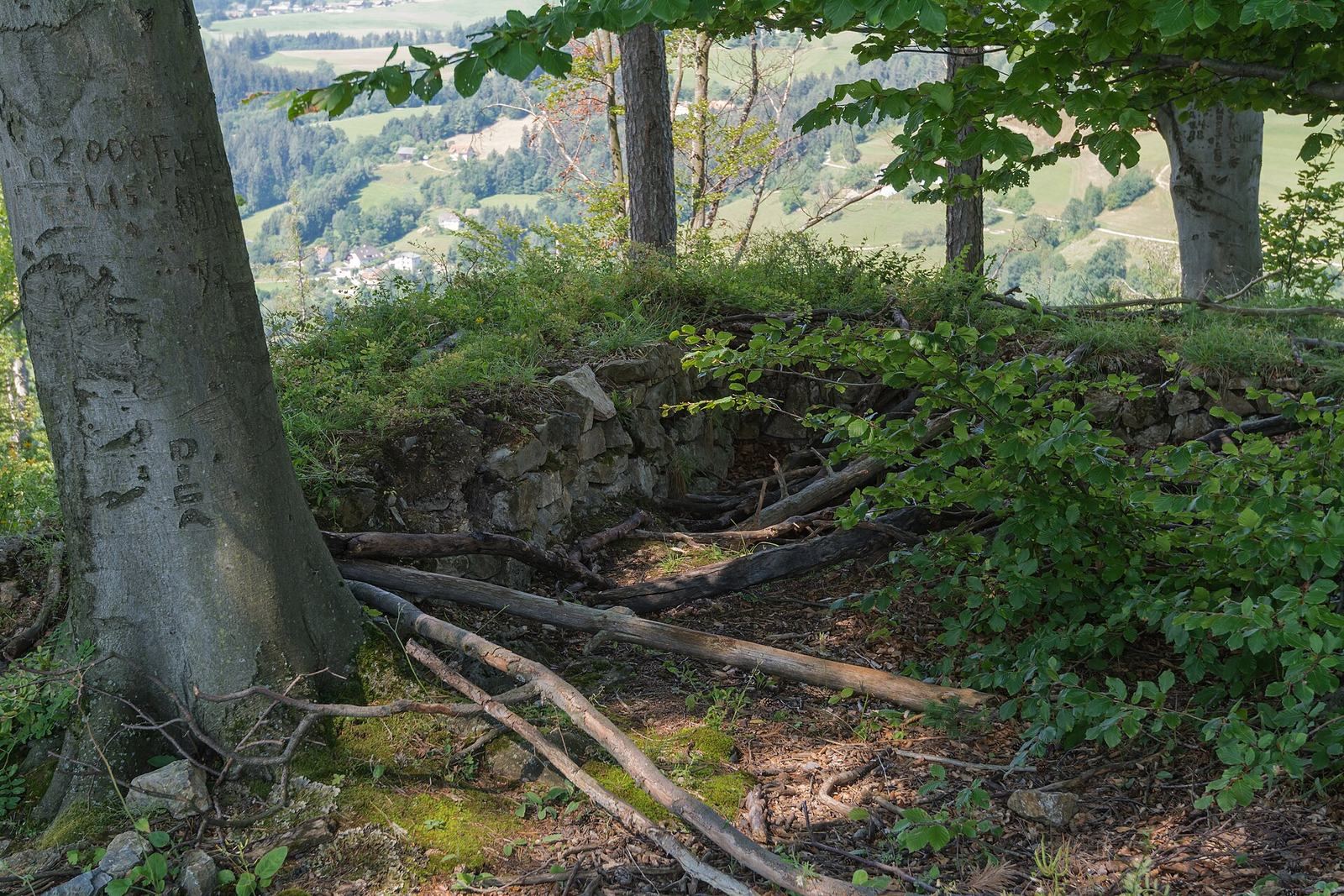
The surviving remains occupy the flattened summit of Franziskanerkogel, a spur of Laudonkogel that rises to about 713 metres above sea level. The hill stands roughly 200 metres above the Lankowitzbach valley. The summit falls steeply to the north, west and south; the stream borders it to the north and east, while rocky ground offers natural protection on the western side. The castle’s central platform was roughly rectangular, about 30 by 40 metres, and formed part of a three-part arrangement of central and outer defended areas. The position has views toward Voitsberg and nearby fortifications, as well as southeast toward the southern Graz Basin and Wildon.
Core castle
Enclosure and entrance
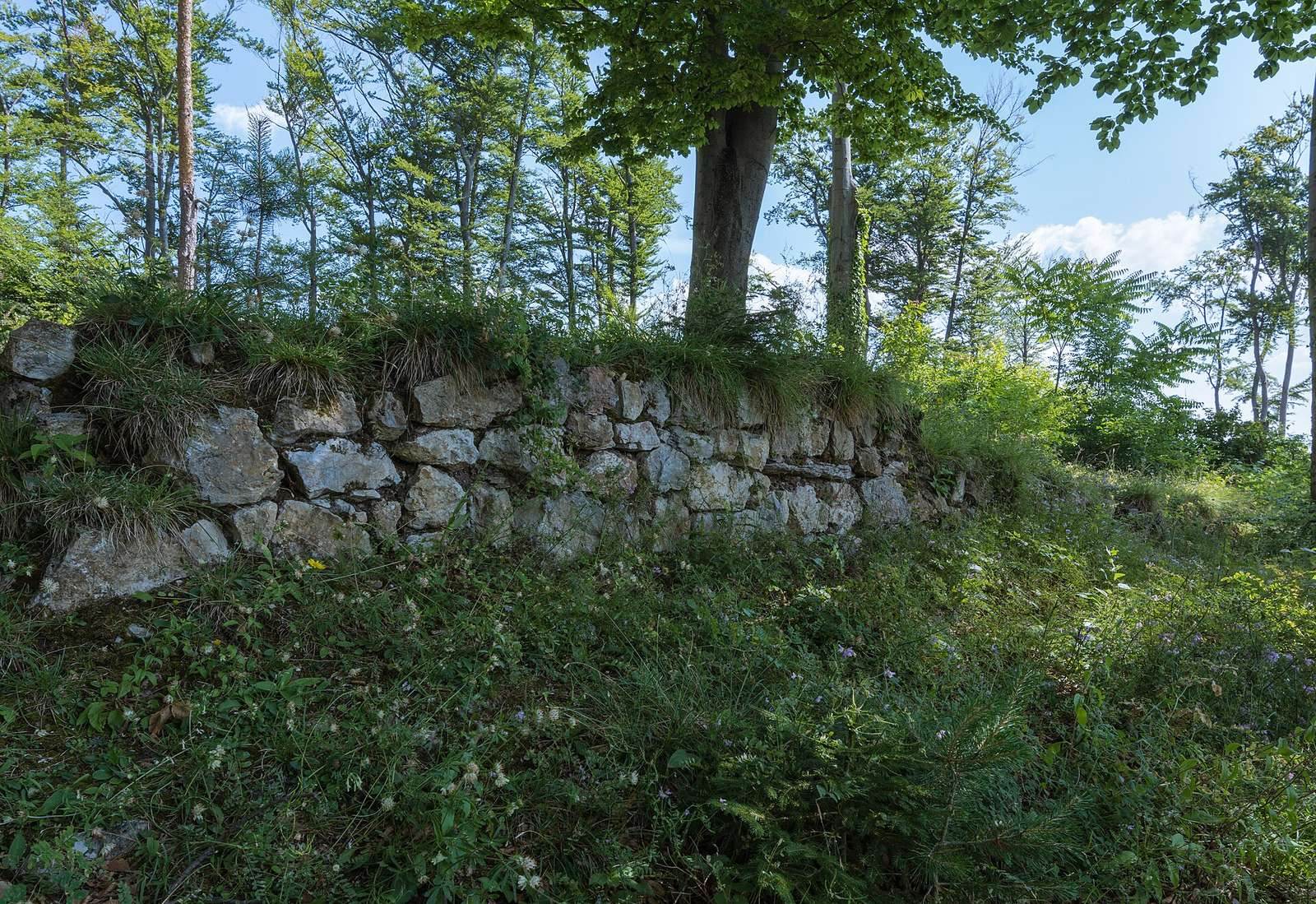
A defensive wall probably enclosed the central castle; its collapsed remains are still faintly visible. A substantial ditch and an outer bank protected the eastern side. On the southwest, a gatehouse was attached to the enclosing wall, with another wall rising toward the core. The approach passed through the eastern outer bailey before probably entering the core through a gate on its northeast side. A building remains south of this probable entrance.
Residential building
Excavations in the southern part of the core castle exposed foundations for three rooms in a building interpreted as the castle’s principal residence. The rooms were about 5.5 metres wide internally. On the west, the building used small cut stones laid regularly and levelled with rubble, a form attributed to the twelfth or thirteenth century. Its eastern part is built of irregular rubble and probably belongs to the fifteenth century. South of the cistern, another excavation revealed a levelled floor layer and walls of rooms joined to the defensive enclosure.
Cistern and possible keep
A circular masonry cistern at the center of the core castle measures 6.85 metres across. Its enclosing wall is 1.35 metres thick, with a well at the center for drawing water. Clay lined the inner face of the outer wall; rubble packed around it was stacked near the edge and sand filled the gaps. The substantial wall may have formed a chamber around the well. Its small rubble stones are partly laid in courses and bonded with mortar. The cistern is difficult to date, but it may have been built by the thirteenth century, or reused an earlier structure. Its upper edge was later adjusted to match the surrounding ground. The circular structure was once interpreted as a tower or fortified keep, but was later identified as the cistern. Northeast of the residence, a large rubble mound has been suggested as the location of a keep, though that identification remains unconfirmed.
Outer defenses
Eastern outer bailey
An approximately triangular plateau east of the core castle tapers to a point and may have been enclosed by a defensive wall. Excavated masonry in the north and faint traces in the southeast are consistent with such an enclosure. The wall is made of irregular, roughly coursed rubble and may date to the fifteenth century, though its age is uncertain. A deep, V-shaped ditch and an outer bank mark the plateau’s eastern edge; the bank may contain the remains of a wall. Excavations attributed earthworks in the outer-work area to the Copper Age and Urnfield period.
Lower outer works
Farther east and lower on the slope is another roughly triangular defended area. A hollow in the ground may mark a cistern, and a heavily worn bank survives at the eastern end. A second, lower forework is also described farther east of the main outer-bailey area. A broad ditch separates the eastern plateaus and another cuts across the slope south of the summit platform.
Excavated evidence and finds
Layers and artifacts
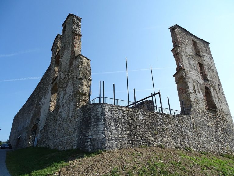
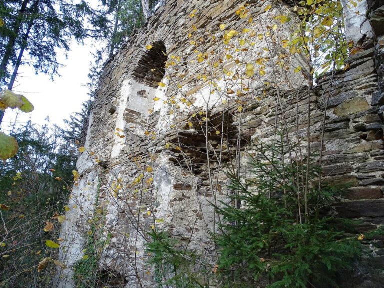
Only sparse masonry is visible above ground, much of it barely discernible. Excavations in the 1980s revealed a thick, charcoal-rich layer in the outer bailey, dated to the thirteenth century and possibly connected with conflict or the dismantling of the castle. Work in 2020 exposed walls in the core and neck ditch, probably dating to the late thirteenth or early fourteenth century. The excavated evidence also indicates substantial human-made movement of earth during the thirteenth century.
Finds from the hill include a fragment of a Copper Age stone axe and Urnfield pottery. Roman objects include coins, brooches and pottery, among it terra sigillata, a fine red-gloss tableware, dating from the first century to the early fifth. Pottery, jewelry and a Carolingian spearhead associated with the proposed early fort provide evidence for activity around the turn of the ninth century; the spearhead is dated approximately 740/750 to 800/820. Medieval finds include pottery, animal bones, projectile points, keys, weights and agricultural tools. Most belong to the thirteenth and fourteenth centuries, with a small number dating to the fifteenth.
Evidence of craft activity
A spindle, clay spool, bronze needle and murex, a marine mollusk associated with purple dye production, suggest possible textile work. Other finds point to metalworking between the tenth and thirteenth centuries, and the iron ore used may have come from nearby.