Fortress of Mainz: A Rhine Garrison’s Defensive System
Site at a Glance
- Popularity
- High
- Country
- Germany
- Primary era
- Early Modern
- Eras represented
- Medieval, Early Modern, Modern
- Civilizations
- Electorate of Mainz, French, German, Habsburg, Habsburg Austria, Holy Roman Empire, Kingdom of Prussia, Swedish
- Site type
- Military
- Remains
- Wall
On this page18 sections
History
The Fortress of Mainz was a system of fortifications around the garrison city of Mainz, Germany, from about 1619 to 1918. Built and repeatedly altered by different powers, it served successively as a Federal Fortress, administered for the German Confederation, and an Imperial Fortress, held by the German Empire. Its military presence and defenses strongly influenced civic life.
Early-modern defenses and occupation
Around 1619, Elector Johann Schweikhard von Cronberg began strengthening Mainz’s medieval defenses. An elector was a prince entitled to participate in choosing the Holy Roman Emperor; Mainz’s electors also held the city’s archbishopric. The works reinforced parts of the existing walls and turned the strategically placed Jakobsberg into Schweickhardtsburg. The city lacked enough soldiers to defend itself effectively, and King Gustavus Adolphus of Sweden entered without opposition on 23 December 1631. Swedish forces occupied Mainz until January 1636, strengthening its defenses and building Gustavsburg near the mouth of the Main.
After the Thirty Years’ War, Elector Johann Philipp von Schönborn expanded the fortress. From 1655 to 1675, sixteen bastions, projecting defensive works built into a wall, formed a new enclosure. A citadel, a fortified stronghold within a larger defensive system, replaced Schweickhardtsburg as the fortress headquarters. French forces occupied Mainz in 1688. The following year, the League of Augsburg, an alliance opposing French expansion, besieged and retook the fortress between June and September. After the French withdrew, a campaign ordered by France devastated the Palatinate.
New rings and French rule
From 1710 to 1730, Elector Lothar Franz von Schönborn commissioned military engineer Johann Maximilian von Welsch to build a second defensive ring. In 1733–34, Elector Philipp Karl von Eltz-Kempenich ordered further forts and connecting works, including Forts Welsch, Elisabeth, and Philipp, along with a new arsenal. Together, the projects added layers to the defenses around the city.
During the French Revolutionary Wars, French revolutionary troops under General Custine took Mainz without a fight in 1792, as the city lacked funds for an adequate garrison. Prussian and Austrian forces recaptured and enlarged the fortress in 1793. From autumn 1794, Governor Andreas von Neu held it during the 1795 siege. The Peace of Campo Formio ended the First Coalition War in October 1797. After Austrian troops withdrew, Mainz was handed to France on 30 December.
Under Emperor Napoleon, the city, called Mayence from 1798, became France’s principal fortress on the Rhine and its eastern frontier there. French military engineers built Fort Montebello and developed further plans, including designs by Simon François Gay de Vernon and Colonel Clément.
Siege, epidemic, and Federal Fortress
During Napoleon’s retreat in autumn 1813, Mainz was the first stopping place for his Grande Armée on French soil. Soldiers suffering from typhus spread an epidemic through the city’s narrow streets. Russian and Prussian troops blockaded the fortress from early January 1814, later joined by a German Confederation force commanded by Duke Ernst of Saxe-Coburg. The fortress capitulated on 4 May. Of the 30,000 soldiers trapped inside, only half remained alive.
After the Congress of Vienna, the city and surrounding area became part of the Grand Duchy of Hesse, while the fortress was placed under the German Confederation, a league of German states established after the Napoleonic Wars. The arrangement was signed on 30 June 1816. The peacetime garrison numbered about 7,000 and could rise to 20,000 in wartime. It included equal Austrian and Prussian contingents and a Hessian infantry regiment. Prussia and Austria supplied governors and commandants in alternating terms, generally of five years.
The German states regarded Mainz as a strategic defense against France and financed its modernization. Under engineer Franz von Scholl, a six-year rebuilding and expansion program adapted the fortress to polygonal fortification, a system using angular fronts and detached works. Further construction followed from 1841 to 1848. Mainz remained a permanent garrison maintained jointly by Prussia and Austria.
Prussian and Imperial Fortress
In June 1866, by decision of the German Confederation, Prussian and Austrian troops left Mainz and were replaced by Bavarian, Saxe-Meiningen, and about 12,000 Hessian soldiers. During the Austro-Prussian War, Bavarian Major General Ludwig von Rechberg served as military governor. After the war, Mainz became a Prussian fortress and, in 1873, a fortress of the German Empire.
In 1872, authorities approved the expansion of Mainz’s Neustadt. The northern Schönborn bastion belt was demolished and Kaiserstraße laid out along its former line. The city paid for a new defensive wall, the Rheingauwall, around the growing district. An agreement signed on 21 September 1872 transferred 25 hectares of land to the city for building and opened a further 122 hectares of private land for development. Fort Biehler, built from 1880 to 1884, was the last major work strengthening the fortress. Existing forts were reinforced by 1890 in response to the threat from explosive shells, and the Pritzelwitz Cavalier, a raised artillery position, was built in honor of Gustav von Pritzelwitz.
Outer defenses and the end of the fortress era
An imperial order of 18 March 1904 authorized the abandonment of the northwest front and removal of Mainz’s inner ramparts, and ended the fortress building-restriction zone. By 1912, many fortifications and gates had been demolished on the order of Emperor Wilhelm II. At the same time, longer-range artillery made a new outer belt necessary. Construction began in 1909 as the Selzstellung, Mainz’s outer defensive position in Rheinhessen, extending from Uhlerborn to Weisenau. It comprised about 318 bunkers, served by a military supply railway and purpose-built roads. The line was designed for rapid occupation by regular field troops and became combat-ready through mobilization after war was declared.
In 1916, planners proposed another defensive line on the Westerberg, parallel to the Mainzer Berg, against a possible French advance. A railway was built for the project, but changing military plans brought the work to a halt and the railway was later dismantled. The fortress’s military role ended in November 1918, when French troops occupied Mainz after the Armistice of Compiègne. The occupation lasted until 1930. The city’s fortifications were converted into green spaces in the Mainz Green Belt, while French authorities supervised the demolition of the new Rheinhessen bunkers during the 1920s.
During the Second World War, underground passages in the fortress served as air-raid shelters. The citadel held prisoner-of-war officers in both world wars; during the Second World War it was Oflag XII-B, a camp for captured officers.
Remains
The fortress formed a roughly semi-elliptical perimeter following the Rhine, about 12 kilometres long and nearly 8 kilometres wide. Its defenses combined strengthened medieval walls and earthworks with bastioned enclosures, detached forts, later angular defenses, and outer bunkers. On the left bank of the Rhine, the Hartenberg and the heights of Weisenau formed major defensive positions.
Early-modern enclosures
Jakobsberg and the citadel
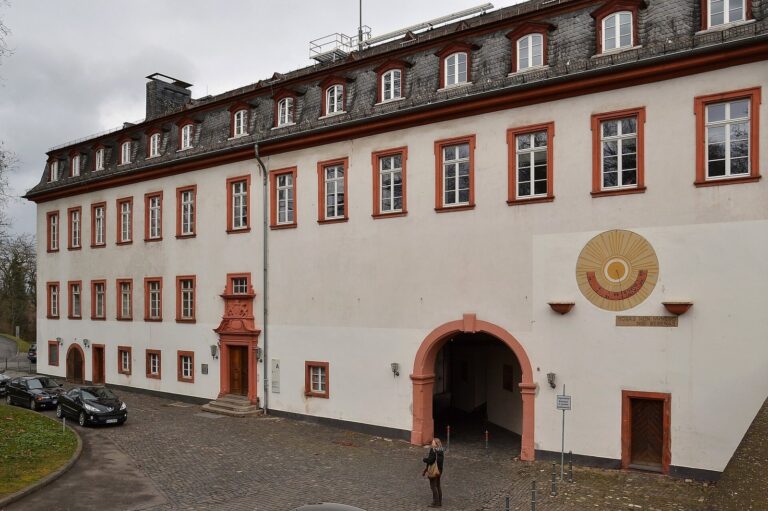
The citadel occupies the Jakobsberg, where the earlier Schweickhardtsburg stood. It became the fortress headquarters and is now the principal surviving remnant of Mainz’s fortress era. The hilltop position formed one part of the defensive system beside the city.
The first defensive ring
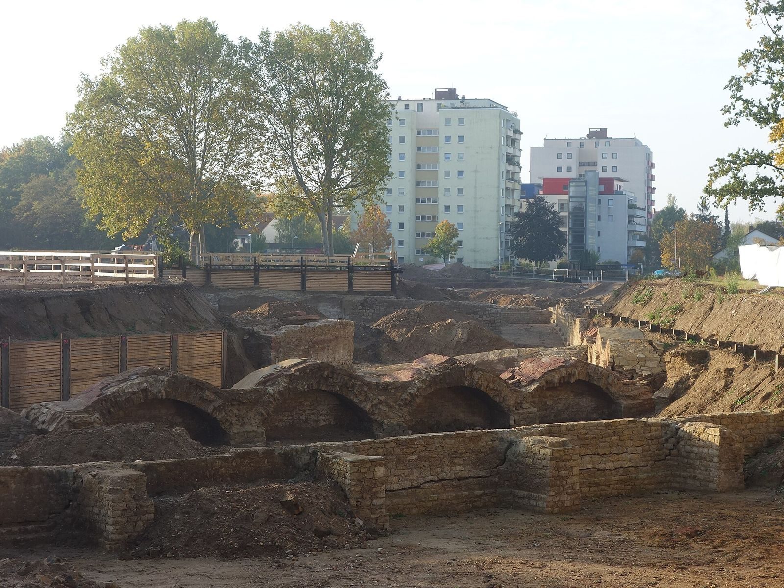
The early works strengthened the medieval wall with earthworks. The first enclosure had thick walls and deep ditches, with small crescent-shaped outworks. Water-filled ditches and marshy ground toward Mombach helped defend the approaches. Beyond a sloping open area intended to expose attackers to fire, countermining galleries allowed defenders to detect or disrupt enemy tunnels; another line of forts lay farther out.
Advanced forts and river defenses
The second ring consisted of five advanced forts or enclosed defensive works linked by an additional wall. A subterranean passage connected it to the first ring for the movement of troops in wartime. Named works included Fort Hauptstein in front of the Münster Gate, the Karlsschanze before the New Gate, and the Josephsschanze on Linsenberg. Later additions included forts Welsch, Elisabeth, and Philipp, a double angular work, connecting routes, and a wall joining defensive positions along the Rhine.
Nineteenth-century system
Polygonal works
The nineteenth-century system used angular fronts and detached works. Permanent casemates, protected spaces built into fortifications, enclosed parts of the southern and western landward defenses. Plans emphasized defensible subsections, protected inner forts, and bomb-resistant structures for troops and supplies, as well as fortified camps for large units. A tower fort was built on Petersaue in 1845. Austrian engineers also used underground works around Mainz, unlike the “New Prussian” approach of tall, exposed towers.
Forts and military buildings
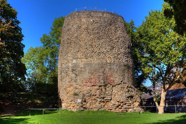
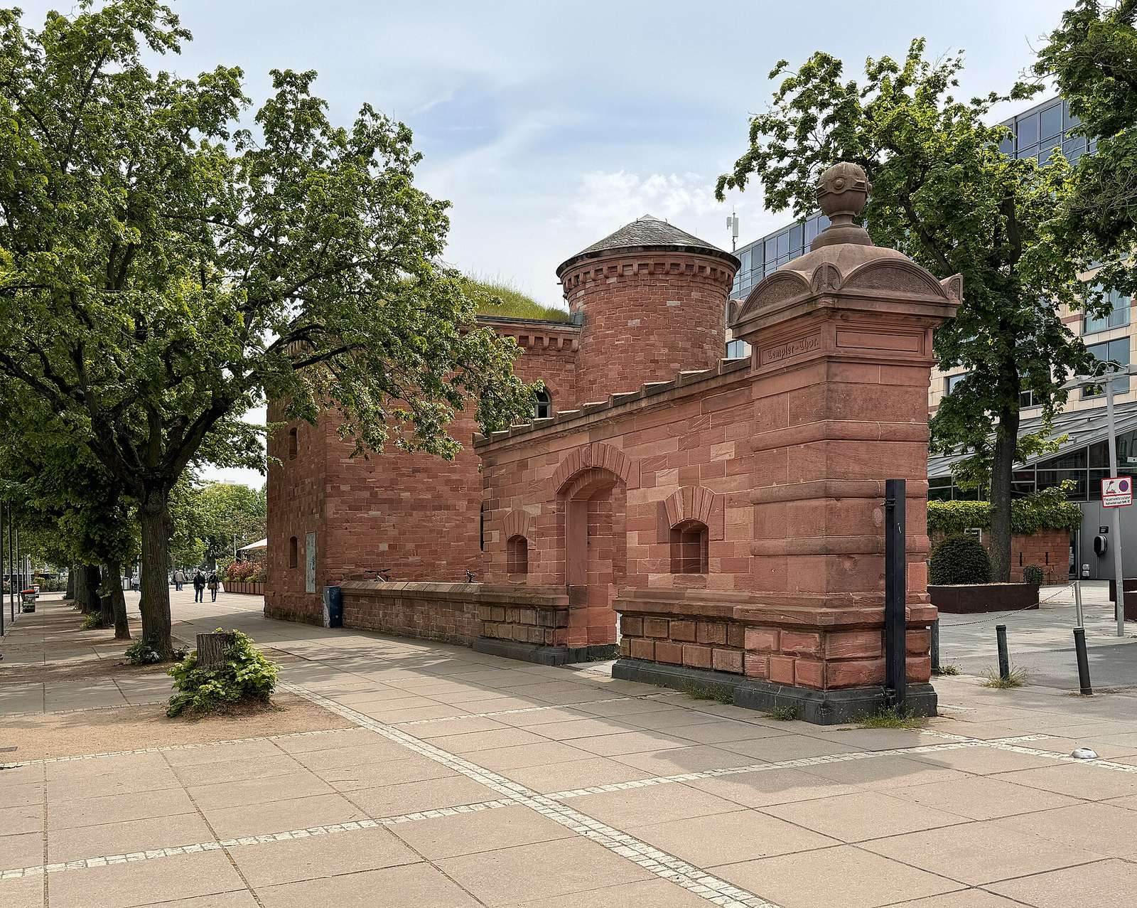
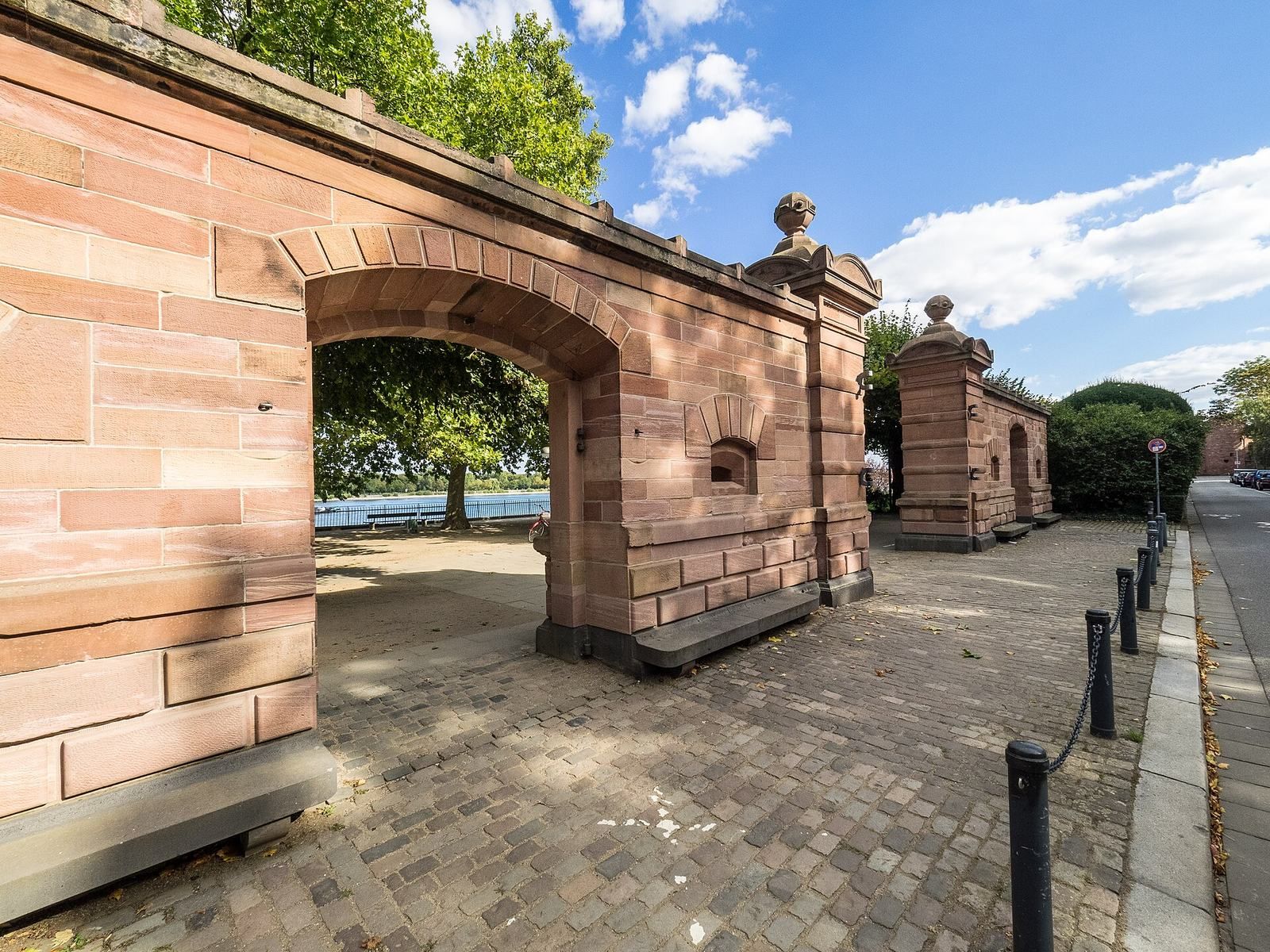
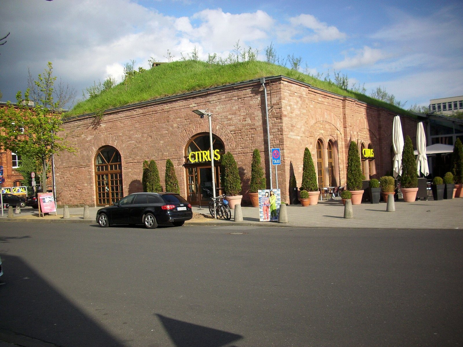
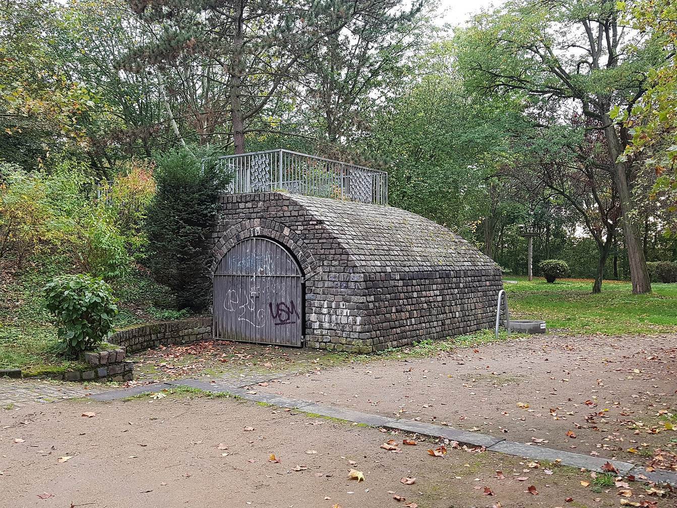
Named components included Forts Bingen, Mariaborn, Joseph, and Gonsenheim, as well as Forts Hartenberg, Hartmühl, Karl, Weisenau, Karthaus, Heiligkreuz, Hechtsheim, Zahlbach, Stahlberg, Großherzog von Hessen, Neue Mainspitze, Alte Mainspitze, Josef, and Biehler. Other works included the Dahlheimer Schanze, Bretzenheim Tower, Pritzelwitz Cavalier, and Rheingauwall. Military buildings included the Prinz Karl barracks, rebuilt Schönbornhof barracks, Neutorkaserne, the New Arsenal, and a provision magazine at Kastel. Fort Weisenau is in the Volkspark, and the provision magazine is at Schillerplatz. A large part of Fort Joseph survives beside the university hospitals and houses a private collection of historical uniforms. A casemate from Fort Bingen remains on the Johannes Gutenberg University campus.
Armored gun position
In 1866, military engineer Maximilian Schumann tested an armored mobile gun position at the fortress artillery range on the Großer Sand. Its mount needed only a narrow firing opening, protected by iron plates. The trials showed promise but were interrupted by the Austro-Prussian War and later forgotten. An armored position based on Schumann’s design was built on the citadel’s Drusus Bastion.
Outer defensive positions
The Selzstellung
The Selzstellung combined independent bunkers at its main combat positions with planned field positions for infantry and protected shelters. Telegraph stations connected the command bunkers of its four sectors, with the central command bunker at Marienborn. Fort Muhl had two levels, electric lighting, stove heating, ventilation, a dressing and operating room, a bakery, and water supplies intended to last 90 days. It was designed to house 291 soldiers. The Dechenberg strongpoint formed another part of the line.
The Westerberg railway
The Westerberg project included a cog railway from Ingelheim to Westerhaus Castle. The railway was completed as part of preparations for a proposed defensive position on the Westerberg. Changing military plans led to its dismantling.