Fort de Chelles: A Nineteenth-Century Fort in the Defenses of Paris
Site at a Glance
- Popularity
- Medium
- Country
- France
- Primary era
- Modern
- Eras represented
- Modern
- Civilizations
- French
- Site type
- Military
- Remains
- Fort
On this page9 sections
History
Fort de Chelles is a nineteenth-century fort on the mountain in Chelles, France, built to help defend Paris. It formed part of the Séré de Rivières network, a system of French fortifications devised by General Raymond Adolphe Séré de Rivières after France’s defeat and partial occupation by Prussian forces in 1870. Built between 1876 and 1879, the fort was armed in August 1878. By 1881, the wider system included 18 forts, five smaller enclosed defensive works called redoubts, and 34 artillery batteries, or positions for groups of guns.
Construction and strategic role
Fort de Chelles was designed to defend Paris and to help control the Marne valley and the railway connecting the capital with eastern France. Its planned garrison numbered 363 men, with 29 artillery pieces. Marshal Patrice de Mac-Mahon, then president of France, visited on 8 April 1878.
In September 1894, the fort joined military maneuvers with Fort de Vaujours and the Montfermeil batteries. Directed by General Saussier, the exercise simulated an attack approaching from the Soissons–Meaux line. A company of the 154th Infantry Regiment defended the fort. Around 1900, the site also took part in exercises using optical communications.
Quarrying and underground reinforcement
Gypsum had been quarried on the mountain for more than a century, both in open pits and underground in successive layers known as masses. In the nineteenth century, operators included Tixier, Trioux, Bichot, Dutreuil, and Parquin, whose company employed as many as 50 workers. Heavy rain caused landslides in late 1878; in October, a landslide buried one of Parquin’s open quarries. Quarrying ended in 1880 after military land restrictions and easements, along with serious collapses.
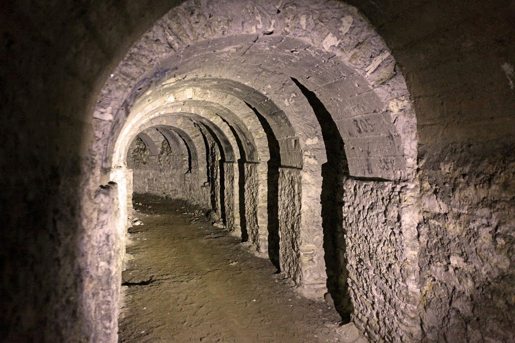
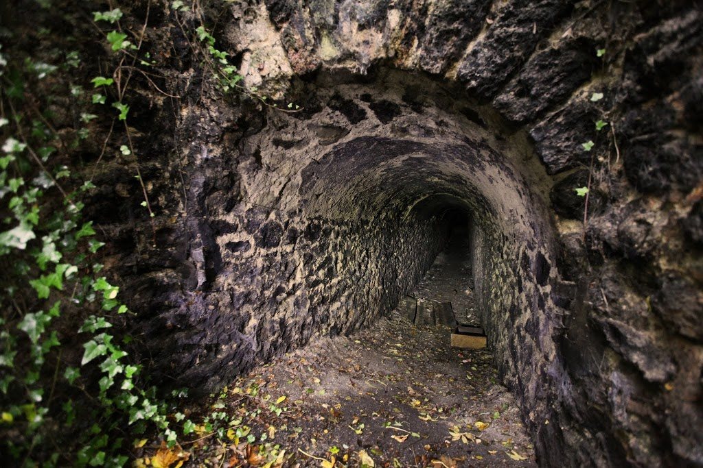
Military engineers began surveying the old galleries in 1891 to assess the danger to the fort. From 1904 to 1909, they reinforced workings in the second gypsum layer beneath or beside the fort after movement in its masonry and repeated collapses. Rather than fill the galleries, they supported them with masonry pillars and arches. The reinforced passages were reserved for army engineers to use and inspect.
Concerns about the ground continued after the military period. In 1963, Henri Trinquand, president of the Chelles Archaeological and Historical Society, warned of the danger posed by the mountain’s deep galleries. A 1999 study by the French Geological Survey classified most of the mountain as having a very high ground-movement hazard.
The First World War
The 3rd Battalion of the 68th Territorial Infantry Regiment arrived on 12 August 1914. Territorial units were reserve formations, and this regiment belonged to the 85th Territorial Division, which was responsible for the eastern sector of Paris’s fortified camp. On 15 December, the regiment left the sector permanently for a line extending through Dammartin, Ève, Ver, Othis, Longperrier, Moussy-le-Vieux, and Le Mesnil-Amelot.
As German forces approached Paris from mid-August to early September, troops prepared the ground between forts with cleared areas, trenches, and artillery positions. French and British forces stopped and repelled the German advance at the First Battle of the Marne. A local tradition claims that fire from the fort brought down a German aircraft on 2 September 1914 and that its two airmen were captured, but the claim remains unverified.
The fort’s anti-aircraft equipment was expanded later in the war. A 90-centimeter searchlight was installed at the end of 1914, followed by two 75-millimeter guns on platforms in April 1915. Four more guns were added in March 1918 by the 10th Battery of the 64th Anti-Aircraft Artillery Regiment.
Later use and redevelopment
The fort had no active military role in the Second World War. Local testimony associates its use by the German army with storage. In 1945, officials considered converting it into a detention center for war criminals, but rejected the proposal because the layout was unsuitable.
During the 1960s, Kodak used the fort to store film and polluting products, making use of the site’s low humidity. The municipality of Chelles bought it in 1972. Later uses included shooting ranges for a local sports association and training for the town fire brigade. In 2007, the fort and surrounding mountain became part of an urban-park redevelopment. The surviving buildings were sealed while a possible future use was considered.
Remains
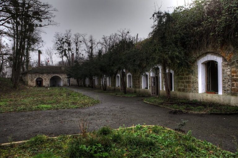
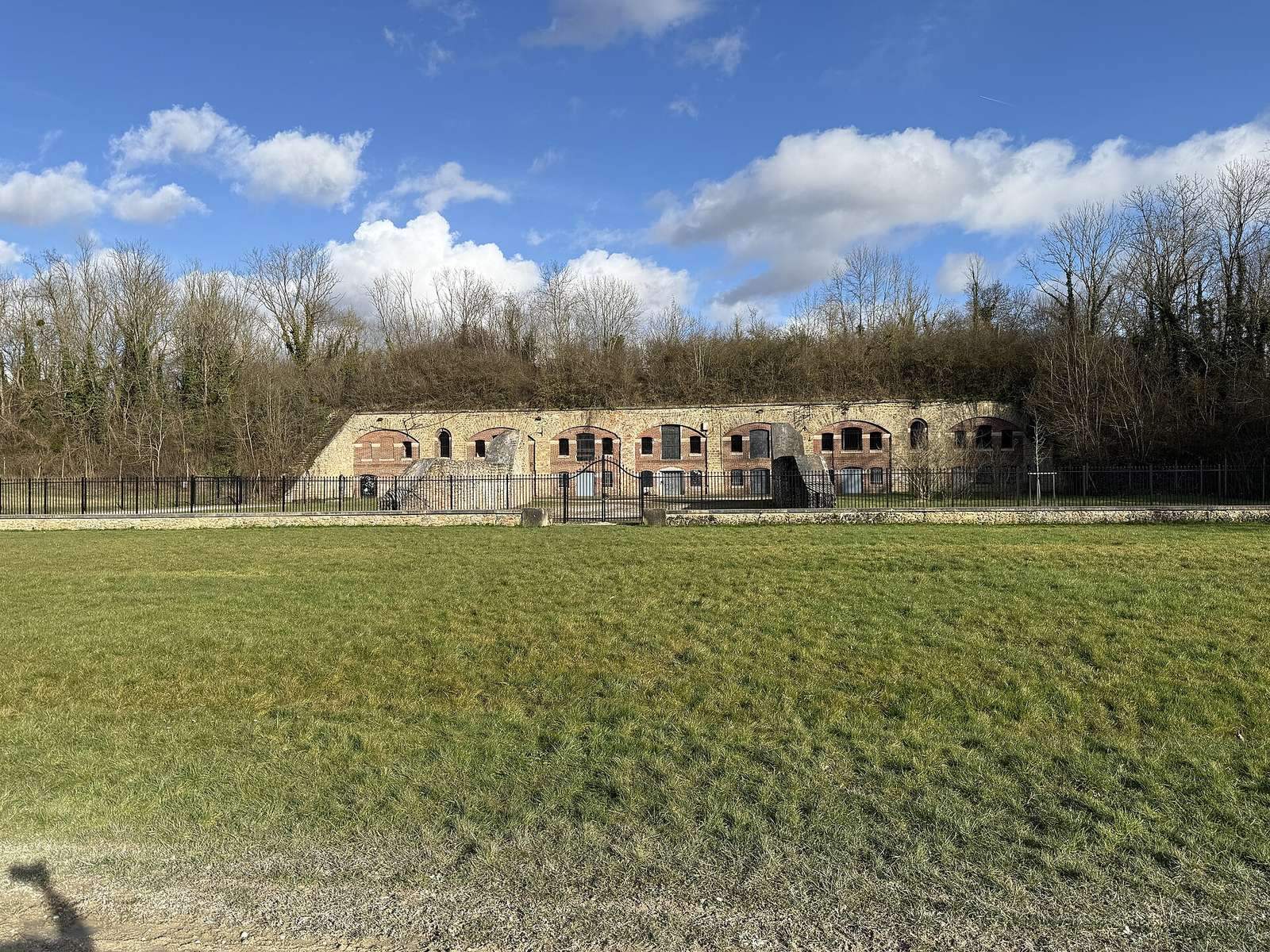
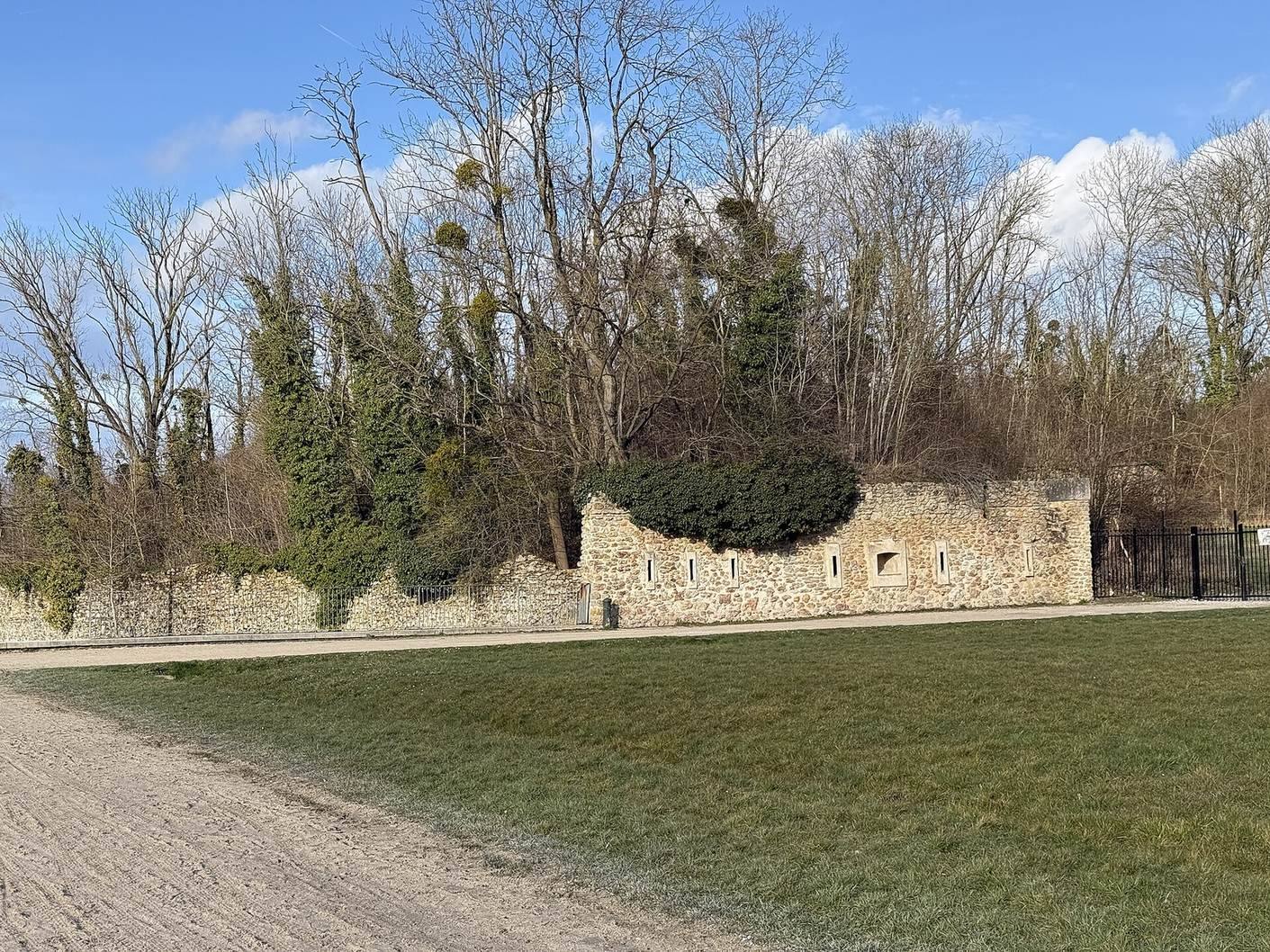
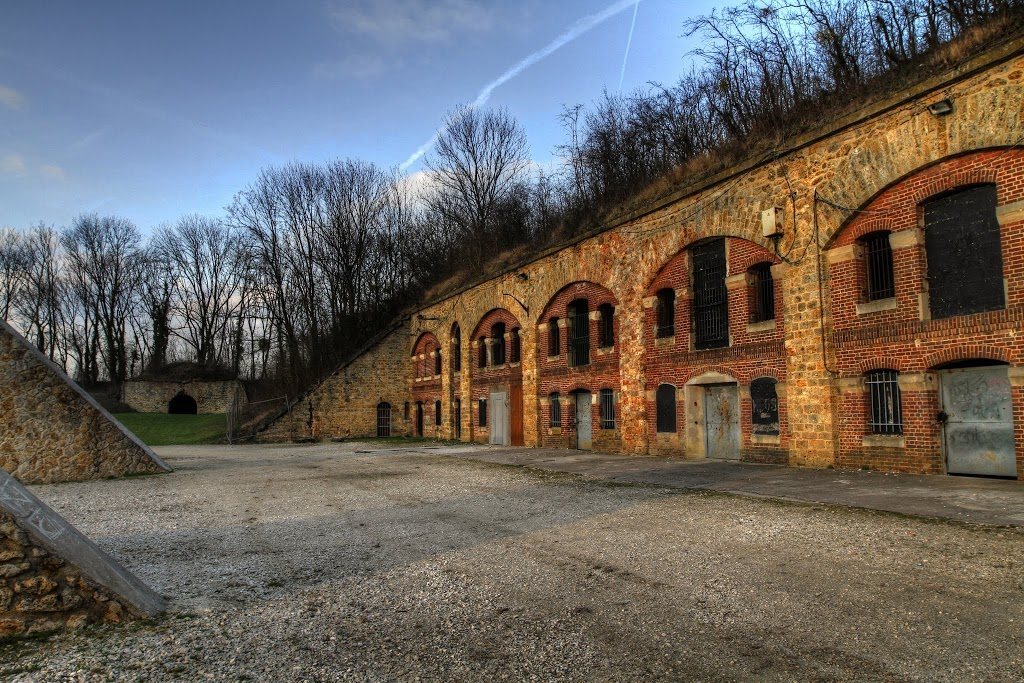
Set 104 meters above sea level on the municipality’s highest ground, the fort has a small, east-oriented pentagonal plan. Its ramparts, barracks, dry ditches, and underground gypsum workings form the main elements of the site. Redevelopment altered the historic defensive ground as well as parts of the surviving structures.
Ramparts and ditch defenses
The rampart armament was arranged in 14 positions and two casemates, protected places for artillery. Three caponiers, fortified structures designed to defend a fort’s ditch, comprise two single examples and one double example. They are degraded and blackened by fires lit during fire-brigade training. Part of the dry ditch was altered and flooded in 2007, and water entered one caponier.
Barracks and entrance
The barracks had a single story and seven bays, with terracotta brick used in the interiors. The entrance once carried a pediment inscribed with the fort’s name and the dates 1876 and 1879. The pediment was removed in the 1960s or 1970s to allow taller vehicles through, and the entrance itself was dismantled during the 2007 redevelopment. The wall along the fort’s rear side was cut down to about 50 centimeters above ground. The former police offices and kitchen were demolished, the cleared outer slope was reshaped, and the historic military road was buried.
Gypsum galleries
Underground gypsum galleries extend west, south, and east from beneath the fort’s footprint. In the second gypsum layer, military engineers strengthened galleries with rubble-stone masonry bonded in hydraulic lime mortar, a lime mix that sets when damp. The deeper workings in the third layer form part of the mountain’s broader network of quarry galleries.