Alauna in Valognes: A Gallo-Roman Town in Normandy
Site at a Glance
- Popularity
- Medium
- Country
- France
- Primary era
- Classical
- Eras represented
- Iron Age, Classical, Medieval
- Civilizations
- Celtic, Norman, Roman
- Site type
- City
On this page24 sections
History
Iron Age occupation and the Roman foundation
Alauna in Valognes was a Gallo-Roman town at Alleaume in France. Its Roman development began in the Augustan period, the reign of Rome’s first emperor and the years around it. Before then, occupation had spread across the area from the first half of the first century BC, during La Tène D, a late phase of the Iron Age La Tène culture. Enclosures and parcel boundaries crossed land later incorporated into the town.
Immediately west of the later settlement, an agricultural complex with a metalworking workshop occupied a large enclosure entered from the east through a monumental porch. It remained in use until the Roman town was built in the first century AD. Though the complex was abandoned, its arrangement influenced a road that crossed the site and the town’s later street plan.
The Roman town was not simply a continuation of this earlier occupation. Its first built-up area was smaller, concentrated mainly in the north and center. As Alauna expanded, development spread into areas that had also been occupied during the Iron Age.
Expansion and political role
Alauna grew and gained monumental buildings in the second half of the first century or early in the second. Its height lasted into the late second century or the first half of the third, when activity extended across the town’s broadest area. The street network was probably planned from the outset, then completed and adjusted as the settlement grew.
The town’s administrative status remains uncertain. Alauna is often proposed as the chief town of the Unelli, an ancient Gallic people, but Crociatonum and Cosedia, later called Constantia, have also been suggested. Its size and public buildings make the proposal plausible, and its population may have reached 3,000 to 4,000. One reconstruction holds that Alauna and Cosedia were chief towns of separate northern and southern territories in the Cotentin during the Early Roman Empire. Under Diocletian, whose reign included major administrative changes, the territories were brought together. Constantia then became the sole chief town of the enlarged territory, known as Constantinus Pagus.
Alauna lay on routes connecting towns and settlements across the region. The Peutinger Table, a map of Roman roads preserved in a later copy, places it on a road linking it with Coriallo, at present-day Cherbourg, and continuing southeast through Crociatonum and the Baie des Veys toward Bayeux, Vieux and Rouen. The Antonine Itinerary, a Roman list of routes and road stations, describes a route south through Cosedia or Constantia and Avranches toward Rennes. Other roads connected Alauna with the Cotentin coast, though some proposed routes and links to the town’s internal streets remain uncertain.
Decline and later occupation
The town declined progressively from the middle of the third century. Its principal monuments went out of use over time, finds became less common, and activity appears to have shifted toward the center. The reasons are uncertain. The loss of political status may have contributed, as may the growing economic influence of Coriallo, which had a maritime connection with Roman Britain.
Activity during the later Roman Empire and early Middle Ages is poorly understood, though occupation and the recovery of building materials from ruins may have continued. New dwellings were built in the southern Victory district in the twelfth century and near the northern baths in the fifteenth; their remains were later reburied after investigation. From the Middle Ages, Valognes developed across the Merderet. A direct line of continuity between the Roman town and medieval Valognes is difficult to establish. Farming gradually took over the ancient site, while agriculture and the salvage of stone reduced the height of its buildings. These activities also helped preserve foundations beneath relatively shallow soil.
The ancient name appears in Roman route records, then gives way after a long gap in written references to medieval forms: Aleaume in 1251 and Alleaume in 1258. Both forms were used until the mid-eighteenth century, after which Alleaume alone is recorded. Linguists accept a connection between Alauna and Alleaume, though the later form may also have been influenced by the personal name Alleaume. Deriving Valognes from Alauna is difficult to support. The Celtic name Alauna itself has no certain meaning; proposed interpretations connect it with a river, a height, a deity, or words meaning “nourisher” or “wanderer.”
Rediscovery and archaeological work
Excavations at the baths in 1695 helped identify the ancient town. In September and October of that year, the Jesuit scholar Pierre-Joseph Dunod excavated the theatre on the commission of Nicolas-Joseph Foucault, a senior royal official. Dunod also recognized the baths, which had previously been mistaken for a castle attributed to Clovis I. Bernard de Montfaucon published a plan of the theatre in 1722, and in 1765 Anne Claude de Caylus published drawings and a partial bath plan based on work by engineer René Cevet.
In the nineteenth century, Charles de Gerville resumed investigations, collecting finds, noting their locations and monitoring damage caused by roadworks. The Society of Antiquaries of Normandy continued the work in 1845. The baths received protected-monument status in 1862, becoming the first ancient building in the Manche department to receive that protection. A 1905 interpretation linked coin finds to a supposed fire at the end of the fourth century; the archaeological picture instead indicates a gradual decline beginning much earlier.
Three excavation campaigns at the baths in the 1990s clarified their layout and chronology. From 2012 to 2022, archaeologists Laurence Jeanne and Laurent Paez-Rezende coordinated wider research combining archive study, artifact analysis, excavations and radar surveys of the ground. The work helped revise the estimated area of the town from about 45 hectares to around 60. Radar survey can reveal buried plans and relative sequences, but it does not establish precise architectural details or absolute dates.
Remains
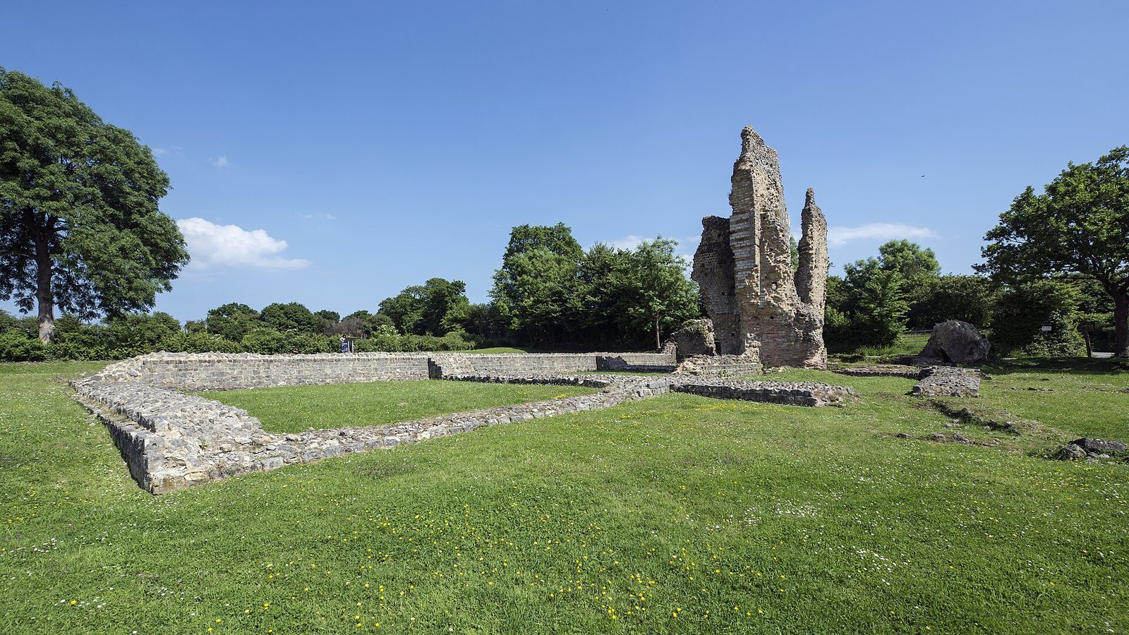
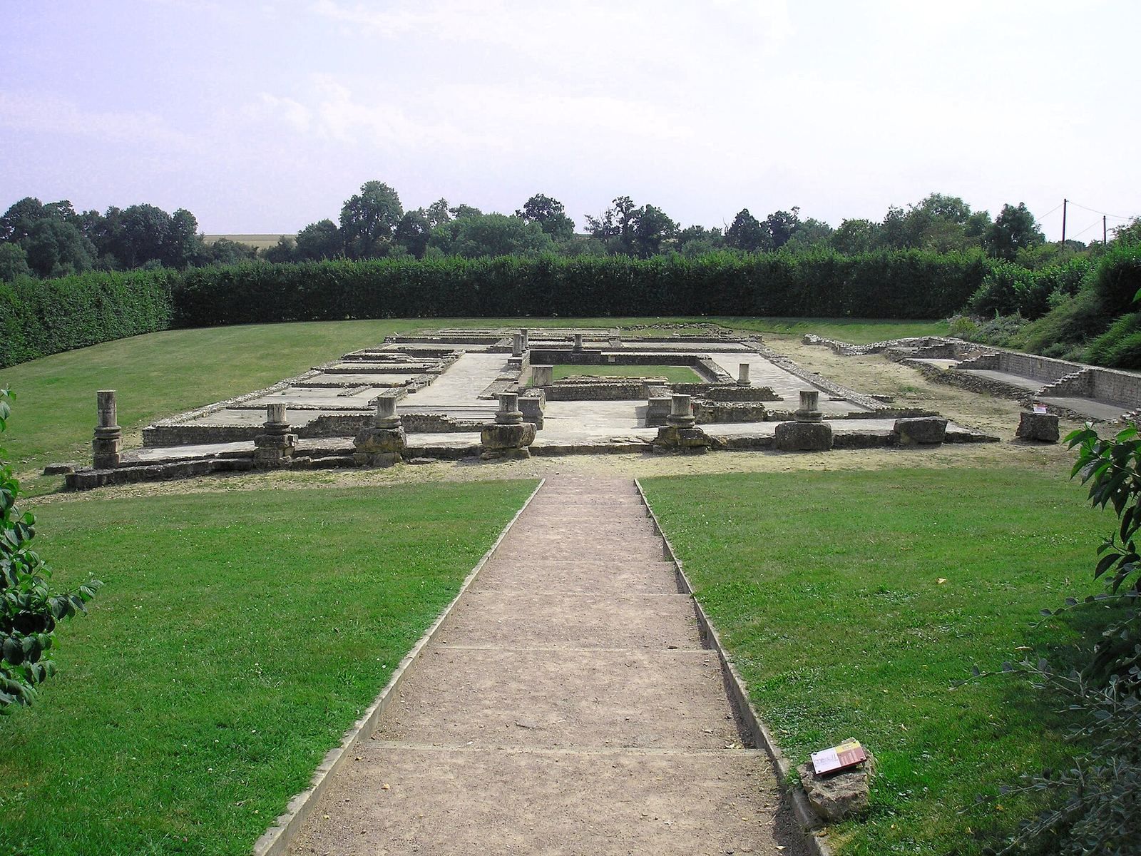
Alauna’s remains form a broad urban plan organized around a roughly north-south and east-west street grid, with public, religious and residential areas spread across a plateau and its slopes. The baths in the north are the only ancient buildings still partly standing. Foundations, buried plans and archaeological finds provide evidence for the town’s other structures and activities.
Setting and street plan
Terrain and building materials
The town occupied the northwestern edge of a plateau between two parallel valleys running northwest to southeast. The plateau descends toward the Merderet depression in the southeast. Much of the southeastern settlement stood above 50 metres, reaching about 60 metres near the theatre; other areas followed slopes of up to 10 percent. The baths occupied a low point in the northwest, at about 38 metres. Valognes and Alleaume lie across the Merderet.
Loam covers the plateau above red clay, sand, and gravel and pebbles. The slopes are largely formed of Hettangian deposits, including Valognes limestone. Quarries west of the town supplied local stone used in foundations, walls, mortar and roads.
Roads and drainage
The street pattern was close to a right-angled grid, broadly aligned with the cardinal directions, though individual streets sometimes deviated. The principal north-south street, the cardo maximus (main north-south street), ran east of the baths toward the Victory district. Its line is partly followed by the Bas-Castelet and Victory roads. Traces continue north beyond the baths, including paving in the Merderet bed; this may represent a road rather than a ford, since the river has changed course.
A principal east-west street, the decumanus maximus (main east-west street), was about 11 metres wide and is partly followed by Dingouvillerie Lane. Its usual surface consisted of regularly sized pebbles. One section had sidewalks protected by a covered colonnade; a stretch near the theatre was paved with large, roughly squared stones, perhaps reflecting a later improvement. Other streets generally used pebbles, sometimes mixed with tile fragments. Traces beside the northern continuation of the main north-south street may mark drains or sewer outlets, and possible sewers have also been detected along the southernmost east-west street.
Civic and religious buildings
Forum and early public building
A large square, probably the forum (civic and commercial center), occupied an entire insula (city block) immediately south of the main sanctuary. Four streets bounded it, with the principal north-south street along its western edge. The square measured about 65 by 100 metres. Small buildings bordered it on at least the west and north, and galleries of shops appear to have lined the square.
Across the principal north-south street, west of the sanctuary, a building filled another block. It appears to have had a central courtyard surrounded by a covered gallery. A street cuts across one of its features, indicating that the building predates the grid. It may have served as a principium, an early public center, though its precise function is uncertain.
Main sanctuary
The principal sanctuary opened to the east and had two successive forms. In its first phase, a fanum, a temple type common in Roman Gaul, had a central chamber, or cella, measuring 9.7 metres on each side, surrounded by a gallery measuring 19 by 19 metres. Its enclosing precinct, or peribolos, was 55 metres wide and at least 70 metres long.
In a major rebuilding, tentatively dated to about AD 50 or 70, the earlier temple was replaced by a raised Roman temple with four columns across its front. It measured 14.3 by 9 metres, with a porch leading into the central chamber and two small structures flanking the steps. The rebuilt enclosure measured 45 metres wide and at least 71.7 metres long, with a colonnade on all four sides and a pavilion at each corner of its eastern side. The sanctuary may have been dedicated to Alauna’s protective deities rather than to the imperial cult. A street separated it from the forum, and the temple did not face the square.
Victory masonry alignment
The feature known as the Wall of Victory is an alignment of large masonry blocks about 41 metres long, 2.6 metres wide and 2 to 3 metres high. The blocks rest on levelled ground without substantial foundations, and their stripped surfaces indicate the loss of facing material. They appear to have come from different buildings, rather than forming a continuous defensive wall. They may have been taken from public buildings, perhaps the forum or sanctuary to the north, and arranged beside an ancient east-west street. Their original positions and the purpose of the alignment remain uncertain.
Other religious remains
Radar survey in 2020 revealed another possible religious complex north of the principal east-west street, toward the theatre. It included at least one temple of the same general type within an enclosure occupying a whole block of about 3,300 square metres. A further complex may lie across the street; the relationships and functions of these possible buildings remain uncertain.
Below and around the foundations of the Chapel of Our Lady of Victory are substantial remains of an ancient building covering several hundred square metres. The building had multiple rooms and was probably public. It may have been a sanctuary, but the tradition that the chapel stands on a pagan temple has not been confirmed by excavation.
Baths and theatre
Public baths
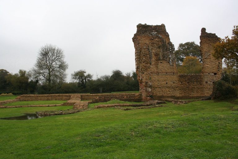
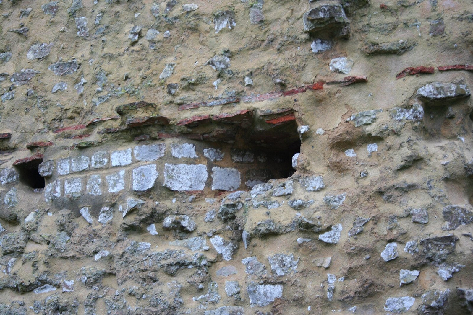
The baths occupy a square a little over 35 metres on each side. Their rooms are arranged symmetrically, with six cold rooms and four warm or hot rooms. The central cold room ends in a rounded recess. A hot room about 7.5 metres across stood above a hypocaust, a heating system that circulated hot air beneath floors or through walls, and received heat from twelve external furnaces. Its walls combine alternating courses of stone and brick.
Built in the mid-first century AD, the complex went out of use about two centuries later. Later generations dismantled and salvaged its masonry, and the area was reused toward the end of the Middle Ages. Excavations from 1989 to 1992 fully exposed the baths. A spring at Bas Castelet, about 500 metres away, supplied water through an underground aqueduct and pipes. A remnant of the conduit can still be seen in a bath wall.
Structures near the baths
Radar survey in 2020 partly revealed a colonnade around a courtyard beside the baths to the northeast. It may have been an exercise area associated with the bathing complex. A partitioned building between the baths and the main north-south street may also have served the baths, perhaps as rooms for different activities or as a gymnasium, but it could instead have been an inn near the town entrance.
A second possible bath suite has been proposed near the center of town, at the junction of the principal north-south and east-west streets. Excavations in the Cau Garden area revealed hollow wall-heating tubes and a waterproof coating made with crushed tile. These features may belong to a public or private bathing area.
Theatre
The arena theatre stood east of the town at Les Buttes, near Castelet manor, and was built largely into a valley slope. Its overall diameter has been reassessed at 72.7 metres. The semicircular cavea (seating area) is separated from the stage wall by two corridors. The central orchestra (performance space) forms an ellipse measuring 24.2 metres along its longer axis and 23.2 metres along its shorter one. Five access passages lead to different levels of seating. A small structure on the central axis, against the orchestra, may have been an honor box. The theatre appears to have been built entirely of small limestone masonry.
Housing, work and burial areas
Residential areas
Test excavations in the early 2010s uncovered residential evidence in the central area, including concrete floors, rubble walls of limestone or sandstone, and hearths. Radar surveys have identified several planned complexes resembling a domus, or private urban house. One, about 1,230 square metres in area, was arranged around an atrium; other examples of a similar general plan covered about 400 to 700 square metres.
More modest dwellings, without a consistent plan, may have been linked with craft or commercial activity. At least eight locations in blocks west, east and south of the monumental center contain evidence of different forms of housing. A residential or mixed-use district near the southern edge, close to the Chapel of Our Lady of Victory, only partly follows the town grid. Farther east, buildings are more dispersed and may represent housing on the urban outskirts.
Craft and exchange
Evidence for metalworking, lime production, woodworking and stoneworking comes from refuse pits, discarded material and filled trenches left by the recovery of building stone. Butchery is indicated by animal bones, chiefly cattle, followed by goats and sheep. These activities occur in outer areas alongside traces of fields or pasture. Galleries of shops along the forum point to trade or craft activity in the center, while a further craft district lay southeast of town along the road toward the Baie des Veys. Its buildings were repeatedly altered and separated by alleys opening onto the road.
Transport vessels and pottery indicate connections with southern Spain and southern Gaul, as well as with Roman Britain. These included vessels used for oil and wine, locally made pottery, and fine red tableware produced first mainly in southern Gaul and later in central Gaul, including Lezoux. Pottery became less numerous and varied from the middle of the third century, in keeping with the town’s decline.
Possible burial grounds
Radar anomalies near the presumed edge of the town may mark burial areas. One set lies outside the settlement near a possible westward continuation of the main east-west road. Mausoleums or funerary chapels may also have stood along the road southeast toward Bayeux, east of a district with substantial craft activity. Dwellings closer to the boundary could indicate later growth over land previously used for burials.
Other finds
Coins and sculpture
Coins from modern test excavations are relatively few. Most date to the Early Roman Empire and are bronze, while late Roman coins are much scarcer. Older discoveries may have included more than 500 coins, but many are now in private collections and were not precisely located when found.
A limestone statuette, 55 centimetres high, depicts a bearded man wearing a crown of leaves. It may have come from a public building, though its original purpose and exact findspot are uncertain. Noted embedded in the wall of a nineteenth-century building in Valognes in 2009, it was removed when the property was sold in 2021 and acquired by the town. Its style and subject support an ancient date, and it may have originated at Alauna or nearby.