Castra of Mainhardt: A Roman Frontier Fort in Germany
Site at a Glance
- Popularity
- Very Low
- Country
- Germany
- Primary era
- Classical
- Eras represented
- Classical
- Civilizations
- Roman
- Site type
- Military
- Remains
- Fort
On this page15 sections
History
The Castra of Mainhardt is a Roman cohort fort in Mainhardt, Germany, established around AD 159/160 as Rome shifted its frontier from the older Odenwald-Neckar line to the Front Limes. This forward sector belonged to the Upper German-Raetian Limes, Rome’s system of frontier boundaries, forts, and defensive works. The fort remained occupied until about AD 260.
Frontier garrison, c. AD 159/160 to c. 260
Mainhardt stood between the frontier forts at Walldürn and Haghof. Routes connected it to the forts at Öhringen and Murrhardt, as well as to the hinterland and the cohort’s earlier base at Walheim on the Neckar. A smaller fort, Mainhardt-East, lay southeast of the main fort and supported security along this frontier stretch. The ridge was poorly suited to civilian settlement.
Around AD 160, the partially mounted cohors I Asturum equitata, a Roman military unit of about 500 infantry and cavalry, transferred from Walheim to Mainhardt. It had originally been recruited among the Astures, a people of northwestern Iberia. By the time it served at Mainhardt, its soldiers probably came from nearby communities and other parts of the empire. Soldiers from Gaul and Dalmatia are also known there.
The cohort probably moved to Britain under Emperor Septimius Severus, who ruled from AD 193 to 211, and is present there by the middle of the third century. The identity of any unit that replaced it at Mainhardt is uncertain.
Investigation and protection
Graves found in 1630 were mentioned in the antiquarian Christian Ernst Hanßelmann’s notes. In the eighteenth century, Hanßelmann began investigating the fort and published a drawn outline in 1768, without excavation. In 1837, residents began taking stones from the western wall for building houses. Physician and local historian Justinus Kerner sought to recover the stones, prompting a limited investigation by a Stuttgart office responsible for statistics and topography.
Württemberg state conservator Eduard Paulus excavated parts of the fort in October 1879, examining sections of its flanks and rear, gates, and part of the headquarters building. The Reich Limes Commission continued investigations in 1893 under Adolf Mettler. Mettler’s work, published in 1909, concentrated on the perimeter, gates, and towers set along the walls; only narrow trenches were dug in the western part of the headquarters building.
A dedication stone dated AD 181, found in 1967, indicates that beneficiarii, soldiers assigned special duties, served at Mainhardt. Work in the civilian settlement during construction of a sports field and school buildings in the second half of the twentieth century uncovered ten cellars. The settlement well was examined in 1979, a rescue excavation took place there in 1987, and an interval tower was excavated in 2000. The fort forms part of the Upper German-Raetian Limes UNESCO World Heritage property and is protected as a registered cultural monument under Baden-Württemberg law.
Remains
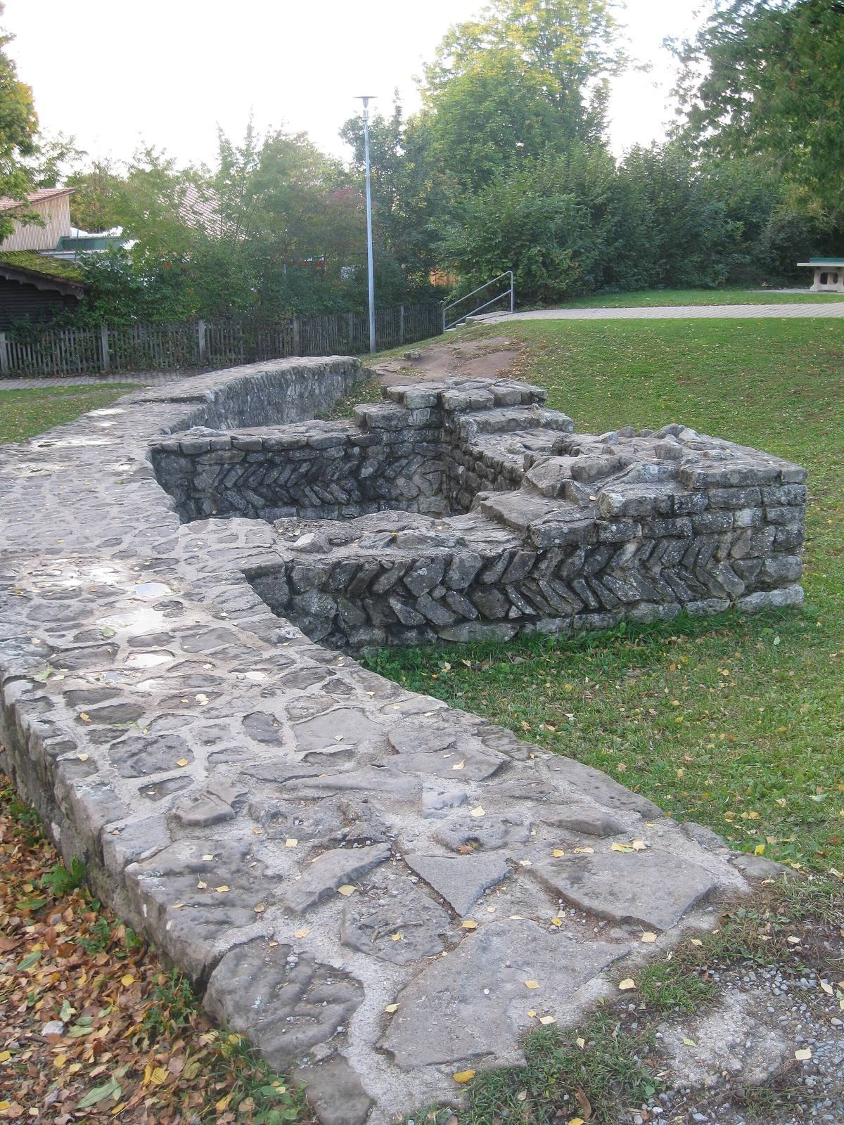
The fort occupied a ridge about 470 metres above sea level, sloping gently northward and bordered by valleys on three sides. It measured 177 by 142 metres and covered about 2.5 hectares. The position offered views toward the east, west, and north; the frontier wall lay roughly 320 to 350 metres east of the fort’s front. Modern buildings cover much of the site. Foundations at the southwest corner are preserved on school grounds, while the eastern perimeter ran approximately along the present main street.
Walls, ditches, and gates
Perimeter and ditches
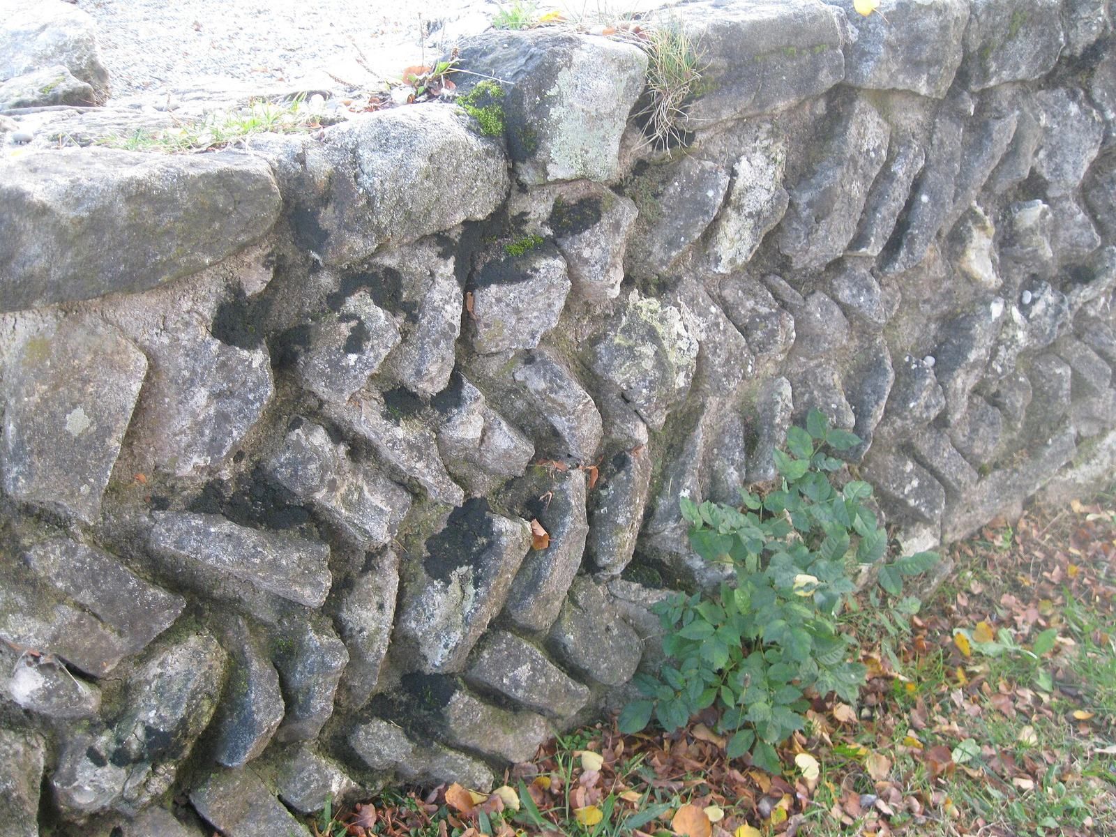
The stone perimeter wall was about 1.25 metres thick, built with two outer faces and a rubble-filled core from local Stubensandstone, a regional sandstone. Roughly shaped blocks formed the outer face, which was originally covered in white plaster. The inner face combined horizontal stone courses with sections laid in a herringbone pattern. An earth rampart backed the wall. Two V-shaped ditches, each about seven metres wide, ran beyond it. A line of large timber posts found in the strip between the ditches may point to an earlier timber fort. A double rampart on the western side was still clearly visible in the eighteenth century.
Entrances and towers
Four gates pierced the defenses, each flanked by a pair of projecting towers. The principal gate on the eastern side was the only one with two passageways and stood in the area now called Schlosshof. The right-hand side gate and rear gate were investigated in 1879. Corner towers and towers set at intervals strengthened the perimeter. The interval towers extended one course of stone beyond the wall and had doorways at the rear.
Camp interior and civilian settlement
Camp interior
Settings for beams laid at ground level and for upright posts indicate at least two phases of construction inside the fort. Five large ovens stood beside the road that ran around the inner perimeter. Each measured about 1.5 to 1.8 metres across and was made from carefully arranged sandstone slabs. Traces suggest that wooden roofs sheltered them, and they may have been used to bake flatbread. They provide the first evidence of this oven type on the southern Upper German Limes.
Settlement buildings and well
The civilian settlement, known as a vicus, lay southwest of the fort in the Steinbühl area. Its long, narrow houses were probably arranged radially along a ring road south of the fort. One timber building excavated there in 1987 extended for 14 metres, was 7.4 metres wide, and rested on sill beams. The settlement also had a well.
Food and landscape evidence
Plant remains from the well included spelt, emmer, barley, and foxtail millet, along with opium poppy, walnut, and fig. Gathered foods included hazelnuts, raspberries, blackberries, wild strawberries, apples, and beechnuts. Weed remains point to managed meadows or pastures, while the manure evidence suggests that horses, goats, and sheep were more likely to have grazed there. Wood remains indicate a landscape with mixed beech and oak woodland, little fir, and many other broad-leaved trees.
Religious and inscribed finds
Jupiter altars and Matronae reliefs
A probable cult place lay near the exercise ground between the fort and frontier, perhaps close to a line of springs. Nine altars dedicated to Jupiter, the chief god of Roman state religion, were recovered between 1944 and 1950. Made of soft Stubensandstone, they were set up by the troops rather than by individual soldiers. Archaeologist Dietwulf Baatz proposed that the soldiers erected altars each year, perhaps on the emperor’s accession anniversary or at New Year, and carefully buried earlier ones when they needed room for new dedications. Three reliefs of the Matronae, female divinities worshipped in parts of the Roman world, have been interpreted as signs of Celtic-Germanic influence in local worship.
Bull imagery and building inscription
An altar discovered in the outer ditch in 2000 depicts a three-horned bull, an image also found in Gallo-Roman settings such as the fort at Köngen. A small altar found in the civilian settlement that year shows a hooded figure, probably holding an offering bowl, beside another three-horned bull; the imagery suggests Gallic influence. A building inscription of the Mainz-based Legio XXII Primigenia, a Roman legion, was found when the western wall was dismantled in the first half of the nineteenth century. The inscription links the legion to construction work at Mainhardt.
Roman Museum
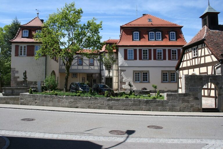
The Roman Museum occupies the former Catholic chapel Maria Krönung, built in 1782 by the Counts of Hohenlohe-Bartenstein in the area of the fort’s former main gate. The chapel served the Catholic congregation until 1963 and became municipal property in 1977. The museum has been housed there since 1987, and its displays were reorganized into thematic sections from 2004. Its collection includes Jupiter altars, inscribed stones, and other finds from the Roman occupation.