Goldbichl: A Prehistoric Sanctuary in Austria
Site at a Glance
- Popularity
- Low
- Country
- Austria
- Primary era
- Iron Age
- Eras represented
- Iron Age
- Civilizations
- Unclassified
- Site type
- Religious
- Remains
- Sanctuary
On this page14 sections
History
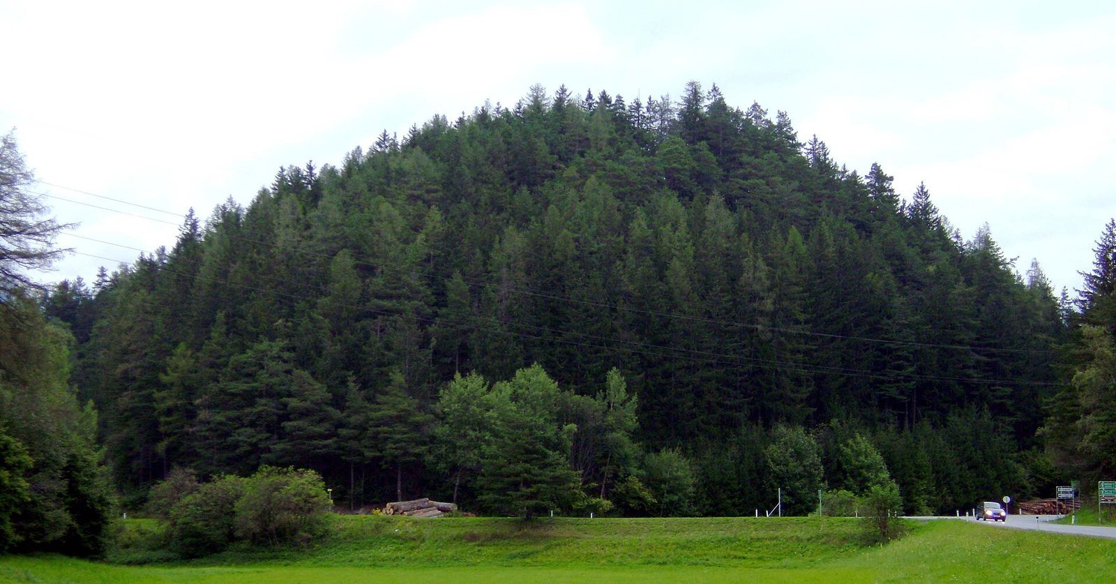
Goldbichl is a prehistoric sanctuary on a wooded hill south of Innsbruck, Austria. Its principal sacred phase began in the early Bronze Age, about 4,000 years ago, and the sanctuary remained in use until the 16th century BC. Its position near the junction of the Wipp and Inn valleys gave the site strategic and transport-geographical importance.
Neolithic Evidence and Bronze Age Ritual
Goldbichl is also called Goldbühel. The name probably comes not from gold, but from the dialect word Galt, referring to young cattle and cows no longer producing milk. Bichl is a Bavarian word for hill.
The Neolithic, Bronze Age and Iron Age are successive archaeological periods broadly distinguished by changes in tools and material culture. A Neolithic flint arrowhead from Goldbichl points to long-distance exchange: its stone came from the Monti Lessini north of Verona, the same area as the stone used for Ötzi’s arrowhead.
During the Bronze Age, Goldbichl was a regional sacred site where people made burnt offerings. Sacrificial fires and cremation, the burning of a body as a funerary rite, were both part of cultural life. Offerings here were mainly sheep and goats, but also included cattle and pigs. Finds originating beyond the area point to the sanctuary’s wider importance.
A young woman was buried at the site after cremation. Because her grave lay within the enclosure, she may have been a priestess, although that interpretation is uncertain.
Raetian Use and Roman Destruction
From about 600 BC, the Raetians, an ancient people of the central Alps, brought Goldbichl into a second period of prominence. They expanded and strengthened its installations. Sacrificial fires were often accompanied by sporting contests, including boxing, and large processions approached the sanctuary along a route aligned with sunrise at the summer solstice.
Destruction and Archaeological Rediscovery
Rome’s conquest of the Alpine region, which took place between 100 and 15 BC, brought the destruction of all the site’s installations. In 1938 and 1939, Austrian prehistorian Oswald Menghin investigated Goldbichl but interpreted the remains incorrectly as a terraced settlement of the late Iron Age. Excavations resumed in 1995, carried out by the Goldbichl Association and the University of Innsbruck’s Institute of Prehistory and Early History. After fieldwork provisionally ended, an archaeological interpretive trail was established in 2006.
Remains
Goldbichl’s remains occupy a wooded hill, with a modified summit and traces of a sanctuary and settlement across the crest and slopes. The surviving layout reflects both the hill’s natural relief and prehistoric changes to its summit.
Terrain and Summit
Hill and slopes
The hill rises to 1,064 metres south of Innsbruck, on the northwestern slope of the 2,246-metre Patscherkofel in the Tux Alps. It stands about 50 metres above the glacial terraces of the Inn Valley and overlooks the Stubai Valley. Goldbichl is formed of quartz phyllite, a metamorphic rock. Its gently sloping northeastern side includes glacial deposits from the Wipp and Stubai valleys, while steep slopes bound the other sides. Rock faces on the southeastern slope reach 15 metres.
Summit plateau
The summit plateau slopes gently northward. Rock eroded from the southern side was redeposited there. During the Iron Age, people raised the originally flatter summit by heaping about seven metres of material onto it.
Sanctuary and Settlement Remains
Sacrificial altar
A clay-and-stone altar at the sanctuary was repeatedly built higher. Fires burned on the sacrificial mound, which could be seen across the Wipp, Inn and Stubai valleys.
Enclosure wall
A wall ran across the hill from west to east, separating the sacred area around the sacrificial mound from the area to its north. The Raetians later reinforced it with palisades, defensive barriers made of upright stakes.
Terraces and houses
North of the enclosure, terraces held houses and gardens. The terraces and a track remain recognizable. Raetian houses also stood on the southwestern side of the hill.
Southwestern ramp
A steep ramp, 40 metres long, led from the southwestern side toward the summit. Its alignment corresponds precisely to sunrise at the summer solstice.
Burial
The preserved grave of the young woman contained cremated bone fragments, pottery pieces and a broken loom weight as grave goods.