Château du Bernstein: A Medieval Fortress in France
Site at a Glance
- Rating
- 4.6
- Popularity
- Low
- Country
- France
- Primary era
- Medieval
- External website
- Open
- Eras represented
- Medieval
- Civilizations
- Holy Roman Empire
- Site type
- Military
- Remains
- Castle
On this page18 sections
History
Château du Bernstein is a medieval fortress in France, above Dambach-la-Ville in Alsace. First mentioned around 1009, it was associated with the Counts of Eguisheim-Dabo, and most of the surviving Romanesque and medieval complex was built between the late twelfth century and the first third of the thirteenth century. Its position on a granite ridge gave it a defensive role, while its later history brought it into the hands of the dukes of Lorraine and the Bishopric of Strasbourg.
Eguisheim-Dabo origins
The fortress originally belonged to the Counts of Eguisheim-Dabo, landgraves of Lower Alsace. It was an allod, meaning hereditary property held outright rather than as a feudal tenure, from 1144 to 1225. Hugh IV of Eguisheim supported Emperor Henry II, the German king and Holy Roman Emperor who ruled from 1002 to 1024, against the Bishop of Metz. During this period he brought his wife, Heilwig, to Bernstein for protection. Heilwig later became the mother of Pope Leo IX.
Count Albert II of Dabo-Moha joined Otto IV and Conrad II of Hunebourg, Bishop of Strasbourg, during the struggle over the imperial succession. The first castle, probably built mainly of wood, was likely destroyed by Philip of Swabia during a punitive expedition at the end of the twelfth century. The Counts of Eguisheim then rebuilt and remodelled the stronghold, creating much of the stone fortress that survives in ruined form.
Albert II’s two sons died at a tournament held by Baldwin IV of Flanders, leaving his daughter Gertrude of Dabo as his sole heir. Her marriage to Theobald I of Lorraine transferred Bernstein to the dukes of Lorraine after Albert’s death in 1211. Gertrude died childless in 1225 after three marriages, and her inheritance provoked a succession dispute. Her third husband, Sigismund of Leiningen, occupied the castle with the support of the Bishop of Strasbourg, but the bishop later changed sides and captured Bernstein after a siege lasting a month in 1227.
Episcopal stronghold
With the consent of Emperor Frederick II, who ruled as Holy Roman Emperor from 1220 to 1250, Bernstein was granted to the Bishopric of Strasbourg in 1236. The castle had been ruined during its capture, but the bishop carefully restored it and made it the seat of a large episcopal bailiwick. This was an administrative district governed by a bailiff or governor on behalf of the bishopric. Bishops John of Lichtenberg and Lambert of Brunn resided at Bernstein in 1354 to 1365 and in 1374 respectively.
The fortress continued to be drawn into regional conflicts. Strasbourg mercenaries and citizens of Dambach-la-Ville invested it during the Dachstein War in 1421, but the Peace of Speyer returned it to the bishopric in 1422. French military forces known as the Armagnacs ignored the peace arrangements in 1444. Later, members of the Bundschuh movement, a series of late-medieval and early-modern peasant uprisings in the German-speaking lands, used Bernstein as a refuge.
Abandonment and later damage
The castle’s military value declined as artillery developed. The bishopric transferred the bailiwick to Benfeld in 1580, and Bernstein was then abandoned. Swedish troops pillaged and burned it in 1632 during the Thirty Years’ War, the wider European conflict that devastated much of central Europe between 1618 and 1648. Local peasants caused further damage during the French Revolution, when the castle was sold as national property.
In the nineteenth century, Félix de Dartein cleared sections of the lower castle to build a hunting lodge and associated outbuildings from materials taken from the ruins. The lodge was destroyed by fire in 2005. The castle ruins became protected as a French monument historique in December 1932 and remain state property.
Name and traditions
The name Bernstein is traditionally explained as “bear rock,” formed from German words meaning bear and rock. A local legend attributes it to bears said to have occupied the rocky site, rather than to the word for fossil resin.
Several traditions connect Bernstein with medieval chivalry and local legend. One story describes a Count of Dabo returning from the Second Crusade in 1149 and recovering his fief after his brother had expelled his daughter. Another tells how Otto of Rosheim supposedly rescued Adelaide in 1213 by luring the castle garrison away with fires. A darker tale recounts a lord accidentally killed by his faithful wife as he approached her window in disguise. The couple were later said to appear in a crystal coach pursued by demonic dogs.
Remains
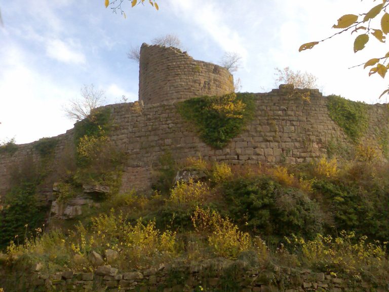
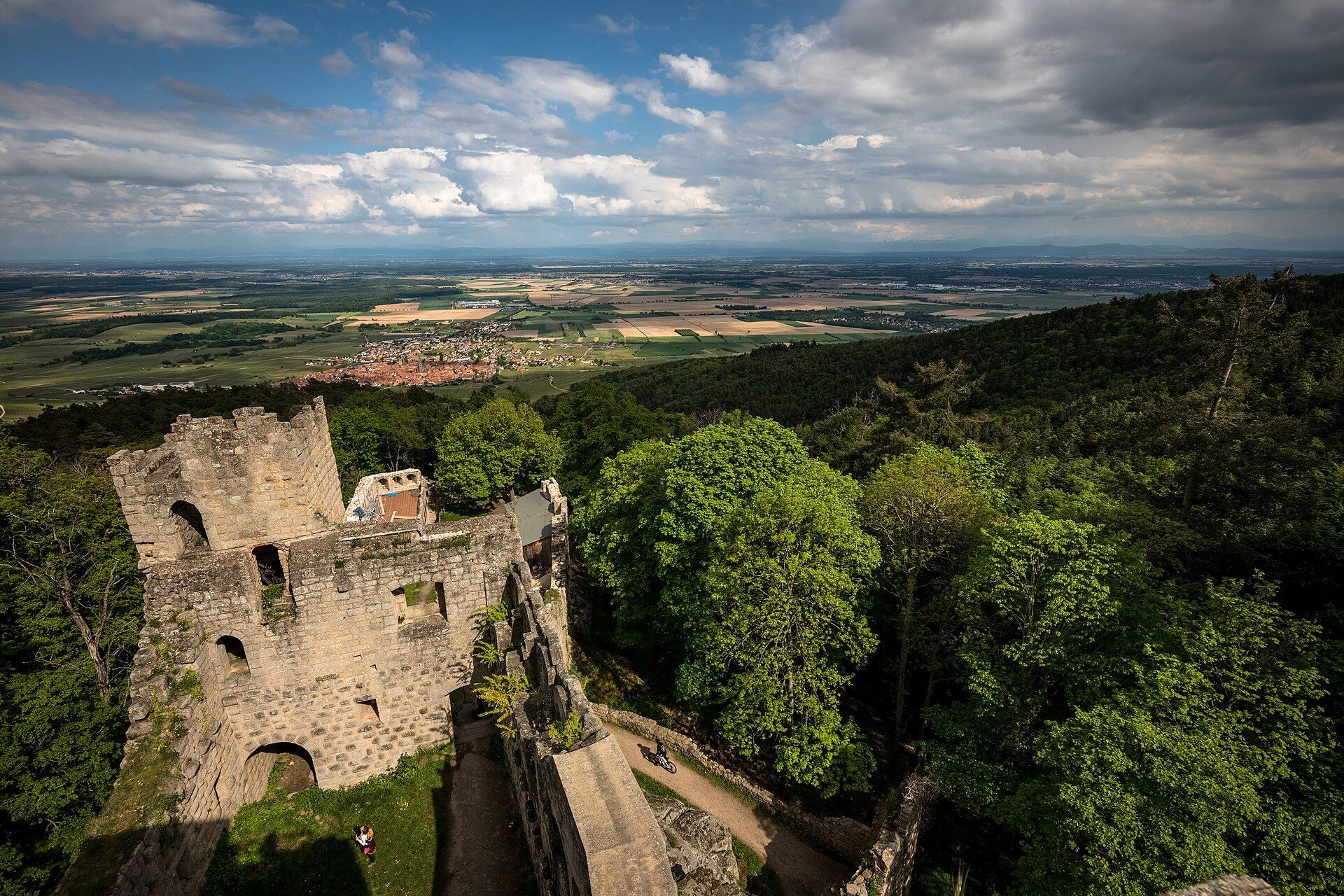
The ruined fortress stands about 562 metres above sea level on a granite ridge between Dambach-la-Ville and Thanvillé. The elongated rock creates two levels: the upper castle occupies the higher western ridge, the lower castle lies on the lower eastern ridge, and advanced works extend along the southern side. Granite is used throughout the fortress. The northern outer wall includes a dry-stone section following the summit terrace, probably dating from prehistoric times. The surviving buildings belong to several construction campaigns and later alterations.
Upper castle
Pentagonal keep
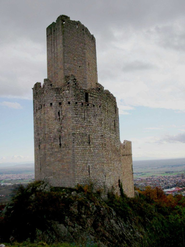
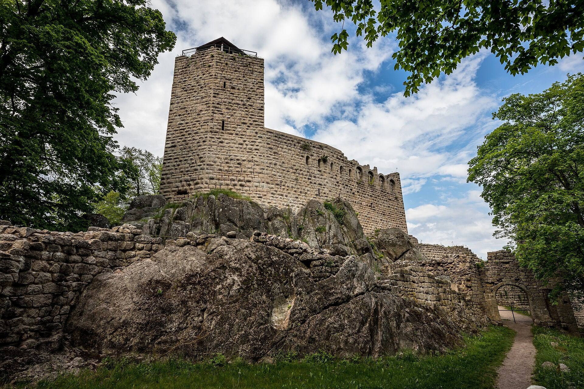
The upper castle is the oldest and best-preserved part of the complex. From west to east it contained the pentagonal keep, a rainwater cistern, the seigneurial residence, the Romanesque tower, and the upper barbican. The keep faces Dachfirst mountain with its pointed side toward the expected direction of attack, shielding the buildings behind it. Its granite walls still rise about 16 to 18 metres. Battlements remained visible into the twentieth century.
The keep’s extremely confined interior indicates a primarily military purpose, and its lower level may have served as a dungeon. Two narrow openings for observation or weapons pierce the southern face. An eastern doorway about 11 metres above ground and a northern latrine stand at the same level. Access came by a sheltered, retractable footbridge from the attic of the adjoining residence.
Seigneurial residence
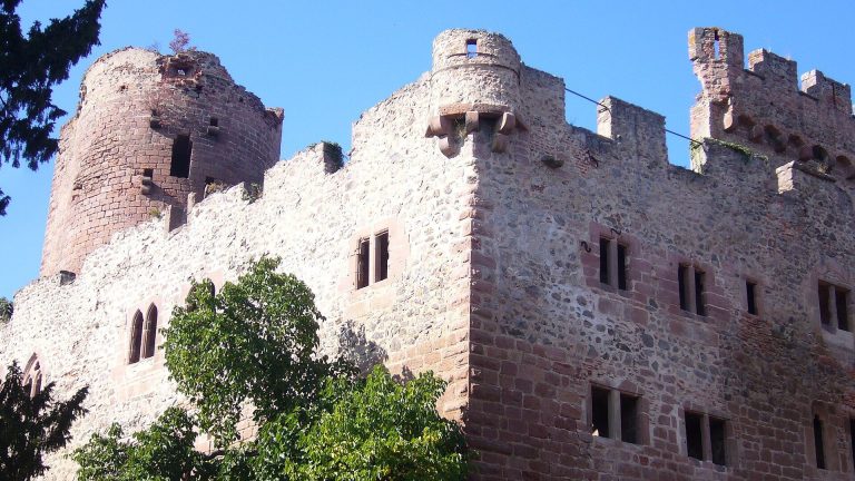
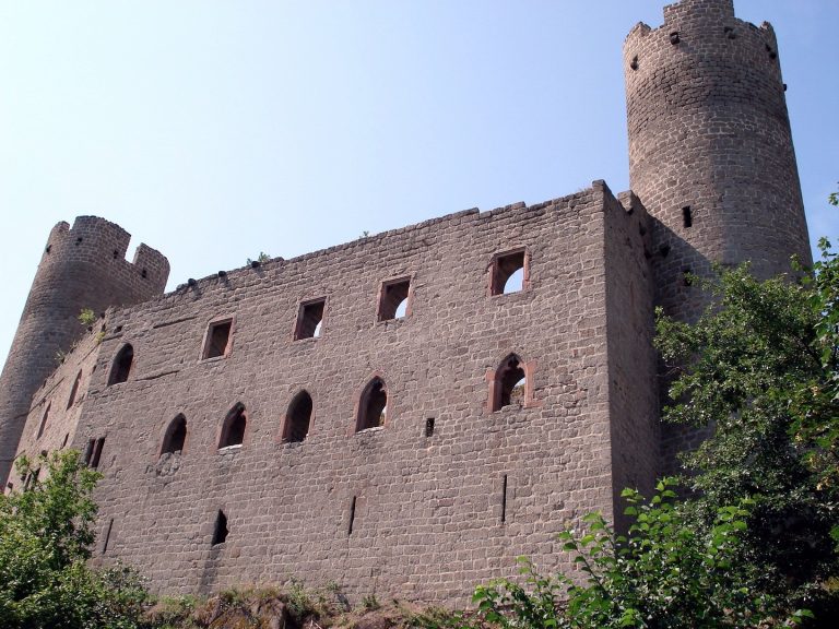
The two-storey palas, the principal residential and representational building of a medieval castle, stood east of the keep. Its first level originally had ten loopholes, four toward the south and six toward the north. The western openings were blocked when the cistern was installed. The entrance portal opened on the east, and the upper floor contained a reception hall and residential rooms.
Four eastern twin-arched windows and five simpler western windows pierced the southern facade, all with semicircular arches. Another twin-arched window stood in the eastern wall above the entrance. Its central mullion, the vertical stone divider between the arches, was carved with two bears. Much of the northern upper wall has disappeared, making the original arrangement of its openings difficult to establish.
Romanesque tower
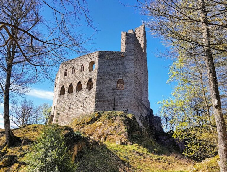
At the northeastern corner stands the Romanesque tower, which originally rose through four levels. Its first level lies slightly below the palas and has a ceiling about five metres high. A loophole pierces its eastern wall. The second level had a ribbed vault and openings on all four sides, including an eastern twin-arched window, simple northern and southern windows, and a western doorway with a semicircular arch.
The vault was probably destroyed when the tower was heightened. The masonry of the third level differs from that below, while the fourth preserves traces of battlements. A later doorway connected the tower with the attic of the palas. The building may have housed the castle chapel, although another interpretation places the chapel in the lower-castle tower. It is also associated with a chapel dedicated to Saint Margaret.
Upper barbican and cistern
The upper barbican occupies the eastern end of the upper castle between two towers. A barbican is an outer defensive work protecting an entrance or approach. Earth and rubble heavily obstruct the structure, but an east-west stairway through it connected the lower and upper castles. Two terraces of unequal size lay on either side.
A stairway at the northeastern corner formerly led toward Saint Margaret’s Tower. The eastern retaining wall has a loophole overlooking the lower castle. Later work raised the northern wall, and surviving openings, corbels, and traces of a rectangular opening suggest that the barbican may have carried an upper storey with a small projecting structure, giving it as many as three levels.
A rainwater cistern was formed between the keep and the palas, probably around the fourteenth century. It resulted from the conversion of the ditch created at the foot of the keep when the palas was remodelled. The cistern responded to a serious logistical weakness: the main rock had no well and depended on collected rainwater.
Lower castle
Saint Margaret’s Tower
The lower castle covers about 40 metres from west to east and 13 metres from north to south. Saint Margaret’s Tower stands at its northwestern corner. This rectangular granite tower was chiefly defensive and overlooked the entrance. Its eastern and southern facades contain staggered loopholes adapted for firearms, showing a later response to changing military technology.
The southern entrance stood about 6.5 metres above ground and was reached by a drawbridge at the end of a stairway set at right angles to the main stair. A second entrance on the west opened toward the upper barbican. Beside the tower, a postern, or small secondary gate, provided passage northward to the exterior.
Courtyard buildings
Residential buildings once stood along both the northern and southern outer walls of the lower-castle courtyard. They probably had two storeys, with their first levels blind toward the wall. The surviving eastern windows are simple or twin-arched, with semicircular or rectangular forms. The western arrangement cannot be reconstructed because the ruins there are badly damaged. The northeastern corner is now occupied by the remains of the nineteenth-century hunting lodge.
Advanced works and water access
Bastion and garden
The advanced works occupy the southeastern corner of the rocky spur below the upper castle. From east to west they consist of the bastion, the garden, and the forecourt. The bastion and Saint Margaret’s Tower are later defensive additions, with the tower built toward the end of the fifteenth century.
The bastion has a wall that curves outward from the castle. Before it was built in the fifteenth century, an angle tower to the southeast provided the only protection for access to the well. The garden extends westward from the bastion. Its southern wall rises several metres from a rocky foundation. A passage beside the bastion leads toward the northern ditch, while the entrance to the underground well passage lies at the garden’s southwestern corner.
Well passage
The well passage begins at a Romanesque portal and continues through a vaulted gallery about 9.2 metres long to a spring at the foot of the castle rock. Part of the gallery is cut directly into the rock, while the remainder is built in masonry. Four openings in the vault supplied light. Because the spring and well lay outside the upper and lower castles, protecting the water source shaped the arrangement of the advanced works.
Forecourt and outer walls
The forecourt is the best-preserved part of the advanced works and forms the fortress’s sole access route. Its eastern side contains the Romanesque outer portal, equipped with a drawbridge and a rectangular postern on the south. A wall north of the portal separated the forecourt from the garden. It includes a doorway and a loophole, while corbels and a stone arch indicate a former defensive wall-walk, a passage used by guards along the wall.
A narrow passage about 20 metres long and 5 metres wide runs from the forecourt to the lower-castle portal. The outer enceinte, or enclosing defensive wall, survives most clearly along the north, although that section is heavily ruined. Stones continuing the line of the northern wall can also be traced along the southern wall-walk, indicating that the enceinte extended on that side as well.
Steep drops protected much of the fortress naturally, while the pointed keep faced the most expected direction of attack. The southeastern approach offered easier ground for attackers than the western and northern sides. The external spring and well were also exposed, and the need to defend them prevented a ditch from being built along that part of the enceinte. The bastion and the cistern below the keep were later adaptations to these defensive and supply problems. The eventual spread of cannon made the fortress obsolete.