Château du Frankenbourg: A Medieval Hilltop Fortress in France
Site at a Glance
- Rating
- 4.7
- Popularity
- Low
- Country
- France
- Primary era
- Medieval
- Eras represented
- Iron Age, Classical, Medieval
- Civilizations
- Holy Roman Empire
- Site type
- Military
- Remains
- Castle
On this page16 sections
History
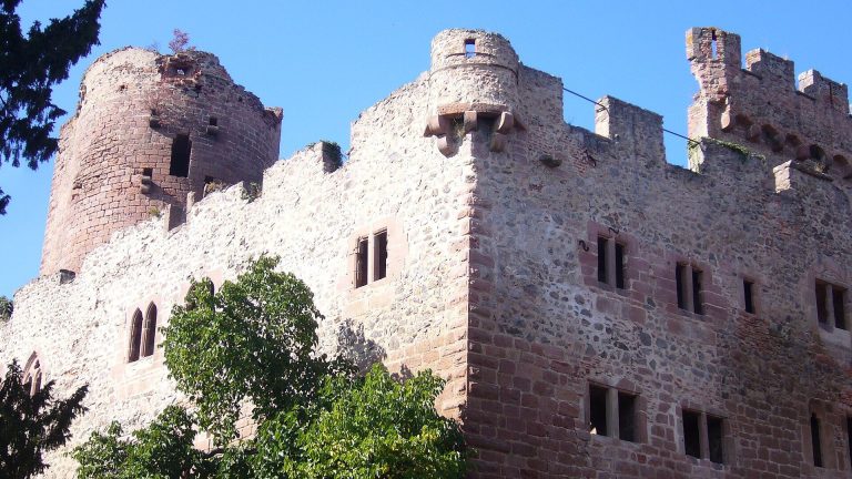
Château du Frankenbourg is a medieval hilltop fortress in France, built on the Schlossberg above Neubois and La Vancelle in Alsace. Probably constructed at the beginning of the twelfth century, the castle occupied a strategic summit controlling the meeting area of the Giessen and Lièpvrette valleys and the route toward Lorraine. Its position also commanded the entrance to the Val d’Argent and helped explain the fortress’s long importance.
Before the medieval castle
The Schlossberg was used before the medieval foundation. Finds from the mountain include Bronze Age objects, Roman coins, a bronze statuette known as the three-horned bull, and a bronze coin bearing the image of Constantine I. These discoveries point to activity on the summit and its surroundings during several earlier periods, although they do not establish the exact origin of the later castle.
A sixteenth-century account by Daniel Specklin attributed the fortress’s construction around the fifth century to Clovis, the Merovingian king traditionally associated with the establishment of the Frankish kingdom in Gaul and with conversion to Christianity. This attribution is generally regarded as legendary. The same tradition says that Clovis promised to convert before the Battle of Tolbiac, while his Christian wife Clotilde prayed for his victory in the castle chapel.
Foundation and the Counts of Frankenbourg
The medieval fortress was probably built at the beginning of the twelfth century, possibly over an earlier fortification. The name Frankenbourg appears in a charter issued by Emperor Henry V in 1123. A record from 1143 identifies the castle as the property of the Counts of Frankenbourg, a branch of the Counts of Saarbrücken.
From 1189, the Counts of Frankenbourg adopted the name Werd. Their descendants held the county and, from shortly after 1196, the landgraviate of Lower Alsace. A landgrave was a territorial count whose authority was comparable to that of a prince. During the third quarter of the thirteenth century, Heinrich II Sigebert of Werd had the keep erected, strengthening the castle’s position within the surrounding lordship.
Ecclesiastical lordship and repeated pledges
Frankenbourg became a fief of the Strasbourg bishopric in 1232. In this setting, the bishopric was not only the diocese governed by the bishop but also an ecclesiastical territorial lordship. Around 1336, the financially declining Counts of Werd pledged the castle to the Mullenheim family. After the Werd line ended, their heirs, the Counts of Oettingen, sold the remaining inheritance, including Frankenbourg, to the Strasbourg bishopric in 1359.
During the later Middle Ages, control of the castle repeatedly changed through pledges and partial sales. Between 1393 and 1489, the Strasbourg bishopric pledged it successively to Johann of Leiningen-Rixingen, Claus and Adam Zorn, Burkhard of Lützelstein and his sons Jacob and Wilhelm, and other holders. Parts of the property were sold in 1449 to Hans of Uttenheim zu Ramstein and Claus Bock, in 1454 to Jacob of Hohenstein, and in 1462 to the Strasbourg Cathedral Chapter, the city of Sélestat, and the Wurmser family.
The bishopric invested in the fortress during this period, spending 1,000 florins on reconstruction in 1411 and 2,000 florins in 1447. In 1470, Sélestat appointed a castellan to watch the castle because of the possibility of an attack by the Burgundian forces of Charles the Bold. The Strasbourg Cathedral Chapter acquired the remaining property and forest holdings in 1483 and retained control of the Comte-Ban, the territorial county district associated with Frankenbourg and its dependent villages, until the French Revolution. The district was then confiscated, and the castle passed into state ownership.
Fire, decline, and conservation
A lightning-caused fire destroyed Frankenbourg in 1582, although the castle was subsequently rebuilt. From the beginning of the seventeenth century, it deteriorated progressively and eventually became a ruin.
The ruins were classified as a historic monument in 1896, while the separate protohistoric enclosure received the same status in 1990. Volunteers cleared the overgrown remains during the 1970s and 1980s, and the keep was restored in 1981. Since 2013, the association Les Mains d’Or du Frankenbourg has brought volunteers together to monitor the ruins and stabilize the vegetation around them.
Remains
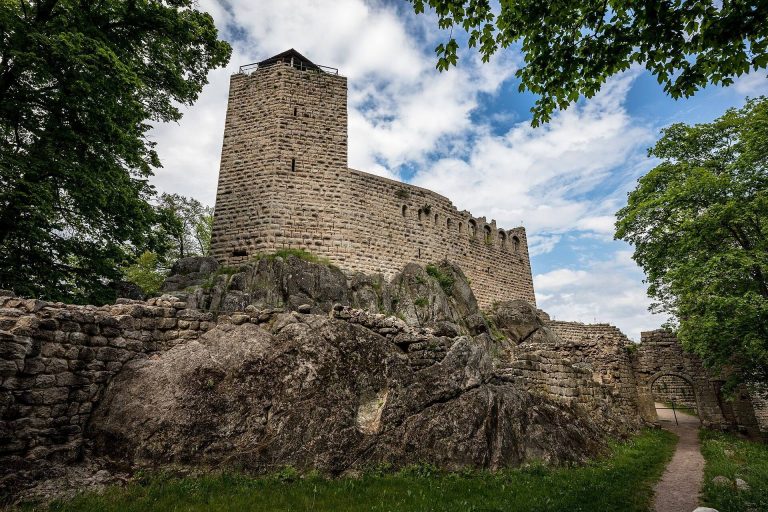
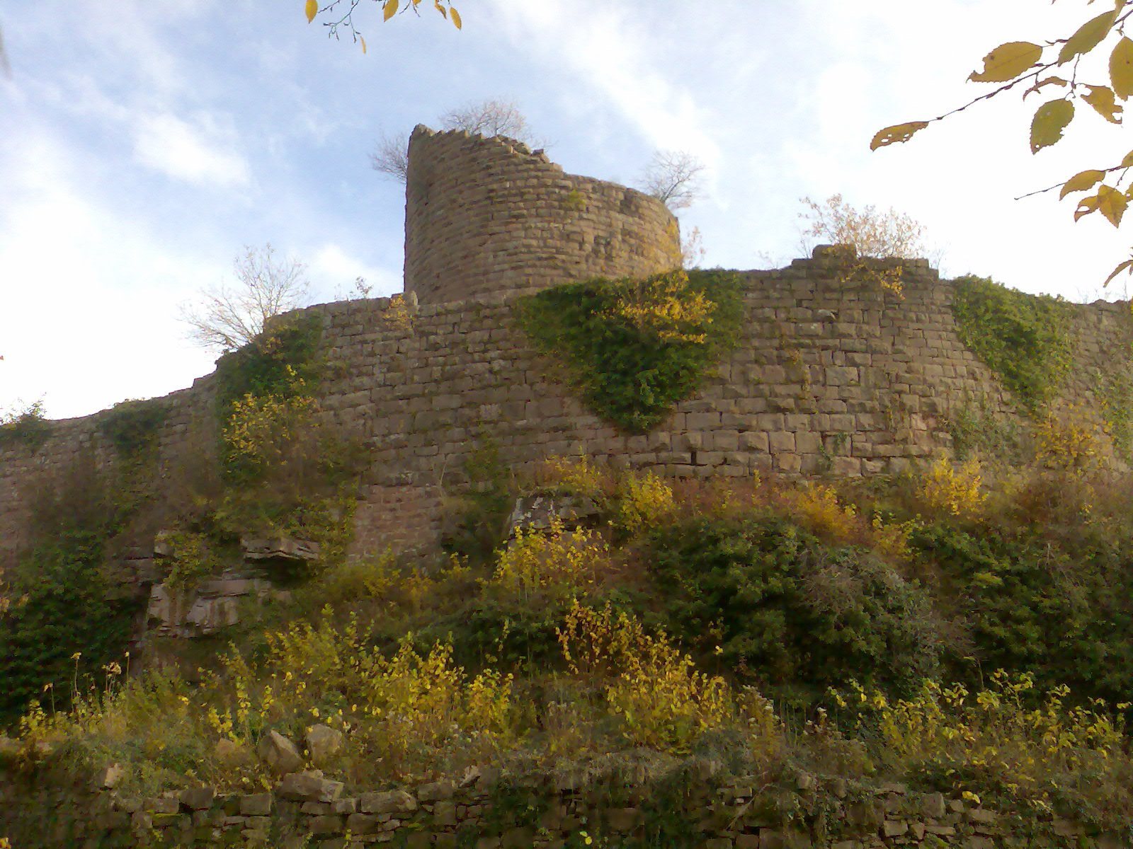
The remains occupy the 703-metre summit of the conical, forested Schlossberg. The summit overlooks the Alsatian plain, the Villé valley, the Lièpvrette valley, and the entrance to the Val d’Argent. The medieval fortress is arranged as an elongated enclosure aligned approximately north-south. Its walls rise between 6 and 10 metres and follow sandstone rock that was used as a foundation. Around the mountain are three roughly parallel wall systems, reflecting the site’s complex earlier and medieval development.
Medieval fortress
Enclosure and entrance
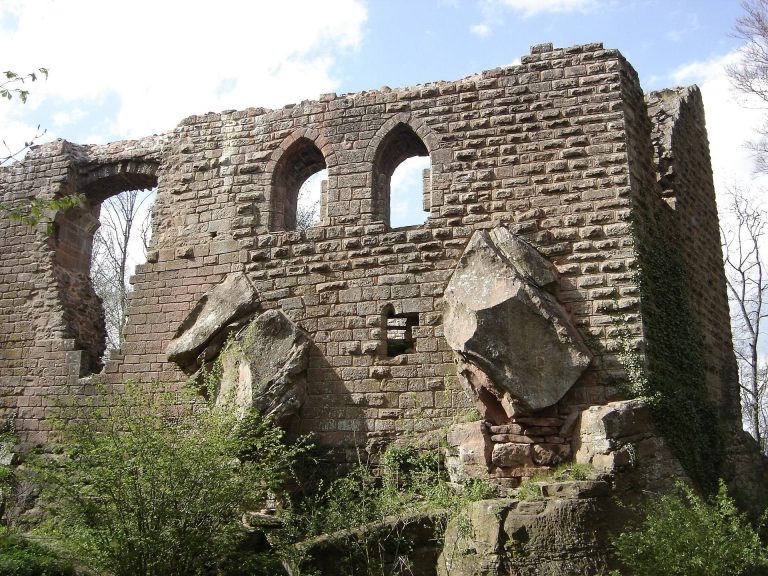
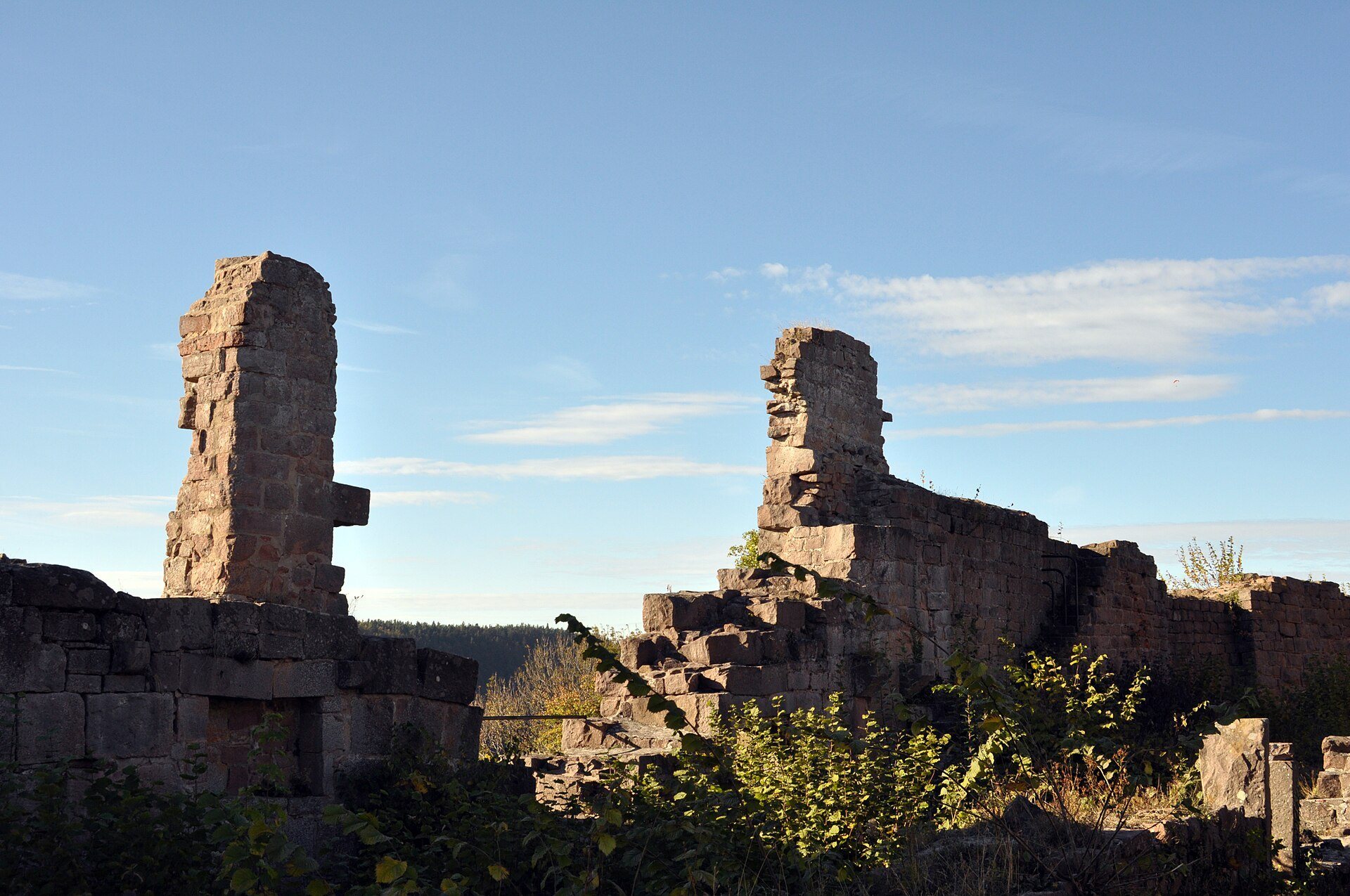
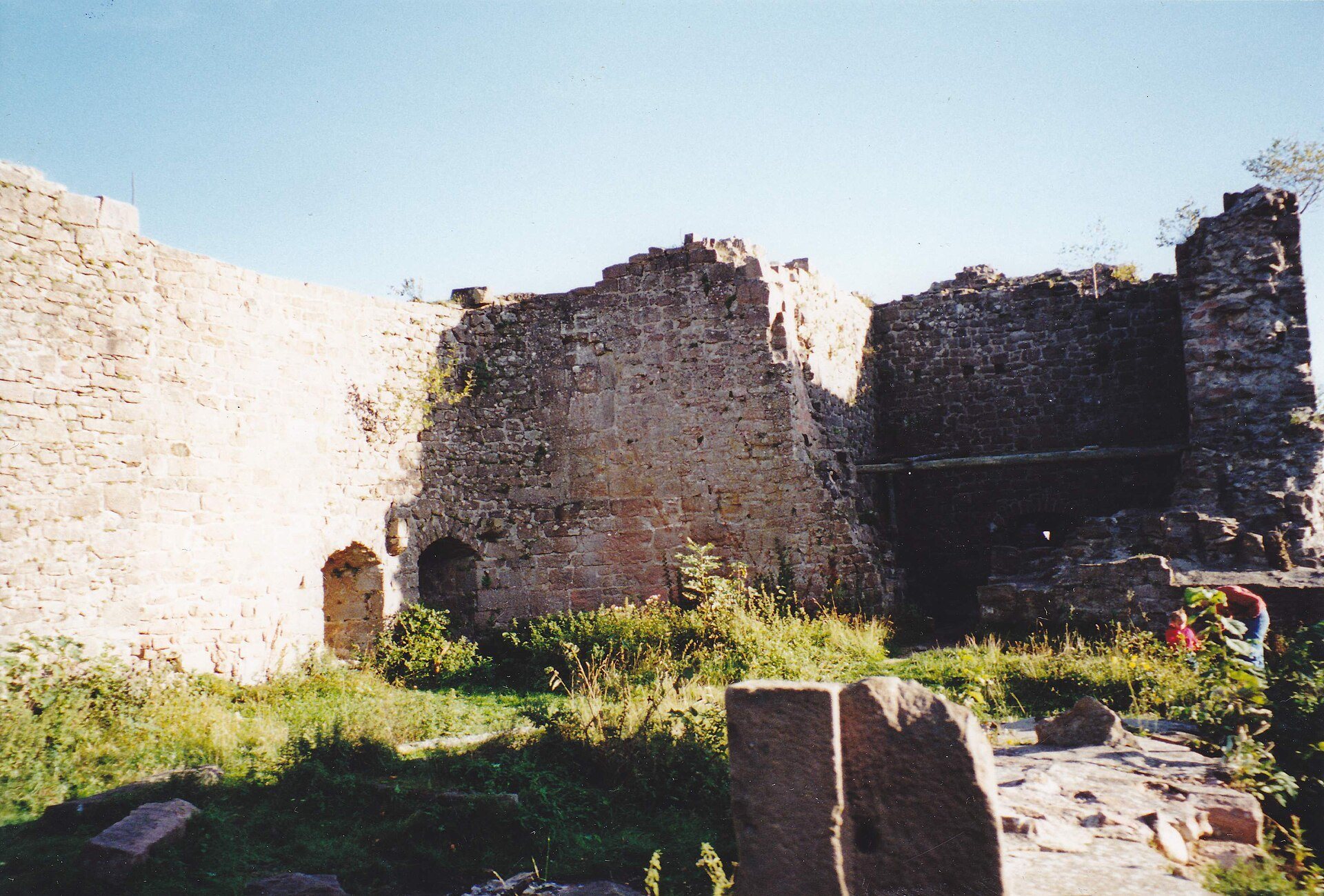
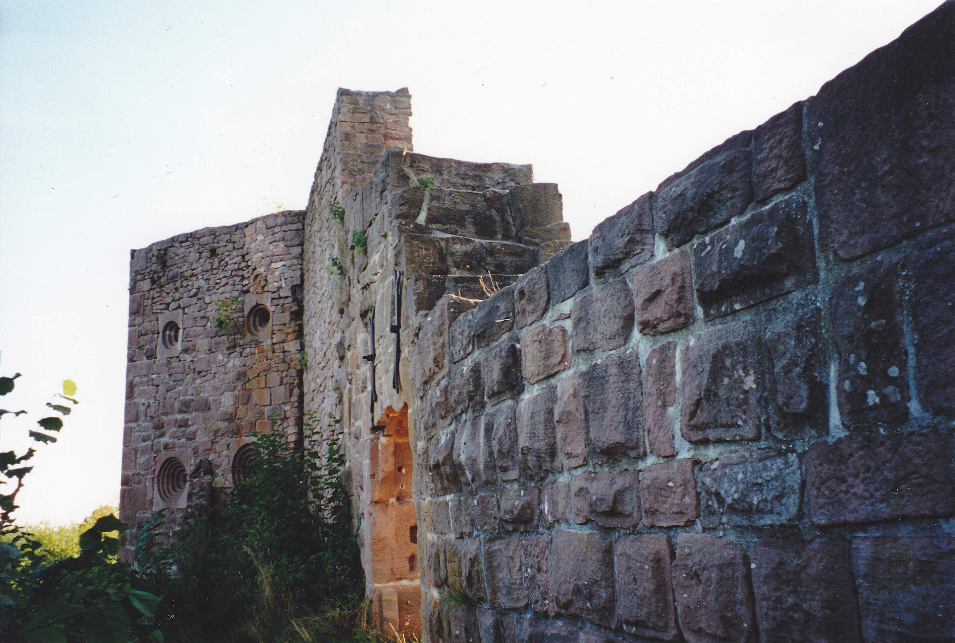
The principal medieval remains consist of a large polygonal enclosure. Its entrance is on the eastern side, facing the valley. A triangular flanking tower was added to the medieval wall during the sixteenth century to protect this approach. Residential buildings survive along the western side, while a twelfth-century bastion closes the complex on the south.
Thirteenth-century keep
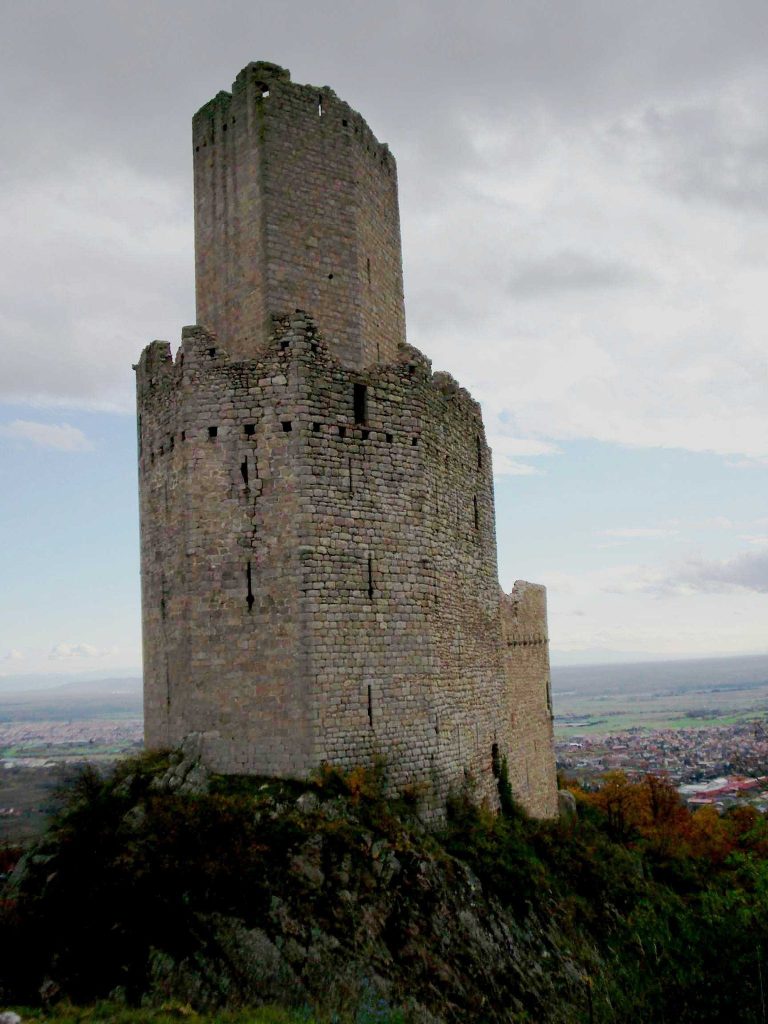
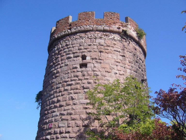
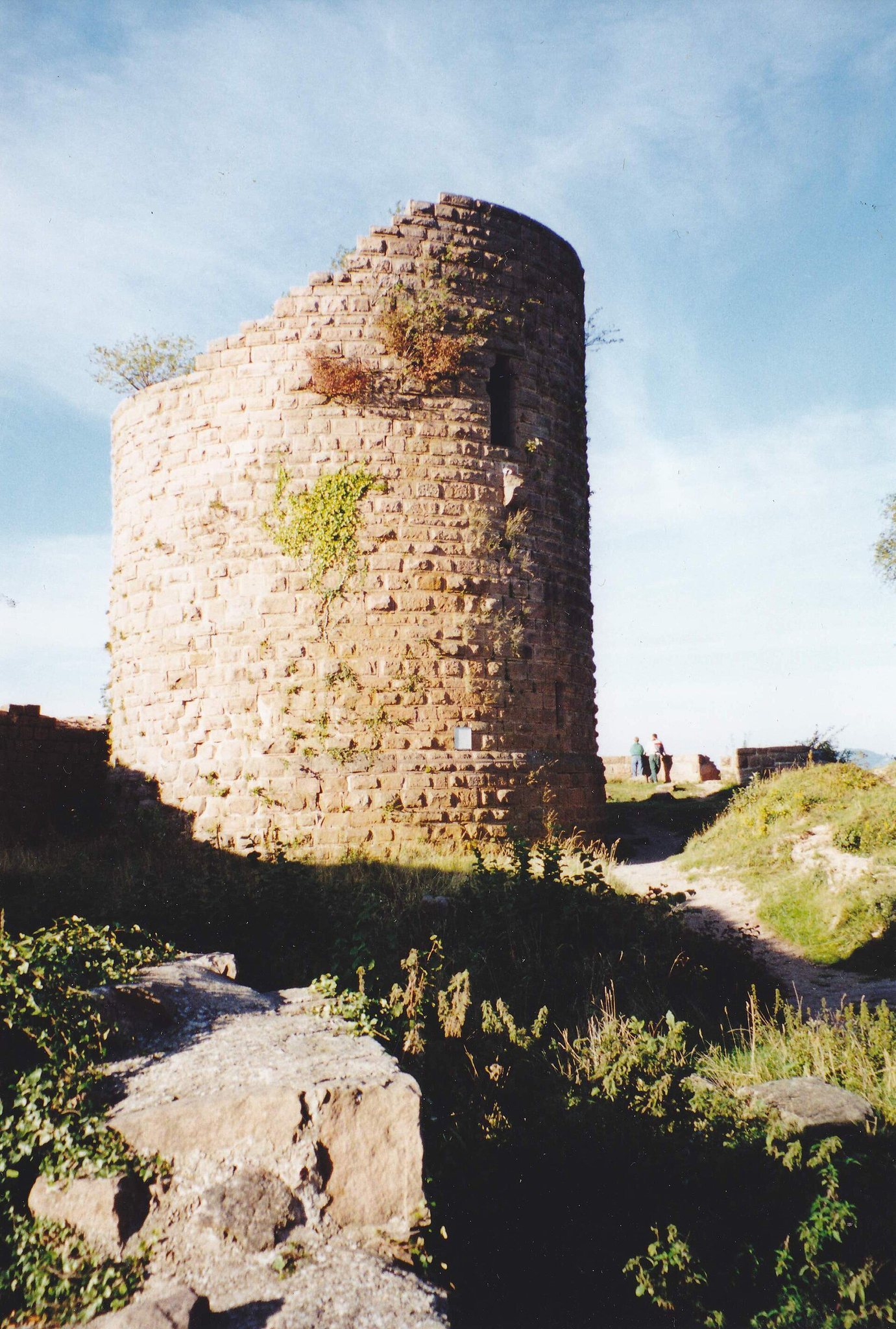
The northern part of the enclosure contains the relatively well-preserved stump of a round keep from the thirteenth century. Built from bossed stone blocks, whose outer faces project beyond the main surface, the tower is also described as having been erected around 1250. It survives to about 11 metres in height, with walls approximately 4 metres thick. A brick vault remains visible inside. The tower was restored in 1981 after the ruins had been cleared and consolidated.
Staircase and valley opening
On the southern side, a well-preserved stone staircase of approximately 20 to 25 steps runs against the enclosing wall. It probably led to the first floor. Near the staircase and the entrance is a small ground-level opening, partly concealed by rubble, that provides a view toward the Lièpvrette valley.
Upper and middle enclosures
Upper or Frankish wall
The upper or innermost wall adjoins the medieval castle on its western side. Also called the Frankish wall, it may belong to an earlier settlement or fortification that preceded the medieval fortress. Its position beside the castle forms part of the upper defensive system on the summit.
Middle or pagan wall
The middle enclosure, traditionally called the pagan wall, surrounds approximately 1.7 hectares. The medieval castle partly covers it on the eastern side. Sections survive on the northern and southern slopes about 150 metres below the castle, and the southern section follows an almost straight line that rises gently uphill before merging with large natural rocks.
The wall is built from very large blocks joined with dovetail keys. It is approximately 1.80 metres thick, while surviving sections measure about 0.60 to 0.90 metres in width and 0.50 to 0.70 metres in height. Its date remains uncertain. Proposed interpretations place it in the late Iron Age, possibly during the La Tène period, in the Gallo-Roman period no later than the fourth century, or in the Merovingian period. The La Tène period was a later Iron Age culture of central and western Europe, while the Gallo-Roman period refers to the Roman and Romanized world of Gaul during the later Roman Empire.
The wall has been interpreted either as part of a protected site combining semi-industrial and semi-cultic functions or as a Roman or early medieval fortification. Wooden fragments have supported a possible Merovingian date, whereas the building methods have also been considered compatible with the late Iron Age or Roman periods. Many of its stones were probably reused in the medieval castle.
Outer enclosure and archaeological finds
Outer wall
The lower or outer wall lies beside the pass between the Schlossberg and the Altenberg. If its line enclosed the mountain at a uniform elevation, it would have surrounded approximately seven to eight hectares. Excavations in 2014 uncovered remains of a post-slot wall, a defensive structure whose upright timber posts were set into slots in its foundation, together with three Nauheim fibulae and Celtic and Roman coins. Because the late La Tène fibulae lay beneath the wall foundation, the outer wall was constructed no earlier than the second half of the first century BC.
Bronze bull and earlier finds
Several finds help place the enclosures within a wider sequence of activity. Gallic coins, limonite, and a pot containing several hundred coins were found near the middle wall in 1932. The coins were identified as either Gallic or Gallo-Roman. Bronze coins bearing the image of Constantine I were found there in 1926, and archaeological evidence indicates Roman activity on the site during the third and fourth centuries.
The three-horned bronze bull discovered in the area is preserved at the Maison du Val de Villé. An inhabitant of Rombach-le-Franc found the statuette. Alongside the Bronze Age objects and Roman coins from the mountain, it contributes to the evidence for the long use of the Schlossberg before the construction of the medieval fortress.