Grobiņa Castle: A Medieval Livonian Order Fortress in Latvia
Site at a Glance
- Rating
- 4.7
- Popularity
- Medium
- Country
- Latvia
- Primary era
- Medieval
- Eras represented
- Medieval, Early Modern, Modern
- Civilizations
- Duchy of Courland and Semigallia, Livonian Order
- Site type
- Military
- Remains
- Castle
On this page16 sections
History
Grobiņa Castle is a medieval fortress in Grobiņa, Latvia, built and developed under the Livonian Order from the thirteenth century onward. First mentioned in the 1253 division treaty of Courland, it protected the road between Kuldīga and Memel and the older route between Memel and Kuldīga. Its earliest construction remains uncertain, but proposed dates for the first Livonian Order castle include approximately 1245 to 1251.
The Curonian and Viking-age settlement
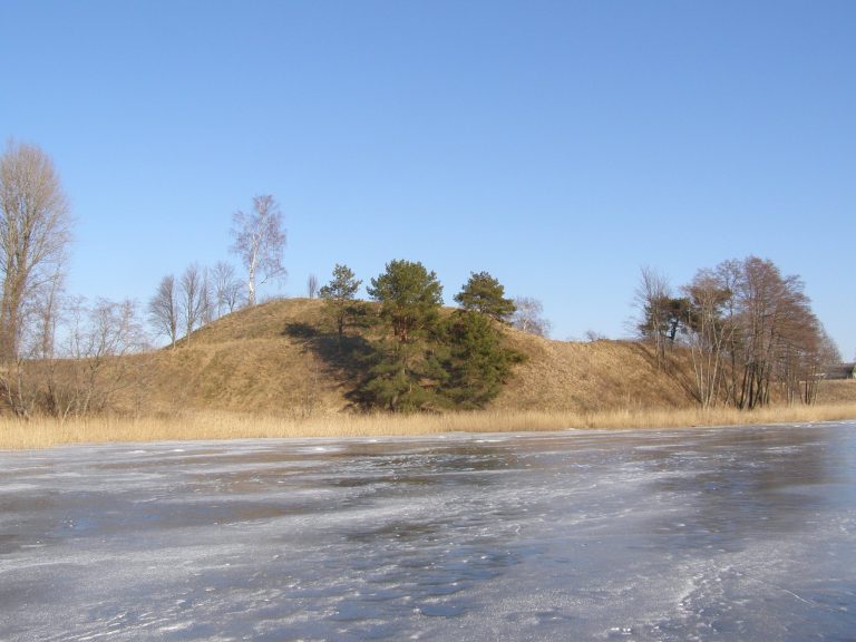
The castle replaced an earlier Curonian fortified settlement on nearby Skābāržu kalns, about 100 metres away. From the sixth to the eighth centuries, merchants and warriors from Gotland and mainland Sweden established a settlement at Grobiņa beside the then-navigable Alande River. It became the largest known Viking colony in the Baltic region and may have been one of the earliest cities in Eastern Europe.
Skābāržu kalns may be the Seeburg, also called Jūrpils, mentioned in Scandinavian sources and in the ninth-century Vita Sancti Ansgari, a life of Saint Ansgar. The identification remains disputed. Curonians occupied the settlement around 800 and refused tribute to the Swedish king. King Olof may have captured Grobiņa around 854 with a large army and destroyed the fortress, an event that reduced the settlement’s importance. Excavations in 1929 and 1930 uncovered three burial grounds containing approximately 3,000 graves.
The Livonian Order stronghold
After the Christian conquest of Courland, the 1253 treaty assigned Grobiņa to the Livonian Order, a Catholic military order that controlled much of medieval Livonia in present-day Latvia and Estonia. The first castle was probably built of wood. A Curonian wooden castle was captured by the Curonians after the Battle of Durbe on 13 July 1260, when a Lithuanian-Curonian army decisively defeated the Livonian Order. The Order recaptured and burned it in 1263. The later fate of that earlier castle is unknown.
After the Livonian Order transferred the Memel region to the Teutonic Order in 1328, Grobiņa was probably rebuilt in stone on the right bank of the Alande, on a raised site about 200 metres from Skābāržu kalns. Master Goswin von Herike strengthened and enlarged the existing castle around 1347 and 1348. The fortress repeatedly served as an Order base in southern Courland and was strengthened and rebuilt over time.
Grobiņa was first recorded as the seat of a bailiff in 1399. A bailiff was an Order official who administered a castle district, while the bailiff of Grobiņa was subordinate to the Komtur of Kuldīga, the commander of a larger administrative and military district. The first named bailiff was Goswin von Ascheberg, who held office from 1426 to 1430. Klaus von Streithorst, who served from 1551 to 1560, was the last. During the Order period, Grobiņa was also known for breeding falcons. In 1559, the first witch trial in the history of Latvia took place near the castle walls.
Transfer to Prussia and the Reformation
During the Livonian War, Gotthard Kettler, the last master of the Livonian Order, pledged Grobiņa Castle and its associated lands to Duke Albrecht of Prussia in 1560 for 50,000 guilders. The agreement was signed in Reval, the historical name for Tallinn, on 5 May, although the duke’s officials had already left the castle between 28 and 30 April.
The castle was already connected with the Protestant Reformation. In July 1560, Johann Funck, a Lutheran preacher from Königsberg, visited Grobiņa, where a Protestant pastor was preaching in the castle church. An inventory from the same year lists the church’s silver vessels and furnishings, including a silver chalice, a square plaque with a silver crucifix and two silver images, a silver ring, a gilded copper monstrance, chandeliers, a hand-washing basin, and an old mass vestment decorated with crucifixes. In 1562, a castle administrator, a clerk, and servants were recorded there. An arsenal was first mentioned in 1590.
Ducal residence and wartime destruction
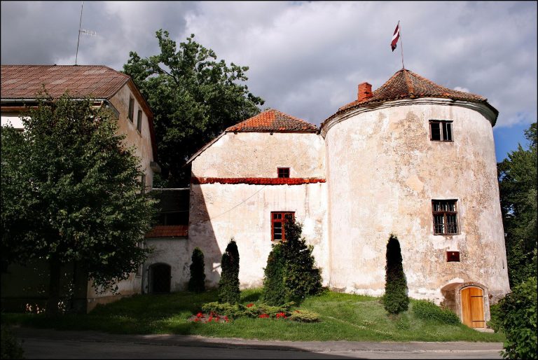
Grobiņa returned to the Duchy of Courland and Semigallia around 1608 or 1609 as part of the dowry of Sophie of Prussia, who married Duke Wilhelm Kettler. The castle became one of the ducal residences. It was substantially rebuilt and further fortified during the seventeenth century, probably changing from an Order stronghold into a more residential castle. In 1645, Grobiņa was recorded as a fief of Louise Charlotte of Brandenburg, who probably undertook additional expansion and fortification.
Under Duke Jacob Kettler, Courland reached its greatest economic prosperity. After returning from Swedish captivity in 1660, Jacob stayed at Grobiņa Castle with his family. The castle nevertheless suffered repeated wartime damage. Swedish troops under Marshal Robert Douglas burned the town and plundered the castle in 1659 during the Second Northern War. During the Great Northern War, the Swedish army under King Charles XII occupied and destroyed the castle again. Its military importance then declined, although administrative offices for the surrounding territory remained there until the Duchy of Courland and Semigallia ended in 1795.
Abandonment, investigation, and conservation
Polish insurgents plundered the abandoned castle in 1794. It was no longer inhabited after 1809 and gradually deteriorated. In that year, Ulrich von Schlippenbach described the outer walls as strong and in good condition, but noted that the castle was unoccupied and that earlier visitors had found only one habitable room and remains of an old weapons store. King Friedrich Wilhelm III of Prussia visited Grobiņa while staying at Memel in connection with Napoleon’s invasion.
The castle grounds had belonged to the city since the eighteenth century, and a city park was established around the ruins in the nineteenth century. Bernhard Schmid investigated the remains in 1921, preparing drawings, plans, and a condition description. Conservation began in the 1970s under the architect Ilgonis Stukmanis, leaving the walls in relatively good condition. In 1998, the medieval castle and its bastions were designated a state-significance archaeological monument in Latvia. The archaeological complex, including the hill fort, was placed on Latvia’s Tentative World Heritage List in 2017.
In 2019, the ruins were redesigned as part of the Alande River Recreation Park project and partly reconstructed. The work added a viewing platform within the east wing, replaced an outdated event stage, marked the line of the collapsed west wall with gabions, and installed wooden stairs on the western slope toward the reservoir.
Remains
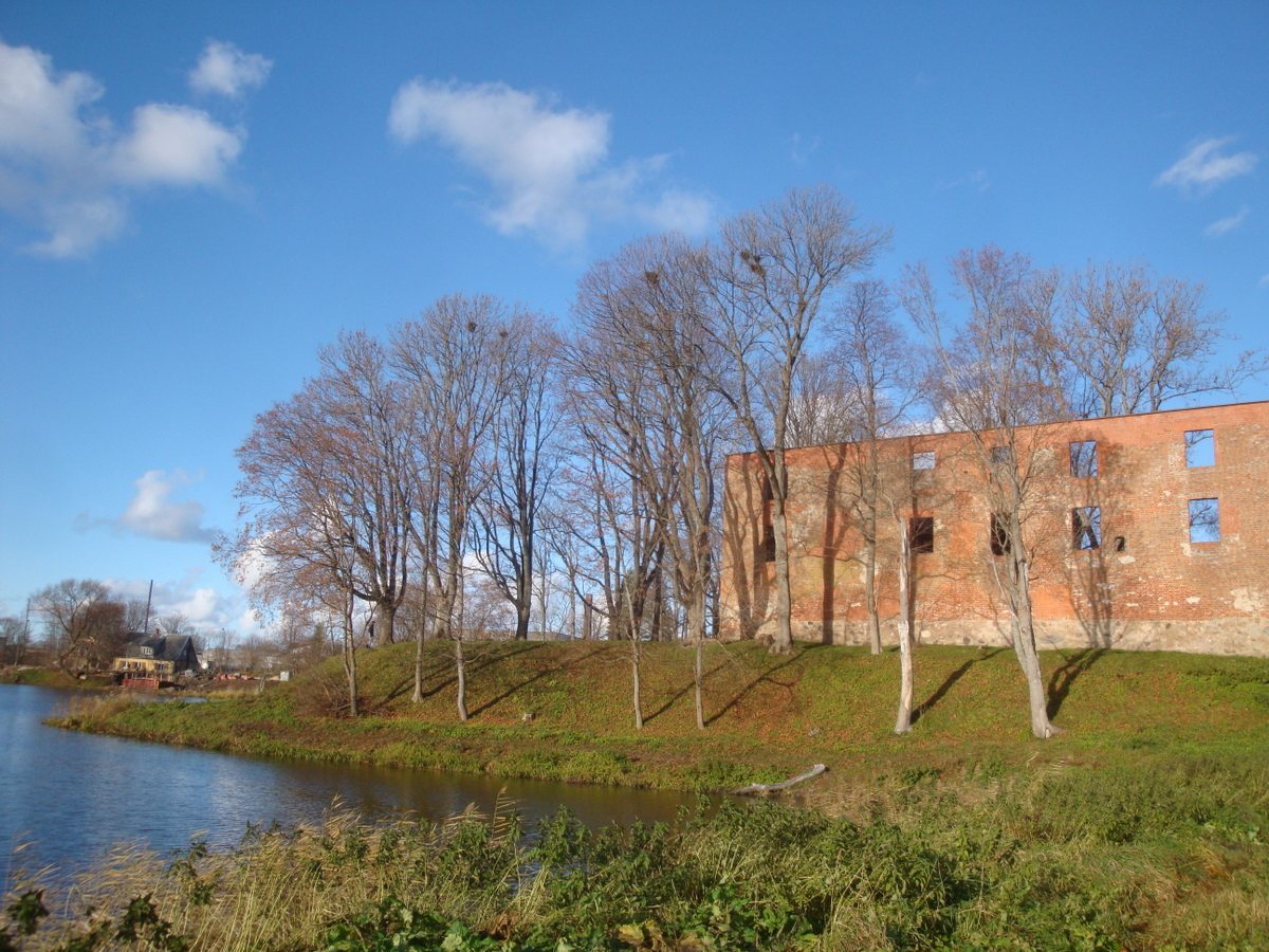
Grobiņa Castle occupies a slight elevation on the right bank of the Alande River. Impounded water forms a reservoir on the southern and western sides, while defensive ditches were dug to the north and east. The rectangular complex measured approximately 58 metres in length and between 34 and 38.6 metres in width. A three-storey south wing formed the oldest surviving part, while buildings or wings extended along the northern, eastern, and western sides. A tower stood in the west wall.
Castle construction and courtyard
The earliest lower sections, including the cellar and part of the ground floor, were built mainly from fieldstone. Large bricks measuring approximately 8.5 by 15 by 29 to 29.5 centimetres were used in the upper levels and in later seventeenth-century alterations. Some brickwork was laid in two courses, and bands of fieldstone visible in the upper storeys appear to be later additions. Buildings attached to the courtyard sides of the north, east, and west walls probably served mainly economic purposes, although only a small part of these structures can be securely assigned to the Order period.
The courtyard is approximately 36 metres long. A solitary lime tree stands near its centre, while a former water feature has disappeared. The courtyard entrance now crosses the filled northern ditch and a shallow depression in the rampart. An earlier bridge may have stood at this point.
South wing
Order-period arrangement
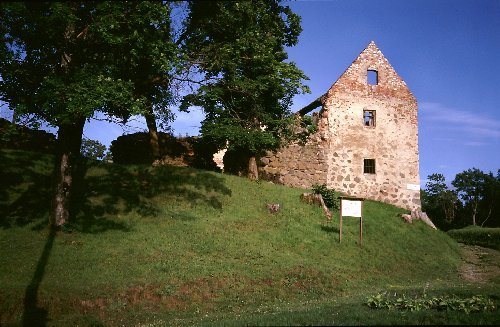
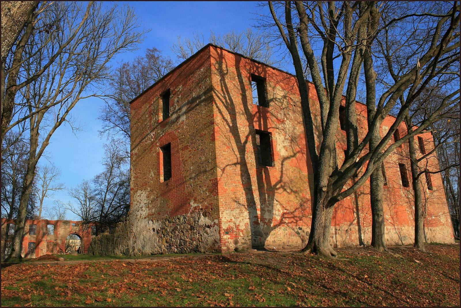
The south wing measures approximately 11.2 by 34 metres and is the oldest surviving section of the castle. It was probably designed for a convent, the resident community of Order brothers, numbering twelve, although the surviving remains do not establish that this number actually occupied the building. The cellar is almost completely filled in, and its internal partition walls have disappeared. Two cross-walls survive on the exterior walls, allowing the former division of the upper level into three rooms to be reconstructed.
The eastern room measured about 5.8 by 9.6 metres. It had large semicircular wall niches and one window in each of its eastern and western walls, and it functioned as a chapel. The central room measured approximately 12 by 9.6 metres and contained a staircase built into the wall. It served as a refectory, the communal dining hall of the Order brothers, and as an entrance hall. The western room measured about 13 by 9.6 metres and served as living and sleeping quarters, probably divided by light wooden partitions. Latrine or drainage pipes were set into its western wall, and a latrine recess stood inside the room.
A door in the northwestern corner of the western room led to the western curtain wall, the enclosing defensive wall of the castle. From there, a covered circulation or defensive passage connected the south and west wings.
Service rooms and upper levels
The ground floor contained mainly service rooms, including a kitchen and bakery. The kitchen remains described by Schmid in 1921 no longer survive. A chimney pipe three bricks wide was recorded in the courtyard wall during the 1920s, but that fragment has also disappeared. Two ground-floor entrances remain visible, one on the courtyard side beside the east wing and another opposite the staircase.
Remains of vault springings survive on the courtyard wall of the first upper level, although the existence of a complete vault is uncertain. The windows were altered in the seventeenth century in the Baroque style. Large six-pane windows were inserted and smaller earlier windows were blocked. One old blocked window remains visible in the central room’s outer wall, while another remains open in the eastern room’s courtyard wall.
The second upper level has no visible internal partitions. Its outer wall contains five later Baroque windows and two considerably smaller older windows that were subsequently blocked. Possible traces of an original wooden gallery have been noted, but this interpretation cannot now be verified.
East, north, and west wings
East wing
The east wing had an outer wall about 1.3 metres thick and a courtyard wall about 0.74 metres thick. It was built mainly of fieldstone with brick facing. The bricks, measuring approximately 7 by 13.5 by 27 to 28 centimetres, are slightly smaller and lighter than those used in the south wing.
Nine small windows opened toward the courtyard at intervals of about 4.25 metres, suggesting a series of small separated rooms. A large fireplace or smoke hood formerly stood in the northeastern corner, although it is no longer visible. The existence of a cellar is unknown. A viewing platform was added in the middle of the east wing during the 2019 redesign.
North wing
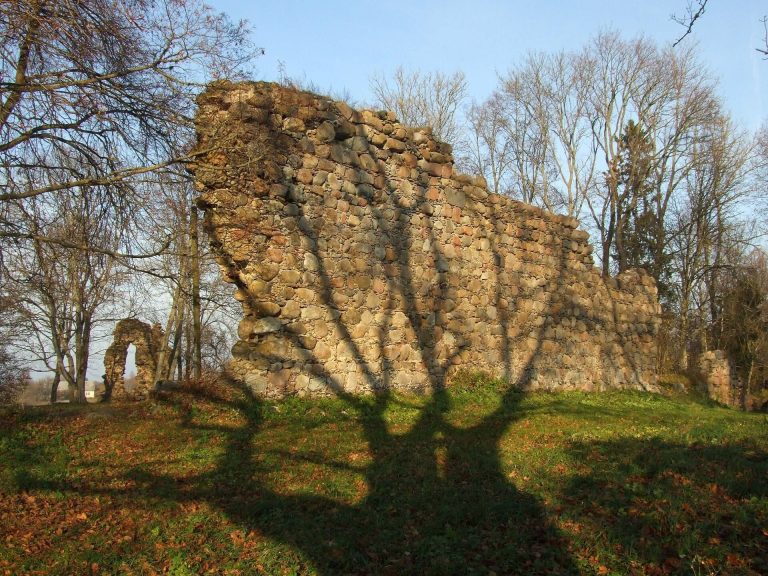
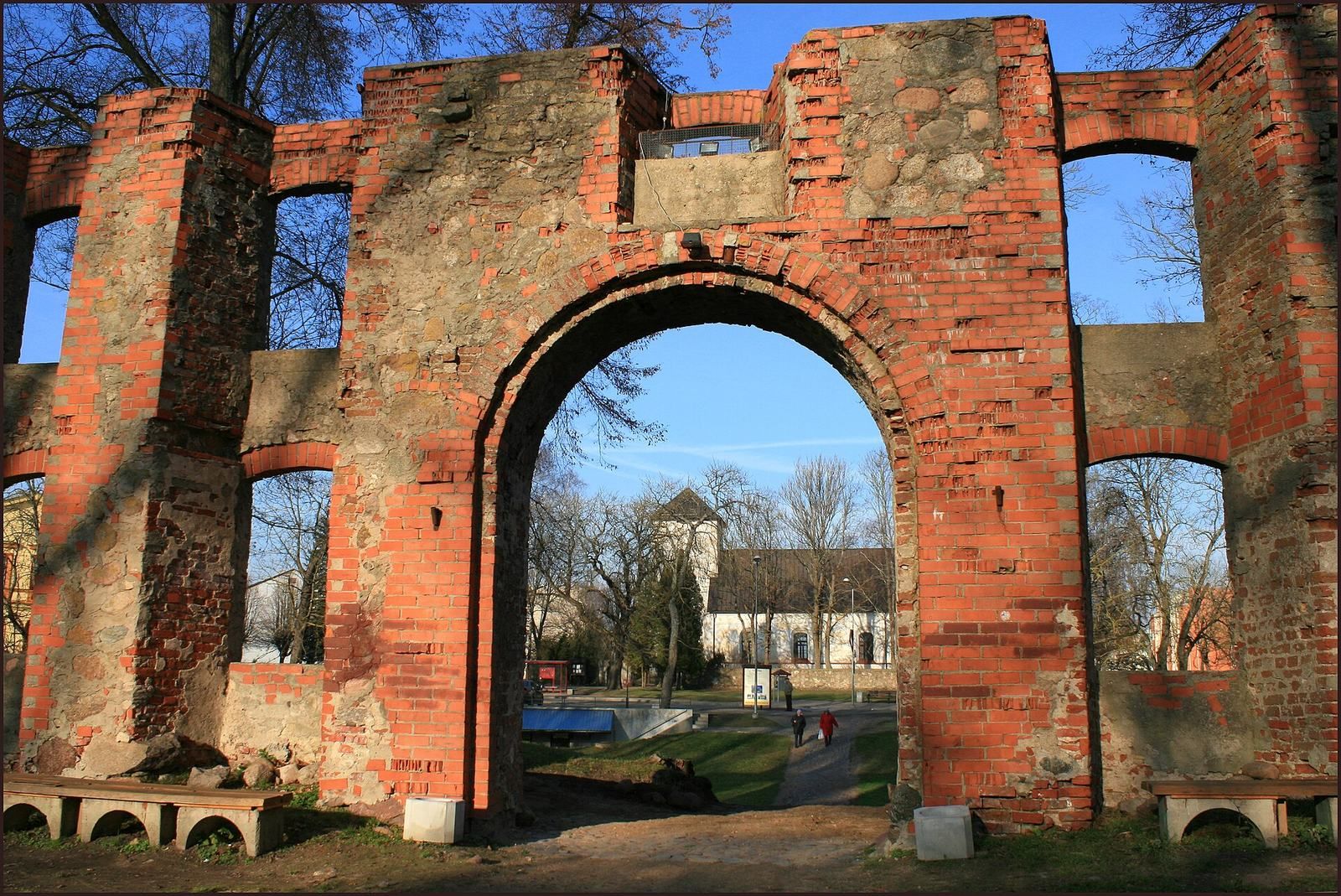
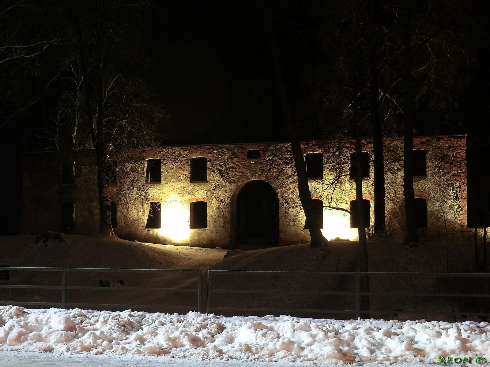
Only the outer wall of the two-storey north wing survives. In 1921, a centrally placed main portal measured 3.56 metres in width and had a seventeenth-century arched opening. Four windows stood on each side of the portal on each storey, with an axis spacing of 3.6 metres. A section of wall with a window is now missing at the northwestern corner, while cellar remains survive on the western side.
West wing and medieval entrance
The west wing was about 23 metres long and, according to its foundations, contained three large rooms with cellars. Its outer wall belonged to the first medieval construction phase and projected 4.3 metres west of the southern wing’s western end. The medieval main entrance was located in this projection, probably within a square gate tower, and may have been reached by a ramp from the lakeshore.
A covered defensive passage ran along the 13.2-metre section of wall between the gate and the south wing, and traces of its roof connection remain. Seventeenth-century rebuilding created a larger main gate in the north wing, after which the western entrance was blocked. Part of the old gate arch still survived in the early twentieth century, but by the middle of that century the west wing had been almost completely destroyed. Before the 2019 reconstruction, its remaining traces were too slight to define the wall line. Gabions now indicate the former course of the collapsed western wall.
Ramparts and bastions
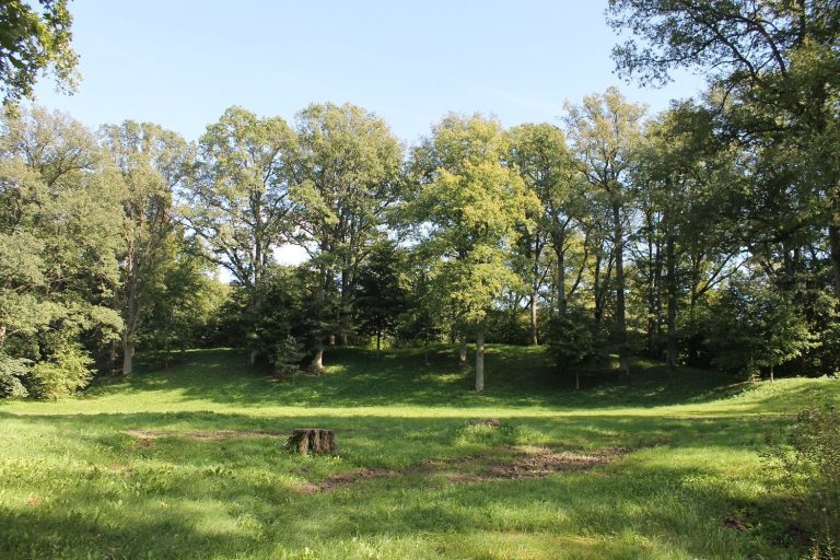
Earth ramparts and four corner bastions, projecting fortifications, were constructed around the castle during the sixteenth century and further developed during the sixteenth and seventeenth centuries. A palisade, or defensive fence made of stakes, formed part of these works. The rampart edge lies about 6 to 7 metres from the castle walls on the north and west, was originally immediately beside the south wing, and lies about 24 metres from the east wall. The northwestern and northeastern bastion projections are the best preserved.
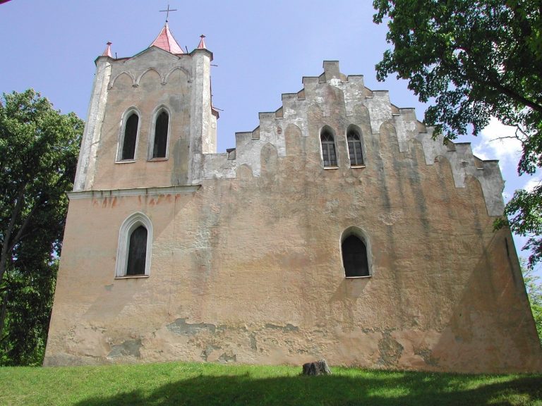
The defensive ditches have silted up and become overgrown with trees, as have the western and southern slopes. The eastern side was converted into a park in the nineteenth century. The western and southern slopes descend toward the reservoir, and Grobiņa Church stands opposite the castle ruins.