Šlokenbeka Castle: A Livonian Order Road Fortress in Latvia
Site at a Glance
- Rating
- 4.6
- Popularity
- Medium
- Country
- Latvia
- Primary era
- Early Modern
- External website
- Open
- Eras represented
- Medieval, Early Modern, Modern
- Civilizations
- Duchy of Courland and Semigallia, Livonian Order, Russian
- Site type
- Domestic
- Remains
- Manor House
On this page11 sections
History
Šlokenbeka Castle is a fifteenth-century Livonian Order road fortress and manor complex in Latvia, located at Milzkalne near Tukums. The Livonian Order was a Catholic military and religious order that governed parts of medieval Livonia, including areas of present-day Latvia and Estonia. Šlokenbeka was built as a small castellated fortress beside an important road junction and later became an agricultural estate. It is described as the only Latvian fifteenth-century castle-manor or fortified manor complex preserved in such a complete form.
Livonian Order fortress
The fortress probably originated after 1484, when forces from Riga captured, plundered, and burned Tukums Castle and its adjacent settlement. Its first fortifications are attributed probably to Werner von Butlar, a Livonian Order vassal and commander of Tukums. In the fifteenth century, von Butlar received estates in the Tukums area as a fief. Durbe Manor, between Tukums and Šlokenbeka, was recorded in 1475 as a small estate connected with his fief and with Šlokenbeka.
In 1537, the Livonian Order master von Brüggeney confiscated Dietrich von Butlar’s fief. The confiscation followed his failure to fulfil obligations to the Order, his support for the Reformation, and his involvement on the side of the Lutheran bishop Wilhelm in the Saare-Lääne conflict. On 9 May 1541, the former Butlar fiefs were granted to the committed Catholic Dietrich Schenking. Šlokenbeka was first documented on 19 January 1544, during the transfer of the fief, as a fortified place by the stream of the dammed Sloka. Schenking also received patronage rights over the parish churches of Tukums and Kandava.
In 1544, the fortress withstood a siege conducted according to contemporary military practices, despite its weak construction. Werner von Butlar tried to recover it by force but was defeated. The episode confirms the fortress’s role in the conflicts surrounding the Livonian Order during the final decades of its rule.
From Order fief to hereditary estate
After the Livonian Order was dissolved in 1562, the southern part of its former state was granted by King Sigismund II Augustus to Gotthard Kettler, the Order’s former master. The territory became the Duchy of Courland and Semigallia, a Baltic duchy that remained distinct until its incorporation into the Russian Empire in the late eighteenth century. During the 1570s, Duke Kettler converted former fiefs, including Šlokenbeka, into hereditary property to secure noble support.
Dietrich Schenking died in 1573. On 6 December 1580, his six sons divided the inheritance, and Šlokenbeka went to Mathias Schenking, who compensated his brothers. Mathias later became commander of Tukums Castle. In 1610, under a privilege issued by Duke Gotthard, the former Šlokenbeka Order fief formally became the property of the Schenking family.
War soon exposed the limits of the old fortress. In 1605, during the Polish-Swedish War, a Swedish force of about 4,000 men landed near Plieņciems and advanced toward Tukums. The Swedes captured and burned the undefended Tukums fortress and took Mathias Schenking prisoner. Šlokenbeka, although it served as an auxiliary fortress, had become an insecure refuge as firearms grew more powerful. In 1622, forty Swedish soldiers under Colonel Asersen captured Tukums and occupied Šlokenbeka, where local nobles had hidden their possessions. The soldiers seized considerable booty and returned to Riga. These attacks ended the castle’s military importance.
Agricultural estate and manor complex
The property remained with the Schenking family until 1677. It then belonged to Christoph Putkammer, chancellor of the Duchy of Courland and Semigallia, from 1678 to 1701, followed by the von der Brüggeney family in the early eighteenth century and the von Grothus family from about 1730 to 1815. The von Medem family held it in the early nineteenth century, Baron von Bulmering from about 1840 to 1848, and the von der Recke family from 1848 until the agrarian reform period after the First World War.
Putkammer rebuilt the former fortress as an agricultural estate between 1678 and 1701. Farm buildings were added, and defensive structures were adapted to estate use. Swedish forces attacked and occupied the property in 1701. During the eighteenth century, the Grothus family continued to add barns and other agricultural buildings. From 1789 to 1808, the owners used nearby Durbe Manor as a summer residence. By the beginning of the nineteenth century, Šlokenbeka was a prosperous and profitable estate, while the owners lived at the newer, larger brick-built Durbe Manor.
After Courland and Semigallia became part of the Russian Empire, the estate passed through the Medem and Bulmering families. From 1841 to 1845, the Bulmerings built a wooden residential house in the southwestern corner of the enclosure, replacing an older servants’ house. The von der Recke family financed new agricultural buildings in the 1860s with income from the estate distillery. Reconstruction directed by Ludvig von der Recke continued approximately from 1869 to 1903. The distillery exported its production to Germany and England and produced up to 15,000 buckets annually.
Twentieth-century decline and restoration
During the First World War, a German army field hospital operated at the estate. After Latvia’s agrarian reform, the property was assigned in 1920 to the Tukums forestry administration. Poor maintenance caused the buildings to deteriorate, and they remained unused after the Second World War. The historian and archaeologist Heinz Pīrangs surveyed the manor-fortress in 1926.
Until 1949, the complex housed a machine-tractor station. It was then transferred to the Latvian Soviet road administration for storage of road-maintenance equipment and later housed a road-construction and repair organization. Neglect led to collapsed roofs and ruinous buildings. Restoration based on a project by the architect E. Kalniņš began in 1977, although work may also have started in 1972. Many partly preserved walls and the defensive enclosure were rebuilt, some blocked firing openings were reopened, and the principal buildings were reconstructed. By the late 1980s, the first group of interconnected farm buildings and the northern gate tower had been restored, followed by the southern gate tower, former manor house, servants’ house, and inn.
The Šlokenbeka road-construction company used the complex from 1990. In 2000, the Latvian Road Museum moved there from Ogre, bringing exhibits related to road construction. The complex was transferred to the Latvian Ministry of Transport in 1997 and included in a European cultural-heritage list. It passed to the municipality in 2006; the northern wing and Saime House were reconstructed as a community hall. In 2024, municipal authority was exercised through the limited-liability company Šlokenbekas pils. The complex is a nationally significant archaeological monument and includes nationally significant architectural monuments.
Remains
Šlokenbeka stands on the northern bank of the Slocene River, near Tukums, on a low terrace projecting almost to the water on the southeastern slope of an ancient valley. The valley widens here to nearly 500 metres, and the position formed a bridgehead for crossing the river. Roads once led west toward Tukums Castle, north toward the Gulf of Riga and Riga, east toward the Valguma lakes and a large marsh, and south across the river toward Jelgava and the southern Riga-Prussia road.
Medieval defensive enclosure
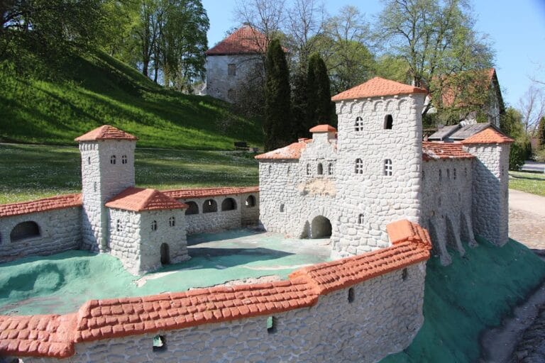
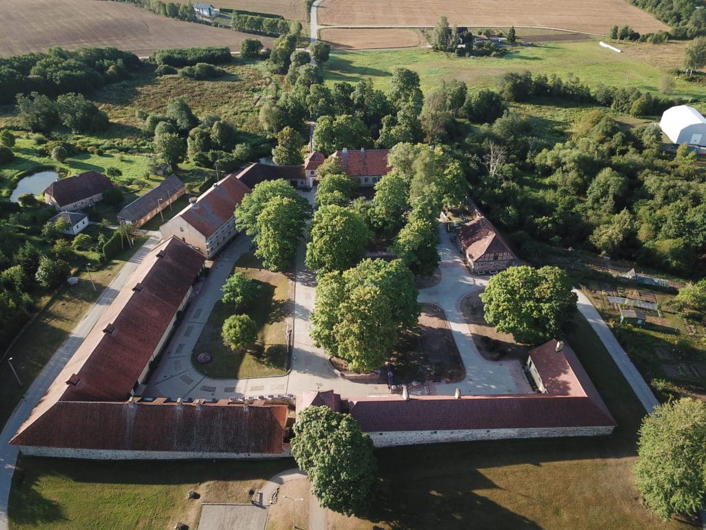
The fortress is an elongated, irregular north-south rectangle adapted for firearms. It is a Courland-type road or camp castellum, meaning a compact fortified enclosure organized around its defensive perimeter. Its four sides measured approximately 128, 111.5, 123, and 84 metres, enclosing about 12,250 square metres, or more than 1.2 hectares.
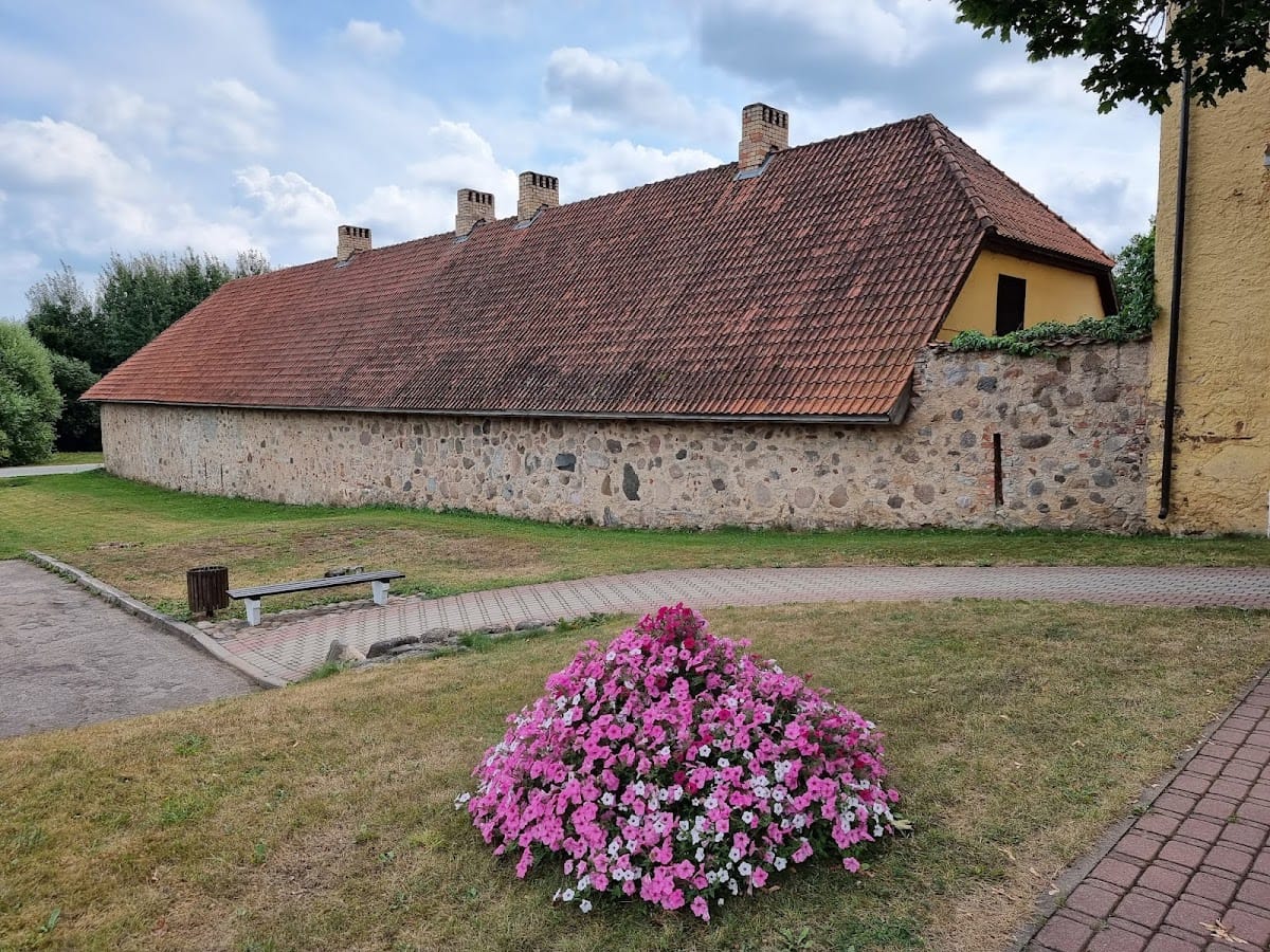
The roughly one-metre-thick enclosure was built of fieldstone. Brick, measuring about 24-25 by 13-14 by 7-7.5 centimetres, mainly lined the tall firing slits. A wall-walk ran along the parapet, and elongated openings allowed firearms to be used from the walls. The enclosure follows the sloping ground, with the southeastern corner about five metres lower than the northwestern corner. A ditch probably surrounded the northwestern corner.
Thirty-five firing openings were recorded as wholly or partly preserved, including fourteen in the western wall, five in the northern wall, eight in the eastern wall, and eight in the southern wall. The medieval defensive wall now retains thirty-one firing slits. They are about 142 centimetres high and 15 centimetres wide on the exterior, widening to approximately 175 centimetres high and 80 centimetres wide inside. Their positions covered the road from the northern junction and the road along the eastern wall toward the mill dam. The garrison consisted of infantry mercenaries equipped with firearms, while no separate artillery positions have been identified.
Manor-period buildings
Gate towers
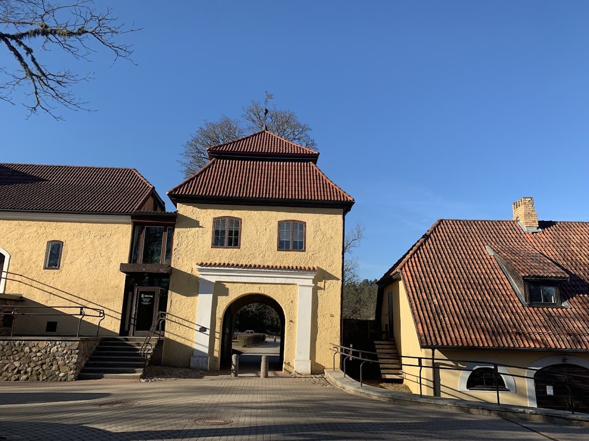
Gate towers were built in 1688 at the centres of the northern and southern walls, directly opposite one another on the same axis. These became the principal entrances during the manor period, after the fortress had lost its military role. The towers were remodelled in the Classical style in 1752 or 1772, using the eighteenth- and nineteenth-century revival of ancient Greek and Roman architectural forms. Their façades and gate portals received brick and plaster ornament, and mansard roofs were added.
Residential and agricultural buildings
The original central manor house was wooden. Nineteenth-century rebuilding demolished the structure, leaving its foundation walls, while earlier firing openings in the western wall were incorporated into buildings elsewhere. A wooden residential building was erected against the southern wall between 1841 and 1845, replacing an earlier servants’ house. By the nineteenth century, the western wall was the only side that remained more or less free of buildings. Documents were kept in a room above one of the gate towers during that period.
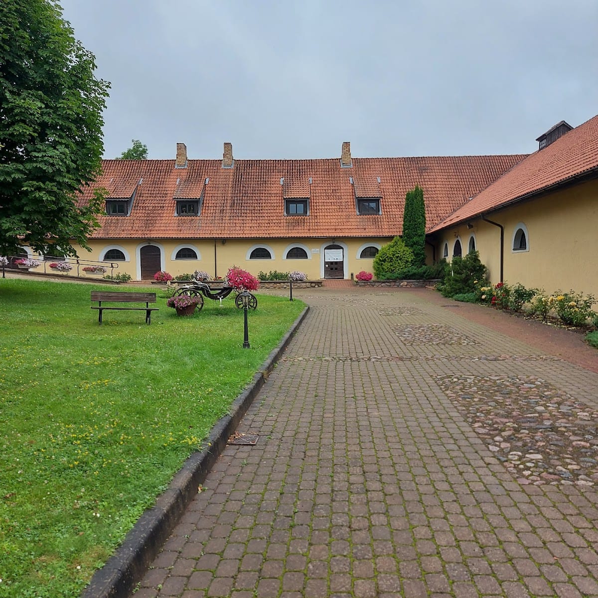
The agricultural conversion added a distillery, cattle shed, vaulted cellar, barn, hay barns, and other farm structures. A large stone barn was built against the northern wall late in the eighteenth century. The surviving complex includes the northern and southern gate towers, a granary formed from the western tower, upper and lower carriage sheds, the former manor house, servants’ house, inn, and interconnected farm buildings arranged along the inner sides of the medieval wall. The estate also had a school and parish administration building from the nineteenth century, with one account dating one of these buildings to 1862.
River landscape and archaeological finds
A bridge crosses the Slocene opposite the southern gate tower. Nearby are an associated mill and millpond, although the mill’s construction date is uncertain. An obelisk near the mill commemorates Baron Mathias Dietrich Reinhold von der Recke, and a von der Recke family burial chapel stands nearby.
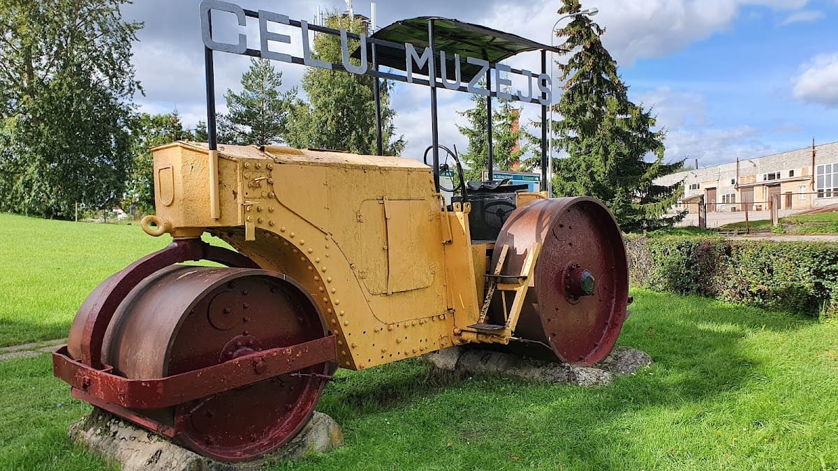
Small-scale excavations in July 2013 preceded planned expansion of the Road Museum and examined how far groundworks could proceed. Finds from the cultural layer included stained-glass fragments, stove tiles, porcelain, ceramics, musket balls, horse fittings, and a Spanish coin dating from the sixteenth or seventeenth century. The restored complex now accommodates the Latvian Road Museum, whose displays include road signs, road rollers, and other objects connected with road construction.