Abbeylara Monastery: A Cistercian Abbey in County Longford
Site at a Glance
- Popularity
- Very Low
- Country
- Ireland
- Primary era
- Medieval
- Eras represented
- Medieval, Early Modern
- Civilizations
- Norman
- Site type
- Religious
- Remains
- Monastery
On this page8 sections
History
Abbeylara Monastery was a Cistercian abbey in County Longford, Ireland, founded in 1210 by Richard de Tuit, an Anglo-Norman lord. The Cistercians were a Catholic monastic order, and Abbeylara’s ties to Dublin became important in medieval disputes within the order.
Tradition and foundation
Tradition placed an older monastery on the site and credited its foundation to Saint Patrick, traditionally regarded as the missionary who brought Christianity to Ireland. Saint Guasacht, an early Irish Christian saint, was named as its first abbot, the head of a monastery.
De Tuit died less than a year after founding the Cistercian house. Monks from Saint Mary’s Abbey in Dublin joined the new community in 1214, and work on permanent buildings began in 1216. The interval may have allowed time to prepare the site. Saint Mary’s was Abbeylara’s parent house, the monastery from which its community was established. Dublin’s abbey had itself been founded from Savigny, while Abbeylara belonged to the Clairvaux lineage within the Cistercian network. It established no daughter houses, lay in the Diocese of Ardagh, a bishop’s district, and was dedicated to the Virgin Mary.
Cistercian ties and medieval conflict
During the Conspiracy of Mellifont, a dispute among Irish Cistercian monasteries over their relationship with the order’s central authority, Abbeylara supported the Anglo-Normans and the general chapter, the Cistercians’ central assembly. Its alignment, associated with its links to Dublin rather than Mellifont, continued for at least a century. In 1318, the monks of Abbeylara and Inch were accused of forcibly driving Irish people from the area.
The abbey’s finances were poor: an assessment for 1302–1306 put its yearly income at four pounds. Its poverty deepened after Edward Bruce, a Scottish military leader campaigning in Ireland, plundered the monastery in 1315 and occupied it for an entire winter.
O’Farrell influence and decline
From the fifteenth century, the Gaelic Irish O’Farrell family increasingly influenced the abbey’s political alignment. Richard O’Farrell became abbot in 1411, and every later abbot came from the family. Between 1410 and 1435, the pope authorized the community to sell indulgences, remissions of temporal punishment for sins whose guilt had been forgiven in Catholic practice, to finance repairs to the abbey church.
By the sixteenth century, only six monks remained, and their shared monastic life had greatly diminished. The church’s transept arms, the crosswise sections of its plan, were walled off to accommodate the smaller community.
Dissolution and later fate
Although the abbey was very poor, it held 5,500 acres of land when it was dissolved in 1540. The community continued for a time, but the monastery finally closed between 1540 and 1552. The O’Farrells protected the house. Royal commissioners considered the district too dangerous to visit, so they sought information from Abbot Richard O’Farrell and the prior, a senior monastic officer, instead.
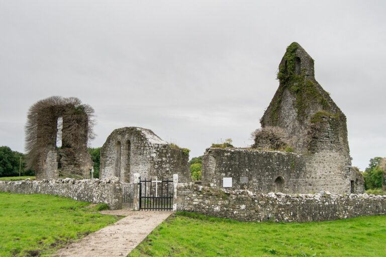
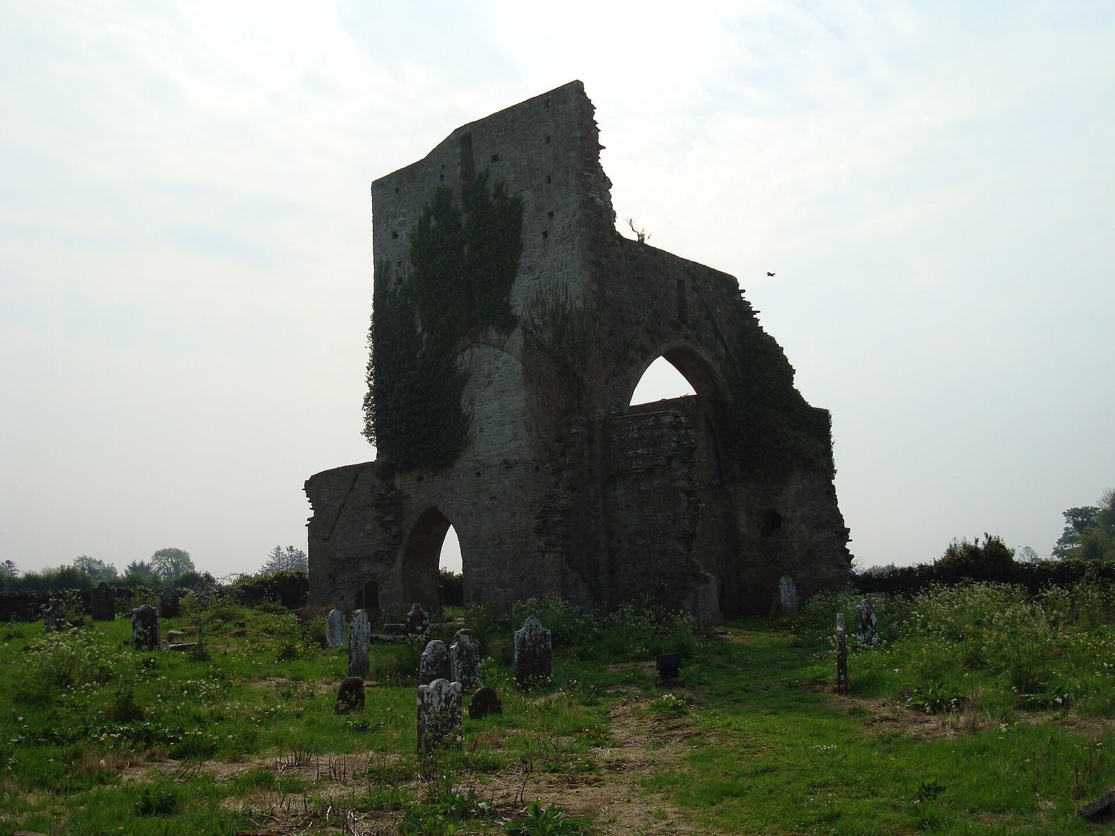
Much of the monastery was destroyed, and the church was demolished fairly soon after the community closed. Its tower was adapted as a fortified residence. Abbeylara is designated an Irish National Monument.
Remains
Church and monastic layout
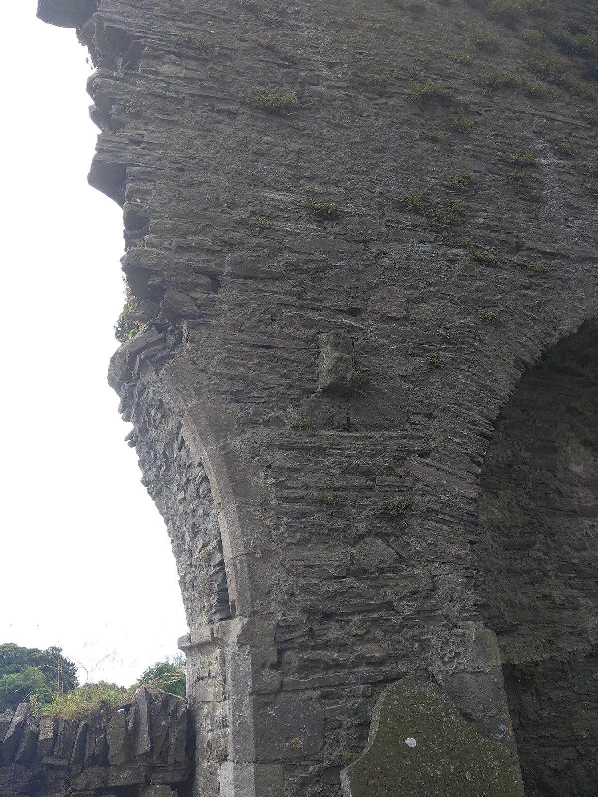
The medieval church had a cross-shaped plan. Its surviving fabric centers on the tower at the crossing, where the church’s main body met its cross arms. Portions of the north and south walls adjoin the tower, along with a spiral access stair. The cloister, a covered passage around a courtyard, lay south of the church.
Carving and cemetery
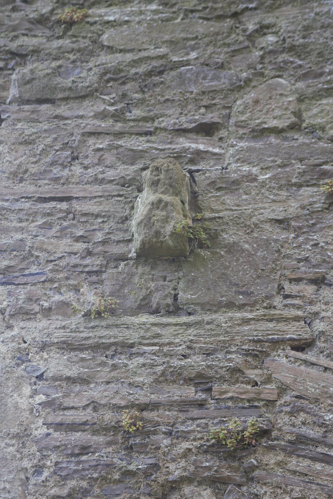
A fifteenth-century sandstone relief is set into the inner face of the crossing’s south wall, 2.5 metres above ground. It may be a Sheela-na-gig, a type of medieval figure carving often depicting a naked woman, but its condition prevents a definite identification. The relief measures 0.37 by 0.22 metres. A cemetery surrounds the monastery site and was used from the sixteenth through the twentieth century.