Granard Motte: An Anglo-Norman Frontier Castle in Ireland


Site at a Glance
- Rating
- 4.5
- Popularity
- Very Low
- Country
- Ireland
- Primary era
- Medieval
- Eras represented
- Medieval, Modern
- Civilizations
- Norman
- Site type
- Military
- Remains
- Castle
On this page7 sections
History
Granard Motte is the remains of a motte-and-bailey castle in Ireland, built around 1199 by the Norman or Anglo-Norman knight Richard de Tuit, also known as Richard Tuite. The medieval stronghold was constructed on and within an earlier hillfort during the period of Anglo-Norman expansion in Ireland. Its position made it a frontier fortress on the northwestern edge of the Anglo-Norman lordship of Meath, where it was intended to suppress the O’Reillys of southern Breifne.
The Anglo-Norman stronghold
The castle combined a raised earthen mound with an adjoining enclosed courtyard. A timber tower stood on the summit, protected by a palisade, while the bailey was enclosed and defended by banks and ditches. King John stayed at Granard in 1210 during his campaign against Hugh de Lacy, an Anglo-Norman magnate. Richard de Tuit died in the same year, an event recorded in the Annals of the Four Masters, a major Irish historical chronicle compiled in the seventeenth century. His remains are said to lie in the Cistercian abbey at Abbeylara, which was apparently founded by him or by one of his sons.
Rath Granard and the Ó Fearghail clan
The site later became known as Rath Granard and developed an association with the Ó Fearghail, or O’Farrell, clan of Annaly, the historical territory around present-day County Longford. It may have served as the inauguration place of the Ó Fearghail chiefs. Seán Ó Fearghail, chief of Annaly, is believed to have died there immediately after his inauguration in 1475. He was buried at Abbeylara.
Modern alterations and protection
A grotto was built into the northern side of the monument in 1925, when a large quantity of stone was removed with explosives. A statue of Saint Patrick was erected on the summit in 1932 to mark the 1,500th anniversary of the beginning of his mission to Ireland. In May 2017, a hole about 1 metre in diameter was dug into the side of the mound. The resulting damage prompted a survey by the National Monuments Service and repairs by the Office of Public Works. Granard Motte is a National Monument of Ireland and is listed in the Record of Monuments and Places as LF010-080001. The earlier hillfort has a separate record, LF010-080002.
Remains
Granard Motte occupies an elevated position about 220 metres southwest of Granard town, at an altitude of 163 metres. The mound overlooks the Inny valley and the surrounding countryside, and lies about 5.7 kilometres west of Lough Kinale. It is a large, flat-topped, circular earthen monument, with the motte rising above the adjoining bailey and surrounded by substantial defensive earthworks.
The motte and summit
The motte rises approximately 9 metres and has a relatively level summit measuring about 27 metres from northwest to southeast and 22 metres from east-northeast to west-southwest. The summit stands roughly 4 metres above the bailey and contains an Ordnance Survey trigonometrical station. A timber tower originally occupied this elevated platform, enclosed by a palisade made of upright stakes.
A deep fosse, or defensive ditch, surrounds the motte on its northeastern side and along the line from west-southwest through north to east-northeast. This rock-cut ditch is about 10.5 metres wide and 3.5 metres deep. Beyond it is a steep external bank approximately 8 metres wide and 2.9 metres high. On the southern side, a deep trench near the summit appears to have supplied the principal protection. Fragmentary remains of a later castle can be seen in the southeastern face of the mound.
The bailey and associated features
The bailey was a palisaded courtyard adjoining the mound. Its plan was U-shaped, while its surviving form on the southwest side is D-shaped. The enclosure is marked by an inner bank of earth and stone, a broad intervening fosse about 12 metres wide, and an outer bank approximately 10 metres wide and 2 metres high. These earthworks preserve the defensive arrangement that protected the settlement area beside the tower mound.
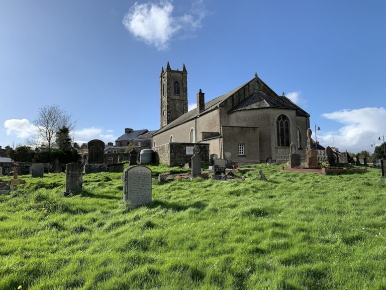
A grotto is built into the north side of the monument. A medieval church and graveyard lie about 100 metres to the north. The hollow within the motte has generated local traditions that it conceals a castle, buried gold, or a grain store, linking the physical feature with the site’s later folklore.