Qʼumarkaj: Capital of the Kʼicheʼ Maya Kingdom in Guatemala
Site at a Glance
- Popularity
- High
- Country
- Guatemala
- Primary era
- Medieval
- Eras represented
- Medieval
- Civilizations
- Maya
- Site type
- City
On this page22 sections
History
Qʼumarkaj is an archaeological site in Guatemala that served as the Kʼicheʼ Maya kingdom’s capital during the Late Postclassic, the final major pre-Columbian period of Maya history. Founded around 1400 as a defensible seat of rule, it became a centre of Kʼicheʼ power before the Spanish conquest. Its name is often translated as “place of old reeds,” though “houses of rotten reeds” is considered more precise. The Nahuatl name Utatlán translates the city’s name; Tlaxcalan allies of the Spanish called it Tecpan Utatlan, adding a word that identified it as a seat of government.
From earlier capitals to Qʼumarkaj
Before Qʼumarkaj, the Kʼicheʼ capital was at Jakawitz, identified with the site of Chitinamit, and later at Pismachiʼ. Pismachiʼ was probably established in the early 14th century. Qʼumarkaj was founded just north of it around 1400, during the reign of Qʼuqʼumatz. The new capital’s defensible position suited the kingdom’s growing power, although Qʼumarkaj was still relatively new when the Spanish arrived.
Qʼuqʼumatz expanded the kingdom, ruling first from Pismachiʼ and later from Qʼumarkaj, and relied on an alliance with the Kaqchikels, another Maya people. His identity is uncertain. His name means “Feathered Serpent,” a religious image and title used elsewhere in Mesoamerica, and he may have been the ruler known as Ajpop Kotujaʼ. An early Colonial Kʼicheʼ text calls him Qʼuqʼumatz Kotujaʼ, but also names his father Kotujaʼ Qʼuqʼumatz, leaving unclear whether the names refer to one person or to a father and son. Qʼuqʼumatz married Xlem, daughter of the Tzʼutujil king of Malaj.
Qʼuqʼumatz offered his daughter in marriage to Tekum Sikʼom, ruler of the Kʼoja. Sikʼom killed her rather than accept the marriage as submission, and the war that followed ended with Qʼuqʼumatz’s death in battle against the Kʼoja. Two years later, his son and successor Kʼiqʼab led a Kʼicheʼ-Kaqchikel campaign with Kotujaʼ, the king-elect. They killed Sikʼom, captured his son, recovered Qʼuqʼumatz’s bones, and returned with prisoners, jade, and metal. Kʼiqʼab’s forces also took settlements in the Sacapulas area and subdued the Mam near Zaculeu, who had supported the Kʼoja.
Expansion, government, and society
Under Kʼiqʼab, Kʼicheʼ territory grew to include Rabinal, Cobán, and Quetzaltenango. Its western reach extended toward the Pacific border region between Guatemala and Mexico; with Kaqchikel support, its eastern frontier reached the Motagua River and its southern one reached Escuintla.
A major uprising in 1470 transformed the balance of power. During a gathering of highland peoples, two of Kʼiqʼab’s sons and some of his vassals rebelled, killing senior lords, members of the Kaweq lineage, and Kaqchikel warriors. Kʼiqʼab’s loyal sons defended him at Pakaman. The king was compelled to make concessions and lost political authority. The newly empowered Kʼicheʼ lords then turned against their Kaqchikel allies, who left the kingdom and established their capital at Iximche.
Kʼiqʼab died around 1475. The Kʼicheʼ subsequently fought the Kaqchikels and Tzʼutujils, perhaps seeking to restore Qʼumarkaj’s earlier authority. Under Tepepul, an attack on Iximche ended in severe defeat, and the Kʼicheʼ no longer challenged the Kaqchikels there directly. Tepepul’s successor, Tekum, led a campaign against the Tzʼutujils and died in battle near Lake Atitlan’s southern shore. Late in Qʼumarkaj’s history, the Nijaib lineage appears to have challenged the dominance of the Kaweq.
The kingdom’s government joined four leading lineages in a system headed by a king, a king-elect, and two captains. The Kaweq selected the king, called the Ajpop, and the Ajpop Kʼamha, who assisted him and succeeded him. The Nijaib and Saqik houses chose the qʼalel, or supreme judge, while the Ajaw Kʼicheʼ selected the atzij winaq, or spokesperson.
About 15,000 people are estimated to have lived in the wider Qʼumarkaj area during the Late Postclassic. Society included nobles, vassals, merchants, rural workers, artisans, and enslaved people, among them convicted criminals and war captives. Nobles, known as ajaw, were regarded as sacred; vassals, or al kʼajol, served as soldiers and were subject to noble law. Merchants enjoyed a privileged position but paid tribute. Noble families traced their descent through the male line to founding war leaders who appear to have entered the highlands from the Gulf coast around AD 1200 and later adopted the language of the people they ruled.
Twenty-four important lineages, or nimja (“big houses”), were associated with palace complexes where nobles conducted business, arranged marriages, held feasts, and met for ceremonies. Four larger lineages chose the rulers: Kaweq and Nijaib each had nine principal lineages, Ajaw Kʼicheʼ had four, and Saqik had two. A Kaweq lineage also supplied priests for the Temple of Qʼuqʼumatz, who may have taken part in administering the city.
Conquest and later history
In March 1524, Pedro de Alvarado entered the region after defeating a Kʼicheʼ army in the Quetzaltenango Valley, where the Kʼicheʼ leader Tecun Uman was killed. Fearing an ambush and the difficulty of moving cavalry through Qʼumarkaj’s narrow streets, Alvarado camped outside the city. He summoned the Ajpop, Oxib-Keh, and the king-elect, Beleheb-Tzy, to his camp and seized them. Kʼicheʼ warriors then attacked the Spanish Indigenous allies and killed a Spanish soldier. Alvarado ordered the captured lords burned alive and set fire to the city. Qʼumarkaj was conquered, destroyed, and abandoned in 1524.
During the Colonial period, cut-stone facings from the city’s buildings were taken for construction in Santa Cruz del Quiché. Stone continued to be removed as building material through the late 19th century, badly damaging the ruins. Hernán Cortés’s letters from Mexico contain the earliest Spanish reference to Qʼumarkaj. Francisco Ximénez visited in the late 17th century. In 1834, Miguel Rivera y Maestre prepared a report for the Guatemalan government; in 1840, John Lloyd Stephens and Frederick Catherwood visited, and Catherwood mapped the site and drew the Temple of Tohil. Alfred P. Maudslay surveyed it in 1887.
Archaeological work included Jorge F. Guillemín’s clearance and mapping of surviving buildings and nearby sites in 1956, three excavation seasons by the State University of New York at Albany in the early 1970s, and major excavations begun by Kenneth Brown in 1977. A 2003 project combined archaeological and historical research to investigate the city’s development and political organization. Little restoration has taken place. Qʼumarkaj and its satellite sites remain places for Kʼicheʼ Maya ceremonies, especially around the solstices and New Year; Pismachiʼ and Atalaya are also used for ritual practice.
Remains
Setting and urban plan
The site’s core occupies a plateau of about 120,000 square metres, roughly 2.5 kilometres west of Santa Cruz del Quiché. Ravines more than 100 metres deep enclose the plateau, and a natural causeway to the southeast links it with the eastern plain. The ravines cut through soft volcanic-ash deposits over weathered limestone and channel runoff into gullies that feed the Negro River. From there, the water system reaches the Chixoy and Usumacinta rivers and ultimately the Gulf of Mexico.
Cores from the surrounding valley contain heavy silt deposits associated with the city’s 15th-century population peak. These deposits have been interpreted as evidence of intensive hillside terracing, tree clearance for lime-plaster production, and resulting changes to local microclimates.
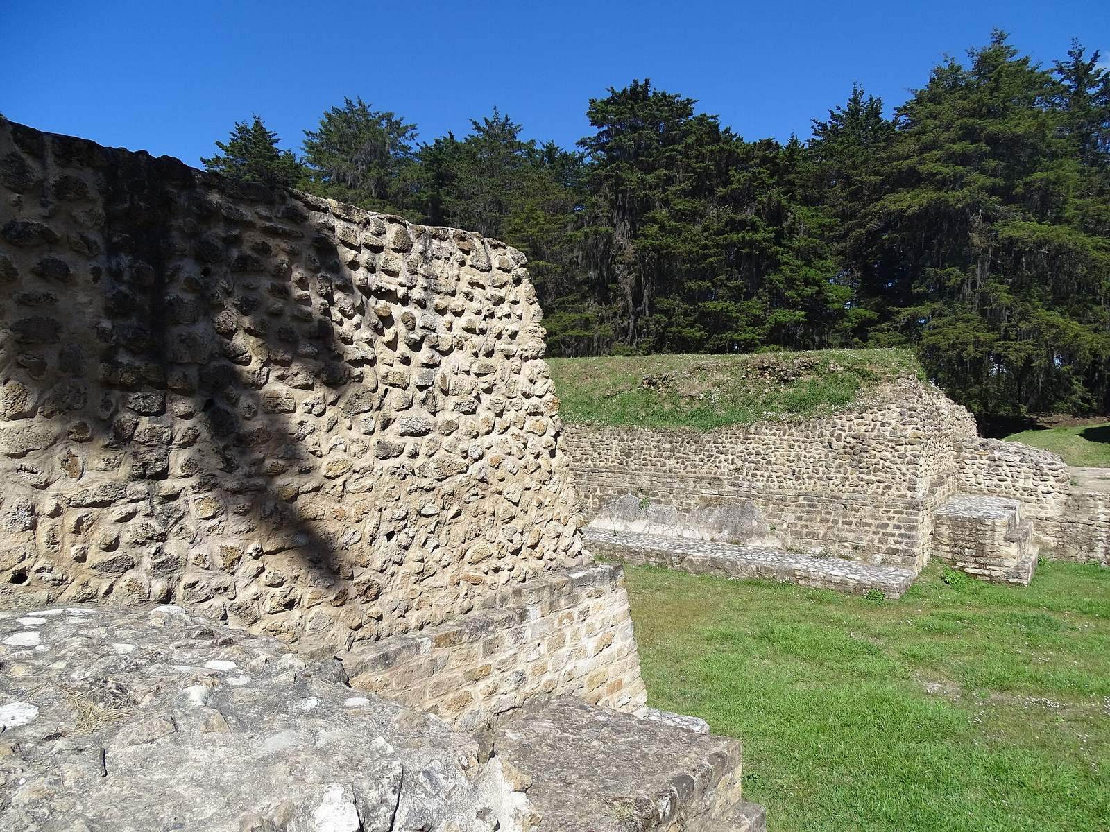
Qʼumarkaj was the largest of five major sites clustered within about four square kilometres. Atalaya and Pakaman lie to the east, Pismachiʼ to the south, and Chisalin to the north; settlement also extended across the land between them. Most finds in the core belong to the Late Postclassic, though ceramics include pieces from the Preclassic. Temple pyramids, palace remains, and a Mesoamerican ballcourt occupy the site.
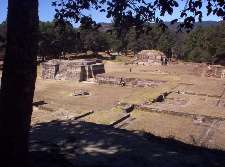
The principal buildings were arranged around a central plaza with a plaster floor. Repeated groups of pyramids, long buildings, and multi-courtyard residential compounds appear to have belonged to the nimja lineages. A street approached the plaza from the west and continued across it and the ballcourt. It divided the site broadly into northwestern and southwestern halves before branching north and east toward the ravine rim. Six lineage compounds have been identified in each half, though the divisions were not strict: Kaweq-associated buildings occur on both sides. The Kaweq and their allies occupied most of the site, while Nijaib buildings lay in the east, possibly extending to Atalaya.
Colonnades and decorative forms at Qʼumarkaj, including skull imagery, effigy censers, squatting figures, and extensive stucco, have been linked to architectural parallels at Mayapan in the Yucatan Peninsula.
Temples around the central plaza
Temple of Tohil
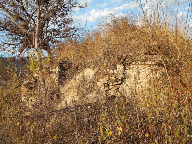
The Temple of Tohil stood on the west side of the main plaza, which it dominated. Its steep pyramid had stairways on three sides and a temple building at the summit. The base measured 10 metres on each side, and painted stucco covered the exterior. Today, rubble and a mud core remain, with an opening where offerings continue to be made. Francisco Ximénez described the building as the city’s tallest and noted 30 steps on each stairway and surviving pillars that may have supported an elaborate masonry roof.
Human sacrifice took place at the temple. Victims may have been thrown down the principal stairway before decapitation, and their heads may have been displayed on a skull rack, a structure for displaying human skulls, probably southeast of the temple and now beneath fallen debris. A jaguar image decorated the temple’s stucco.
Temple of Awilix
On the east side of the plaza, the Temple of Awilix appears to have been the city’s second most important temple. A large rectangular platform supported a smaller platform and a temple building at its eastern end. A broad stairway rose on the west, with two large panels of sloping wall and inset vertical surfaces flanking the lower level. Four main building phases and several repairs preceded the Spanish conquest. The third-phase floor was painted dark green, and fragments of incense burners were found beneath the first phase. The exterior stone facing has been removed.
Temple of Jakawitz
A large mound on the south side of the plaza marks the Temple of Jakawitz. Removal of its stone facing left a core of rubble and earth. The temple formed part of a compound with a patio, the temple on the north, a palace on the south, and a long building to the east. Drawings by Rivera y Maestre suggest that the temple was narrow and had four or five terraces.
Temple of Qʼuqʼumatz
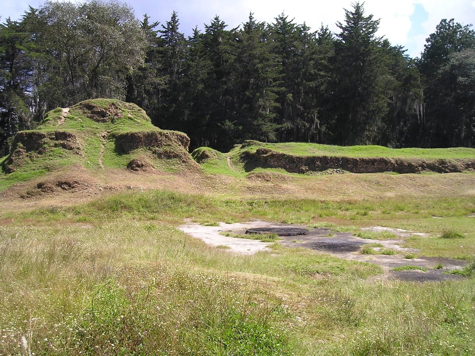
The circular Temple of Qʼuqʼumatz and its associated palace stood between the temples of Tohil and Awilix, slightly north of Tohil’s central axis and slightly south of Awilix’s. A circular impression in the plaza marks its location. Traces indicate a circular wall about six metres across surrounding a circular platform, with a passage roughly one metre wide between them. Small stone platforms stood on its east and west sides, and the structure probably supported a roof.
Ballcourt, palaces, and plaza platforms
Ballcourt
The surviving ballcourt lies southwest of the main plaza, directly south of the Temple of Tohil. It retains its characteristic form and is aligned east to west, measuring 40 metres long. Its stone facing has been removed. Four ballcourts existed across the wider site, one in each of the city’s four major political divisions. The Kaweq palace stood 15 metres north of the surviving court and the Ajaw Kʼicheʼ palace 15 metres to the south; the court’s northern and southern ranges appear to have been associated with those lineages.
Lineage palaces
Lineage palaces were long rectangular buildings beside plazas, raised on platforms about one metre high. They generally had two levels: a roofed lower entrance room and an upper level containing the principal rooms. Larger examples could have several stairways to the lower room and multiple doors and pillars leading into the main rooms. Most palace remains are now rubble. A small Nijaib palace stood directly behind the Temple of Awilix.
A second lineage palace southeast of the main plaza was excavated in 1972. Its simple building had one room, a bench at the back, an altar in the middle, and traces of hearths at both ends of the main chamber. Six funerary urns were found among the remains. One, placed near the altar, contained rich offerings including a gold necklace.
Plaza platforms
Thirteen small platforms once stood in the central plaza. Three, each about 2.5 metres wide, lay north of the Temple of Qʼuqʼumatz. South of it, five similar platforms alternated between circular and square forms, with a sixth square platform nearby. They may have served as altars. Farther south, traces of two larger square platforms measure 10 and 8 metres on each side, with a circular impression between them marking another platform. The larger squares may also have served as auxiliary altars. Two further large platforms in the southeast part of the plaza have no identified function.
Gladiatorial platform
Immediately behind the Temple of Tohil, a square platform in the plaza’s northwest measures 18 metres on each side and stands two metres high. Six layers of plaster remain on its upper surface. It has been identified as a gladiatorial platform and appears to have been associated with Kaweq military lineages, including the Nima Rajpop Achij.
Caves
Three caves enter the bedrock on the site’s northern side. The largest extends about 30 metres and contains several altars cut into the rock. The cave systems include limestone, marl, and volcanic-ash layers. Modified caves may have reached perched water tables, which could have supplied water for ceremonies during seasonal droughts. They may also have represented Tulán Zuyuá, the “Place of Seven Caves” in Kʼicheʼ origin tradition.
Satellite sites
Chisalin
A few hundred metres north of Qʼumarkaj, Chisalin occupies a narrow strip of land about 110,000 square metres in area, surrounded by ravines. Its northeast side connects with a plateau forming part of the eastern plain. Ruins cover nearly the entire strip, including a small, heavily eroded plaza.
Pismachiʼ
About 600 metres south of Qʼumarkaj’s core, Pismachiʼ occupies a small plateau separated from it by a deep ravine containing the Ismachiʼ River. The plateau is twice the size of Qʼumarkaj’s, but the ruins occupy only a small area in its southeastern part. The site is also called Ismachiʼ and continues to be used for Kʼicheʼ ritual practice.
Atalaya
About 600 metres east of the core, Atalaya covers 3,250 square metres on four terraces overlooking the approach to Qʼumarkaj at the start of the eastern plain. It is associated with the Nijaib lineage. Local tradition holds that a paved route passed the site.
Pakaman
Pakaman lies about one kilometre east of Atalaya and 1.6 kilometres east of Qʼumarkaj. Local tradition places the paved route north of Atalaya and south of Pakaman. The site was probably the first important outpost on the approach to the capital. Its original name may have been Panpetaq, meaning “place of arrival.”