La Ventrouze Castle: A Fortified Residence in the Perche
Site at a Glance
- Rating
- 5
- Popularity
- Very Low
- Country
- France
- Primary era
- Medieval
- Eras represented
- Medieval, Early Modern
- Civilizations
- French
- Site type
- Military
- Remains
- Castle
On this page9 sections
History
La Ventrouze Castle is a fortified residence in the Perche, a historic region of northwestern France. Its construction is dated to the 12th century and to the 15th–16th centuries, and the fortified castle is also described as a 15th-century work. The estate’s fief, a landholding associated with feudal obligations, was among the most important in the Perche and contributed to the region’s defense.
Medieval lordship and conflict
The fief is first recorded in 1260 under the name Ventrosa. It belonged initially to the counts of Perche, then passed through a succession of alliances to the House of Château-Gontier, the dukes of Brittany, the House of Bourbon-Vendôme, and the Auvé family. The Auvés held it from the 14th through the 17th century.
The family line included Jean Auvé, lord of Soulgé-le-Bruant, who died in 1388, and his son Simon, lord of Plessis-Bourreau in Biermé, Soupé, and Brouassin. Simon married Marguerite de Clérembault, who died in 1452. Their son Louis, lord of Genetay and Plessis-Bourel, is recorded in 1432 and married Renée de Clairembault. Their son François held the lordships of Feillet, Vaujours, and La Ventrouze and married Jeanne de Lespervier. François II Auvé, born in 1474, married Marguerite de Vieuxpont. Their daughter Marguerite, lady of La Ventrouze, died in 1602 and married Claude de Gruel, lord of La Frette; their son Claude II de Gruel died in 1615.
The castle was probably ruined during the Hundred Years’ War, the prolonged conflict between the English and French crowns conventionally dated from 1337 to 1453.
Later owners and changing use
The Sérent family later held La Ventrouze. Armand-Louis de Sérent (1736–1822), marquis de Kerfily and lord of La Ventrouze, was the son of Louis, marquis de Sérent de Kerfily, and Marie-Madelaine-Gabrielle Charette de Montebert. His son Armand-Sigismond de Sérent lived from 1762 to 1796.
The property was sold in 1792 as national property, land made available for sale by the state during the French Revolution. It served as a farm for an extended period before returning to residential use. The privately owned castle received partial listing as a French historic monument on 5 December 1979.
Restoration took place during the 20th century. From the 1980s, André Escaro and his wife had the residence restored by architect Lucyna Gautier. The work included fitting out the first floor, reinstating dormers on the east façade, and restoring a cross-mullioned window, divided into sections by intersecting vertical and horizontal members.
Remains
Castle layout
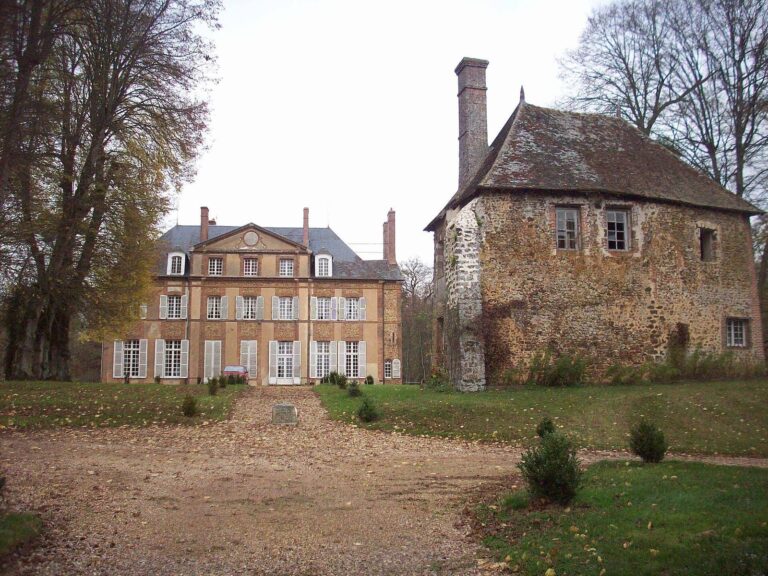
The surviving complex combines a moated enclosure, a defended entrance approach, the principal residence, and a well.
Enclosure and moats
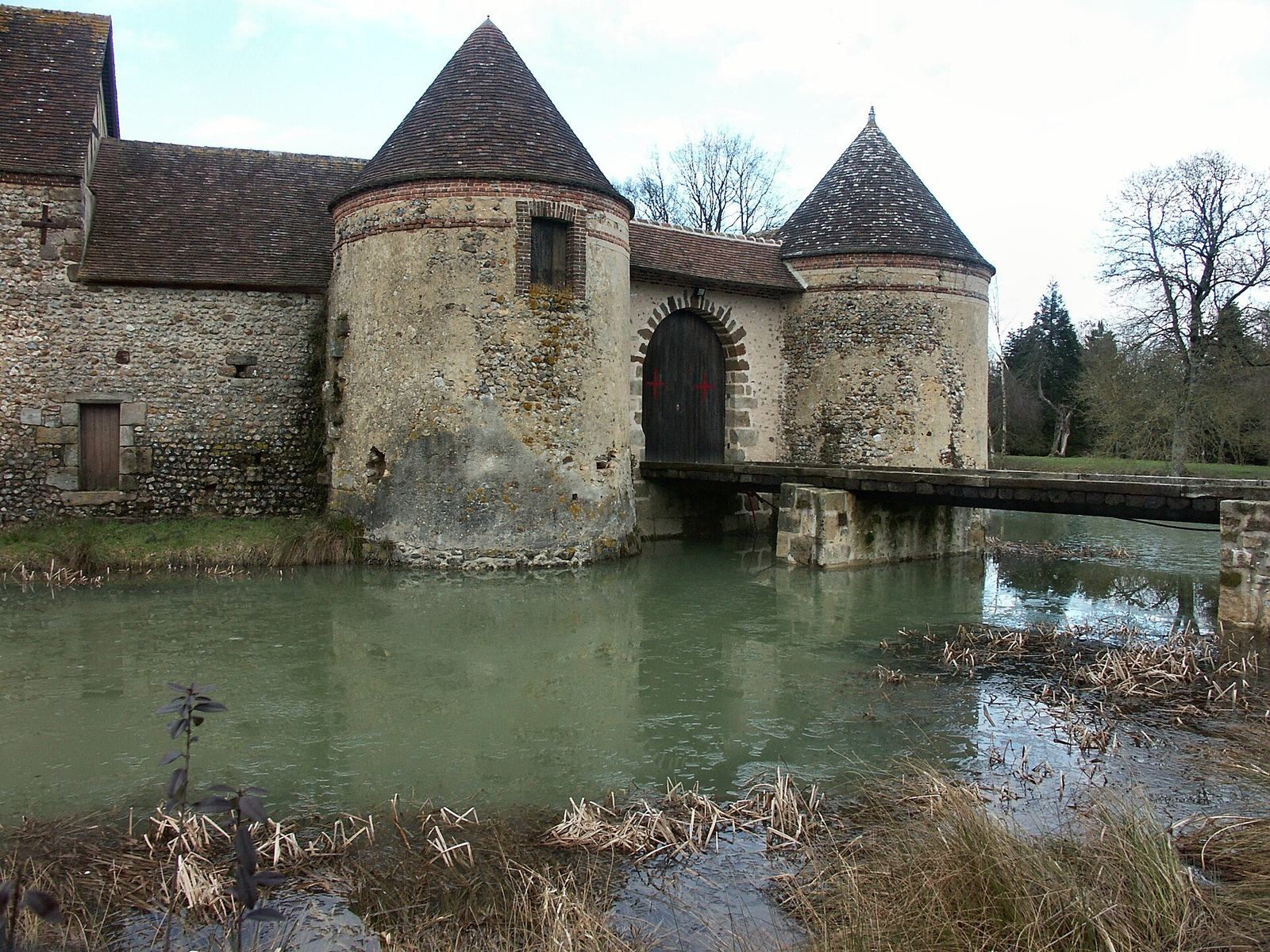
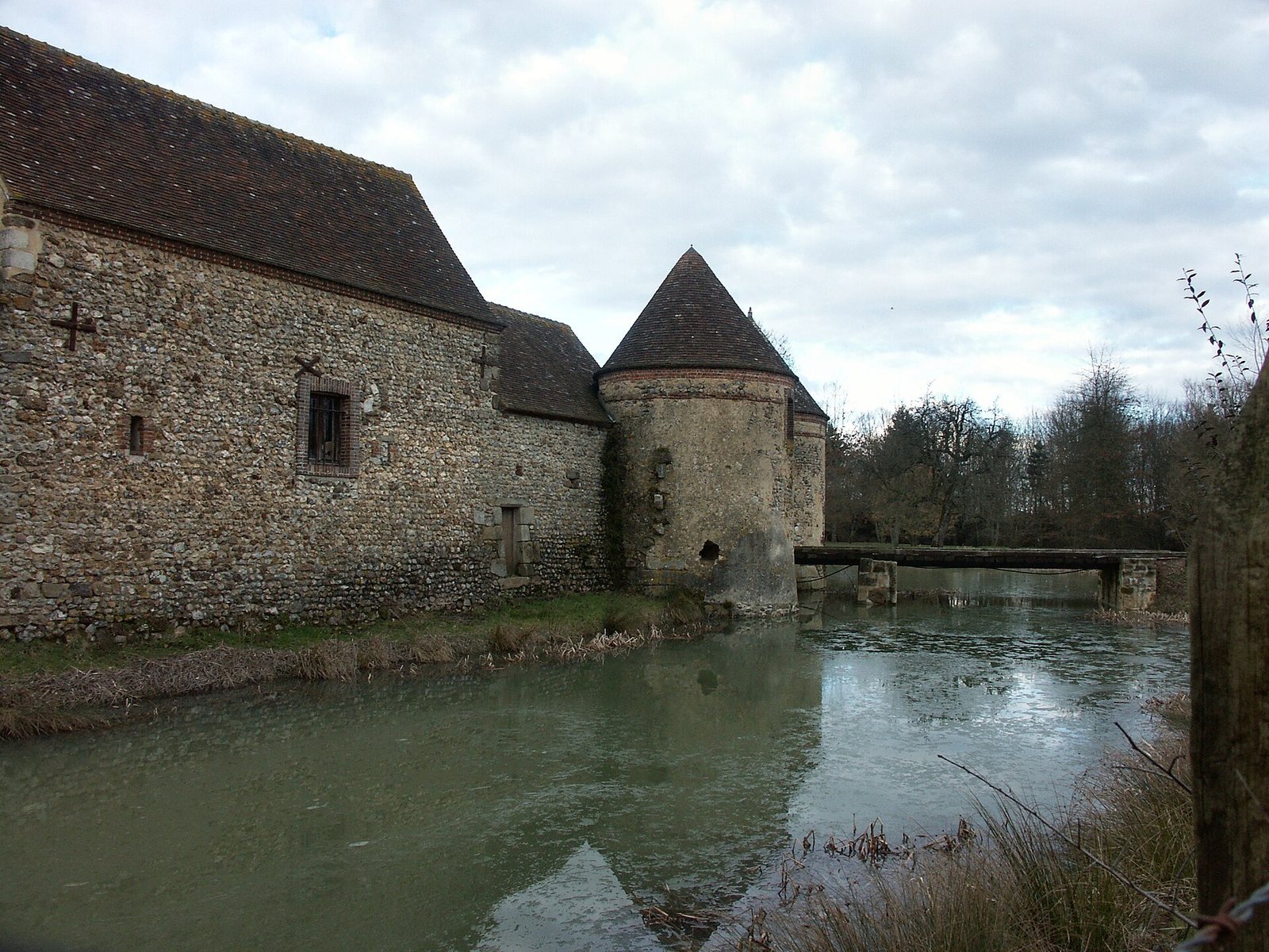
Broad moats surround the buildings, and part of the water-filled moat was filled in at an undetermined date. The surviving feudal-castle masonry is made of rough flint and grison. The 15th-century walls were originally coated with render.
Entrance towers and bridge
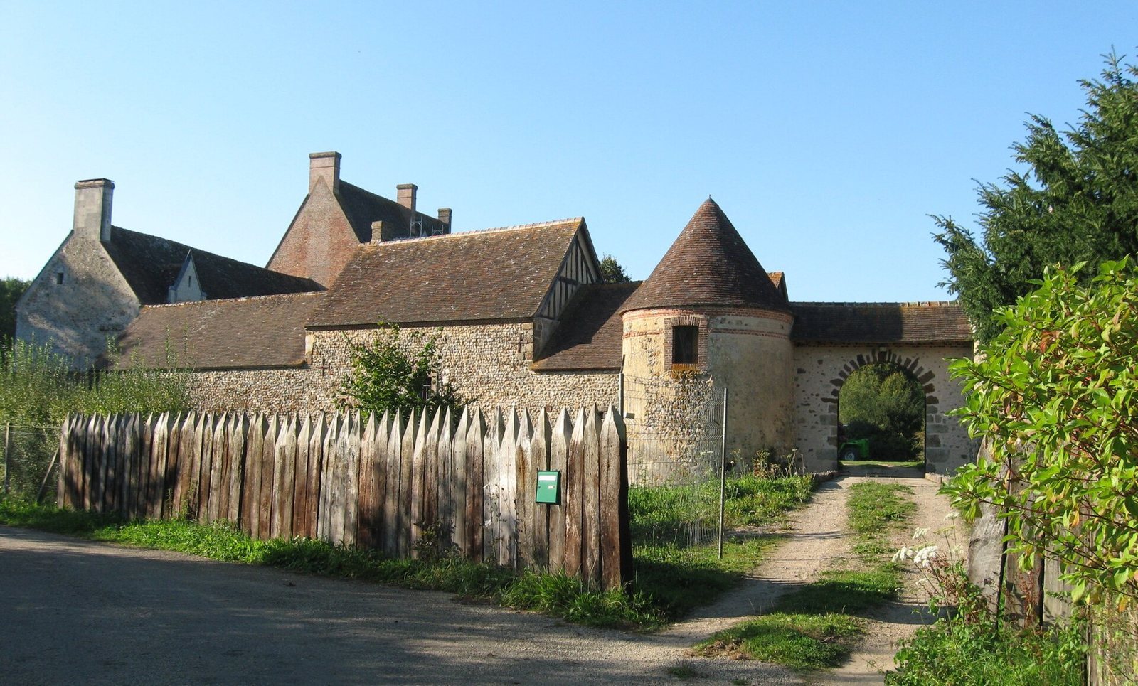
Two round towers defend the approach to the former drawbridge, which has been replaced by a stone bridge. Each tower extends into a small outbuilding, and courses and bonding of brick can be seen near the towers’ tops. The original entrance arrangement also included a small fortified structure guarding the gateway.
Principal residence
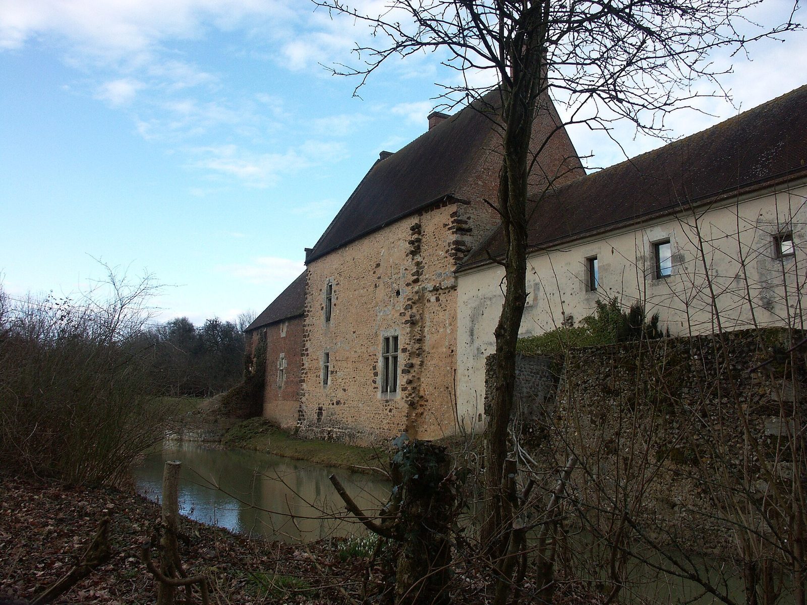
The residence has three sections with high gables. The central section retains its original volume, while the attached sections have been lowered and cut short. The buildings are made of pink brick. An upper storey constructed between 1480 and 1500 features ochre and brown bricks arranged in diamond patterns among the pink brickwork. The lord’s residence ran along the moat and retains four chimneys, two on the ground floor and two on the upper floor. Restoration reinstated the 15th-century dormers on the east façade and repaired a cross-mullioned window.
Well
The well is 18 metres deep and 1.8 metres in diameter. It uses a two-bucket method of drawing water, a technique known in the region since the 17th century. Foundation traces around the well suggest that a small building may once have covered it to help protect the water.