Dayr-e Gachin Caravanserai: A Historic Roadside Inn in Iran
Site at a Glance
- Popularity
- High
- Country
- Iran
- Primary era
- Early Modern
- Eras represented
- Classical, Medieval, Early Modern, Modern
- Civilizations
- Qajar, Safavid, Sassanid
- Site type
- Economic
- Remains
- Caravanserai
On this page26 sections
History
Dayr-e Gachin Caravanserai is a roadside inn for travelers and their caravans in Qom Province, Iran, on the historic route between Ray and Isfahan. Its first foundation most likely dates to early Sasanian rule, the era of an Iranian dynasty that preceded the Islamic conquest. The likeliest sequence is a foundation under Ardashir I followed by rebuilding under Khosrow I. The site served a corridor of military and commercial importance and was repeatedly restored and reshaped over subsequent centuries.
Sasanian beginnings and the Ray-Qom corridor
Accounts by the medieval historians Yaqubi and Hasan ibn Mohammad Qomi attribute the caravanserai to Khosrow I, also known as Anushiruwan, while another tradition associates it with Ardashir I. Qomi also relates a legend in which a king of Rûm, a medieval term for the Byzantine realm, sent a group called the Amalek to serve Khosrow. The tale describes them as exceptionally large remnants of the legendary people of Ad and says the king assigned them to build the inn.
The surrounding corridor had defensive value in the Median and Achaemenid periods, and its commercial importance grew under the Seleucids, Parthians, and Sasanians. Dayr-e Gachin stood where routes running north, south, east, and west converged. It was part of the Silk Road, a network of trade routes connecting East Asia with western Asia and the Mediterranean. Routes linked Xi’an, Hotan, and Kashgar with Ray, then continued through alternative lines via Saveh or Qazvin, Kermanshah, Hamadan, Ctesiphon, Babylon, and Antioch. In the Islamic period, the road also connected with the Great Khorasan road, used by merchants and pilgrims. Yaqubi maintained that travelers could not cross the desert between Ray and Qom without the caravanserai.
Medieval itineraries describe the journey between Ray and Qom as a series of stages. Ibn Rustah gives distances for the route from Qom through an intermediate stop to Dayr-e Gachin, and then onward via Dazeh, near Varamin, to Ray. Later accounts divide the journey into five stages, passing through Dazeh, Dayr-e Gachin, Kaj, and a settlement called Majus. The Dayr road was the earliest of several routes between the two cities. Other tracks ran by Garmsar and Siyah Kuh on the Shah Abbas road, joined that route northwest of the salt lake, passed through Kahrizak and Kangargard and forts near Howz Sultan, or followed the later line via Hasanabad, Qaleh Sangi, Kushk-e Nosrat, and Manzariyeh.
Historical writers describe the caravanserai’s position, road stages, facilities, and residents. Ibn Rustah preserves the earliest surviving Persian-language form of its name, Dayr Kajin. Other writers who discuss the building or its route include al-Istakhri, Abu Dulaf, Ibn Hawqal, al-Maqdisi, Qomi, and the Seljuk statesman Nizam al-Mulk. Abu Dulaf called the building a fortress, reflecting its military role. The name Dayr-e Gachin has also prompted different interpretations. One tradition connects it with a plaster dome said to have stood over the building. Shams Gheis-e Razi understood deir as a prayer dome, while Mehrdad Shokoohy interpreted it as a type of caravanserai. Linguist Ali-Ashraf Sadeghi rejected a Pahlavi origin for the word and suggested the building may first have been called Gonbad-e Ardashir, with Dayr adopted later. Historical records also use the name Kardashir.
Medieval restoration and security
During the Seljuk period, Sultan Sanjar’s vizier Muin al-Din Kashi restored both the caravanserai and the road between Ray and Qom. Income from nearby Kaj was assigned to their upkeep through a charitable endowment. Nizam al-Mulk records that government soldiers were stationed at Dayr to control a road threatened by robbers near Siyah Kuh and Karkas Kuh.
A medieval legend places the swallowing of the legendary Iranian king Bahman by a dragon at Dayr-e Gachin. A later interpretation tentatively linked Bahman with Eumenes and the dragon with Antigonus, commanders who fought in the struggles over succession after Alexander the Great. It proposed a connection with the Battle of Gabiene, though the proposed battlefield lay considerably farther north; military activity may have extended across a wider area. Shah Ismail I also passed through the region during a campaign from Fars toward Firuzkuh and Mazandaran.
Safavid and Qajar transformations
The caravanserai was extensively rebuilt under the Safavids, acquiring its present general form, and remained in use into the middle of the Qajar period. In the late thirteenth century of the Islamic Hijri calendar, the senior Qajar official Mostofi al-Mamalek commissioned repairs by an architect from Isfahan. A nearby underground water channel was constructed, along with a rural complex measuring about 200 by 300 metres that appears to have remained unfinished.
During the Qajar period, under Amin al-Sultan, the main road was rerouted through Hasanabad and the Dayr route fell out of use. The caravanserai was abandoned as a roadside inn and local people used it to keep livestock.
Identification and conservation
The site’s identity was debated in modern scholarship. In 1955, Vladimir Minorsky proposed that ruins explored by Alexander Friedrich Stahl along the Ray-Qom route, south of and between two hills, might be Dayr-e Gachin. Hossein Karimian’s 1970 publication brought together earlier historical research while noting that the present site had not yet been identified. In 1976, Modarresi Tabatabaei argued that a caravanserai near Aliabad, described in a Qajar text, was Dayr-e Gachin. That text said its materials had been reused for an Aliabad guesthouse, but the building is more likely the separate Stone Caravanserai of Aliabad. Local people call the present site Dayr.
Emergency repairs followed the caravanserai’s addition to Iran’s National Heritage List in 2003 and continued through 2006. In 2023, it was inscribed with 53 other caravanserais as part of the UNESCO World Heritage property The Persian Caravanserai. The group inscription was Iran’s 27th World Heritage property.
Remains
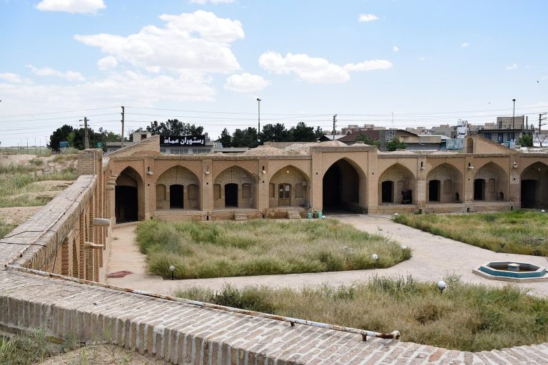
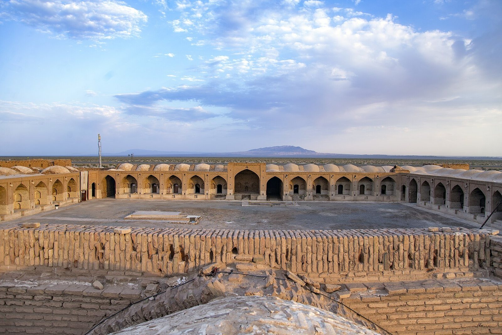
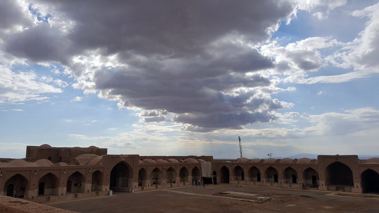
The surviving complex is roughly square and follows a four-iwan plan, with an iwan, a vaulted hall open on one side, at the midpoint of each side. It measures about 109 by 108 metres and covers approximately 12,000 square metres. The central courtyard is about 69 metres across and covers more than 4,700 square metres. The main entrance occupies the middle of the south wall, while the other three iwans face inward across the courtyard.
Enclosure and building fabric
Walls and towers
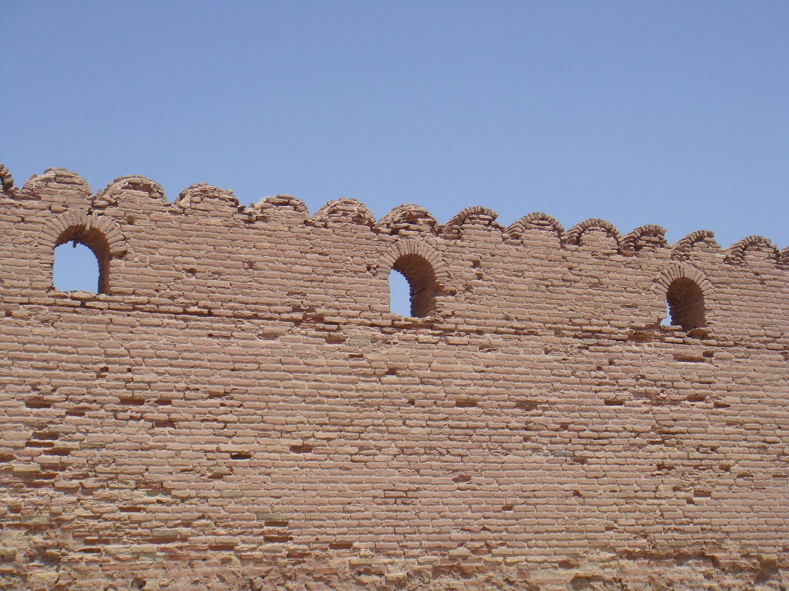
Four round towers mark the outer corners, and two half-oval towers flank the principal entrance. The perimeter walls and towers are more than three metres thick. Sasanian brickwork survives in the walls and towers up to roof level, including defensive openings above the roofline. The towers served for guarding and for lighting torches to help travelers find the inn at night. A dome above each major tower has been proposed as a Sasanian feature, though that interpretation remains uncertain.
Materials and construction
The main building materials are brick, lime, sun-dried mud brick, and plaster. Sasanian bricks measure about 36 by 36 by 8 centimetres and were laid with plaster mortar. Smaller bricks, about 25 by 25 by 5 centimetres, appear in some vaults associated with later rebuilding. The extent to which the present plan preserves the Sasanian design is uncertain, since later builders reused Sasanian material. Stone was used in the mill, in the mosque’s prayer niche, and in the upper part of an earlier entrance feature.
Entrance and courtyard
Entrance complex
The entrance complex rises about 15 metres and contains eight rooms. It is the only two-storey part of the caravanserai, and its rooms do not open directly onto the courtyard. They may have served permanent staff and guards. An intermediate vestibule separates the rooms from the gate and courtyard, offering shelter from cold and sunlight. Two chambers beside the entrance served as shops for supplies. The present entrance is a large, open-sided vaulted structure built with smaller bricks, replacing the original gate. A space above it may have held a plaque or inscription.
Courtyard and iwans
Ten chambers line each side of the courtyard. Each has a small iwan about one to one and a half metres high, making it easier to load and unload travelers’ baggage. The larger northern iwan is more elaborate than the others, with a lobby and three chambers behind it. Service spaces occupy the corners of the complex, with the mosque to the southeast, the private hall to the northeast, the bath to the southwest, and the fodder store and mill to the northwest.
Guest rooms and stables
Residential chambers
The 44 residential chambers are nearly uniform. Each has nine wall niches about a metre above the floor, a small arched entrance, and a fireplace opposite the entrance. Small openings between the iwans allowed animals to be tethered so travelers could tend them before moving them into the stables. The iwan walls also contain niches and fireplaces.
Stables
Long vaulted stable corridors lie behind the chambers and connect to the courtyard at two points. Their L-shaped entrances made it harder for animals to escape. Openings in the roofs provided daylight, and the passages are wide enough for two laden camels to pass. The stables contain 66 small iwans or platforms for caravan staff. Their sizes vary, and platforms at suitable heights have fireplaces.
Residential, religious, and service spaces
Private hall
The private shabestan, an enclosed interior hall, occupies the northeast corner. Its octagonal courtyard and elaborate residential rooms were intended for royal or other high-ranking occupants. The octagonal design is not characteristic of Sasanian architecture and points to Islamic-period construction or rebuilding. Extensive reconstruction makes the earlier form and use of this area difficult to establish.
Mosque
The mosque in the southeast corner measures about 15.5 by 15 metres. Four columns, each about 1.5 metres square, support a unit of four arches. Their lower metre is built from large bricks bonded with plaster-and-earth mortar, and the roof was rebuilt in the Islamic period. A prayer niche, or mihrab, in the centre of the south wall faces the qibla, the direction of prayer. The suggestion that the mosque occupies the site of a Sasanian fire temple, with an earlier dome and a ritual path around the fire, remains an interpretation.
Bath
The bath in the southwest corner is about the size of the mosque and is more eroded than the rest of the complex. Its roof has been lost and some walls have collapsed. It included a changing room, a hot room, and two vaulted water tanks. A Safavid date has been proposed, while its octagonal plan and vaulting point to Islamic building techniques. A triangular detail in the vaulting, also used in Qajar construction, supports the possibility that the bath in its present form dates to the nineteenth century. Reused Sasanian bricks are also present. A square courtyard beside the bath has no direct connection to it and opens onto a stable; it may have served as the caravanserai’s kitchen.
Toilets and water service
Six toilets are separated from the bath by a wall. A separate service space contains a basin about 40 centimetres high, two shafts for water and sewage, and a platform about one metre high on its western side. Steps lead from the platform to the roof. The water shaft also supplied cold water to the bath.
Mill
The mill stands in the northwest corner, beside the northern audience hall where the side stables meet. It was apparently powered by animals. A dividing wall separates the stables; the wall is thought to be Qajar-period work, suggesting the mill may have been added later. Stone was used in the mill’s construction.
Water and associated remains
Reservoirs
Two water reservoirs lie behind the western side of the caravanserai, near the bath. Their brick roofs have a flat profile with pointed cross-sections, a technique indicating Islamic-period rebuilding. One reservoir is in relatively good condition, while the other is ruined and filled with sand. One was found holding water and served caravans passing through the area.
Nearby archaeological features
Other associated remains include a brick kiln, a dam, and an Islamic-period cemetery southwest of the caravanserai, where graves are covered with bricks. A possible fire temple west of the main building has a roughly square, angular plan with sides about six metres long.
Qajar buildings
A separate Qajar mud-brick caravanserai stood beside the main complex. About 500 metres to the east, a distinct mud-brick fort has a single entrance and is mostly ruined.
Landscape and preservation
The surrounding landscape is arid, with roughly 40 to 50 millimetres of annual rainfall and large changes in temperature between day and night. Groundwater carries salts from the sedimentary basin toward the surface. Evaporation and related chemical processes contribute to salt formation and erosion at the base of the caravanserai’s walls.