Walls of Timoleon: Fourth-Century BCE Fortifications at Gela, Italy
Site at a Glance
- Popularity
- Medium
- Country
- Italy
- Primary era
- Classical
- Eras represented
- Classical, Modern
- Civilizations
- Ancient Greek, Italian
- Site type
- Military
- Remains
- Wall
On this page14 sections
History
The Walls of Timoleon are fourth-century BCE Greek fortifications at Gela, on Sicily’s southern coast in Italy. They were built during the city’s rebuilding by Timoleon, a Corinthian Greek military leader and statesman active in Sicily, between 339 and 317 BCE, after forces from Carthage, the North African city-state, destroyed Gela in 405 BCE. Their later use in the Greek-Carthaginian struggle and their preservation beneath dunes make them important evidence for the city’s history after its destruction.
Rebuilding and warfare
Agathocles, a Greek ruler of Syracuse, used the fortifications as a strong outpost during his war against the Carthaginians, who competed with Greek powers for control of Sicily. The defenses discouraged Hamilcar, a Carthaginian commander, from attacking. Repeated sieges by Agathocles between 317 and 309 BCE formed part of the military pressures that left a southern postern, or small secondary gate, and a northern route to the wall-walk, the path along the top of a wall, unfinished.
Later use
After the walls stopped serving a defensive purpose, a dwelling was built beside them. In the Middle Ages, people took building material from the sections that stood exposed above the sand.
Discovery and conservation
In February 1948, farmer Vincenzo Interlici uncovered large squared blocks while digging in his orchard beneath high dunes. He said a dream of buried treasure had prompted him to dig. The antiquities authority in Agrigento became involved, and excavations began several months later under archaeologist Pietro Griffo. Work continued until 1954, with Dinu Adameșteanu and Pietro Orlandini also among the archaeologists. Interlici remained at the site during the excavations and informally acted as its custodian.
The excavations identified the walls as fortifications of Hellenistic Gela. Hellenistic refers broadly to Greek history and culture following the campaigns of Alexander the Great. The discovery provided evidence for the city’s development after 405 BCE, while the dunes had preserved much of the fortification’s mudbrick construction.
A ministerial commission considered how to protect the mudbrick, for which conservation methods were poorly understood. It chose a protective system rather than covering the walls with sand. Glass panels and a canopy were installed in the 1960s, but water entering behind the glass trapped heat and moisture, encouraging mold and plant growth and loosening the clay. In 1982, an iron canopy was replaced by a reinforced-concrete slab on a copper base, placed directly on leveled mudbrick. This further restricted the bricks’ ability to dry and threatened their condition. A fence was installed around the site in the 1980s.
From 1994, the Caltanissetta heritage authority carried out a conservation campaign led by Rosalba Panvini. Workers removed the glass panels, filled the holes left by their metal fixings, cleared damp, loosened earth, and replaced missing bricks with visibly different mudbrick. A temporary cover was later replaced by a modular shelter in 2009.
Remains
The fortifications occupy a promontory in the Capo Soprano district of Gela, in a public area between the modern city and the coast west of the harbor. The site covers 133,307 m² and lies at an elevation of 45 m above sea level. Its wall extends for about 350 m and measures approximately 8 m high and 3 m wide.
Main wall
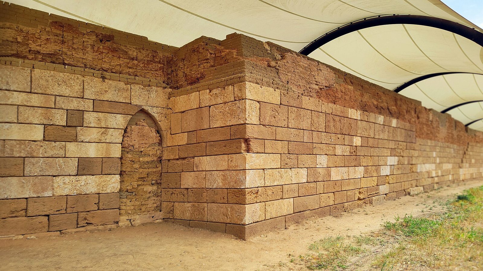
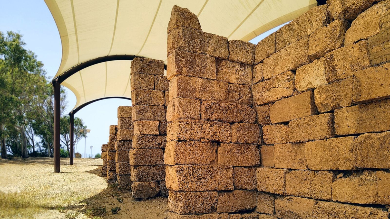
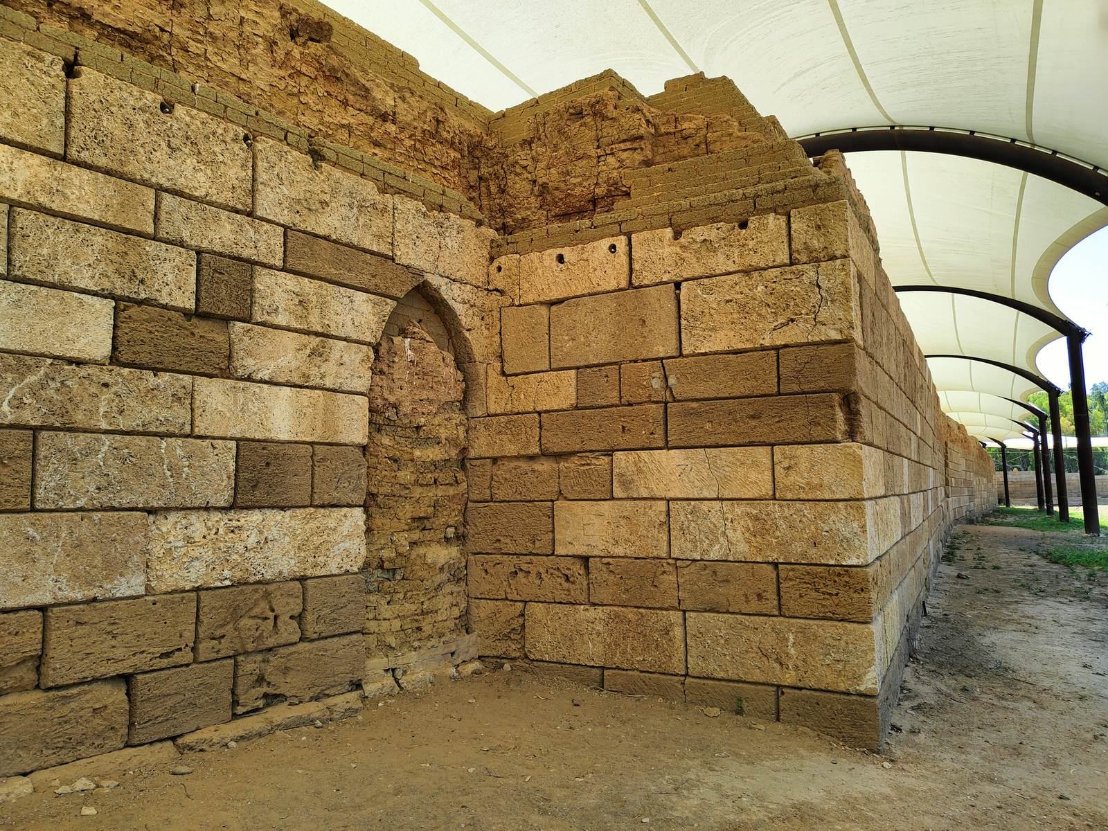
The wall has a lower section made of two outer faces of limestone blocks around a core of rubble and earth. Many exterior blocks have deliberately rough, projecting faces. Above this base, courses of sun-dried mudbricks form the superstructure. The bricks measure 40 × 40 × 15 cm and were bonded with a thin mixture of clay and sand; they may once have had red plaster.
Sand dunes covered the fortifications for centuries and preserved the stone and mudbrick across about three quarters of the wall’s present extent. In the portion exposed above the sand, medieval removal of building material left the original line of the wall.
Entrances and wall access
Southern postern
The southern postern has a pointed opening formed by courses of masonry stepping inward to create a false pointed arch. A corner of the curtain wall, the main continuous defensive wall, concealed the entrance from approaching enemies. Two recesses in the stone facing, each 10 × 10 cm and 2 m long, were intended to hold a wooden bar-and-bolt closure. The opening was sealed during construction with a mudbrick curtain that remains visible.
Northern postern and ramps
The northern postern is a straight doorway with jambs and a lintel. One of the two stair ramps leading to the wall-walk lies to its right. The wall-walk had regularly spaced crenellations, alternating raised sections and gaps along its parapet. The doorway and ramp remain unfinished, and a later raising of the fortification in mudbrick partly covered the ramps. This addition may have been associated with sand accumulating against the masonry.
Other structures and water management
Comb-shaped wall
A later wall runs along the southeastern side, attached to the eastern end of the original fortification. Regularly spaced spurs project across the outer face, giving it a comb-like form. It is built from reused blocks and rests directly on a dune that had accumulated over the lower section of the earlier wall. Its date cannot be established more precisely.
Dwelling
Near the southern postern, a later dwelling abuts an offset in the fortification’s outer foundation. Its walls are made of stones laid without mortar and topped with mudbrick. A cooking surface in the room’s southeastern corner and pottery fragments indicate domestic use.
Drainage channels
Three channels at the base of the visible wall carried rainwater outwards and down the hillside. Their sides rest on two blocks projecting from the southern face of the structure.
Protective shelter
The current shelter is open on all sides and has a saddle-shaped roof formed from a continuous glass-fiber fabric membrane coated with polytetrafluoroethylene (PTFE). Corrosion-resistant steel tubes, each 40 cm in diameter, support the roof at intervals of about 15 m. The shelter covers approximately 2,000 m².