Scoglietto Sanctuary: A Roman Religious Site near Grosseto
Site at a Glance
- Popularity
- Low
- Country
- Italy
- Primary era
- Classical
- Eras represented
- Classical, Medieval
- Civilizations
- Ostrogothic, Roman
- Site type
- Religious
- Remains
- Sanctuary
On this page12 sections
History
The Scoglietto sanctuary is a Roman religious site on a promontory near Grosseto, Italy. Its earliest known religious phase dates to the 2nd century BCE, and a larger sanctuary developed from the mid-1st to the early 2nd century CE. The site became associated with Diana, the Roman goddess of hunting and protector of pregnant women.
Early worship and Diana
Human activity in the area reaches back to prehistoric times. A cave below the promontory was used in that period and may have hosted religious or ritual practices. The earliest religious phase on the promontory itself dates to the 2nd century BCE. An inscription dedicated to Diana Umbronensis, found in the early 2000s, links the sanctuary to Diana; the epithet probably refers to the Ombrone River. The dedication has also led to the suggestion that Diana was worshipped in a sacred grove there.
The earliest building has been interpreted as the home of a small religious association called the Domus Dianae, meaning “House of Diana.” A shrine from the early or middle Roman Republic, the period before rule by emperors, had a different alignment from the later temple. It may represent an earlier form of worship at the site. The shrine could have remained in use after the larger sanctuary was established and may later have served as a treasury.
Growth of the Roman sanctuary
The sanctuary expanded between the mid-1st and early 2nd centuries CE. A major phase of building took place in the late 1st century, probably during the reign of Domitian, emperor from 81 to 96 CE. Construction continued at least into the middle of the 2nd century. The promontory may then have stood much closer to the sea, and its position near maritime routes may have helped the sanctuary prosper. Its location near the territory associated with the Roman town of Cosa, along with the presence of boars and deer associated with Diana, may also have influenced the choice of site.
Decline and late Roman transformations
By the end of the 2nd century, the religious settlement had declined, and both the sanctuary and the House of Diana lay in ruins. A replacement temple was built over the remains of an earlier one, probably in the 3rd century during the Severan period, when the Severan dynasty ruled the empire in the late 2nd and early 3rd centuries. Builders reused materials from the abandoned complex.
A burial ground had formed beside the temple by the middle of the 4th century. Later in that century, the temple was systematically demolished and its offerings destroyed. The demolition may have been connected with religious change after the Edict of Thessalonica in 380, which established Nicene Christianity as the official religion of the Roman Empire. Worship or offering practices appear to have continued after the temple’s destruction. Lamps placed over the collapsed remains suggest that this activity lasted for about fifty years.
Later occupation and modern investigations
In the early 6th century, the temple area was adapted for residential use. The settlement was later abandoned after a severe fire affected both the dwelling and the ruins of the religious buildings. Radiocarbon analysis of skeletons from the cistern indicates that the area may have been occupied again between the early 11th and early 13th centuries.
In the modern period, the Grand Duke of Tuscany planted an olive grove on the promontory’s slopes. Surface surveys took place in 2005, followed by systematic excavations from 2009 to 2011 by Tuscan archaeological authorities and the Alberese Archaeological Project, with help from a local cultural association. Geoarchaeological research has also examined changes to the coastline and surrounding environment.
Remains
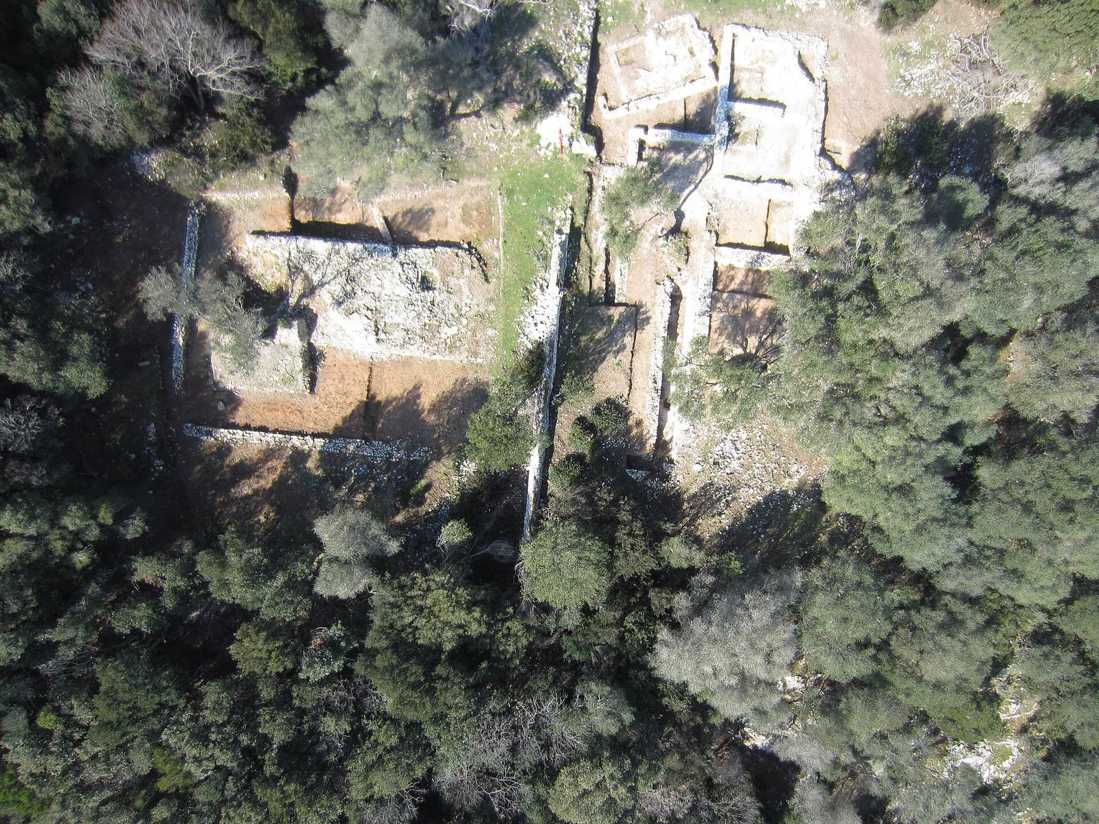
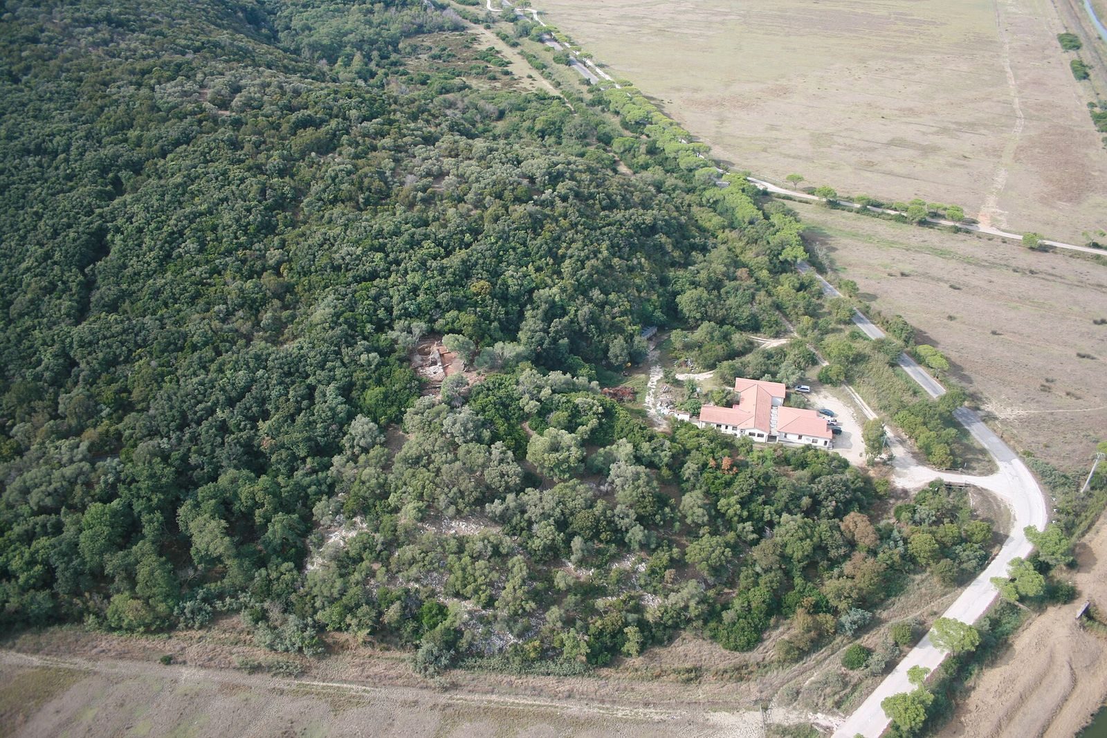
The sanctuary occupied the northern end of the Scoglietto promontory, an extension of the Uccellina Mountains in the Maremma Regional Park near Alberese. The remains include an early building cut into bedrock, a multiroom sanctuary, and a later temple within an enclosed sacred area. The site is about 3 km from the present coast, although the shoreline may have been much closer in antiquity.
The early shrine and promontory
A small route cut into the bedrock gave access to the sanctuary. The earliest known religious building was rectangular, with a trapezoidal end, and was also cut into the rock. It ran north to south and shows at least three building phases, represented by walls built against one another. Finds from its deposit of religious offerings include black-glazed pottery, Greco-Italic storage jars, fine Roman pottery, lamps, bronze coins, two small glass containers for perfume or ointment, a necklace bead, and a small bronze dog. A statue of Diana and another figure resembling Isis, an Egyptian goddess whose worship also spread through the Roman world, were recovered at the site.
A cistern built in the 2nd century BCE or the following century supplied water to the promontory and remained in use during the later Roman phase. A wall more than 12 km long crosses the promontory, dividing woodland from agricultural land. It was probably built during the Renaissance and was later restored by the National Combatants’ Organization, an Italian public body associated with veterans’ welfare and land reclamation.
The multiroom sanctuary
The later sanctuary contained at least seven rooms. Some had floors made from a lime-based material or from black-and-white mosaic tiles. Two rooms below ground may have served as small storage spaces. Large niches and a projecting curved end formed part of the exterior, while a room with a mosaic floor has been interpreted as a water shrine. The complex also included a fountain and a cistern. Bricks used in additions, including work from Domitian’s reign, carried the stamp of Titus Claudius Gobathus, a Roman kiln owner and businessman. Some additions combined different masonry techniques.
The replacement temple and sacred enclosure
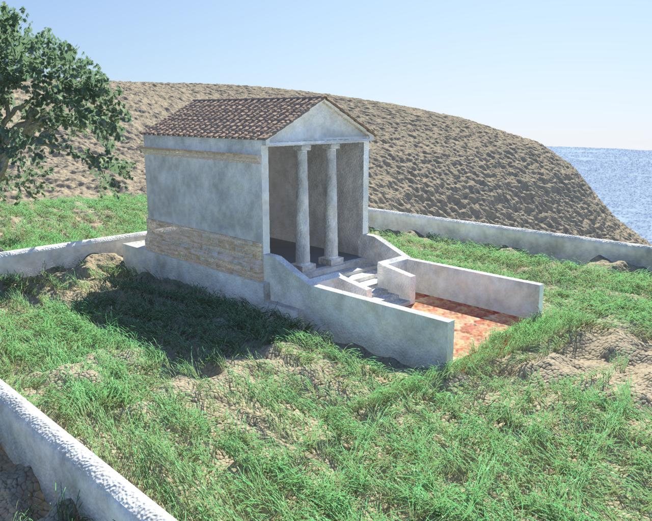
The replacement temple was rectangular, measuring 11.5 by 6.5 m, and faced a small plaza paved in a herringbone pattern. A short ramp and steps led to a larger staircase inside the building, which reached a raised platform in the principal chamber. Cut pieces of marble formed geometric patterns on the chamber floor, where an altar or place for offerings may have stood. Marble slabs covered the temple’s exterior over a brick-faced base. A surrounding wall of roughly dressed stone enclosed the sacred area; a thick layer of lime found in place indicates that this wall, too, was clad in marble. A service room stood directly north of the temple.
Burial, demolition, and offerings
A simple burial beside the temple’s western outer wall dates from 348 CE to the end of the 4th century. The body lay in a pit covered with bricks and stones, and the grave cut through earlier layers of collapse and abandonment. The temple was later razed almost to its foundations. Masonry blocks lay around its perimeter, and a fragment of a destroyed marble statue rested on marble chips in the northeastern part of the sacred enclosure. The statue in the principal chamber had been shattered, while fragments of coins and lamps lay scattered across the site. Demolition material and the remains of at least seven people filled the cistern; these individuals may have belonged to a larger burial ground that was desecrated.
Large numbers of religious oil lamps were recovered. Most belong to North African Roman pottery types, with a smaller group made locally. The imported lamps are generally better preserved. They may have been stored in the temple’s principal chamber, where they were less exposed to deterioration.
The early 6th-century dwelling
The residential phase included a circular hut made of rammed earth. Building it required removing the temple’s south wall and curved end, as well as part of the substantial bedding below the floor. Postholes along the cut mark where upright timbers stood, and layers of burnt clay preserve evidence of the hut’s destruction. A partly dug-out pit was covered with wooden planking that formed a floor outside the dwelling. Cooking pottery, storage jars, reused materials, and a Byzantine coin of Justinian were found within the hut. A boundary wall with a stone base and earth upper part stood to its west. A pebble-paved access road and a wooden palisade also marked and protected this side of the settlement.
The cave below the promontory
The cave contains prehistoric and Roman-period deposits. Roman coins and a burial ground were found there during excavations in 1948 by Luigi Cardini and Rittatore. These finds indicate human presence in the cave from at least the 2nd century CE into Late Antiquity, the later centuries of Roman rule and the transition to the early medieval period. A worked flint recovered from vegetation and soil above the late Roman temple provides evidence of a prehistoric object on the summit, but on its own does not establish that people settled there in prehistoric times.