Limyra: An Ancient Lycian City and League Capital
Site at a Glance
- Popularity
- High
- Country
- Turkey
- Primary era
- Classical
- Eras represented
- Iron Age, Classical, Medieval, Early Modern
- Civilizations
- Byzantine, Lycian, Ottoman, Ptolemaic, Roman
- Site type
- City
On this page25 sections
History
Limyra is an ancient Lycian city at Sahilkent near Finike in Türkiye. Pottery points to settlement there in the third millennium BCE, and the city was flourishing by the second millennium BCE. Located on the southern coast of Asia Minor along the Limyrus River, Limyra later grew into a prosperous city and an important trading center in the Greek world.
Early settlement and Lycian rule
Pottery from the end of the eighth century BCE marks a later phase of occupation. Limyra’s development during the Archaic and early Classical periods, Greek and eastern Mediterranean historical eras before the Hellenistic age, is only partly understood.
In the fifth century BCE, Limyra produced coins for the Kuprlli dynasty, a ruling family based at Xanthos, and held an important place among the region’s settlements. In the fourth century BCE, the Lycian ruler Pericles made the city the capital of the Lycian League, a federation of Lycian cities. He backed a revolt against Persian rule and is thought to have defeated the ruling family of Xanthos, briefly extending his authority across Lycia and neighboring areas to the north and east. Persian power later returned through Mausolus, the Carian governor based at Halicarnassus. After the revolt was suppressed, Lycia’s independent ruling dynasties ended and the region became part of the territory governed by Caria’s Hecatomnid dynasty.
Hellenistic and Roman periods
Alexander the Great’s conquests ended Persian rule and opened the Hellenistic period, when Greek-influenced successor kingdoms took shape. Most of Lycia came under Ptolemy I Soter. When Galatians, a Celtic people who had settled in parts of Anatolia, invaded, Ptolemy II Philadelphus supported Limyra. The inhabitants honored him with a Ptolemaion, a monument dedicated to a ruler of the Ptolemaic dynasty. Ancient writers including Strabo, Ptolemy, Pliny the Elder and several Latin authors mention Limyra. Pliny identified the city in relation to the river that receives the Arykandos.
Limyra also entered the history of the Roman imperial family. Augustus, Rome’s first emperor, adopted his grandson Gaius Caesar as heir in 17 BCE. After the Parthians invaded Armenia, Gaius went there in 2 CE and installed a king loyal to Rome. He was seriously wounded after being deceived and died at Limyra in 4 CE while returning to Rome. The city remained important under Roman emperors, and major urban works followed. In the second century CE, the Lycian benefactor Opramoas of Rhodiapolis commissioned Limyra’s theatre.
Christian administration and modern study
Limyra became a bishopric subordinate to the metropolitan see of Myra. Six bishops are associated with the city: Diotimus, linked with Basil of Caesarea; Lupicinus, who attended the First Council of Constantinople in 381; Stephen, at the Council of Chalcedon in 451; Theodore, at the Second Council of Constantinople in 553; Leo, at the Second Council of Nicaea in 787; and Nicephorus, at the Council of Constantinople in 879–880. These councils were gatherings of Christian bishops concerned with church doctrine and governance. Limyra continued to appear as a bishopric in the twelfth and thirteenth centuries and is also retained as a titular see, a bishopric held as a title rather than an active local diocese.
Charles Fellows encountered the ruins in 1838 and returned to investigate them in 1840. J. A. Schönborn visited in 1842, and later the British researchers Spratt and Forbes came upon remains while traveling upstream along the Limyrus. After a long interval, J. Borchhardt visited Limyra in 1965 during a survey at Myra and excavated here from 1969 to 1974. Excavations led by T. Marksteiner began in 2002 under the University of Vienna’s Department of Archaeology.
Remains
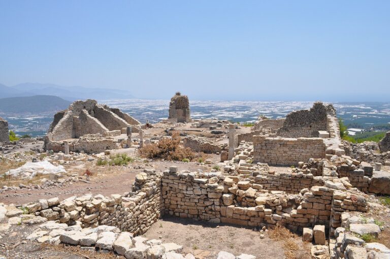
Limyra’s remains extend from the foot of its hilltop citadel, or acropolis, into the lower city. The site combines defensive works, streets, religious and civic buildings, and burial grounds from different periods.
City layout and defenses
The lower city is divided into two separately walled areas. During the late Lycian dynastic period, a defensive wall enclosed about 25 hectares, while additional fortifications protected the hill. Two tall towers rose above the citadel; they may have been intended to display the standing of the rulers who built them. The remains also include lower and inner fortresses, stretches of eastern and western walling associated with the unsettled post-antique period, colonnaded streets and cisterns.
Burial grounds and monuments
The five cemeteries
Five cemeteries flank the settlement. They date from the fourth century BCE or earlier and contain a large group of Lycian rock-cut tombs, along with numerous carved reliefs and inscriptions in the Lycian language and script. The first cemetery occupies a cliff at the entrance to the Arykandos Valley.
Monument of the eastern Lycian dynasty
A monumental tomb associated with the eastern Lycian dynasty stands on a raised platform. Its plan has columns at the front and rear, but not along the sides. Sculpted female figures, called caryatids, supported chambers at the front, while military scenes decorated the side walls. The design brings local building traditions together with Greek influence. Other large tombs at Limyra are thought to have served aristocratic families.
Mausoleum of Pericles
The mausoleum of Pericles is distinguished by its reliefs and sculptures. Among them is a scene of Perseus, the hero of Greek mythology, killing Medusa and one of her sisters.
Carved tombs and inscriptions
The two-storey tomb of Xntabura bears reliefs showing a sacrifice, an apocalyptic scene and themes central to Lycian imagery. In the Xuwata cemetery, part of the second necropolis, a simpler rock-cut tomb carries a relief of a duel modeled on the celebrated shield of Athena Parthenos, a statue made by the Greek sculptor Phidias. Another carved scene presents Tebursseli as a victorious hero defeating the generals Arttumpara alongside his king Pericles in the Xanthos Valley. The double tomb of Artimas in the fifth necropolis bears an Aramaic inscription, one of the few known from Asia Minor, pointing to links between Lycia and the central regions of the Persian Empire.
Civic and religious buildings
Sanctuary of Zeus
A sanctuary dedicated to Zeus, the chief god of ancient Greek religion, lies in the western part of the city. Inscriptions found in 1982 helped identify it. An enclosure wall bounds the sacred precinct, and a monumental ceremonial entrance connects it to the urban road network. The eastern front measures about 15 metres across and is partly obscured by a later Byzantine wall.
Ptolemaion
The Ptolemaion is among the named monuments of the city. It was dedicated to a ruler of the Ptolemaic dynasty.
Theatre, bathhouse and streets
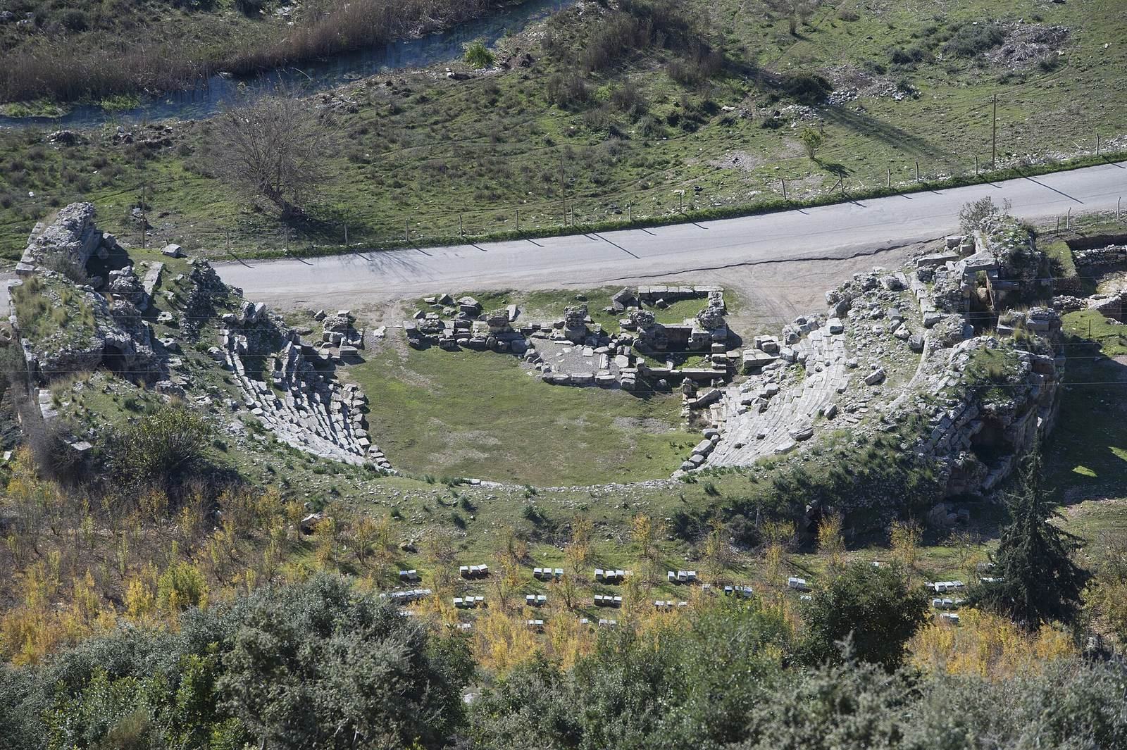
The Romans cut the theatre into the hillside, where it could seat about 8,000 spectators. The city’s Roman-period remains also include a bathhouse with a complex heating system and streets lined with colonnades.
Arch of Ornimythos
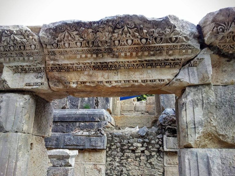
An early Imperial-period honorary arch, a monumental structure honoring a person, was dedicated to Ornimythos. Architectural study and the dedication inscription have helped establish where its surviving stones originally belonged.
Churches and Kâfi-Baba Tekke
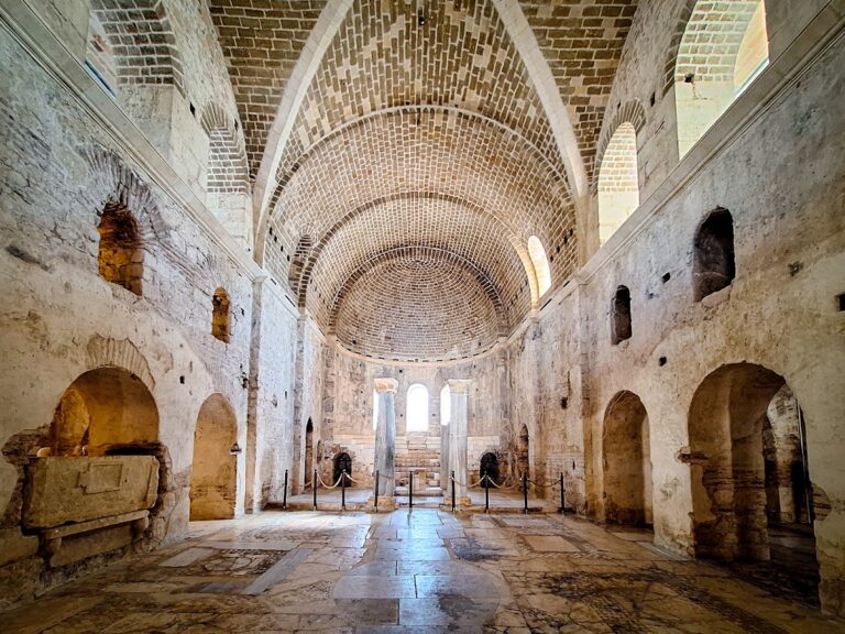
The remains include an episcopal church and a Byzantine church. The site also contains Kâfi-Baba Tekke, a lodge associated with the Bektashi, an Islamic Sufi order. Founded in the sixteenth century, it is identified as the oldest Bektashi monastery on Turkey’s southern coast.
Western approach and Roman bridge
Gate and memorial to Gaius Caesar
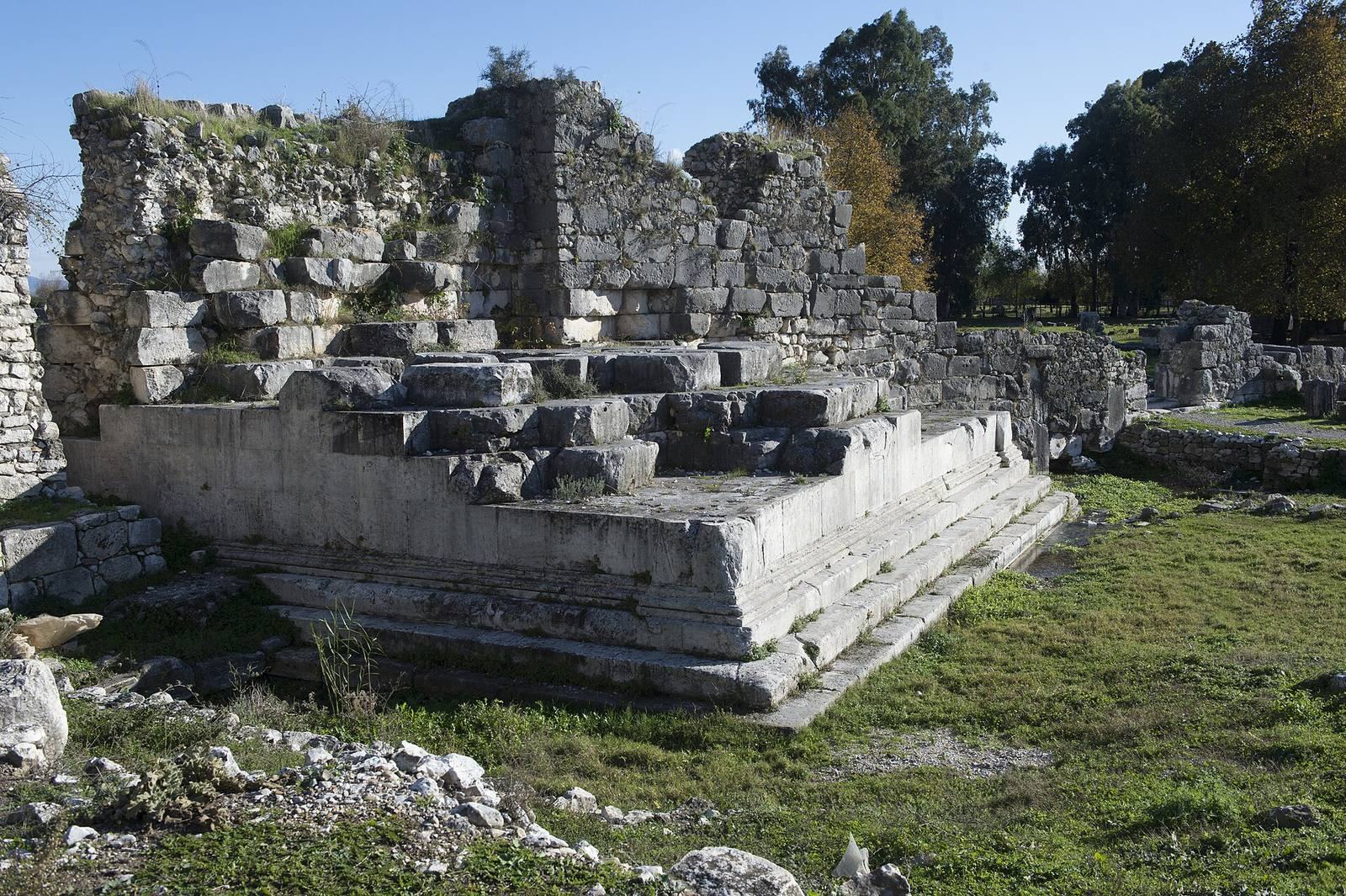
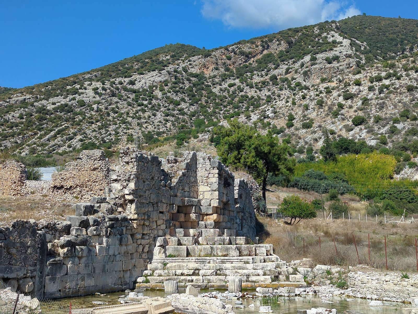
A gate in the western city leads across marshy ground toward the stone-based memorial to Gaius Caesar. This massive monument dates to around 4 CE and is a commemorative tomb, or cenotaph, rather than a burial place.
Roman bridge
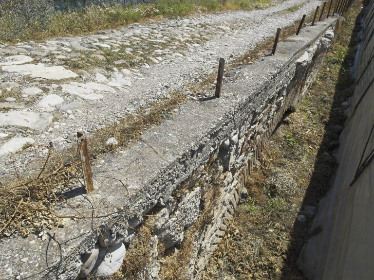
About 3.2 kilometres east of the ruins, a Roman bridge extends for approximately 360 metres across 26 shallow, segment-shaped arches. It is considered one of the world’s oldest examples of a bridge built with this type of arch and is in poor condition.
Archaeological layers and excavated buildings
Sequence of occupation
Excavations identified thirteen superimposed layers, each containing architectural remains. Layers I–V belong to the Hellenistic period; layers VI–VII date to the fourth century BCE; layers IX–XI to the fifth century BCE; layer XII to the sixth century BCE; and layer XIII to the seventh century BCE. A later investigation found a human-made layer XIV beneath layer XIII, making it the deepest cultural level in that excavation area.
Classical walls and hillside structures
North of the Classical fortification, excavators traced wall M3 eastward and interpreted it as a terrace wall. It lies above layer VIII and dates to the fourth century BCE, in the same construction phase as the fortification. Wall M7 meets M3 at a right angle and runs south nearly to the inner face of the fortification, where later Byzantine construction covers it. Together, the walls bounded the eastern side of an open space measuring 20 by 7 metres behind the defenses. A wooden structure on small-stone foundations gave access to a walkway along the wall, supported on timber. East of M7, a floor strengthened with mortar marks an interior space at the level of layer VIII.
M3 remained in use until the end of the fourth century BCE. Much of it was later dismantled and covered as layer V formed at the start of the third century BCE. The construction of layer VIII and the M3–M7 structures damaged much of layer IX. Layer X preserved a corner of a rectangular building with a small-stone-paved floor and wall M11. Wall M12, extending west beneath M3, belongs to layer XI.
Earlier buildings and the deepest level
In western excavations, layer XIII contained a small building laid out with right angles. Its walls were made from unworked rubble of small or medium size, and another wall of similar construction extended east. Inside, a compacted earth floor probably included a hearth. Mud-brick walls rested on stone foundations above it. A well pit dug during layer II had damaged these remains.
Layer XIV comprised large unworked blocks running east to west, parallel to the slope. Behind them, toward the hillside, local red erosion material formed an almost level platform. Its fill included a few handmade pottery fragments, with about a metre of sterile soil below; bedrock probably lay beneath this.
Pottery from the city gates
Pottery recovered around the West and East Gates includes about 12,000 sherds, with a combined weight of approximately 286 kilograms. The assemblage was fully counted and quantified for study of its deposition, archaeological contexts, functions and architectural settings, as well as Limyra’s ceramic imports from the wider eastern Mediterranean.