Bridge near Limyra: A Roman Road Bridge in Turkey
Site at a Glance
- Popularity
- Medium
- Country
- Turkey
- Primary era
- Classical
- Eras represented
- Classical
- Civilizations
- Roman
- Site type
- Infrastructure
- Remains
- Bridge
On this page14 sections
History
Roman bridge and route
The Bridge near Limyra is a Roman road bridge over the Alakır Çayı in Turkey, probably built in the late second or third century. Also called Kırkgöz Kemeri, or “Bridge of Forty Arches,” it carried a route east from Limyra toward Pamphylia and Attaleia. It is the largest surviving ancient engineering structure in Lycia. The route likely had particular importance while Lycia and Pamphylia formed a single Roman province, a status they held until the fourth century. Local roads generally served pedestrians and pack animals rather than heavy traffic.
The bridge’s date remains uncertain. Wolfgang W. Wurster and Joachim Ganzert initially proposed a sixth-century construction during the reign of Justinian I, a Byzantine emperor. A late second- or third-century date is now considered more likely. This dating is supported by comparisons with Roman bridges using flattened arches, including the third-century bridge at Kemer over the Xanthos.
Later records and surveys
Charles Fellows visited the bridge in May 1840 and counted 25 arches. T. A. B. Spratt and Edward Forbes recorded the same number after visiting in 1842. An Austrian expedition that included archaeologist Otto Benndorf interpreted the structure in 1882 as part of an ancient road between Limyra and Attaleia.
Wurster and Ganzert conducted the first scientific survey in September 1973, spending two days at the bridge and returning in later years. They published their findings in 1978, and civil engineer Colin O’Connor summarized the work in a 1993 study of Roman bridges. The survey drew attention to damage from expanding agriculture. Local people removed paving stones, while bulldozers used to cut irrigation canals damaged the bridge and crushed its pavement.
Remains
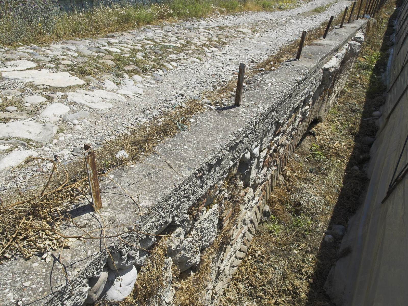
The bridge extends for 360 metres and combines brick, carefully cut stone and rubble construction. Its nearly level roadway runs across 28 openings, with the structure’s ends meeting different parts of the river plain and foothills.
Alignment and roadway
River crossing
The bridge crosses the Alakır Çayı about 3.2 kilometres east of Limyra’s theatre and 3.8 kilometres north of the modern coast. It stands where the foothills of Toçak Dağı meet the Bay of Finike’s alluvial plain, just beyond a narrow river valley that opens onto the plain. Seasonal high water could obstruct a crossing there. The eastern end reaches gravel, while the western end meets rising rock, a position that probably reduced exposure to floods. The road bends sharply south; this turn may also have helped block passage.
Road surface and level
The roadway is 3.55 to 3.70 metres wide, widening to 4.30 metres at each end. Large, irregular limestone slabs pave it, projecting about 10 centimetres beyond both sides of the bridge. The surface sits 30 to 40 centimetres above the arch crowns. Between arches 1 and 20, it lies 20.05 to 20.55 metres above sea level; farther east, across arches 21 to 26, it descends from 19.94 to 19.66 metres. These small changes indicate careful leveling and firm pier foundations, although the bridge’s lengthwise line shifts noticeably between arches.
Arches and supports
Main arches
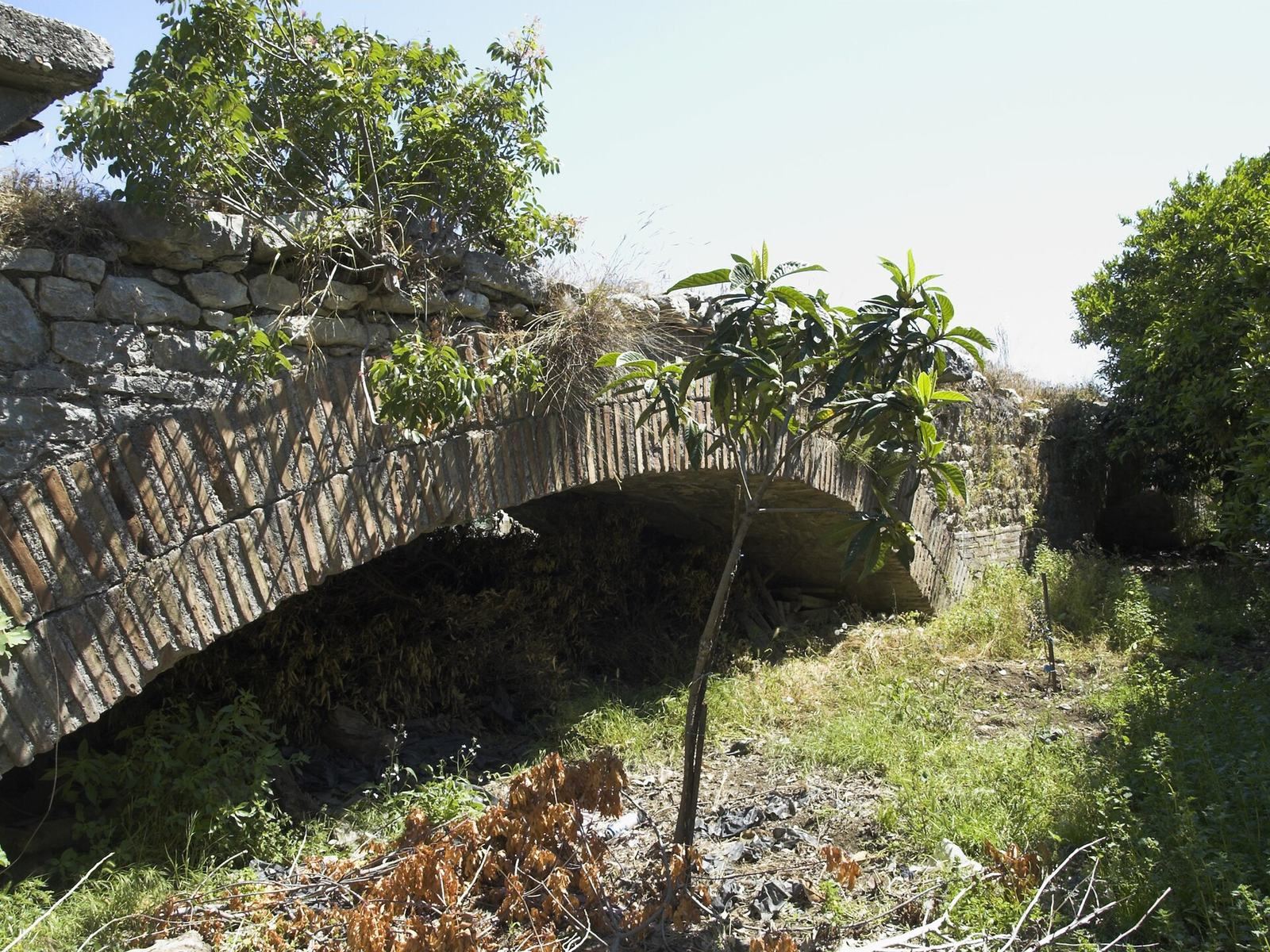
Twenty-six main openings have flattened arches, which curve less than semicircles. Their support-centre spans range from 11.60 to 14.97 metres, with arch 2 the shortest and arch 26 the longest. The spans fall into several recurring groups, including measurements around 11.60 to 12.30 metres, 12.75 metres, 13.10 metres and 13.60 metres. The reason for these groupings is uncertain; they may reflect the repeated use of timber supports made to different sizes rather than adjustments to the riverbed. A pier measured between arches 26 and 27 is 2.10 metres wide. With a typical 12.75-metre span, that leaves a clear opening of 10.65 metres. At a rise of about two metres, the opening is roughly 5.3 times as wide as it is high, reaching about 6.4 times on the largest arch.
Eastern replacement arches
At the eastern end, two small semicircular arches occupy the place of an original twenty-seventh arch, which collapsed and was replaced. The neighboring piers retain traces of the original, flatter arch’s springing points, where its curve began to rise from its supports. The replacement arches have a width-to-rise ratio of 2.7 to 1. They use smaller bricks, including some reused from the earlier arch, and dressed limestone blocks with sloping surfaces at their bases.
Construction and preservation
Arch masonry
The main arch bricks are yellow-red clay plates about 40 by 50 centimetres and five centimetres thick, mixed with fine brick fragments. Set with their short sides upright in two layers following the curve, they form arches about 80 centimetres thick. Joints roughly four centimetres wide contain lime mortar mixed with brick fragments and fine gravel. Once the lower brick layer was complete, builders could move the timber support beneath an arch to another opening. A projecting support for this temporary framework remains beneath arch 26.
Facing and interior fill
Between arches 2 and 21, four outer brick layers are backed by rubble masonry set in mortar. From arches 22 to 26 and along both approach ramps, the facing consists of carefully cut stone blocks. The two semicircular arches use smaller rough stones and bricks set irregularly. Above the arches and piers, the bridge’s interior is packed with rubble and large river pebbles in lime mortar. Structural analysis indicates that the arch curves closely follow the line of the bridge’s own weight. One modern calculation estimates a capacity of a 30-tonne vehicle on a single arch, together with an additional surface load of 500 kilograms-force per square metre on that arch.
River deposits
River sediment covered the bridge above the points where the arches begin to rise from their supports during the 1970s survey. Only two openings were exposed enough for direct measurements. In 1978, the Alakır Çayı flowed beneath three of the bridge’s arches.