Mycenae: A Bronze Age Citadel and Palace Centre in Greece
Site at a Glance
- Popularity
- Very High
- Country
- Greece
- Primary era
- Bronze Age
- Eras represented
- Bronze Age, Iron Age, Classical
- Civilizations
- Ancient Greek, Mycenaean
- Site type
- City
On this page24 sections
History
Mycenae is an ancient citadel and archaeological site at Mykines, Greece, which became a major centre of Mycenaean civilization during the Late Bronze Age. The period from about 1600 to 1100 BC is known as the Mycenaean period after the site. Mycenae’s history extends from prehistoric settlement through its Bronze Age prominence and later Greek and Roman phases.
Prehistoric settlement and Bronze Age power
People lived at Mycenae from the Early Neolithic. Its earliest known pottery dates to about 5000–4000 BC, and occupation continued through the Early and Middle Bronze Ages. The population grew considerably during the Middle Bronze Age. Burials in Grave Circles A and B in the sixteenth century BC contained rich objects, and by about 1600 BC the community showed strong influence from the Minoan civilization of Crete.
Mycenae rose to prominence during the Late Bronze Age, when it was a major political and military centre. At its peak, around 1350 BC, its citadel and lower town covered about 32 hectares and had an estimated population of 30,000. Its influence probably reached across much of southern Greece and the Aegean, including Crete, the Cyclades and parts of southwest Anatolia.
An Egyptian inscription at Kom el-Hetan records a place identified with Mycenae as *Mukana. By the Late Helladic IIIA:1 period, Egypt regarded the city as a major centre on a level with Thebes and Knossos. A scarab associated with Queen Tiye was probably brought to Mycenae by an Egyptian envoy for an earlier generation and later moved elsewhere within the citadel.
Destruction and the end of palace rule
Mycenae was damaged during the wider Bronze Age collapse around 1200 BC and partly rebuilt, but it burned again. Its final destruction is generally dated to about 1150 BC. The cause is uncertain. Suggested explanations include attack, internal conflict, earthquakes and disruption linked to the Sea Peoples. A Dorian invasion has also been proposed but remains disputed; drought has been suggested despite the lack of supporting climatic evidence.
The city never recovered its former position as a centre of literate palace administration. It regained some prosperity before another fire, after which its population was less concentrated.
Greek traditions, Archaic and Classical periods
Greek tradition named the hero Perseus as Mycenae’s founder and made the city the legendary home of Agamemnon. The site is closely linked with Homeric epic, but archaeological evidence does not establish that Agamemnon was buried there. The name may preserve a place-name from before Greek became established in the region. Ancient explanations associated it with the Greek word for mushroom; Pausanias connected it with Perseus, while Homer linked it to the nymph Mycene.
During the Archaic period, a temple to Hera was built on the citadel’s summit. In the Persian Wars, conflicts between Greek states and the Persian Empire, men from Mycenae fought at Thermopylae and Plataea. Eighty are recorded at Thermopylae; at Plataea, Mycenae and Tiryns together provided 400 men.
In 468 BC, Argive forces besieged Mycenae. Hunger compelled the defenders to surrender, after which the inhabitants were expelled and the fortifications destroyed. The city came under Argive control and remained sparsely populated until a short-lived return to settlement in the Hellenistic period.
Hellenistic and Roman periods
After its brief Hellenistic reoccupation, Mycenae was abandoned. In Roman times, its ruins were visited as an antiquity. The second-century AD Greek writer Pausanias described the fortifications and Lion Gate as still visible, and shepherds led him to the site. Later maps misplaced Mycenae, including maps made in the fifteenth century.
Rediscovery and archaeological work
In 1700, Venetian engineer Francesco Vandeyk correctly identified Mycenae during a survey for Francesco Grimani, a senior Venetian official in the Morea. Using Pausanias’s description of the Lion Gate, Vandeyk cleared debris from the entrance and recognized the Treasury of Atreus, which he thought might be a royal tomb. Claude-Louis Fourmont visited in 1729–1730 and drew parts of the walls and gates.
Thomas Bruce, the 7th Earl of Elgin, visited in 1802. Unable to remove the Lion Gate relief, he arranged for the Treasury of Atreus to be cleared and took pottery, carved stone, a marble vase and fragments of its sculptural decoration. In 1810, Veli Pasha, the Ottoman governor of the Morea, excavated the tomb. Heinrich Schliemann later said that Veli Pasha had found bones covered with gold, gemstones and other precious objects, and had removed fragments of the entrance columns.
French troops surveyed and mapped Mycenae in 1834. In 1841, Greek archaeologist Kyriakos Pittakis cleared and restored the approach to the Lion Gate and made an initial exploration of the Tomb of Clytemnestra. Schliemann excavated in 1874 and returned in 1876 with permission from the Archaeological Society of Athens and under the supervision of Panagiotis Stamatakis. Hoping to find Agamemnon’s grave, Schliemann uncovered the royal burials of Grave Circle A and named one mask the “Mask of Agamemnon.” Stamatakis also found Early Helladic pottery in 1877–1878.
Christos Tsountas excavated much of the citadel between 1884 and 1902. The British School at Athens worked at Mycenae from 1920 to 1955 under Alan John Bayard Wace, with assistance from Winifred Lamb; Grave Circle B was discovered in 1951. Later work included excavations on the citadel’s west slope led by Lord William Taylour from 1958 to 1969, investigations by the Archaeological Society of Athens, and research directed by Spyros Iakovidis from 1985. More recent work has also examined the lower town.
Mycenae and Tiryns were inscribed together on the UNESCO World Heritage List in 1999, recognizing Mycenae’s place in Mycenaean civilization, its architecture and its evidence for the development of ancient Greek civilization. A 1964 ministerial decree set protected boundaries that included the acropolis and its wider surroundings. A preservation committee established in 1999 has carried out work to stabilize and improve the site.
Remains
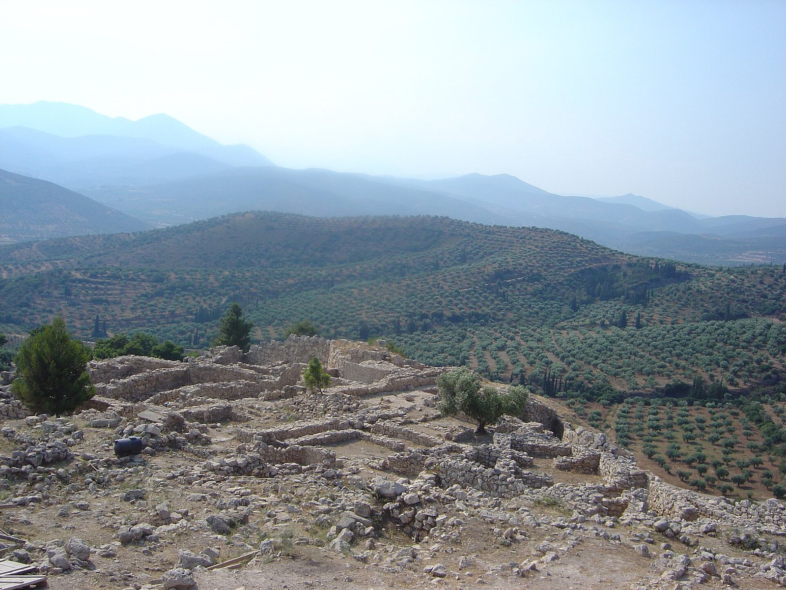
The fortified citadel stands on a hill about 274 metres above sea level, overlooking the Argive plain and routes towards the Isthmus of Corinth. The site lies about 19 kilometres inland, with access to farmland and water. The wider settlement included a lower town as well as the elevated citadel. Massive stone defenses, burial grounds and palace remains occupy the acropolis and its surrounding slopes.
Fortifications
Citadel walls
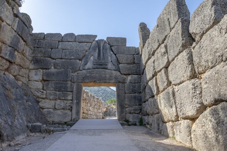
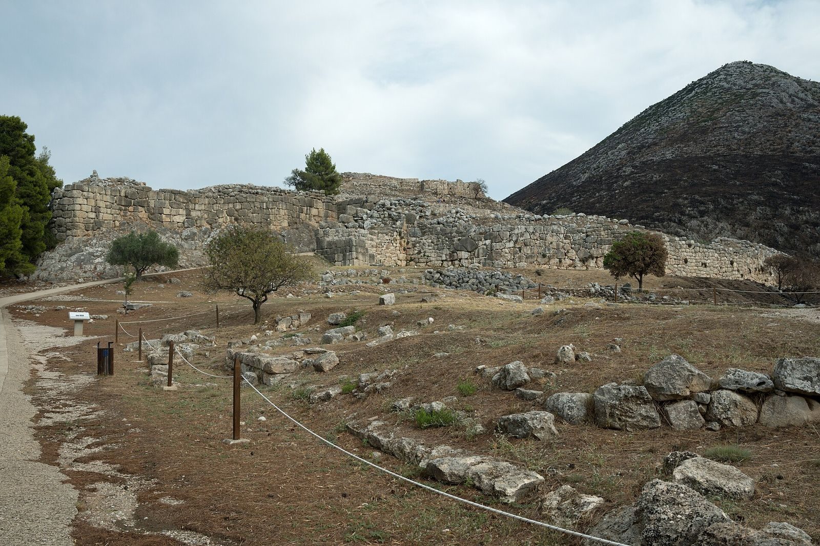
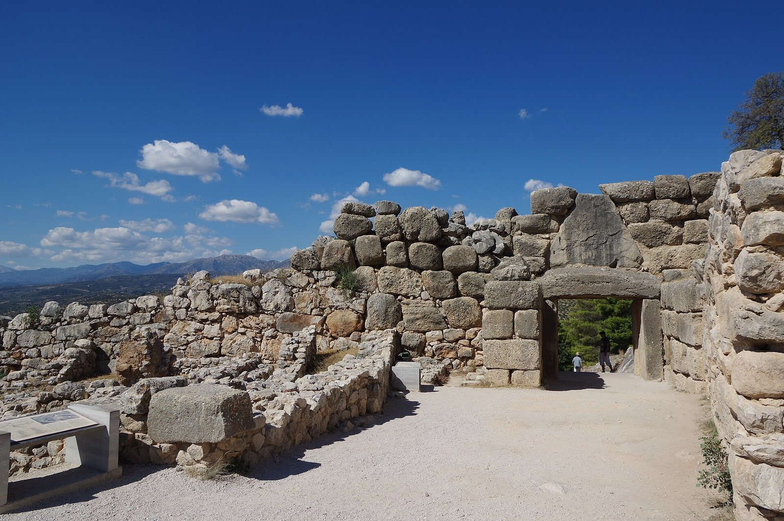
The acropolis and nearby hills were enclosed by Cyclopean masonry, construction using exceptionally large stone blocks. The name reflects a later legend that only Cyclopes could have moved such stones. Where preserved, the circuit wall reaches 12.5 metres in height; it is about 1,105 metres long and 7.5 to 17 metres thick. Some blocks, including lintels and gate jambs, weigh more than 20 tonnes, with the largest estimated at nearly 100 tonnes.
Lion Gate and other entrances
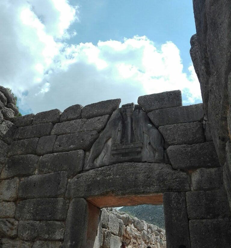
The Lion Gate, the main entrance, was built around 1250 BC as the western wall was extended to include Grave Circle A. A stepped ramp led through the gate, past the burial enclosure and towards the palace. Above the lintel, a triangular opening reduces the weight pressing down on it, and the gate bears a sculpted relief. A smaller secondary gate, or postern, was built through the north wall.
Northeastern extension and water supply
Near the end of the Late Helladic IIIB period, the fortifications were extended again to the northeast. This addition included a protected opening used for military movement, called a sally port, and a concealed passage descending about 99 steps. The passage was built with stone courses that project inward as they rise, and led to a cistern cut into rock 15 metres below the surface. A tunnel carried water from a spring on higher, more distant ground.
Burial enclosures
Grave Circle B
Grave Circle B lies outside an early section of the citadel wall. It contains ten cist graves, chambers formed from stone slabs, and several deeper shaft graves cut down into the ground. Mounds over the graves held broken drinking vessels and bones from funerary meals, and were topped with upright stone markers. Some of the rich grave goods may indicate burials connected with royalty.
Grave Circle A
Grave Circle A is a walled enclosure containing six shaft graves and the burials of nine women, eight men and two young people. Weapons among the grave goods include decorated and inlaid swords and daggers, spear points and arrowheads, along with practical weapons and objects offered to a deity. Five gold-covered funerary masks were found there, as were the objects now known as the “Mask of Agamemnon,” the Silver Siege Rhyton and the Cup of Nestor. Chemical analysis indicates that the silver objects came from more than one source. The circle had already been buried in prehistoric times. The mask named for Agamemnon predates the conventional date of the Trojan War by more than 300 years and does not identify his remains.
Tholos tombs
Mycenae has nine tholos tombs, circular burial chambers. Archaeologist Alan Wace divided them into three groups based on their architecture and date.
Earliest group
The earliest group, dated to Late Helladic IIA, comprises the Cyclopean Tomb, Epano Phournos and the Tomb of Aegisthus.
Middle group
Kato Phournos, the Panagia Tholos and the Lion Tomb belong to the next group, dated between Late Helladic IIA and IIIB.
Latest group
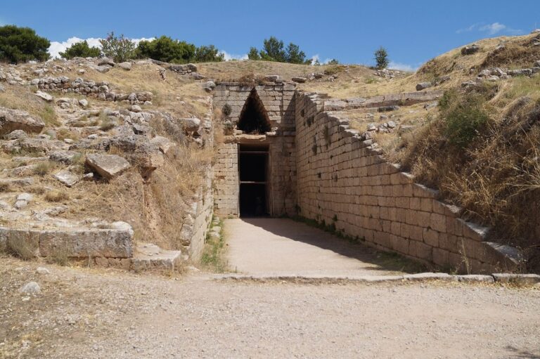
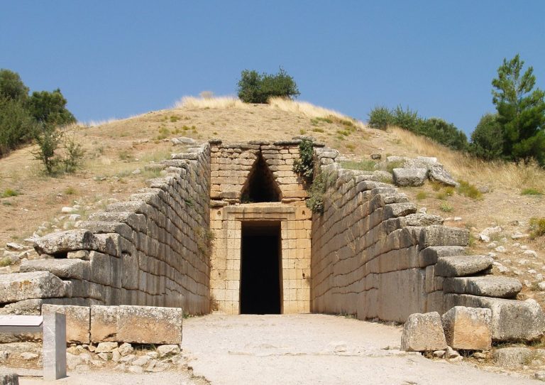
The Treasury of Atreus, the Tomb of Clytemnestra and the Tomb of the Genii form the final group, dated to Late Helladic IIIB. A pottery fragment found beneath the Treasury of Atreus’s threshold supports the group’s date. The Treasury is the largest of the nine tombs. The tombs were plundered in antiquity or later, and the funerary purpose of the Treasury was eventually forgotten before it acquired its traditional name.
Palace and other citadel buildings
Palace
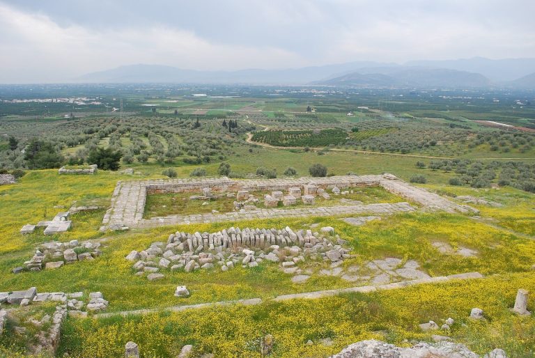
Successive monumental palaces were built within the walls, with each replacing or covering earlier structures. The remains visible on the acropolis belong to the last palace, dated to the beginning of Late Helladic IIIA:2. Its principal hall, or megaron, was organized around a raised central hearth beneath a roof opening supported by four columns. A throne stood against a side wall facing the entrance. Frescoes decorated the plaster walls and floor. The hall opened from a courtyard through a columned porch, and a broad staircase linked a lower terrace with the acropolis courtyard.
Temples
A temple within the citadel included a room known as the Room of the Idols. It contained a scarab associated with Queen Tiye and at least one statue of a type dating to Late Helladic IIIA:2 or IIIB:1. A separate temple to Hera stood at the summit during the Archaic period.
Hellenistic theatre
The Hellenistic theatre was built over the Tomb of Clytemnestra, placing a later public structure directly above the earlier tomb.
Houses beyond the citadel
Houses outside the walls
A small group of excavated houses lay beyond the walls, outside Grave Circle B. The House of Shields, House of the Oil Merchant, House of the Sphinxes and West House date to the period of the northeastern wall extension. They may have served as homes, workshops or both.