Castra of Visegrád-Gizellamajor: A Late Roman Frontier Fort in Hungary
Site at a Glance
- Popularity
- Very Low
- Country
- Hungary
- Primary era
- Classical
- Eras represented
- Classical
- Civilizations
- Roman
- Site type
- Military
- Remains
- Fort
On this page19 sections
History
The Castra of Visegrád-Gizellamajor was a late Roman fort in Hungary, on the south bank of the Danube near the Danube Bend. Its garrison guarded a section of the Pannonian Limes, the Roman frontier system along the Danube in the province of Pannonia. The fort’s form, dimensions, and internal arrangement were described as unique on that frontier.
Frontier and foundation
The fort occupied a closely spaced network of Roman defenses established in response to the Quadi, a Germanic people living across the river in the region known as the Barbaricum. Its garrison could exchange visual signals with at least six nearby tower-forts, the larger Castra ad Herculem to the northwest, and Pone Navata to the northeast. During the fourth century, Pone Navata was changed into a tower-fort.
Coins from the reigns of Vespasian or Titus and Marcus Aurelius, together with masonry beneath the fourth-century occupation, led archaeologist Sándor Soproni to propose that an earlier watchtower had stood here. The evidence does not establish the structure’s identity with certainty. The fort itself was founded under Constantius II and remained in use until the end of the first third of the fifth century. It was renovated during the reign of Valentinian I, and late in the fourth century groups of foederati, people outside the Roman army serving Rome under a formal agreement, settled within its walls.
Settlement and later use
A nearby vicus, a settlement associated with a Roman military site, began in the 340s and had ended by the 360s. Its area was under military control, and graves were later laid across part of its former southwestern extent. After the settlement closed, civilians may have lived inside the fort. Some room entrances were blocked before channel heating was installed, and agricultural tools became more common. Since many of these tools also occur in military settings, they do not by themselves establish who used the rooms.
A major fire destroyed the fort, leaving a clear layer of destruction. From the mid-fifth century, the Huns used its ruins for burials. One grave held a woman whose skull had been deliberately deformed in a manner associated with the Huns; another burial was placed in rubble in the fort’s northern area.
Excavation and protection
Soproni noted the area during a field survey in 1964. A planned dam and river-regulation project threatened the site, and rescue excavations began in 1988 after archaeologists Dániel Gróh and Péter Gróf uncovered Roman walls. Protests over the project had begun in 1984; work on the Hungarian side stopped in 1989, averting the threatened destruction. Systematic excavations continued intermittently through 2004. The name Gizellamajor recalls Gisela of Bavaria, who married Stephen I around 995 and became Hungary’s first queen. Under Hungary’s 2001 cultural-heritage law, the fort is protected as an archaeological site within the nationally valuable cultural-property category.
Remains
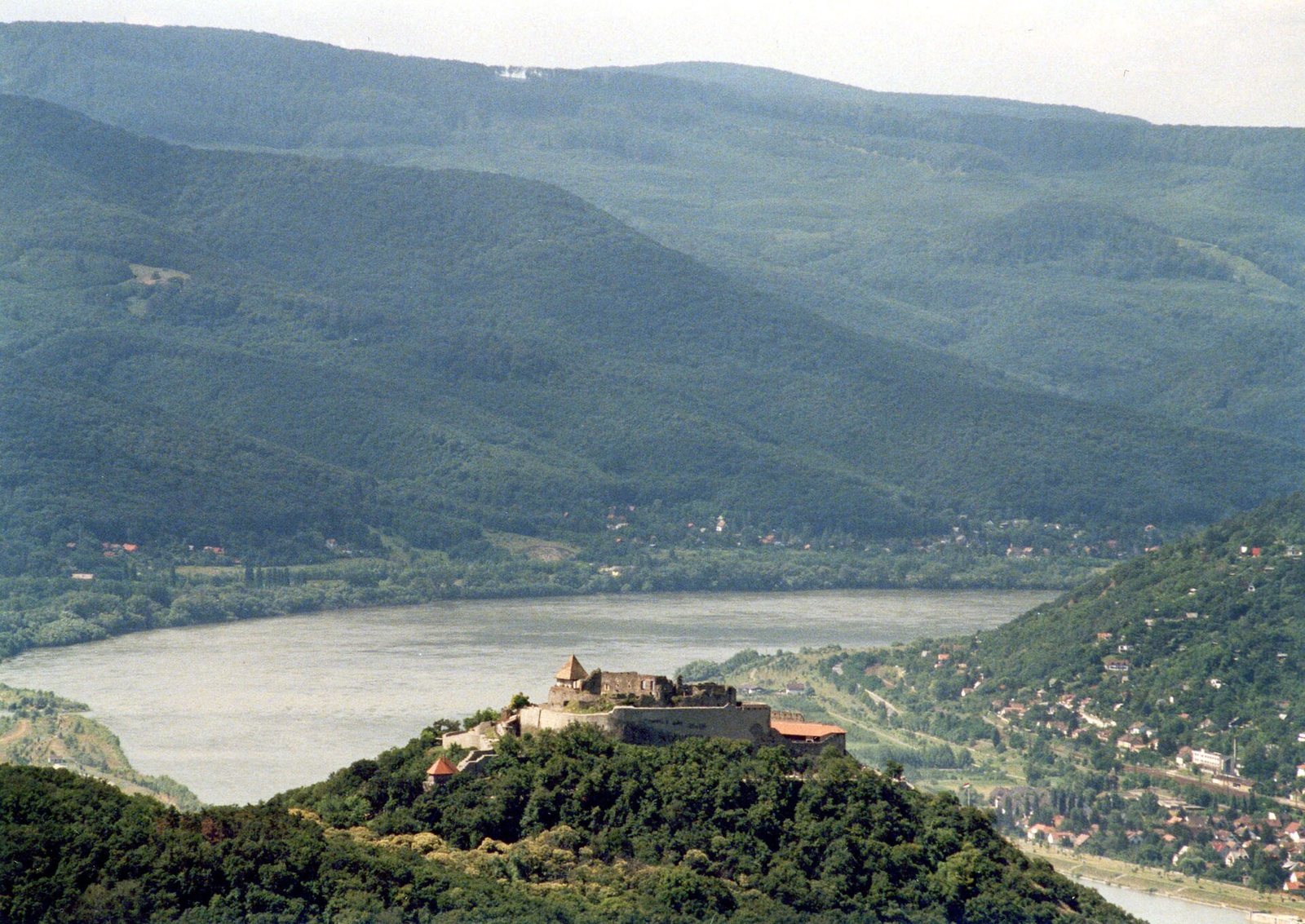
The fort was a stone square, 34.3 metres on each side, with enclosing walls 1.8 metres thick. Buildings leaned against the walls and faced an open central courtyard. The site occupied a lower hillside on the Danube’s south bank, near Dömös Bay and close to the apex of the Danube Bend. Shipping could be watched to the north, northwest, and northeast. Across the river, a headland carries St Michael’s Hill; the Pilis Mountains rise behind the site above a narrow floodplain. Local ground includes weathered volcanic debris and andesite tuff, a rock formed from compacted volcanic ash and fragments, with loess, fine windblown sediment, and fine-grained tuff in places.
Defenses and overall plan
Enclosure and entrance
The fort’s layout followed imagined north-south and east-west lines. In the excavators’ reconstruction, a groma, a Roman surveying instrument for setting straight lines and right angles, stood where the square’s diagonals crossed. A single gate faced the Danube and the territory beyond it. Buildings along the northern wall were later extended farther south, while an added room narrowed the gate passage.
Corner towers
A fan-shaped tower projected beyond the walls at each corner. The northwestern tower contained a small heated bath. In the northeastern corner, three or four holes for beams above a threshold stone may have supported stairs to an upper floor. Relief decoration survives on the stone’s underside. It was reused during the renovation under Valentinian I and may first have formed part of the front of a small shrine-like tomb.
Buildings inside the fort
East and south wings
The eastern wing, built against the eastern wall, measured 22.75 by 6.35 metres, and its walls were about 60 to 70 centimetres thick. Two shallow, clay-bonded partitions were added during a renovation. One room had a channel-heating system, which carried heat through passages beneath the floor, in an irregular L-shaped arrangement. At the southwestern end of the south wing stood an oven. A neighboring room, fitted out during the Valentinian renovation, contained a grain-drying installation with an L-shaped heater. Reused tiles in its channels bore the name of Cohors I Ulpia Pannoniorum, a Roman auxiliary regiment.
West wing and interior alterations
An excavated room in the west wing measured 22 by 5.5 metres and appears to have served industrial work. A separate barrack there extended more than 20 metres. Other changes included a small rectangular room added to the outside of the western wall beside the northwestern tower, and buildings along the north wall that reduced the courtyard as they expanded southward. Thin clay surfaces survived as Roman floors in several places. In the southwest, a floor lay above undisturbed gravel and beneath a layer of burnt posts and beams.
Settlement and cemetery
Civilian settlement
Immediately southeast of the fort, the associated settlement survives as a cultural layer 40 to 100 centimetres thick, with a stone oven. Test trenches in the loess hill to the southwest revealed two other oven types. More than a dozen millstones and hand-mill fragments were recovered in connection with the settlement and the fort’s later alterations. Associated tools included axes, hatchets, hooks, drills, awls, a sickle, a saw blade, a pickaxe, and a knife used in viticulture.
Grave forms and layout
By 2004, excavations on the crest of the southwestern loess hill had uncovered a cemetery of 226 graves. It included prehistoric burials associated with the Bronze Age Mound Grave culture, an Avar burial, and late Roman graves. These included rectangular pits, some with rounded corners and sloping edges; stone-cist graves, pits lined with flat slabs, sometimes topped by irregular stone mounds 50 to 60 centimetres high; and two later-built tombs made with roof tiles or bricks. More than two-thirds of the graves ran west to east, while just over a tenth ran east to west. The cemetery held 75 children and 64 women. Most stone-cist graves, which appear to have been higher-status burials, had been robbed.
Burial objects
Graves dated to about 355–365 contained clothing brooches of bronze, gilded silver, and gold, sometimes set with precious stones, as well as glass beads, decorated belts and buckles, bracelets of bronze, bone, or iron, and mirrors. One finger ring held an amber cameo engraved with Mars. An onion-knob brooch, a late Roman type with bulb-shaped knobs, carried the inscription VTERE FELIX, meaning “Use it happily.”
Graves from the late fourth and early fifth centuries yielded faceted earrings, crescent-shaped silver pendants, bronze or iron brooches, and buckles with beak-shaped ends for belt or shoe straps. A ring bore a Christogram, a monogram representing the name of Christ. Pottery, mostly placed at the feet of the dead, included wheel-thrown vessels and hand-built containers of a type originally associated with peoples beyond the Roman frontier. Glass bottles and beakers were also found. One brick-built grave had been robbed; another held several late Roman skeletons beneath a plastered vault painted with a red lattice pattern.
Other excavated finds
Pottery and coins
By 2004, excavations had recovered 3,555 pottery sherds. Local pottery accounted for 82 percent, smoothed ware for 7.6 percent, glazed stoneware for 6.6 percent, polished pottery for 1 percent, and hand-built or slow-wheel pottery for 3.2 percent. Some smoothed pieces carried lattice decoration. The interpretation of this pottery is disputed, and treating it simply as pottery of the foederati is considered outdated. Fourth-century coins made up 92 percent of the recovered coinage; three-quarters of those belonged to the periods of Constantine the Great and Constantius II. The latest coins date to 378–383.
Glass
The cemetery glass consisted mainly of good-quality bottles and beakers in forms used for about a century from the second half of the fourth century. Production in Pannonia by glassworkers from the Balkan provinces is possible, as are connections with Italy. Similar vessels at Brigetio may indicate that some glassware reached the area by river from there.
Metal and bone objects
Metal finds included brooches, belts, buckles, jewellery, clasps, keys, an iron-handled jug, cauldrons, buckets, and substantial waste from local production. A decorated copper belt-end fitting came from the fort. A bone comb had a triangular handle, circle-and-eye decoration, and a carved horse head on each side.
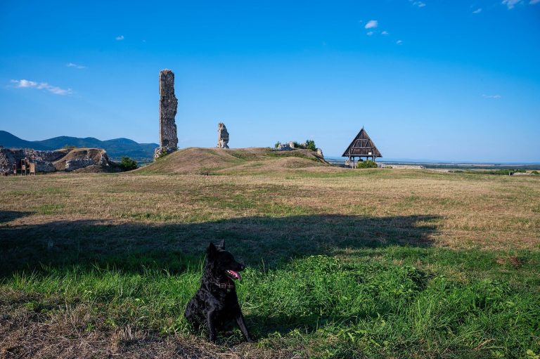
The excavated remains are conserved beneath a temporary wooden shelter and protected by a chain-link fence. The fort has been made visible apart from its northern section beneath Highway 11, which remains uninvestigated.