Oylum Höyük: An Ancient Settlement Center in Turkey
Site at a Glance
- Popularity
- Medium
- Country
- Turkey
- Primary era
- Bronze Age
- Eras represented
- Stone Age, Bronze Age, Iron Age, Classical, Medieval
- Civilizations
- Byzantine, Seleucid
- Site type
- City
On this page20 sections
History
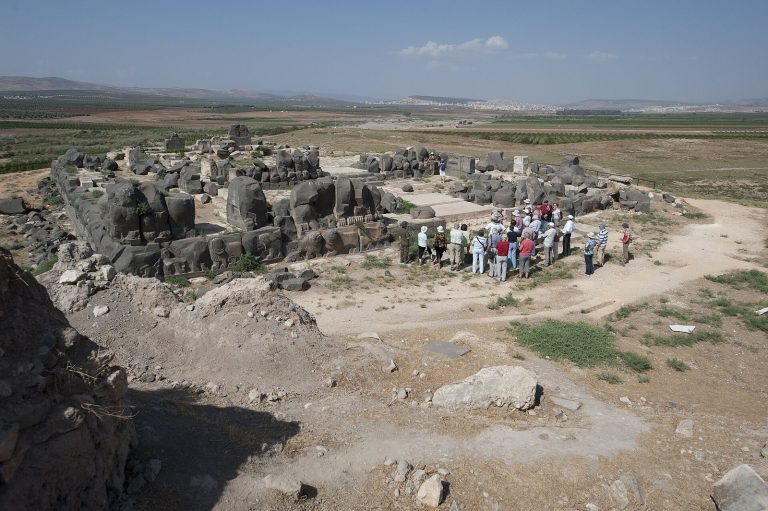
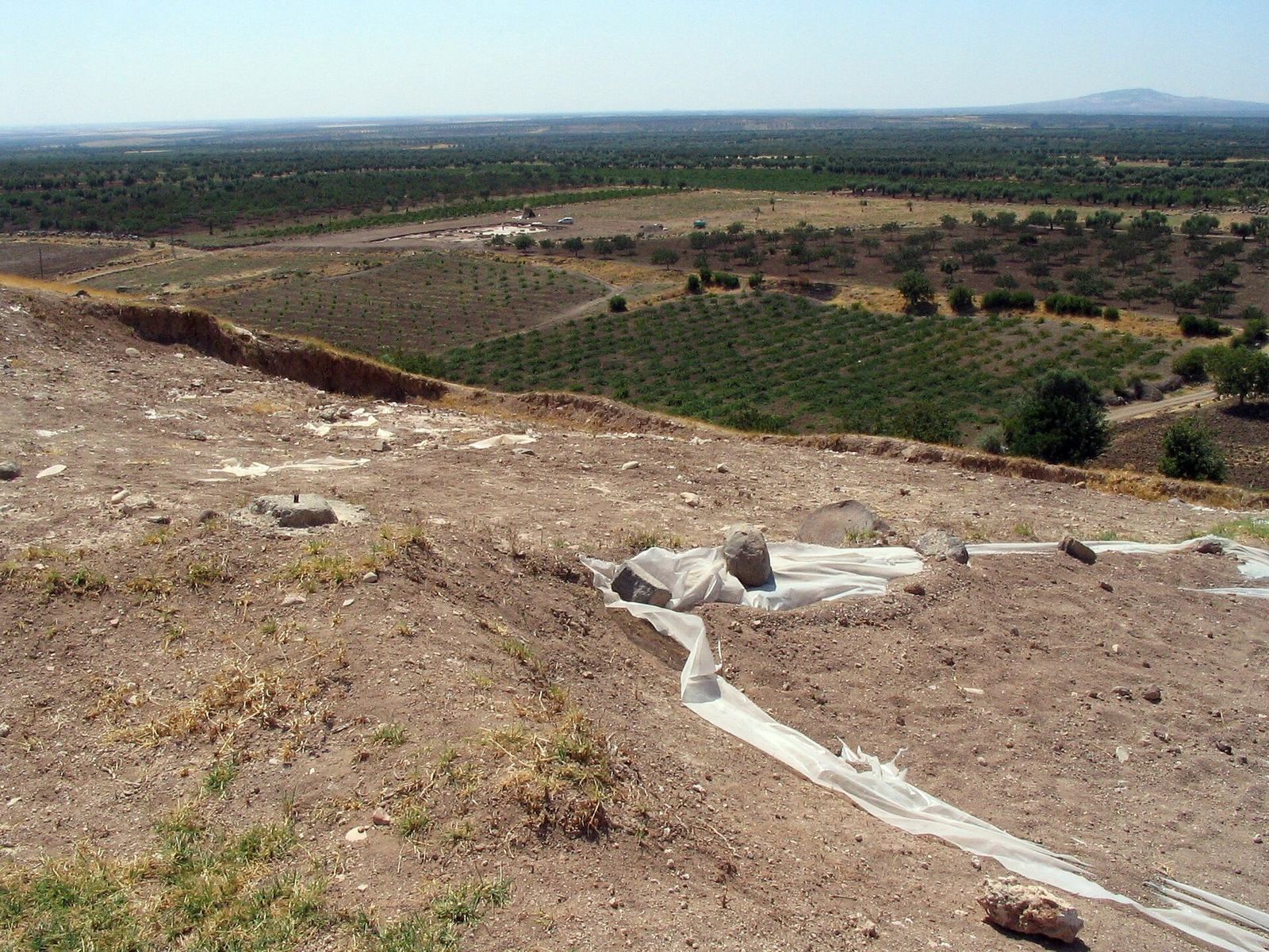
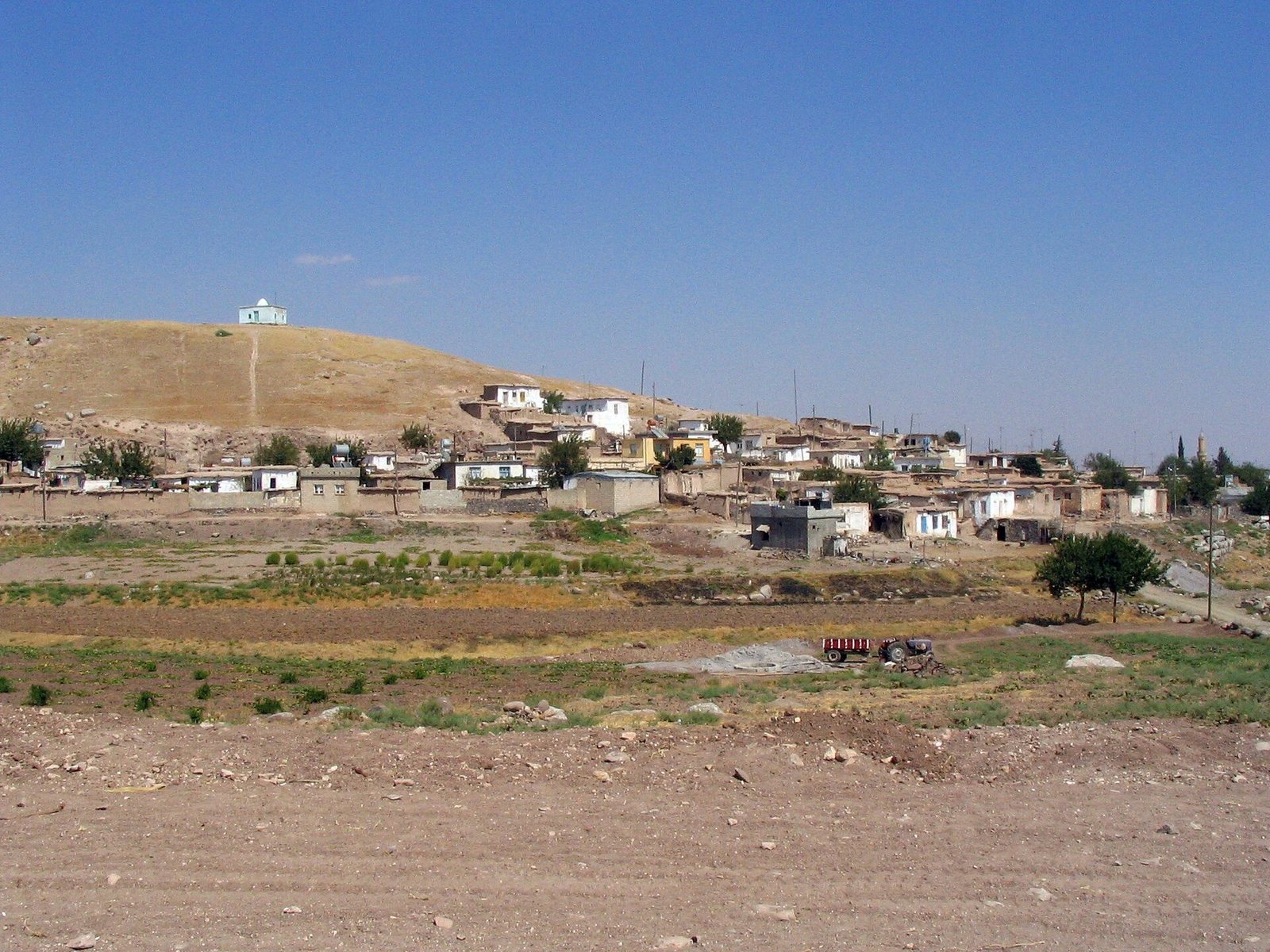
Oylum Höyük is an archaeological settlement mound near Oylum village in Turkey, about 7 km east-southeast of Kilis. It was the Kilis Plain’s principal center from the Neolithic through the Hellenistic period, when Greek influence spread across the eastern Mediterranean and western Asia. The earliest archaeological evidence dates to the Middle–Late Chalcolithic, when copper use emerged alongside stone tools. Oylum was among Anatolia’s largest settlement mounds, with particular importance during the Bronze and Iron Ages, periods named for metals widely used in tools and weapons.
Regional setting and early occupation
The mound occupied a position on routes connecting the Euphrates Valley with the Amik Plain and the Anatolian Plateau with northern Syria. A branch of the trade routes from Aleppo toward Anatolia also crossed the area. The Kilis Plain divides waters flowing toward the Orontes and Euphrates systems, and its position linked Mediterranean societies with Mesopotamia. A temperate climate and abundant plant and animal life made the plain favorable for settlement. Oylum’s occupation included the Obeid phase, an early archaeological period associated with communities in Mesopotamia and neighboring regions.
The settlement’s ancient name is uncertain. Oylum has been proposed as a possible match for Ulisum or Ullis, names associated with the third millennium BC, and for Ullaza, Ukulzat, or Kuilzila, names associated with the second millennium BC. Hassuwa is another proposed identification.
Bronze and Iron Age center
Archaeological evidence points to particular importance during the Bronze and Iron Ages. Two fire destructions occurred in the Middle Bronze Age, each affecting some or perhaps all of the settlement. A further destruction in the Late Bronze Age may have been connected with a Syrian campaign by Šuppiluliuma I, king of the Hittite Empire, an Anatolian power of the second millennium BC.
After the Middle Bronze Age, settlement at Oylum became more village-like. The site has also been interpreted as a royal center, an interpretation strengthened by discoveries made during excavations in 2009.
Later occupation and archaeological work
In the Roman period, settlement shifted to the west bank of the Akpınar River and continued there into Byzantine times, the period of the later eastern Roman Empire. Kyrrhos, an ancient city about 20 km to the west in what is now Syria, then became the region’s main center.
Archaeological work in the area began in the 1950s. Bahadır Alkım’s 1968 survey and surveys by Italian researchers in 1971 helped establish Oylum’s regional importance. Systematic surveys followed in 1984 and 1985, and broader investigations led by Engin Özgen began in 1985. Regular excavations started in 1987 through a collaboration between Hacettepe University and the Gaziantep Museum. From 1990, work continued under Özgen with Hacettepe University and the German Archaeological Institute. Barbara Helwing, Olivier Nieuwenhuyse, and Alan Greaves joined the excavation team in 1995.
Remains
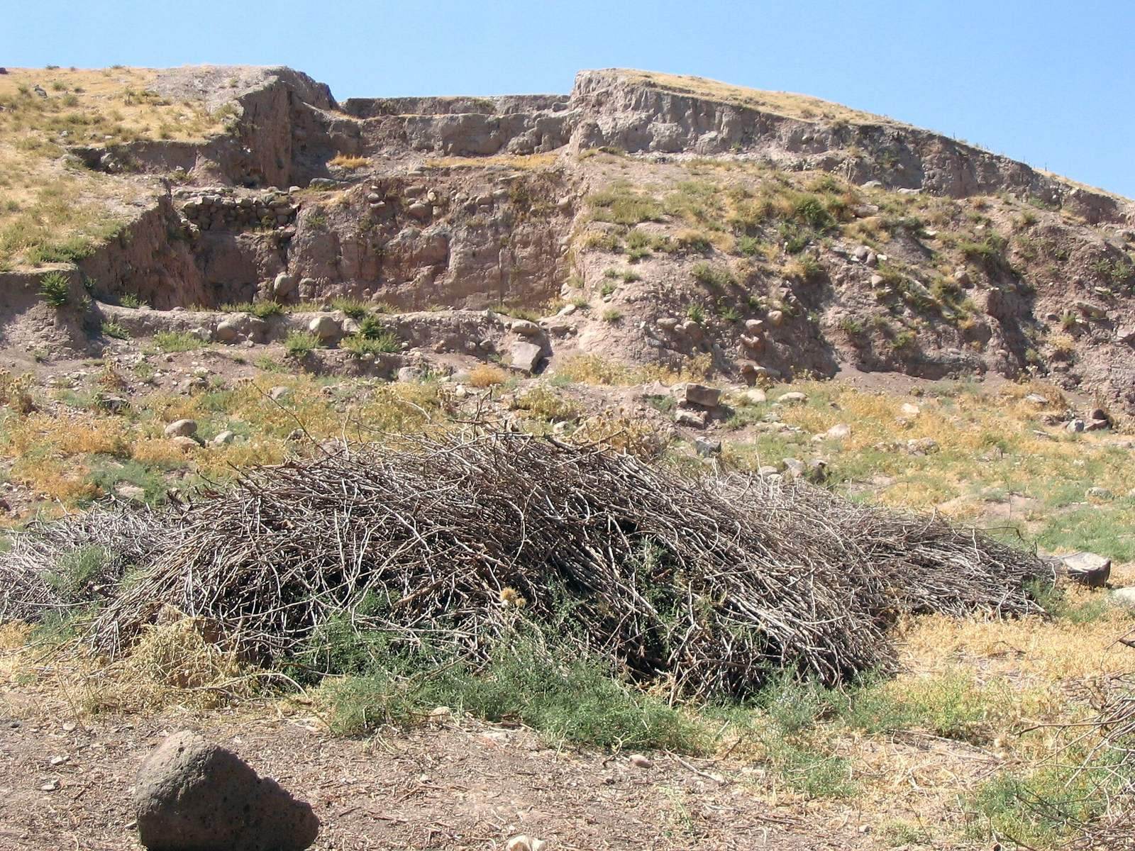
The mound measures about 460 by 320 m at its base. Its two rises are joined by a saddle: the northern one reaches 22 m and the southern one 37 m. Successive occupations left buildings made of mudbrick, blocks of dried mud, basalt, and stone. Houses now stand on the eastern and western slopes, and soil removal has damaged parts of the site.
Early occupation and burial evidence
Terraces and early settlement layers
A terracing wall at the mound’s western foot dates to the early fourth millennium BC. Traces of village buildings and pottery occur on the western terrace, while pottery has also been found on the eastern slope. Three building layers from the Uruk phase, an archaeological period associated with early communities and urban development in Mesopotamia and nearby regions, were identified on the eastern side.
Burials, burned buildings, and diet
Late Uruk-period burials placed the dead beneath house floors. Early Bronze Age graves on the eastern side contained substantial grave goods. A layer spanning Chalcolithic and Bronze Age occupation held burned mudbrick buildings and human remains, including a man whose upper body was damaged and whose knees were drawn toward his abdomen, as well as the remains of three infants. Finds from Chalcolithic settlements indicate a diet based mainly on grain, supplemented by beans, lentils, figs, grapes, and vegetables.
Bronze Age architecture and finds
Eastern terraces and entrance
Construction on the eastern slope during the Middle Bronze Age included extensive terraces and an elaborately built entrance made from basalt blocks. Finds associated with this area included a stone stele, an upright carved slab, depicting a warrior deity. The stele dates to the middle of the second millennium BC.
Palace and kiln
A palace or administrative building from Middle Bronze Age I, an early subdivision of the period, was destroyed by fire. Above its ruins stood a well-preserved pottery kiln built during Middle Bronze Age II, a later subdivision.
Foundation offerings
A Middle Bronze Age II building on the northern rise contained votive objects, offerings dedicated to a deity, beneath its foundations and floor. They comprised a copper axe, one bronze figure of a deity, and a pair of bronze deity figures. Their placement may have been intended to secure divine protection for the building.
Bronze Age inscriptions and seals
A fragment of a cuneiform tablet, written in wedge-shaped signs, concerns a treaty between a Hittite king and a local ruler. An inscription on a lapis lazuli cylinder seal, an engraved cylinder rolled over soft material to leave an impression, names its owner as Bitna, a vizier, or high-ranking official. An Old Babylonian tablet concerns a commercial debt. Other Bronze Age objects point to shared material culture with Alalakh, a Bronze Age city in what is now southern Turkey.
Later buildings and objects
Western summit
A massive mudbrick building on the western summit dates to the late first millennium BC. A silver coin hoard in a jar came from a building on the summit; its latest coins date to the reign of Antiochus III, a king of the Seleucid Empire, a Hellenistic dynasty that ruled parts of western Asia.
Stone-built structure and coins
A large Hellenistic-period building was constructed from substantial stone blocks. Ceramics from the building date to the first millennium BC. Silver, copper, and bronze coins were found near this structure.
Limestone seal
A limestone cylinder seal depicts a man in a garment reaching to his heels, preparing to shoot an arrow at an unidentified two-legged creature. Its carving belongs to the Neo-Assyrian seal tradition, associated with a major Mesopotamian power of the first millennium BC.
Roman and Byzantine remains
Roman-period traces
Roman-period pottery has been found on the southern slopes, and late Roman graves were uncovered on the northern summit.
Byzantine mosaic
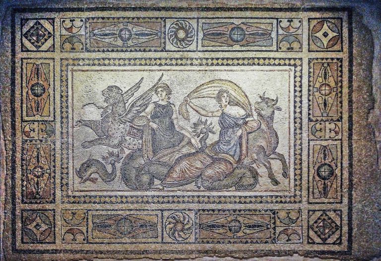
On the west bank of the Akpınar River, a mosaic floor was found in a Byzantine basilica, a large public and religious building type commonly used as a church during that period.