Kamarina: A Greek City-State on Sicily’s Southern Coast
Site at a Glance
- Popularity
- High
- Country
- Italy
- Primary era
- Classical
- Eras represented
- Iron Age, Classical, Modern
- Civilizations
- Ancient Greek, Italian, Roman
- Site type
- City
On this page22 sections
History
Kamarina was a Greek city-state on Sicily’s southern coast in Italy. Thucydides dated its foundation by Syracuse to 598 BC, while the historian Timaeus placed it between 612 and 608 BC and attributed it to settlers from Gela. A Dorian colony, Kamarina was a polis, or Greek city-state, whose inhabitants made peace with a local Sicel community. Several Sicel settlements lay within its territory.
Foundation and early destruction
After about 45 years, Kamarina attempted to break away from Syracuse. The effort failed, and Syracuse destroyed the city in 553 BC. The site then remained uninhabited until about 492 BC, when Hippocrates, ruler of Gela, acquired its territory through an agreement with Syracuse and resettled the city. He took the title of founder. His successor Gelon later gained control of Syracuse, transferred Kamarina’s inhabitants there, and destroyed the city again in 484 BC.
Refoundation and independence
Around 461 BC, after Thrasybulus was expelled from Syracuse and exiles returned to their cities, Gela established a new colony at Kamarina and distributed land among its settlers. The refounded city became independent and prospered for roughly 50 years. In 452 BC, the poet Pindar celebrated the Olympic victory of Kamarina’s Psaumis and praised the city’s swift rebuilding. A democratic constitution has been proposed for this phase, though the form of its government remains uncertain.
Kamarina generally pursued policies opposed to Syracuse. In 427 BC, during the conflict between Syracuse and Leontini, it was the only Dorian city to support Leontini. A truce agreed at Gela in 424 BC brought a wider peace. Syracuse then transferred the territory of Morgantina to Kamarina in return for payment. During the Athenian expedition to Sicily in 415–413 BC, Kamarina initially remained neutral despite earlier ties to Athens and Leontini. As the war shifted in Syracuse’s favor, it sent a small force to assist the city.
Conflict and repeated resettlement
In 405 BC, Carthaginian troops led by Himilco ravaged Kamarina’s territory. After Dionysius I failed to save Gela, Kamarina’s inhabitants withdrew first to Syracuse and then to Leontini. The peace agreement Carthage concluded in 396 BC allowed them to return as its tributaries, but prohibited the rebuilding of the city’s fortifications. Kamarina later supported Dionysius I in his war against Carthage.
After Dionysius I died, Kamarina sided with Dion against Dionysius II and supplied reinforcements for Dion’s march on Syracuse. It had also supported Dion in 357 BC. In 339 BC, Timoleon restored Kamarina with new settlers, and the city regained some of its prosperity. During the war between Agathocles of Syracuse and Carthage in 311 BC, Kamarina sided with Carthage. The Mamertines destroyed it in 275 BC.
Roman rule and later history
During the First Punic War, the conflict between Rome and Carthage from 264 to 241 BC, Kamarina was aligned with Rome. Around 258 BC, Carthaginian forces under Hamilcar seized the city. Roman consuls Aulus Atilius Calatinus and Gaius Sulpicius Paterculus recaptured it, and the Romans punished the population by selling a large part of it into slavery. In 255 BC, a Roman fleet was wrecked by a storm off Kamarina. About 80 of its 364 ships survived, and wreckage reportedly stretched along the coast between Kamarina and Cape Pachynus.
The city declined under Roman rule. By the first century BC, when Strabo wrote, it was largely depopulated, although references by Pliny and Ptolemy suggest that a settlement of some kind continued into the second century AD. The site was uninhabited after antiquity, with no medieval settlement. A tradition tells that residents asked the oracle at Delphi whether they should drain a nearby marsh. The oracle advised against it, but the marsh was drained; the story’s historical basis, date, and connection to any particular capture remain uncertain.
Kamarina’s cemeteries were excavated in the nineteenth century. Work in the urban area began in the early twentieth century and resumed from 1958, continuing through the second half of that century.
Remains
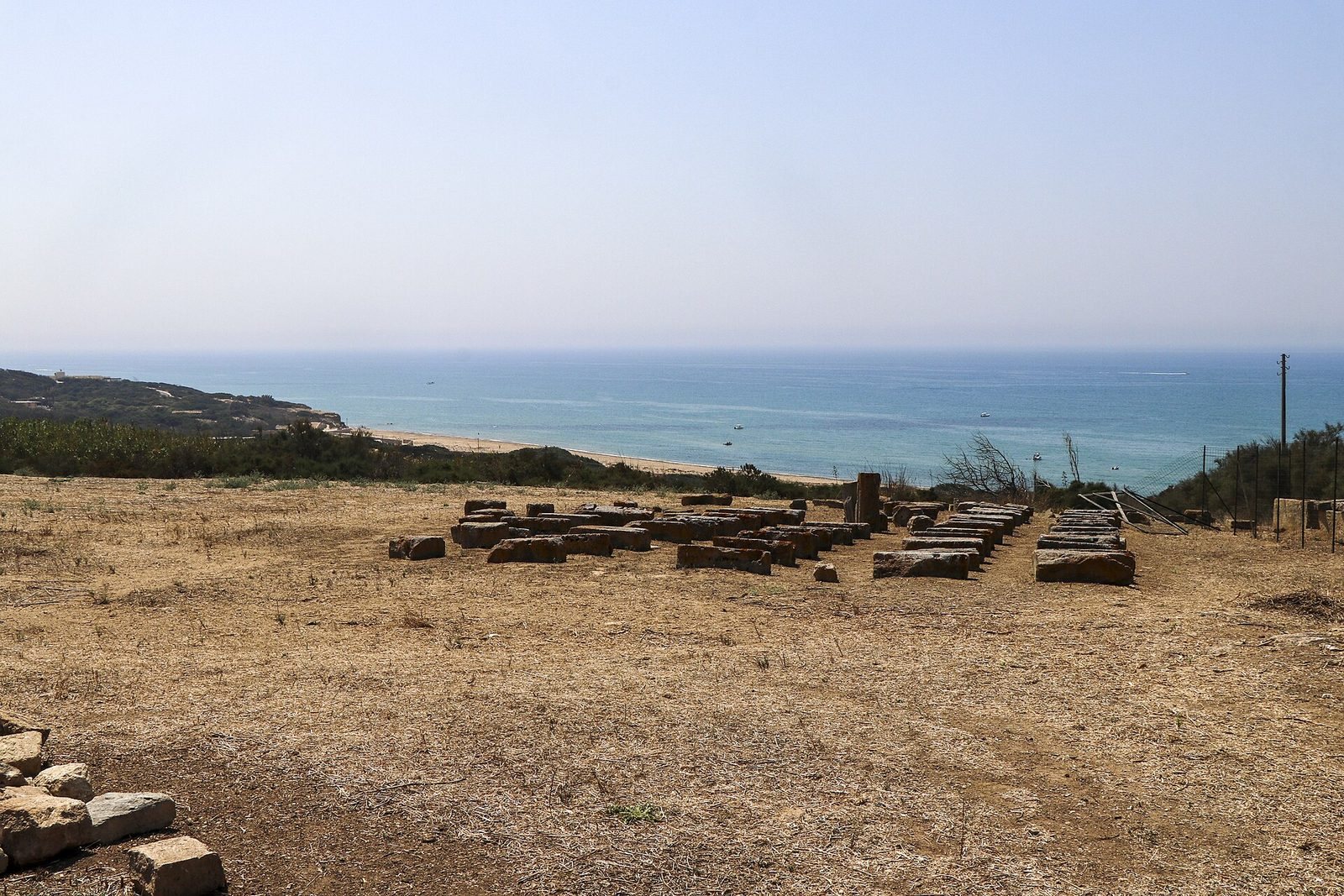
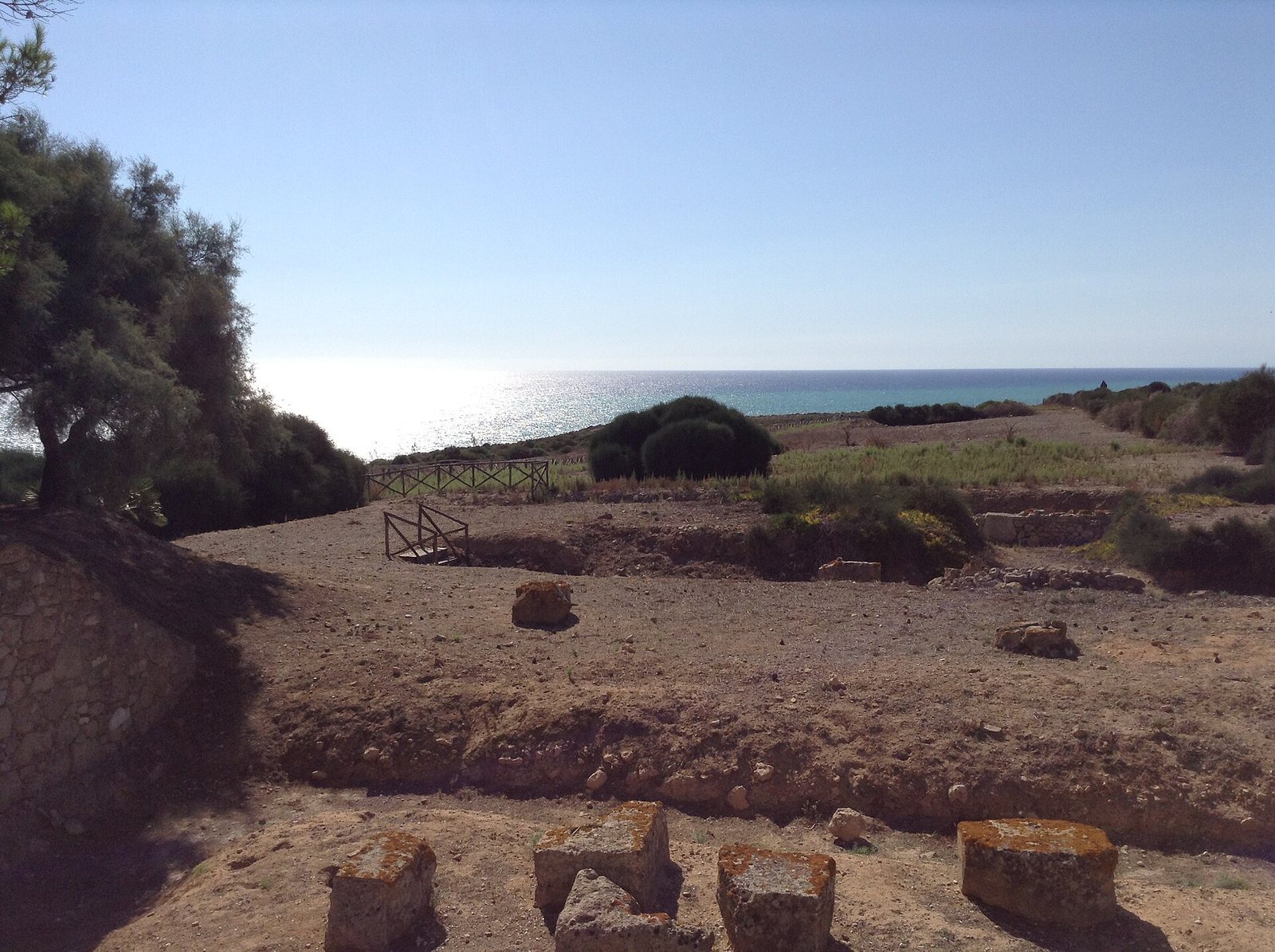
Kamarina was laid out over three hills near the mouth of the Hipparis River, between that river and the Oanis. Its remains include an extensive walled city, a planned street grid, a public center, sanctuaries, residential areas, and cemeteries beyond the urban area. Rivers and marshland shaped both the city’s setting and the use of its surrounding land.
Landscape and water system
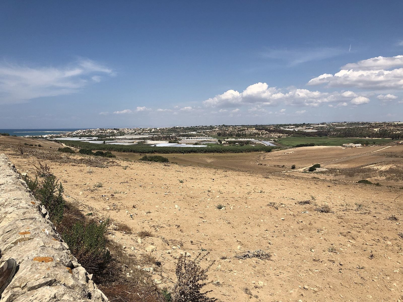
A marshy lake fed by the Hipparis lay immediately north of the city, while the river and marsh also provided natural barriers. The Hipparis supplied water through channels and aqueducts, and its water was diverted to irrigate farmland. The river was navigable and formed a harbor-like inlet; archaeological remains include harbor moles and a canal harbor. A smaller harbor lay about 15 kilometers southeast of the urban center, and another landing place was situated at the Irminio. The Hipparis also supplied building material, while pottery kilns along its course show that its banks were used for ceramic production.
The surrounding agricultural territory, known as the Kamarinaian land, has been estimated at about 200 to 500 square kilometers. The Irminio probably marked its boundary with Syracusan territory, and the Dirillo its boundary with Gela’s; the Hybla Mountains lay to the north. Farms followed a regular pattern aligned with the city plan, and land parcels measured about 5.5 hectares. Sediments along the Oanis indicate changes to the landscape. Drainage work may have helped cultivation, while later signs of waterlogging may point to an environmental difficulty that contributed to the city’s decline. A coastal watchtower associated with Kamarina was called Torre di Camarana in the nineteenth century.
Street plan and defenses
Urban grid
The earliest settlement phase, dated approximately 599–553 BC, consisted of scattered houses. A planned grid, based on Hippodamian principles, or a regular system of streets and blocks, was established in the fifth century BC. The arrangement remained broadly consistent in later phases. Blocks measured about 35 meters on each side. Probably three main east-west streets, about 10.7 meters wide, crossed narrower north-south streets of roughly 5 meters. Plataia B was the principal east-west avenue.
City wall
The wall ran for about 7 kilometers and enclosed approximately 150 to 200 hectares, much of which was built up. Its oldest sections date to the sixth century BC, and it was strengthened toward the end of the fifth century. Extensive remains survive, particularly along the southern side near the Oanis.
Public center and sanctuaries
Agora
The agora, the city’s main public and market space, developed monumental buildings from the fifth century BC onward. A roofed, colonnaded hall called a stoa divided it into two areas. The agora served administrative and religious purposes, with cult sites for Athena, Demeter, Zeus, and Hermes. In Roman times, its northern hall was used to store grain, and the public space was enlarged.
Sanctuary of Athena
A sanctuary to Athena stood on a hill in the ancient city center from the Archaic period, the early era of Greek history before the Classical period. The surviving form of its temple dates to the fifth century BC, and much of its main enclosed chamber remains. Temple ruins were incorporated first into a church on the site and later into the eastern part of the museum complex. Athena was worshipped there as a protector of the city, a defender in battle, and a patron of crafts.
Other cult sites
Kamarina also had cults of Heracles and Apollo Patroos, an ancestral aspect of Apollo. Inscriptions refer to one or more sanctuaries of Demeter and Persephone, deities associated with agriculture and seasonal renewal. A sanctuary of Demeter lies on the southern slope.
Homes and agricultural land
Residential areas
Excavations have uncovered houses in the residential quarters, including the House of the Merchant, the House of the Inscription, and the House of the Altar. A lead tablet bearing a commercial document came from the House of the Inscription. In Roman times, the city included larger residences and a district devoted to craft work.
Farms and irrigation
Channels carried water from the Hipparis into the agricultural territory, where a planned irrigation network supported cultivation. Pindar referred to irrigation channels that have counterparts in the archaeological remains. The regular arrangement of farmsteads and their parcels followed the pattern of the city plan.
Cemeteries and burial evidence
Cemeteries lay north of the city near present-day Scoglitti, east of it at Rifriscolaro, Dieci Saline, and Piombo, and west of it at Passo Marinaro, Cozzo Campisi, and Randello. Archaic-period graves occur to the north and east, with the earliest settlement-period finds from Rifriscolaro. Classical-period burials appear in all three areas, while Hellenistic graves lie to the south. More than 2,500 tombs have been found. The Archaic cemetery was also situated near the Oanis, and a new cemetery was established at Passo Marinaro in the fifth century BC.
Inscriptions, coins, and museum collections
Lead tablets and coinage
More than 140 lead tablets found around Athena’s temple contain information about citizens. They may relate to the selection of jurors and officials by lot, or may instead have served as a register of citizens for military purposes. Kamarina’s coinage began in the fifth century BC, with the earliest known issues dating to 461 BC. Silver didrachms, or two-drachma coins, from the last quarter of the fifth century BC show the water nymph Kamarina riding a swan, with the river god Hipparis, represented as a young man with bull horns, on the reverse. Other coins depict Hipparis or Heracles driving a four-horse chariot.
Museum buildings and finds
The regional archaeological museum stands within the archaeological park in a late-nineteenth-century winery complex built on the foundations of Athena’s temple. The estate was a traditional Italian farm, and parts of the temple walls were built into the eastern museum building. Those walls had previously been incorporated into the church of Madonna di Cammarana, constructed during Sicily’s Arab-Norman period and destroyed by fire in 1837.
The eastern building displays finds from the necropolis, including objects dating to the early sixth century BC, female figurines from the sanctuary of Persephone, and fragments of Athena’s temple. One room preserves parts of the temple’s original inner-chamber walls and foundations and includes a model of its original appearance. The western building, formerly a barn, displays finds dating from about 500 BC to the city’s abandonment in the first century BC. More than 1,000 ancient two-handled storage vessels, or amphorae, are displayed in the former wine cellar. They came from places including Corinth, Attica, Laconia, Massalia, Chios, Etruria, and Phoenicia; most were used for child burials during the Greek period. Finds from Kamarina are also held in archaeological museums in Syracuse and Ragusa.
Shipwreck finds
The former wine press displays objects recovered from shipwrecks in Kamarina Bay. These include a Corinthian helmet and a silver ingot dated to the seventh or sixth century BC, lead weights from the second century BC, and glass and bronze vessels from a second-century AD wreck. More than 6,000 coins came from a wreck dating to the third century AD. Horseshoes and tools from a medieval vessel used to transport horses are also displayed.