Mustaj-bey Bridge: An Ottoman River Crossing at Klepci
Site at a Glance
- Popularity
- Very Low
- Country
- Bosnia and Herzegovina
- Primary era
- Early Modern
- Eras represented
- Early Modern
- Civilizations
- Ottoman
- Site type
- Infrastructure
- Remains
- Bridge
On this page4 sections
History
Construction and rebuilding
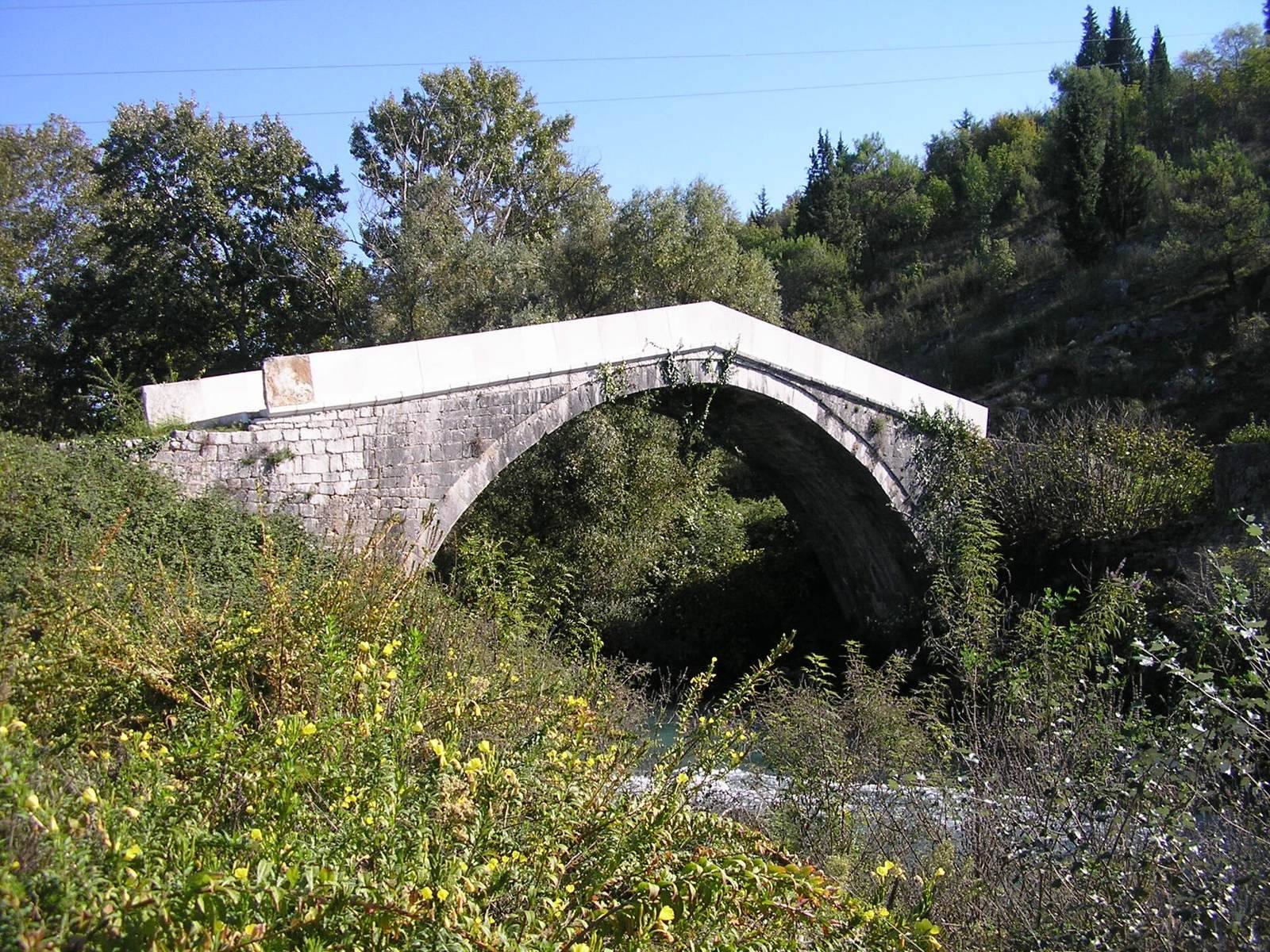
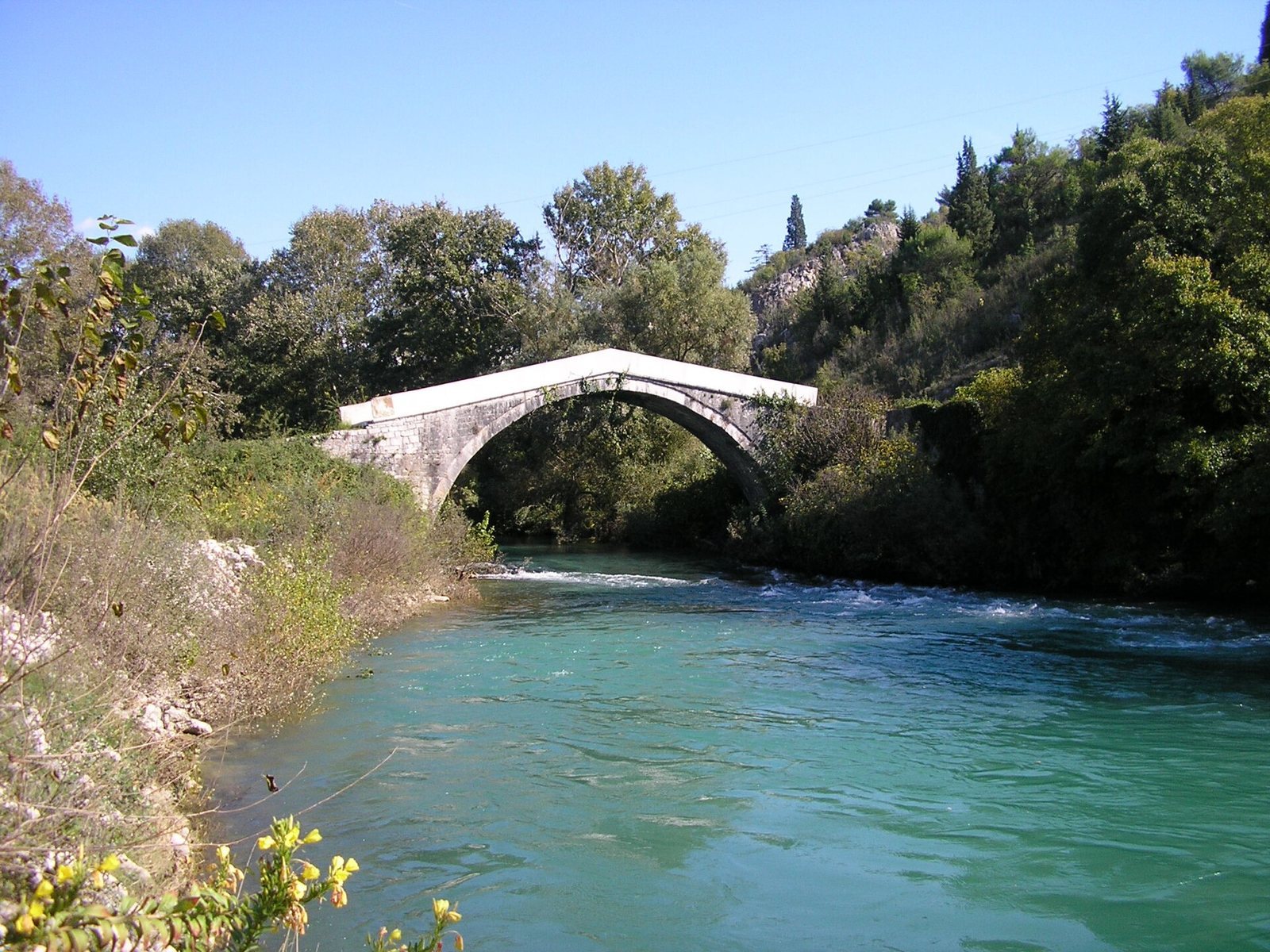
Mustaj-bey Bridge is an Ottoman-era stone bridge at Klepci, near Čapljina, Bosnia and Herzegovina, where it crosses the Bregava River. Mustafa-bey, the sanjak-beg of Herzegovina, an Ottoman governor responsible for an administrative district, built it in 1517. The bridge predates Mostar’s Stari Most, or Old Bridge, by about 50 years and follows a similar model. Roads from an earlier period have been found in the area, raising the possibility that a Roman bridge once stood at this site.
About a century and a half after its construction, Šišman Ibrahim Pasha, whose title marked a high rank in the Ottoman state, ordered the bridge rebuilt.
Conservation and later damage
In 1952, the Institute for the Protection of Monuments conserved and restored the bridge, rebuilding its cobbled surface and walls with unsuitable materials. Neglect brought further deterioration, particularly between 1957 and 1987. Works to regulate the Bregava also damaged the bridge’s natural surroundings. In 1991, reconstruction of a local road threatened the approach ramp, but the Institute for the Protection of Monuments prevented serious consequences.
The bridge sustained no damage during the Bosnian War, though neglect and heavy-vehicle traffic left it in poor condition. It was designated a National Monument of Bosnia and Herzegovina in 2003. Conservation measures in spring 2019 aimed to repair the bridge and prepare for its complete repair and reconstruction.
Remains
The bridge crosses the Bregava on a single limestone arch, about half a kilometre upstream from the river’s confluence with the Neretva. The arch is built in segments, with cut stone forming its underside and joints radiating from the arch. Its opening measures 17.52 m across, rises 6.30 m above the lowest water level, and extends about 1 m below the water surface. The vault is approximately 6.4 m wide, and the front arches sit about 4 cm behind the front walls.
A simply shaped upper stone band above the front walls is 17 cm high. The parapet and its corbel, a projecting stone support, together rise 88 cm; the band extends 10 cm beyond them, and the eaves are about 15 cm thick. The steep walkway is 3.75 m wide and paved with large river pebbles laid in uneven steps. Its highest point is 7.20 m above the minimum water level, while measurements at the right and left banks are 6.44 m and 5.71 m, respectively. Sections of the parapet, upper bands, cobbled surface, and wing walls are damaged or destroyed.