Chemtou: A Numidian City and Roman Marble-Quarrying Centre
Site at a Glance
- Rating
- 3.5
- Popularity
- Very Low
- Country
- Tunisia
- Primary era
- Classical
- Eras represented
- Classical, Medieval
- Civilizations
- Byzantine, Numidian, Roman
- Site type
- City
On this page24 sections
History
Numidian settlement
Chemtou is an ancient Numidian settlement and Roman marble-quarrying centre in Wadi Maliz, Tunisia. It developed after Numidian expansion into the upper Medjerda Valley, with its foundation placed in the fourth or fifth century BC. Punic cultural influences, visible in its buildings and use of Carthaginian measures, accompanied early trade with the wider Mediterranean.
The settlement occupied a crossing of the Medjerda and the meeting point of routes linking Carthage with Hippo Regius by way of Bulla Regia, and Thabraca with Sicca Veneria. Marble was exported from the area at an early date. Around 139 BC, the Numidian king Micipsa dedicated a sanctuary to his father, Massinissa, also a Numidian king. Marble extraction in the area is known from the second century BC.
Roman colony and marble industry
Rome conquered Chemtou in 46 BC. In the early imperial period it became a municipium, a self-governing Roman town with civic rights, and in 27 BC it received the status of a colonia, a formally established Roman colony. Its full colonial name was Colonia Iulia Augusta Numidica Simitthensium, and it belonged to Africa Proconsularis, a Roman province in North Africa.
Large-scale quarrying began under Augustus, Rome’s first emperor. The quarries, previously part of the Numidian royal domain, became imperial property and a monopoly. Veterans supervised the operation, which used people sentenced to forced labour. At an uncertain date, management appears to have passed into private hands, but extraction continued, probably into Late Antiquity, the transition between the classical Roman world and the early Middle Ages.
Chemtou prospered alongside the quarries during the High Roman Empire, the period of Roman imperial power from Augustus through the third century. The city reached its peak under the Severan dynasty, founded by Septimius Severus, when it was extensively transformed and furnished with monumental buildings. The quarry workforce may have exceeded a thousand people. It included skilled stonecutters as well as labourers who stacked and moved blocks and cleared rubble. Enslaved people and prisoners sentenced to quarry work were among them. Some prisoners were Christians, including women, persecuted for refusing to renounce their faith. Imperial officials and financial staff administered the operation, while soldiers guarded the quarries and also worked there. The Severan-era garrison included the cohors II Flavia equitata, an auxiliary unit of infantry and mounted troops.
Numidian marble was a valued luxury in Roman society. It went into imperial buildings at Rome and construction across Roman and Byzantine provinces, the latter belonging to the eastern continuation of the Roman Empire. A column erected at Rome by the common citizens in memory of Julius Caesar was made from the stone. Columns in the exercise courts of Carthage’s Baths of Antoninus also used it. The marble may have appeared in prestigious local buildings, including temples and villas.
Stone travelled from the quarries by river and by land. A paved road led to a river loading point, where rafts carried blocks toward Utica. From Hadrian’s reign, a land route crossed a pass about 800 metres high to Thabraca. It may have been developed because the river had become too shallow for reliable transport.
Late Roman and later settlement
Chemtou was a bishopric by 411 and passed through Vandal and Byzantine rule. Urban life had ended by the seventh century. Large-scale Arab settlement is recorded in the ninth and tenth centuries, under the Aghlabid and Fatimid dynasties, successive Muslim powers that ruled parts of North Africa. The ancient diocese, part of the ecclesiastical province of Carthage, disappeared after the Arab conquest. Simitthu remains the name of a Catholic titular see, an ecclesiastical title recalling a former diocese but carrying no territorial jurisdiction.
Survey, excavation and interpretation
French surveyors recorded the ruins in the nineteenth century. Philippe Caillat prepared a topographical plan for René Cagnat, and Henri Saladin produced a further survey in 1885 using a revision of Caillat’s plan edited by Charles Emonts. Jules Toutain carried out the first excavations in 1892, exposing part of the Roman theatre.
A Tunisian-German archaeological campaign began in 1965, led by Tunisia’s National Heritage Institute and the German Archaeological Institute in Rome. The institutions formalized their cooperation in 1969. Under Friedrich Rakob, early German work examined the quarries and extraction methods. Later investigations explored the work camp and Roman infrastructure, the cemetery beneath the forum, and evidence of Numidian occupation. Christoph B. Rüger’s excavation north of the forum from 1980 to 1984 provided important evidence for the pre-Roman settlement. Michael Mackensen directed work at the camp in 1998. Research begun in 2008 under Philipp von Rummel and Mustapha Khanoussi focused on the city’s early and late phases, the forum, the bridge, and a building interpreted as a possible imperial-cult structure.
On 12 May 1993, construction work for the museum uncovered 1,647 gold coins and one silver coin, buried during the reign of the Roman emperor Flavius Honorius. The Chemtou Archaeological Museum was established through cooperation between the National Heritage Institute and the German Archaeological Institute in Rome, and presents results from excavations carried out between 1965 and 1995. In 2012 Tunisia proposed the Numidian cemetery and ancient marble quarries for possible inclusion on the UNESCO World Heritage List.
Remains
Landscape and city
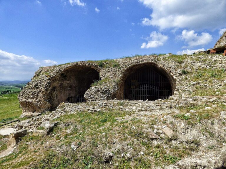
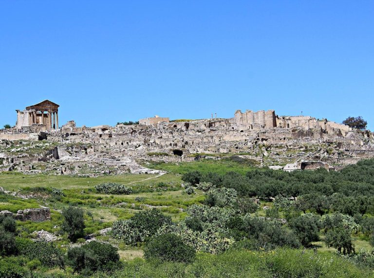
The archaeological area covers more than 80 hectares across a rocky ridge and its southern, western and northern slopes. The remains span about 1,500 years of occupation, and excavation has reached only part of the site. The ridge, Jebel Chemtou, is roughly two kilometres long and lies northwest of the city. Iron oxide colours its rugged limestone surface reddish. A rocky spur forms a flood-protected plateau about 400 metres across and 85 metres above the Medjerda. At its southwestern end, the ground slopes toward high cliffs above the river; the surrounding upper valley is fertile agricultural land.
The ridge and settlement
Jebel Chemtou has three parts: the eastern Temple Mount, the central Yellow Mountain and the western City Mountain. The Numidian-Punic settlement occupied the City Mountain, although its extent is unknown. The Roman colony spread around the mountain’s western spur. Marble was first identified as a building material at the Temple Mount in the second century BC; most later extraction took place on the Yellow Mountain.
Civic buildings and burial grounds
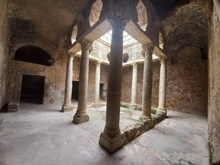
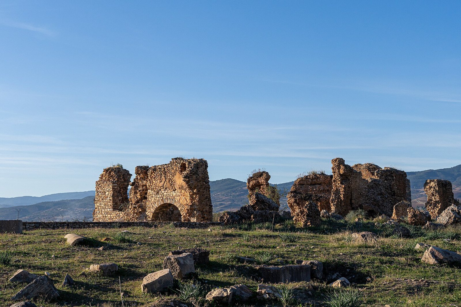
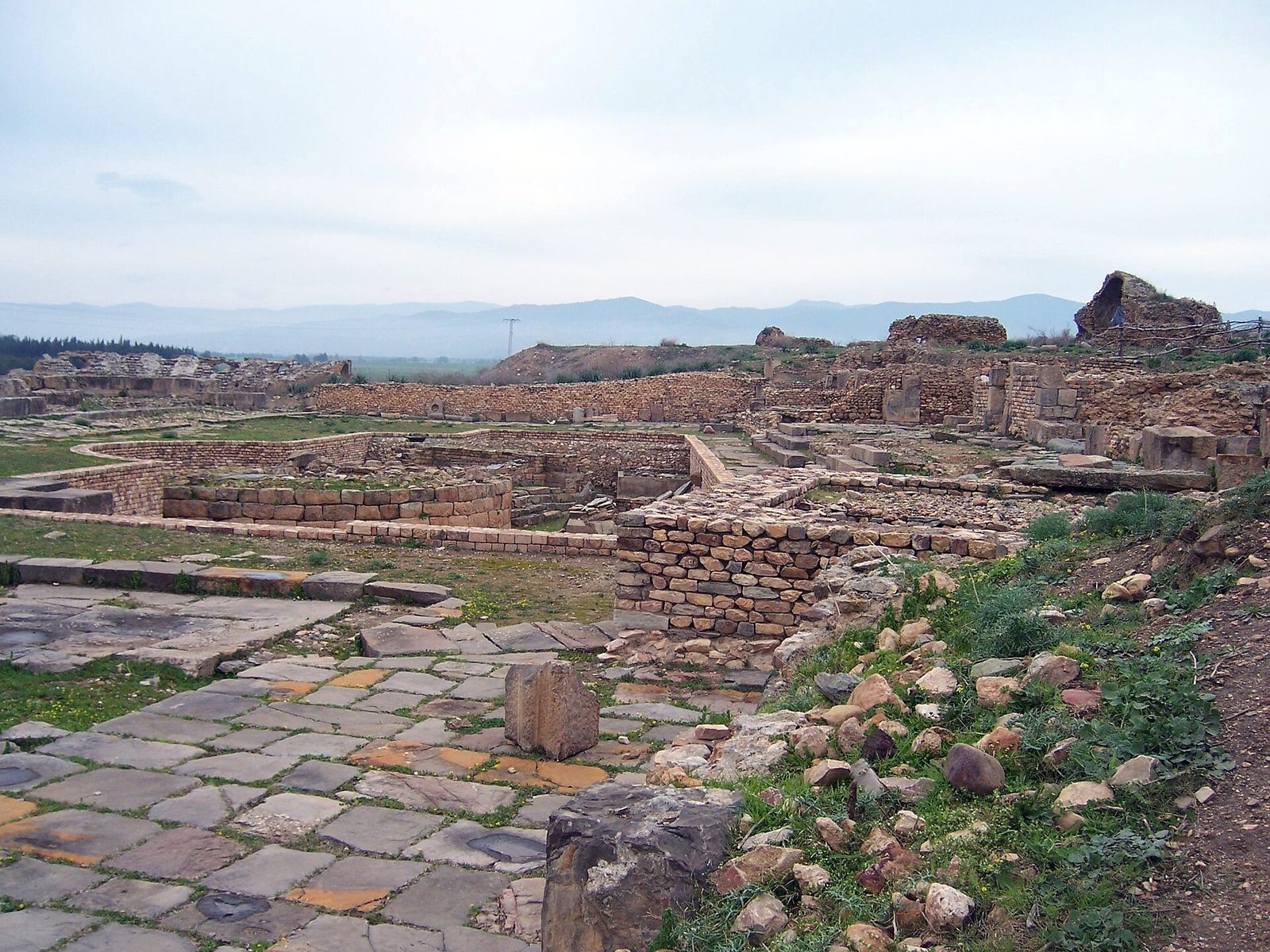
The city’s remains include an amphitheatre, a theatre, a forum with a basilica, or large public hall, and a fountain. Other structures include a covered market, a decorative fountain building, at least three bath complexes and several triumphal arches. A building in the northwest has been interpreted as a structure for the imperial cult, though it is more likely to have been a temple in the Italian style.
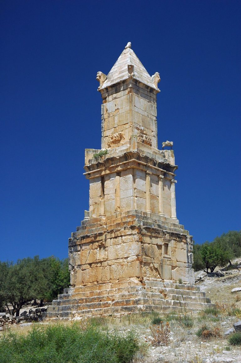
A cemetery used from the fourth to the first century BC lies beneath the Roman forum. It contained monumental tombs, some partly reconstructed. A separate urban cemetery occupied the southern slopes of Jebel Chemtou.
Marble quarries
The limestone deposit extends for more than a kilometre. In antiquity its marble was known as Numidian marble; the name giallo antico means ancient yellow. The quarry zones cover less than 400 square metres and are described as the largest ancient marble quarries in North Africa. The stone varies from yellow through pink to red, with veins, layered bands and breccia, a rock made of angular fragments cemented together. Light and dark yellow varieties were especially prized. An edict of the emperor Diocletian in the late third century placed the marble third among 18 varieties.
Iron wedges were inserted into cuts in the rock to split out blocks. Estimates based on experimental quarrying place the volume removed from the mountain at about 250,000 cubic metres, with quarry rubble amounting to roughly half that volume. One rubble heap alone was estimated at about 45,000 cubic metres. Cutting a column eight metres high and one metre across was estimated to take four workers 27 days.
Sanctuaries and religious remains
The Temple Mount sanctuary
A Numidian sanctuary stood at the summit of the Temple Mount and continued in Roman times as a temple to Saturn. Around 139 BC, Micipsa dedicated a sanctuary at Chemtou to his father, Massinissa. In the late second century AD, Amyrus, an imperial freedman and procurator, or imperial administrator, began renovations and an extension. The sanctuary’s rectangular plan measured about 12 by 5.5 metres. It was built on levelled rock, with paving blocks set into hollows and uneven places. Massive marble blocks were joined with dowels, and a raised base faced east toward the sunrise.
The sanctuary had a symbolic false doorway leading to a three-level pedestal. A second storey took the form of a pavilion with Doric columns, an ancient Greek style with simple column capitals. A trophy relief and other rich decoration showed selective Egyptian influence, especially from Alexandria. A few foundation blocks remain in place. Fragments of the decoration are displayed with a reconstructed façade at the museum. The late-second-century extension added two wings, an access ramp and steps cut into the rock.
Sanctuaries on Jebel Bou Rfifa
On the nearby hill of Jebel Bou Rfifa, a sanctuary to the Dii Mauri, meaning Moorish gods, occupied the eastern slope. Its date belongs to the Severan period. A sanctuary to Caelestis, a North African goddess worshipped in Romanized form, stood on the western slope. Its temple, named for Juno Caelestis, was enlarged in the second half of the second century.
Rock reliefs
About 200 Roman rock reliefs were found on the Temple Mount in the late 1960s; by 1992 the estimated total was about 300. Carved on the mount’s southwestern, western and northern sides, they are badly weathered and are clearest in slanting light. Their repeated scene shows a worshipper, an altar and an animal sacrifice, usually a ram. The worshipper is often shown riding the animal, with a diamond-shaped sign and wreath as attributes. Their style links the reliefs to Saturn, and the earliest examples date to the first century AD. Groups of carvings occupy natural rock ledges, often with a niche in front for offerings. Fragments of vessels and an oil lamp were found at one relief.
Church on the sanctuary site
A small church with three aisles was built on the sanctuary site in the fourth century. Its builders reused architectural elements from the destroyed temple.
Quarry work camp
Enclosure and facilities
The quarry work camp covered about 20,000 square metres, roughly 550 metres northwest of the quarries and 800 metres from the city, on the road to Thabraca. Built in the second century AD, it replaced or incorporated an earlier building of the first century BC, known from pottery representations. A high wall enclosed the complex, with two identified gates. Within it stood a guarded military post with two wings and rounded wall corners characteristic of military construction. The camp also held storage areas, housing, pigsties, workshops, baths, sanctuaries, a water-distribution network and a cemetery.
A dedicated water supply, constructed around the end of the second century or the beginning of Septimius Severus’s reign, made it possible to add baths and latrines. Although the camp stood apart from the city, the quarry superintendent supported the urban community by donating public buildings.
Central labour building
The camp’s central ergastulum, a secure building for confining forced labourers, dates to about 170 AD and covered roughly 3,000 square metres. Towers stood along its thick walls, which separated it from the rest of the camp. Inside were six long, narrow rooms. Each had its own entrance and was separated from the others.
Marble workshop
After imperial quarrying was abandoned, part of the central labour building became a marble-working shop, while the rest of the camp was left behind. The workshop produced goods for local use and export, including bowls, slabs, figures of Venus, makeup palettes, inlaid work, mortars, pestles and cups decorated with reliefs. Some polished marble vessels had walls only two millimetres thick. Separate work areas appear to have handled different stages of production. More than 5,000 objects of various kinds were found in the camp.
Part of the workshop’s vaulted roof collapsed in an earthquake around the middle of the third century. Production later resumed on a smaller scale and continued until the 280s, ending after a sack and destruction. Workers probably no longer lived in the camp during this final phase. In the fourth century, the camp walls were systematically taken for building material and the site was levelled.
Camp cemetery
The camp cemetery lay just in front of its 300-metre-long southern wall. People buried there were placed in simple stone graves beneath modest mounds.
Road, bridge and water systems
Bridge across the Medjerda
The Roman bridge carried the road between Thuburnica and Sicca Veneria across the Medjerda toward Chemtou. An initial attempt to build a bridge dates to the first century AD, probably under the emperor Tiberius, but it did not survive that century. In 112, the emperor Trajan provided a replacement built by the army. The surviving bridge is dated to the late third century and collapsed in the fourth despite reinforcement.
Construction required the river to be diverted temporarily. A platform about 30 metres wide and 1.5 metres thick was formed with wooden compartments, filled with lime-based concrete and capped with stone blocks. The bridge had three arches, but only one carried water, so the structure also served as a dam. Its southern pier is the sole part still in its original position. Building materials included greenish limestone from Bordj Helal, grey marble, limestone from Ain el Ksair and yellow stone of unknown origin.
Water-powered mill
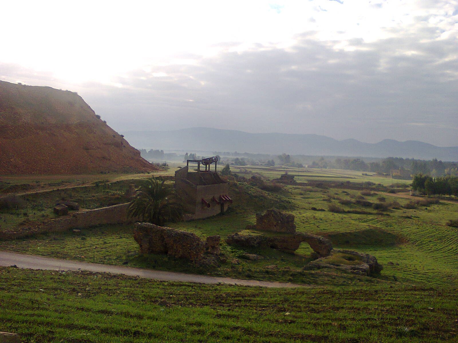
A turbine mill stood on the river’s left bank downstream of the bridge, about a century after the bridge’s inauguration. The rectangular building was made of dressed stone. Its wooden turbines used horizontally mounted paddle wheels, with three millstones attached directly to the turbine shaft. A channel directed water through the machinery and accelerated its flow, allowing the mill to operate during summer. The mill was destroyed in the first half of the fourth century when the bridge collapsed, and its water channel was closed. A model of the mechanism is displayed at the museum.
Aqueduct and distribution cistern
Chemtou’s aqueduct brought water over more than 30 kilometres through bridges, raised arches and underground channels. It supplied the city’s baths, wells and fountains, as well as the quarries and work camp. Nearly two kilometres outside the city stood a large vaulted storage and distribution cistern, with ventilation windows and a capacity of about 10,000 cubic metres. From there, conduits ran toward the city’s northern wall, while pipes on the eastern hill carried water south toward the city and quarries.