Vieux Château of Mauléon-Licharre: A Medieval Fortress in France

Site at a Glance
- Rating
- 4.1
- Popularity
- Low
- Country
- France
- Primary era
- Medieval
- External website
- Open
- Eras represented
- Medieval
- Civilizations
- English, French
- Site type
- Military
- Remains
- Castle
On this page14 sections
History
Vieux Château of Mauléon-Licharre is a medieval fortress in France, built by the rulers of Soule as their authority developed in the 11th century. Soule, also called Zuberoa, was a historic territory in the western Pyrenees that became a viscounty during the medieval period. The castle began as a motte-and-bailey fortification, with a raised earthen mound carrying a wooden tower, an enclosed lower court, a palisade, and a surrounding ditch. Earlier references indicate that a tower already stood on the site, so the castle probably took shape through successive stages rather than in a single building campaign.
English rule and medieval fortification
The castle is first mentioned in 1257, when English forces entered Mauléon by force. In 1261, the English king, who held the title of Viscount of Soule, appointed a paid captain-châtelain. This officer was a military governor responsible for administering and defending the castle on behalf of its ruler, and represented English authority in Mauléon.
Edward I, king of England from 1272 to 1307, ordered repairs and stronger defenses between 1272 and 1287 because of the castle’s strategic value. Further work followed in 1319 and 1374 under successive captain-châtelains. Control was contested, and efforts to recover the fortress from the English were temporarily successful at times, particularly between 1295 and 1307.
French conquest and later damage
In 1449, Gaston IV, Count of Foix and Béarn, captured Mauléon while supporting the French king’s reconquest of Guyenne. Guyenne was a larger region of southwestern France whose control was disputed by the English and French crowns. After Gaston IV died in battle in 1472, the castle and the whole of Soule were permanently attached to France.
The fortress faced further attacks in 1523, when the Prince of Orange and the Lord of Luxe made brief assaults on it. During the French Wars of Religion, the conflicts between Catholics and Protestants that affected France in the second half of the 16th century, the castle was damaged and burned.
Demolition, prison use, and preservation
Louis XIII ordered the castle demolished in 1642. A partial rebuilding was organized in 1648, but the fortress was later abandoned. After peace returned, soldiers and old cannon were reportedly still present, and the castle received notable visitors. Local tradition associates one such visit with someone identified as Richelieu in August 1759, when 24 cannon shots were fired in four salvos. Both the date and the identification are uncertain.
During the French Revolution, the castle became a prison and kept that function for several years. In 1831, the Minister of War refused to restore it, although a garrison continued to occupy the site until 1870, when the town became its owner. The Vieux Château was registered as a monument historique, a protected historic monument, on 4 May 1925. The wider site is also designated as an archaeological site, and ownership belongs to the commune of Mauléon-Licharre.
Memory of the Berterretxe conflict
The castle is also connected with the local song of Berterretxe, which preserves a tradition concerning the conflict between the Agramont and Beaumont factions from 1434 to 1449. These rival noble factions were involved in political and military struggles in the western Pyrenees. Berterretxe, a wealthy man from Larrau who supported the Agramonts, was killed at Ezpeldoi after Louis I of Beaumont sent men to find him. Tradition explains the killing either as the result of an attempted escape or as revenge. A disk-shaped ancient tombstone in front of the Ezpeldoi house at Etchebar commemorates his death.
Remains
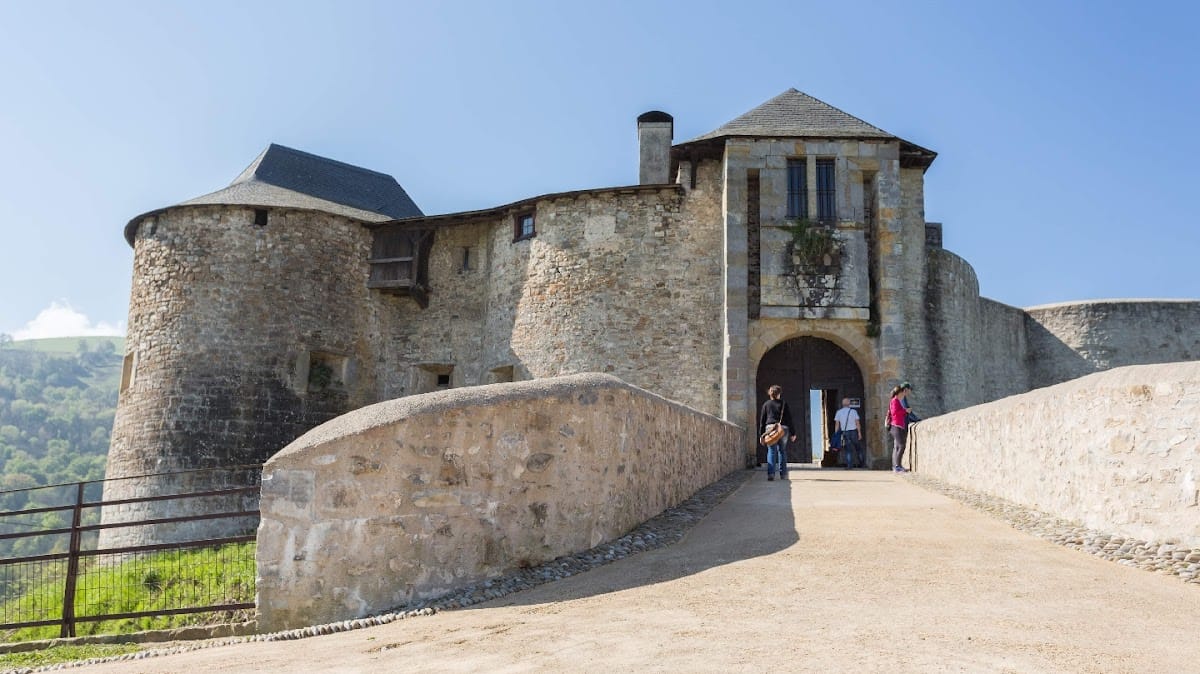
The castle occupies a hill about 195 metres above sea level, overlooking the town and facing Matalon Hill, which rises to 439 metres. Its medieval form is described as dating from the 12th century, although the defenses were extensively altered to accommodate artillery. The surviving fortress follows a pentagonal plan running from northeast to southwest. Its elevated position adds to the height of the walls, which are reinforced by three partly ruined cylindrical corner towers. Artillery loopholes, narrow openings through which guns could be fired, are especially concentrated on the side facing the town.
Walls and defensive features
Walls and corner towers
Sections of the enclosing walls survive with wall-walks along them, allowing movement along the defensive line. The three cylindrical corner towers remain in partly ruined condition, while the walls retain openings associated with the fortress’s artillery phase. A casemate, a fortified chamber for protecting personnel or housing weapons, forms another surviving element of the defenses.
Entrance and internal areas
Bridge and approach
The approach from the northeast leads across a projecting structure and a three-arched stone bridge. A small drawbridge once completed the entrance. Its lifting chains and other elements were dismantled, and planks now occupy the crossing.
Garrison buildings and courtyard
Most of the buildings stand on the northeast side of the fortress. They consist of small rooms that accommodated a small garrison. Within the courtyard, a very narrow entrance at the foot of these buildings leads to the oubliettes, subterranean prison pits traditionally associated with confinement. The courtyard also contains a 29-metre-deep well that reaches the water table.
Outer areas and medieval keep
Level areas
Two level areas lie in front of the castle at opposite ends. They probably contained medieval dwellings. The southwestern area is now overgrown with vegetation, while the areas remain part of the physical setting around the fortified enclosure.
Medieval keep
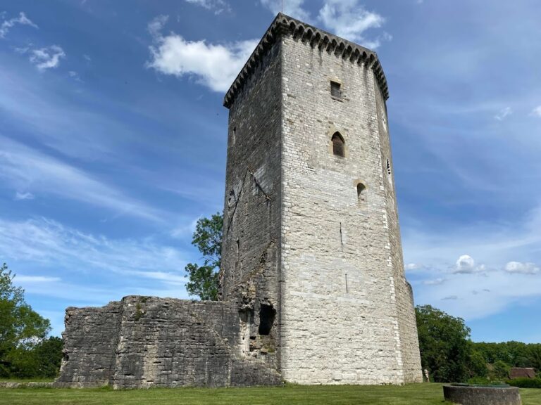
At the southwest are the almost levelled ruins of the medieval keep, the principal fortified tower of the castle. This structure was demolished in the 18th century, leaving only a low and greatly reduced trace of the medieval core.