Grinton Smelt Mill: A Lead-Smelt Works in Swaledale
Site at a Glance
- Popularity
- Low
- Country
- United Kingdom
- Primary era
- Modern
- Eras represented
- Modern
- Civilizations
- British
- Site type
- Economic
- Remains
- Production Complex
On this page12 sections
History
Grinton Smelt Mill is a ruined lead-smelting site on Cogden Moor near Richmond, United Kingdom. The surviving mill was rebuilt around 1820–1822 to process lead and began operating in 1822, continuing a long history of mining in Swaledale.
Mining and the first mill
Lead mining in Swaledale may reach back to the second century BC, and the Yorkshire Dales had become an important lead-producing region by Roman times. The earliest written record of lead working around Grinton dates to 1219. Before the Dissolution, when England’s religious houses were closed and dismantled under Henry VIII, land in the area belonged to the Manor of Healaugh, a landed estate with local authority, and Bridlington Priory, a religious house led by a prior. The land was later sold, but the Crown retained mineral rights, the right to extract minerals.
Reginald Marriott, a relative of William Marriott, received mining rights in the area in 1696. Local landowner and politician Lord Wharton asserted a claim to the land and opened mines less than 100 yards from Marriott’s workings. Their dispute went to trial in 1705, with more than 317 witnesses giving evidence. The court found for Marriott after more than three years. Wharton threatened another case, but none followed; falling lead prices between 1710 and 1720 may have reduced his interest.
In 1720, William Marriott sought to extend his lease through 1727 and was required to pay the Crown one-eighth of his turnover. He built the first mill on the site around 1727, although mining in the surrounding area was already extensive. The works processed lead from the Grinton How Vein, mined at Grinton How, Whiteside and Fearnought, just south of the mill. The site was also known as How Mill, after the vein, and Low Mill, a name thought to distinguish it from Grovebeck Mill, about 1.2 miles west and roughly 330 feet higher. Since heavy lead ore was processed near the mines rather than transported to a central mill, Swaledale came to have more than 30 such works.
The London Lead Company, a British business involved in lead mining and smelting, is believed to have bought the mill and two mines from Marriott in 1733 and installed new furnaces. Whether the company operated in Swaledale is uncertain. During the 1730s, the mill produced a little over 100 tonnes of finished lead per year, including 100 tonnes in the 1739–1740 financial year.
Rebuilding, decline and closure
The mill was rebuilt in its surviving form around 1820–1822 to process lead obtained through hushing, which uses water to expose or dislodge mineral-bearing ground, and hydraulic mining, which also uses water power to extract ore. It began operating in 1822. The long gap between the earlier mill’s decommissioning and the new works reaching full production suggests that the whole site may have been reconstructed.
A downturn in the lead industry between 1829 and 1833 reduced the number of miners in the area. Cheaper imported lead was already contributing to the decline, and local population figures continued to fall. The mill may have closed in 1886, though the Grinton Mining and Smelting Company may have kept its hearths working until 1893. The York Herald reported in 1887 that the mine had closed in 1886 and that a new company had secured a 21-year mining lease, with Crown dues of five percent.
Reuse and conservation
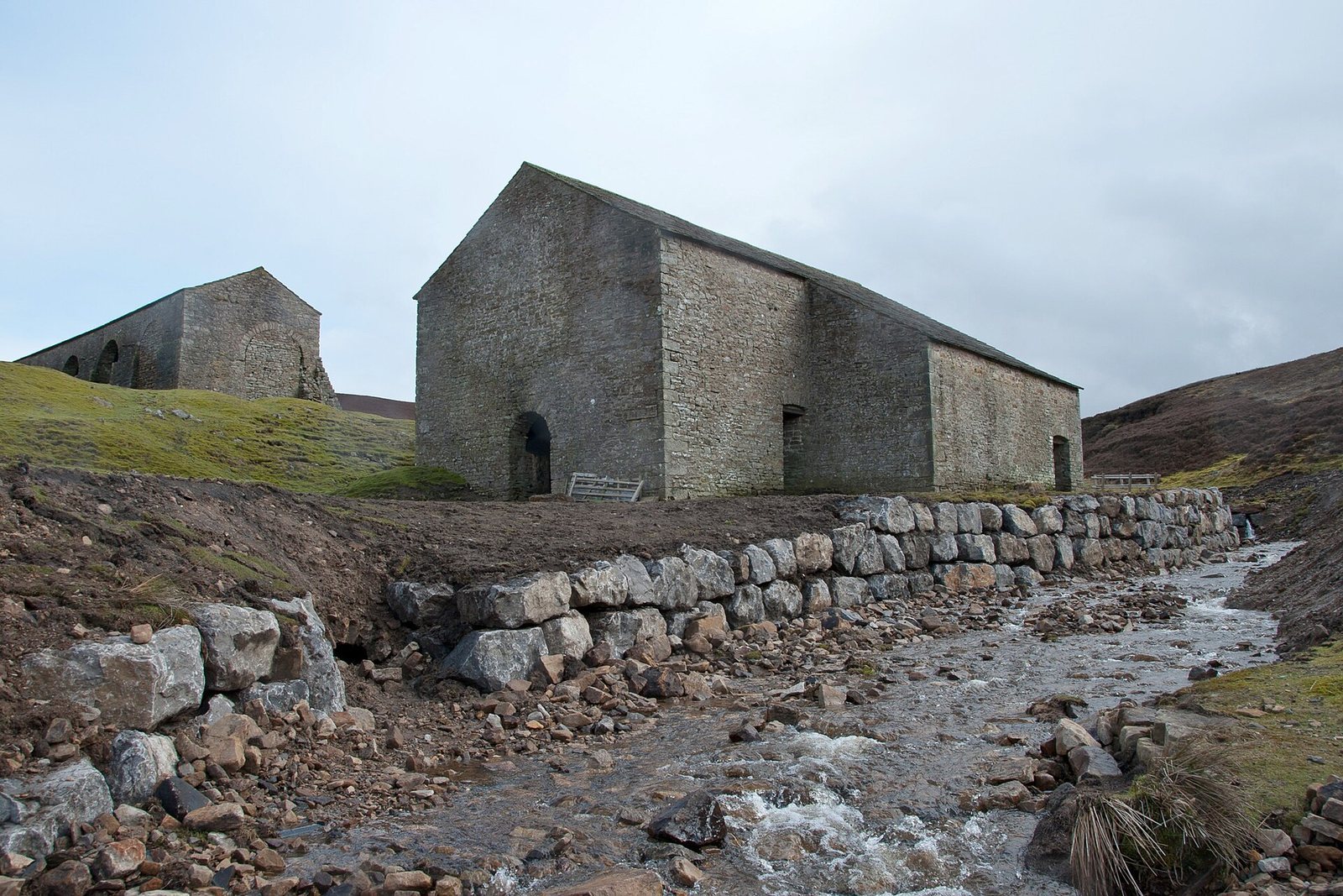
After smelting ended, the site was used as a sheep dip and as shelter for cattle. This reuse led to a new roof being built in 1987, and renovation work followed in 1998. The mill is a scheduled monument, meaning it has legal protection as an archaeological or historic site; its buildings and stone flue are Grade II*, a category for buildings of more than special interest. Flash flooding in 2019 swept away the watercourse and destroyed a stone bridge on the road used to carry ore. Work in January and February 2020 aimed to protect the main mill building from further water damage and subsidence.
Remains
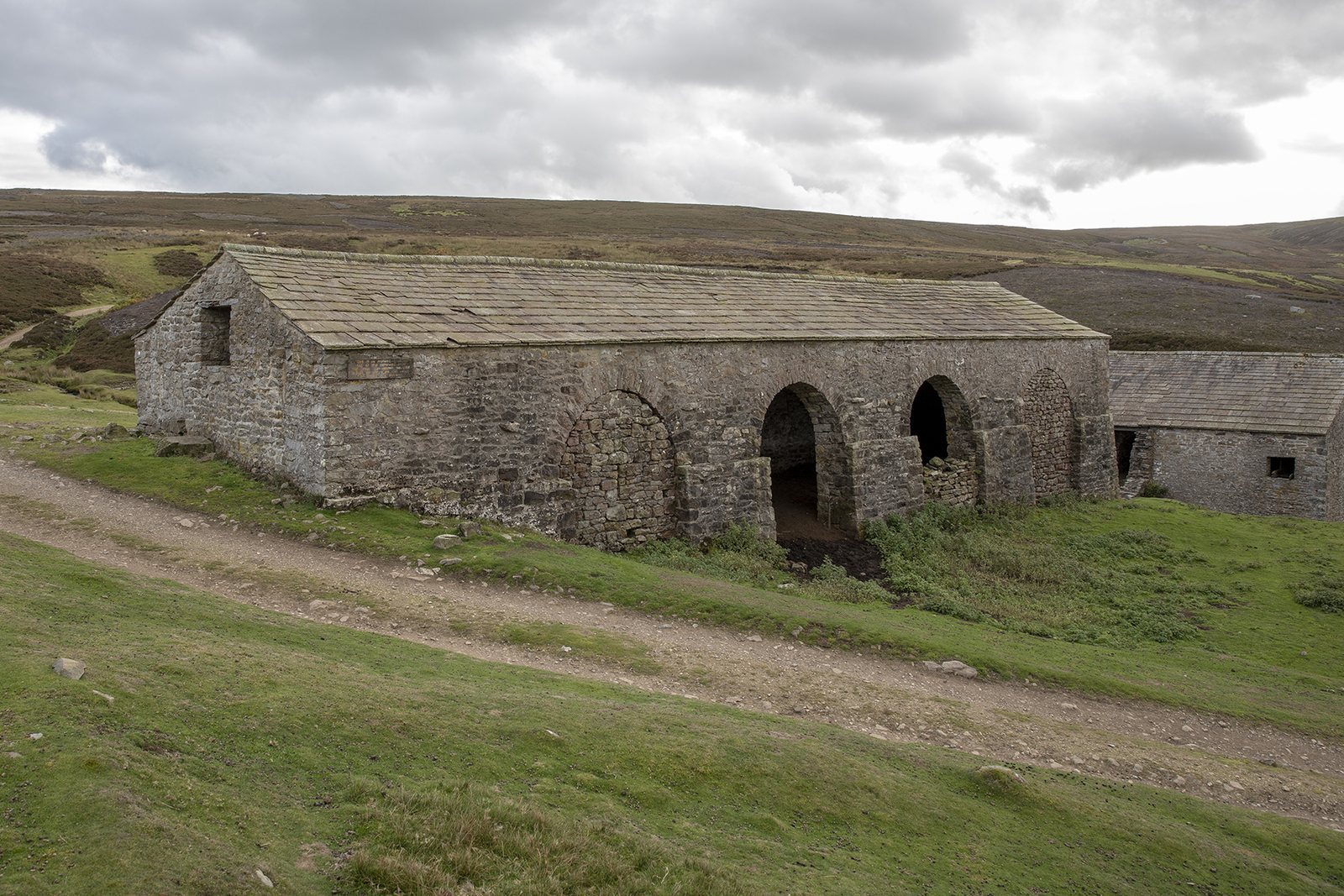
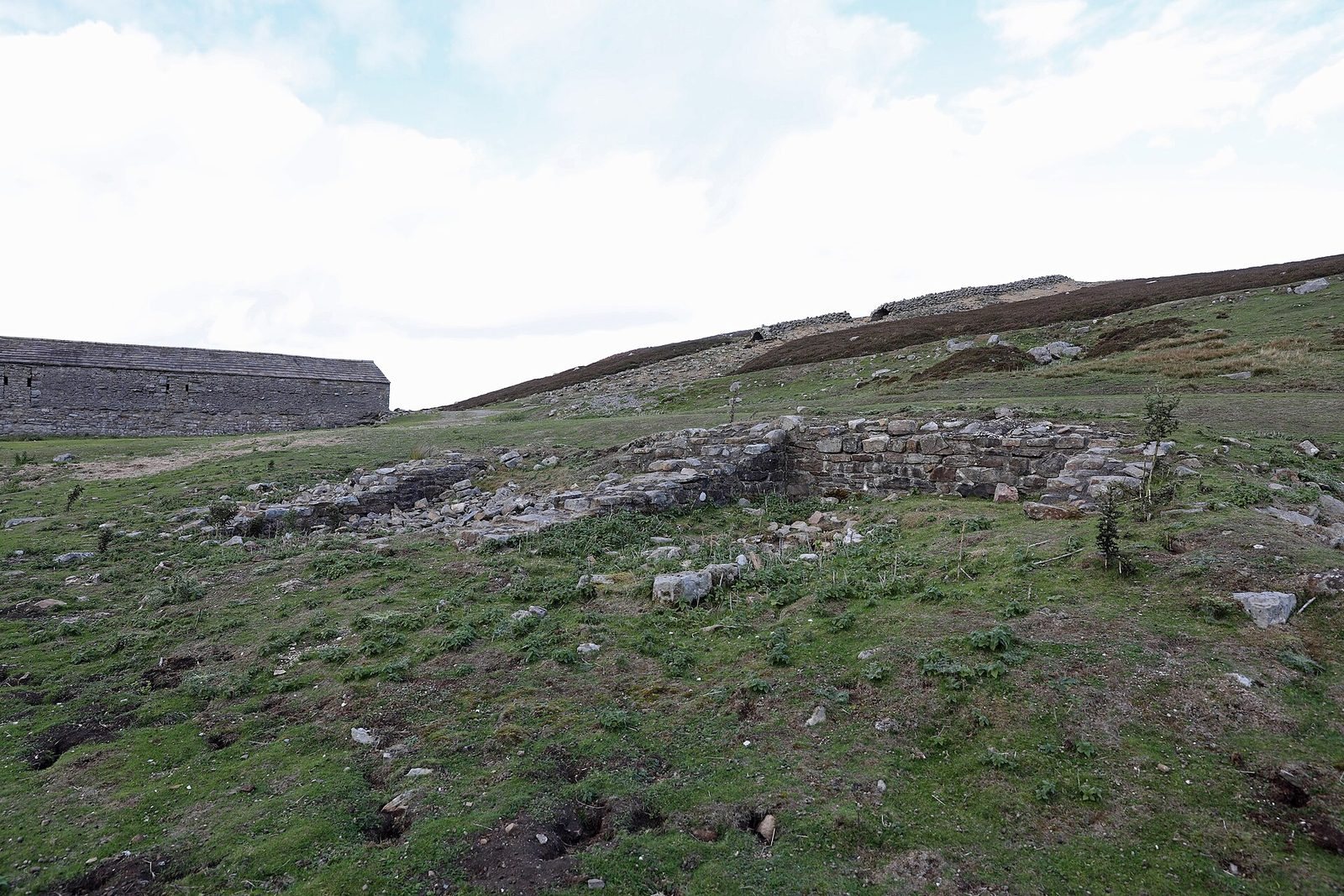
The ruins stand south of Grinton, at the meeting of Smales Gill and Cogden Gill. The original complex had three buildings: the main mill, a peat store and a third building identified as a smithy on maps from the 1890s. The mill and peat store survive, while the smithy was demolished in the 1960s.
Mill buildings and water power
Main mill and bellows room
The main mill measures 53 by 36 feet. Its principal room held three hearths for roasting ore, with a bellows room behind it on the north side measuring 16 by 26 feet. An external waterwheel was attached to the bellows room’s outer wall. It measured about 20 feet across and 20 inches wide.
Peat store
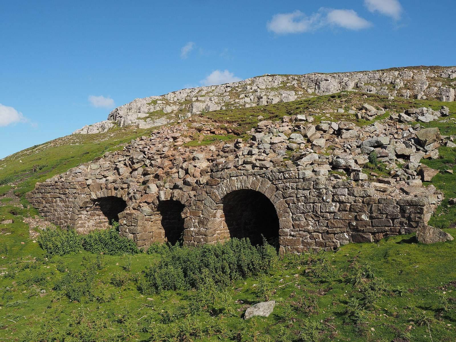
The peat store had chutes along its south side for feeding fuel into the mill. Large open archways in its north wall helped dry the peat, which was brought from neighbouring moorland by horse and cart.
Reservoir and water supply
A man-made reservoir lay immediately south of the mill, on higher ground. It supplied an elevated launder, a raised channel that carried water into the building at roof height, about 10 feet above the waterwheel axle. Water turned the wheel, which operated the bellows and forced air into the furnaces.
Flue and overflow channel
Stone flue
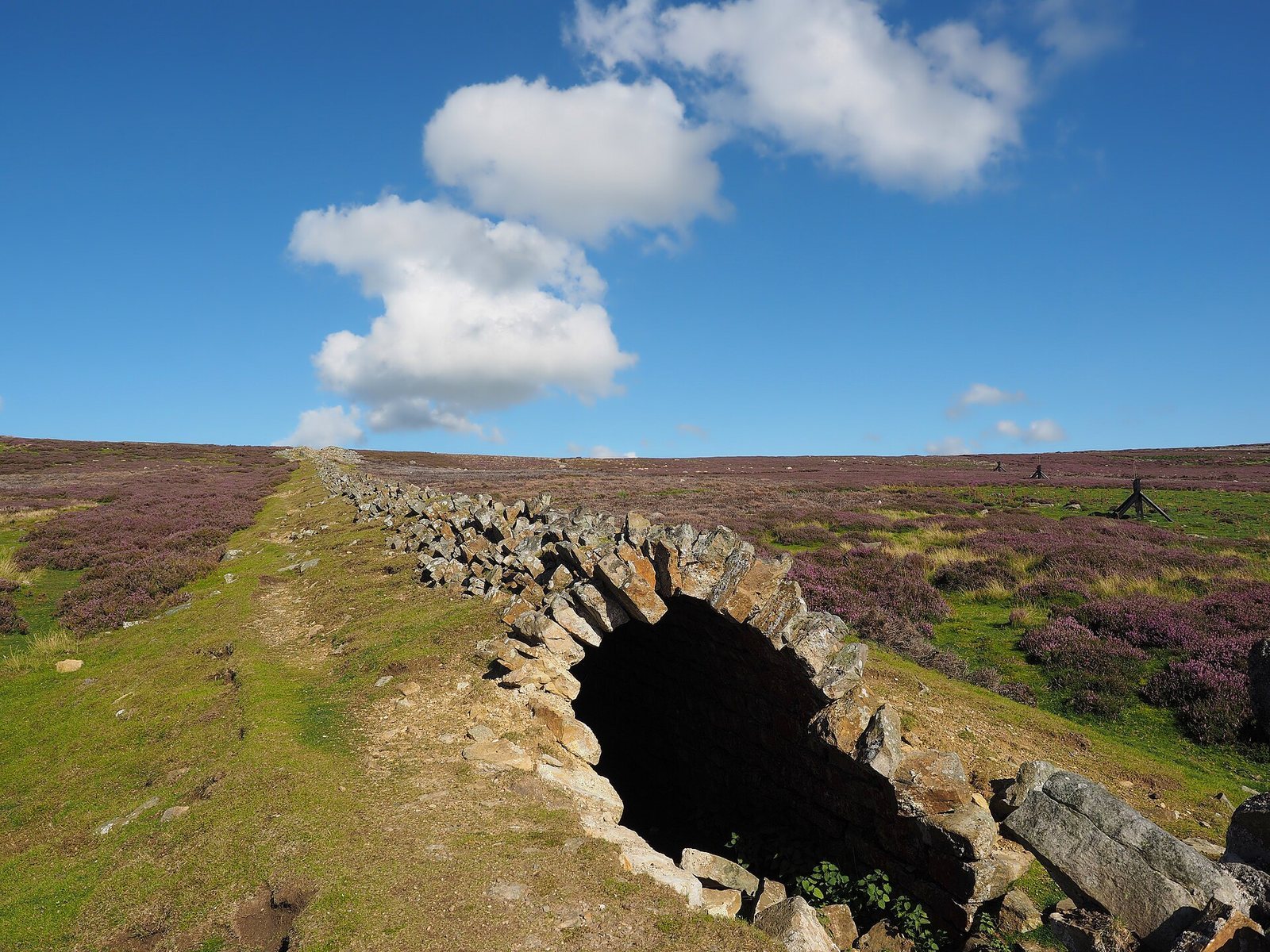
The stone flue, a passage carrying furnace gases away, runs eastward uphill for 980 feet to the top of nearby Sharrow Hill, 1,210 feet above sea level. Its chimney is estimated to measure 9 feet on each side. The surveyed interior measures 5 feet 11 inches high by 5 feet 3 inches wide, and access holes run along the south side.
Overflow channel
Immediately west of the mill, a 40-foot channel with a continuous semicircular vaulted roof carried Cogden Beck away from the site and served as an overflow from the reservoir. A replacement channel protected with rock was in place by 2020.