Larina: An Allobrogian Oppidum and Merovingian Stronghold
Site at a Glance
- Popularity
- Medium
- Country
- France
- Primary era
- Medieval
- Eras represented
- Bronze Age, Iron Age, Classical, Medieval
- Civilizations
- Celtic, Merovingian, Roman
- Site type
- Military
- Remains
- Fortified Town
On this page17 sections
History
Prehistory and the Allobrogian oppidum
Larina is an archaeological site at Hières-sur-Amby in France, where the Allobroges, an ancient Gallic people of southeastern Gaul, developed a major oppidum, or fortified settlement, during the La Tène Iron Age. Rather than functioning mainly as a permanently occupied town, it is understood as a place for periodic gatherings, fairs, and markets, associated with an open-air Celtic sanctuary.
People visited Larina sporadically in the Late Neolithic. During the Final Bronze Age, a settlement grew there, preceding its development as an Allobrogian stronghold.
Roman and late-antique occupation
At the beginning of the Roman period in Gaul, the oppidum was abandoned. A sanctuary to Mercury, the Roman god associated with commerce, travel, and communication, was later established at the site.
From the mid-fourth to the late fifth century, an agricultural settlement occupied the plateau, probably as an outlying part of a villa on the surrounding plain. Its first buildings were destroyed by fire, after which a village and a fanum (a traditional Gallo-Roman temple) were established. Farming and animal husbandry were joined by quarrying for building stone and roofing slabs.
Burgundian and Merovingian settlement
At the beginning of the sixth century, buildings were carefully levelled, burned, or both. The temple was briefly adapted as a large dwelling before it, too, was levelled. A new settlement then arose over the earlier remains as an autonomous Burgundian villa, replacing the late-antique estate’s agricultural outpost. Farming and animal husbandry remained central to life there.
In the second half of the sixth century, the settlement became the centre of a Merovingian castrum (a fortified settlement). The Merovingians were a Frankish ruling dynasty of the early medieval period. The stronghold endured until Larina ceased to be a settlement in the eighth century.
Studies of human remains distinguish an earlier population, mainly of regional origin and with little evidence of ancestry mixing, from a later group with more northerly characteristics. The earlier group had traits associated with farming and crafts. The later population included many warriors and horsemen with characteristic injuries, as well as women and children. This pattern supports the interpretation of Larina as a Frankish colony tasked with protecting the eastern Lyon plain, consistent with a model known from ancient texts.
Abandonment and later history
Larina was deliberately abandoned during the eighth century. Openings in buildings and the chapel were walled up, while the altar and production equipment, including presses and millstones, were removed. As maintenance ceased, walls gradually collapsed. Later settlements arose in more open parts of the plateau and plain. Ownership of Larina was divided equally, and Hières-sur-Amby and Annoisin-Chatelans are its present-day communal successors.
Quarrying damaged the site in the early twentieth century. Father Nicolet, parish priest of Chavanoz, organized excavations from 1970 to 1975 with young people from his parish; professional archaeologists continued the work afterward. From 1977 to 1995, the Ministry of Culture carried out an 18-year excavation campaign led by Patrick Porte. Larina was later developed as an archaeological park, and the Maison du Patrimoine museum in Hières-sur-Amby presents excavation results and finds. The site has been classified as a historic monument since 12 April 1983 and is also listed as the fortified spur of Annoisin-Chatelans.
Remains
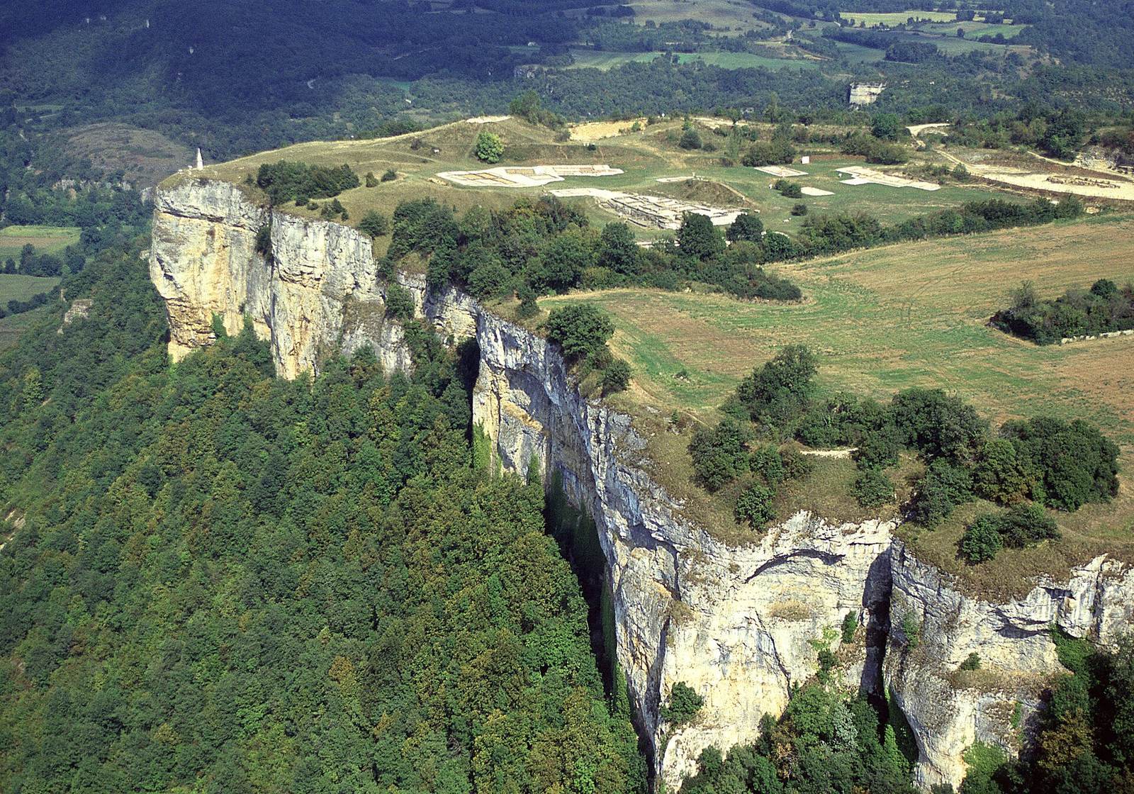
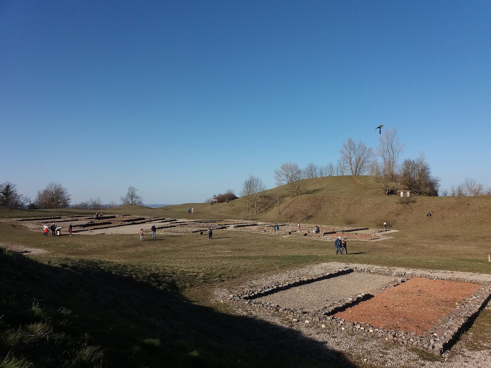
Larina occupies a limestone rocky spur on the Isle-Crémieu plateau, above the upper Rhône and more than 200 metres above the river. Its area exceeds 21 hectares, enclosed by a 950-metre rampart. The site’s construction changed over time, from stonework bonded with clay to later rubble masonry set in lime mortar.
Prehistoric and Iron Age remains
Huts and pits mark the Final Bronze Age settlement, and the first rampart may date to this phase. In the La Tène period, a substantial stone rampart bonded with clay enclosed huts built from woven branches coated with clay. Craft objects and funerary deposits, including folded weapons, metal objects, and ceramics, were placed in cavities in the cliffs known as Trou de la Chuire.
Roman and late-antique remains
Mercury sanctuary
A dedicatory altar to Mercury is dated to the third century by the lettering on its inscription. Large construction blocks scattered across the site also represent the sanctuary.
Village buildings
The late-antique village comprised sixteen buildings raised on pebble foundations, with walls of woven branches and clay. Six houses had a principal room with a hearth and a northern annex. Nine other buildings served communal work, including storage, pressing, workshops, and sheds.
Temple
The village’s fanum had a distinctive plan and deposits of offerings. It was briefly converted into a dwelling at the beginning of the sixth century before being levelled.
La Motte cemeteries
On a nearby hill, La Motte 1 contains in-ground graves. La Motte 2 was established above those earlier burials, with graves arranged in parallel rows inside stone-slab coffins. One grave cut into an abandoned hut; after the burial, the pit was used as a rubbish dump. The deceased’s feet were probably bound. After death, the person was decapitated, and the head was placed on a slab set over the pelvis. This unusual treatment has been interpreted as possibly reflecting fear of the deceased.
Quarry faces
Extensive quarry faces remain at Larina, evidence of stone extraction at the site.
Early-medieval remains
Residence and farm buildings
The early-medieval residence stood over earlier ruins and covered nearly 1,500 square metres. Built entirely of stone rubble and roofed with stone slabs, its plan followed the pattern of large Germanic-type buildings. Two other structures of the same construction served agricultural purposes and contained stables and workshops. One incorporated the remains of an ancient press destroyed by fire and was later extended lengthwise.
Churches and burial grounds
A funerary church for the newcomers stood on another hill, at Mollard 1. Numerous privileged burials and other graves covered with slabs surrounded it. At Mollard 2, a church was later enlarged and divided into separate funerary chapels. A mausoleum stood at the centre of a nearby cemetery of slab-covered graves as the burial ground expanded.
Rebuilt rampart
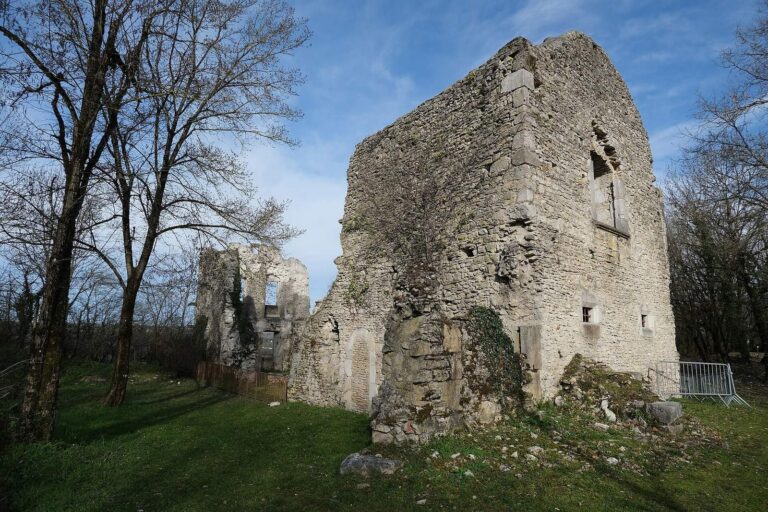
The later rampart was made of rubble bonded with lime mortar and incorporated large ancient blocks.