Caixa de Rotllan: A Prehistoric Dolmen in France
Site at a Glance
- Popularity
- Low
- Country
- France
- Primary era
- Bronze Age
- Eras represented
- Stone Age, Bronze Age
- Civilizations
- Unclassified
- Site type
- Burial
- Remains
- Tomb
On this page6 sections
History
Caixa de Rotllan is a prehistoric tomb, or dolmen, near Arles-sur-Tech, France, dating to about 2250 BC in the second half of the third millennium BC. It may have been built during the Chalcolithic, the Copper Age transition between the Neolithic and Bronze Age, or the early Bronze Age. Its Catalan name means Roland’s Tomb, and local tradition connects the monument with the legendary Frankish warrior.
Prehistory and Roland traditions
According to local legend, Roland died at the Battle of Roncevaux in 778. His horse, Veillantif, carried his body to Vallespir, where it was buried. The medieval Song of Roland gives a different account: Charlemagne takes the bodies of Roland, his companion Olivier, and Archbishop Turpin for burial at the Basilica of Saint-Romain in Blaye.
Other nearby places also became associated with Roland stories. About 1,500 metres north along the ridge, the Palet de Rotllan was linked to a tale in which Roland hurled enormous stones like game pucks at castles in Vallespir. A watering basin was said to be where Veillantif drank, while another dolmen in Corsavy was associated with Roland resting there.
Boundary marker and modern study
From the Middle Ages, the dolmen marked the boundary between the parish territories of Arles and Montbolo. The present boundary between the two communes runs close to the monument.
The earliest published description appeared in 1837, when Jean-Baptiste Renard de Saint-Malo mistakenly identified the dolmen as the nearby Palet de Rotllan. In 1861, naturalist Louis Companyo clarified that the Palet was not a dolmen and warned against confusing such monuments with natural rock formations. At a time when dolmens were commonly attributed to the Celts, military engineer Alexandre-Félix Ratheau produced the first scientific description in 1866, recording the monument’s dimensions and orientation and preparing a plan and three sectional drawings. He also identified the Palet’s stones as abandoned granite millstones. An engraving based on a photograph appeared in 1887. In the nineteenth century, the dolmen was also called Caxa de Roland, and it was classified as a French historic monument in 1889.
Remains
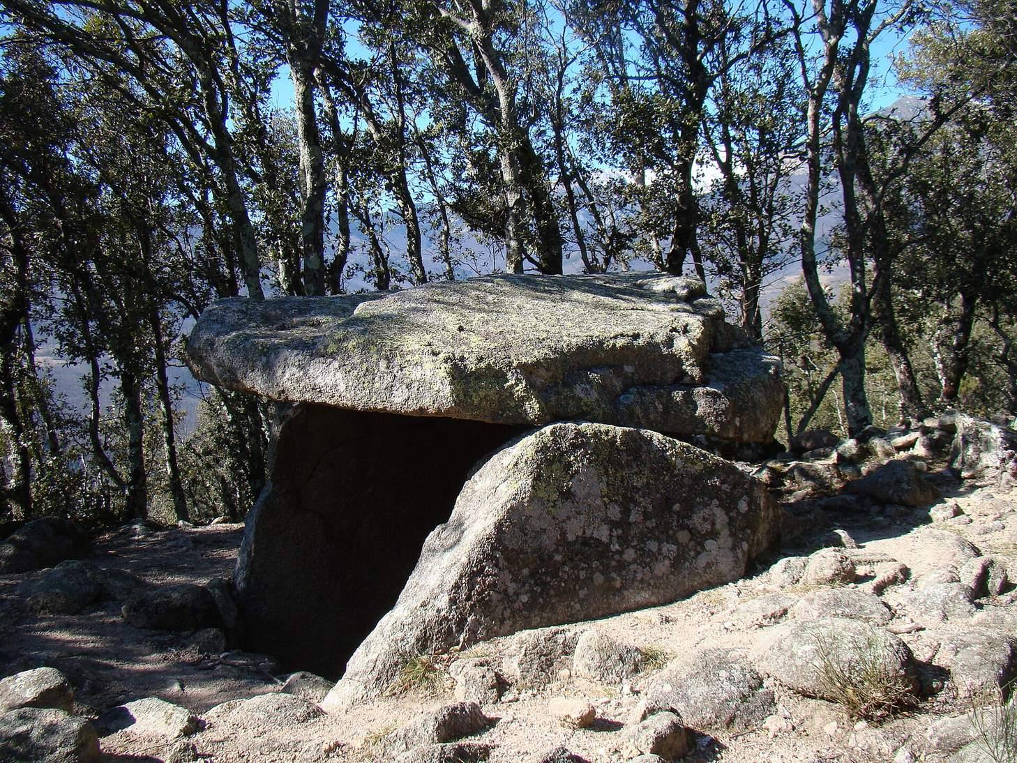
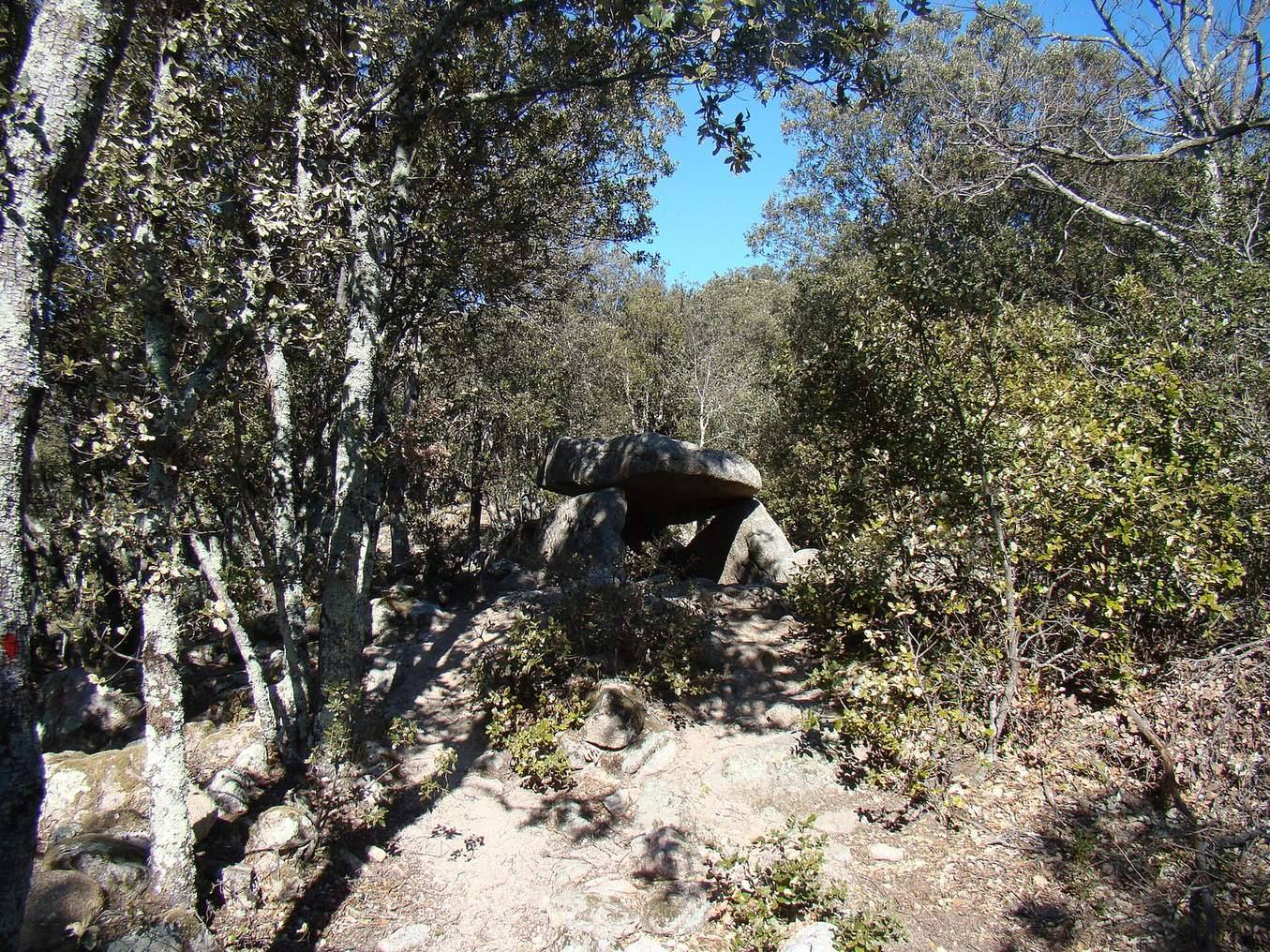
The dolmen stands at about 830 metres above sea level on a ridge on the southern flank of the Canigou massif, beneath a field of granite boulders. Built from local granite, it has three upright slabs supporting a capstone above a roughly rectangular chamber. The chamber’s north-northwest to south-southeast orientation follows the ridge, with its entrance facing southeast.
Chamber and supporting stones
The two side slabs are each 2.40 metres long and rise 1.30 metres above ground; their thickness ranges from 20 to 57 centimetres. The rear slab is 1.20 metres high and 1.25 metres wide, with an average thickness of about 20 centimetres. Framed by the side slabs, it may have been set in place before them. The capstone measures 2.60 by 1.50 metres and is 20 to 45 centimetres thick. Because the supporting stones are irregular, it rests on three points. The chamber measures approximately 2 by 1.30 metres.
Surrounding mound and condition
A roughly circular tumulus, a mound associated with burial, surrounds the dolmen and measures about 10 metres in diameter. The monument is in very good condition. Its overall dimensions are approximately 1.5 metres high, 3 metres long, and 2 metres wide.