Castell Caer Seion: An Iron Age Hillfort in Wales
Site at a Glance
- Popularity
- Medium
- Country
- United Kingdom
- Primary era
- Iron Age
- Eras represented
- Iron Age
- Civilizations
- Unclassified
- Site type
- Military
- Remains
- Fort
On this page12 sections
History
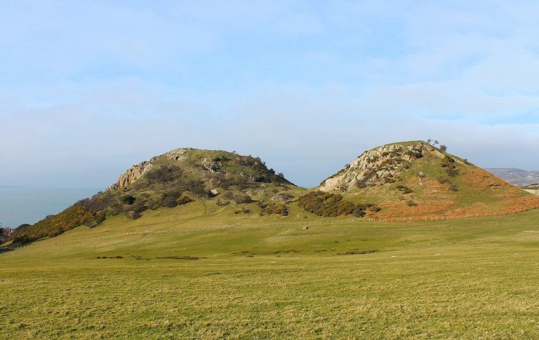
Castell Caer Seion is an Iron Age hillfort on the summit of Conwy Mountain in Wales, United Kingdom. Its earliest known occupation dates to between the sixth and fourth centuries BC, and its enclosures and defences developed over later centuries. The Iron Age is a broad prehistoric period associated with the widespread use of iron tools and weapons. The hillfort may have served chiefly as a lookout and refuge rather than as a year-round settlement.
Iron Age occupation
Archaeological dating places the site’s earliest occupation between the sixth and fourth centuries BC. The smaller enclosure was built around the fourth century BC, and a later fortification phase is dated to the third century BC. Excavators in 1951–52 divided the defences into two periods, while recognizing that their proposed sequence relied largely on interpretation.
The two enclosures appear to have been used at the same time. Their occupation may have ended before the second century BC, making it unlikely that the fort was destroyed during the Roman invasion of Wales in AD 48. The roundhouses within its walls point to activity at the site, while its elevated position has informed the interpretation that it was probably used as a lookout and place of refuge.
Names and later traditions
Caer Seion is regarded as the older form of the site’s name, with evidence for its use extending back to the ninth century. John Leland used the now-obsolete name Sinnodune in his 1530s itinerary of Wales. Castell Caer Lleion appears to have emerged in the late seventeenth century and may have resulted from a mistranslation; “Castell Caer” means “Castle Fort.” Other forms have included Castell Caer Leion, Caer Leon and Conwy Mountain Hillfort.
Tradition connected the hillfort with Maelgwn Gwynedd, a sixth-century king of north-west Wales. The known occupation belongs to the Iron Age, centuries before Maelgwn’s lifetime, which is dated to about AD 480–547.
Excavation and protection
Harold Picton and W. Bezant Lowe began the first recorded excavations in 1906 and returned in 1909. The Royal Commission on the Ancient and Historical Monuments of Wales, an institution that records and investigates historic sites in Wales, carried out more extensive excavations in 1951–52 under W. E. Griffiths and A. H. A. Hogg. Their work identified two fortification periods and raised the possibility that the enclosures had been used concurrently.
A 1991 survey led to further investigation of charcoal-rich deposits. In 2008, George Smith of the Gwynedd Archaeological Trust excavated for Cadw, the Welsh Government’s historic environment service. Radiocarbon analysis from this work established the early occupation range, placed construction of the smaller fort at around the fourth century BC, and suggested abandonment before the second century BC. The fort and surrounding land beyond its boundaries are protected as a scheduled ancient monument.
Remains
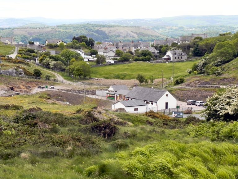
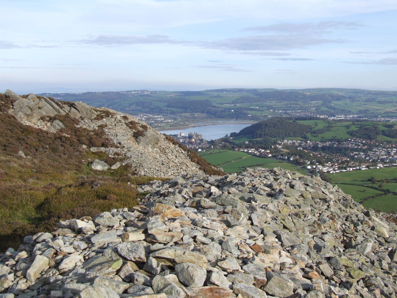
The hillfort occupies the summit of a rhyolite ridge, a ridge of volcanic rock, about 244 m (800 ft) above sea level. Its enclosed area covers about 3 ha (7.5 acres), measuring approximately 326 m (1,070 ft) long and up to 95 m (312 ft) wide. A larger enclosure contains a smaller, separately defended enclosure in its western part. The site overlooks Conwy Bay and the lower Conwy valley, near a trackway along the coastal ridge. Prehistoric routes between the Conwy shore and the northern coast of Snowdonia passed between the fort and the Carneddau hills.
Defensive works and entrances
Larger enclosure
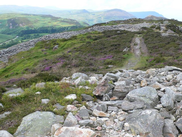
A rampart, a defensive bank or wall, follows a winding line along the accessible eastern, southern and western sides of the larger enclosure. Steep ground and cliffs protect its northern side. The rampart’s southern outer face is heavily ruined and about 10 ft thick, built with fairly large stones that may include slabs set on edge. Its inner face combines laid masonry with edge-set slabs, some of them very large. Around the principal entrance the wall has faces on both sides; farther east, its better-preserved outer face slopes inward for stability. On the shallower north-western slope, a ruined, turf-covered section of rampart can still be traced.
A ditch follows the outside of the north-western rampart and curves south-west around a rocky outcrop at the site’s western end. A further bank and ditch within the larger enclosure runs parallel to the smaller fort’s eastern wall, with low causeways interrupting it. The larger enclosure appears to have changed little during its period of use.
Smaller enclosure and outworks
The smaller enclosure has substantial defences of its own and was more heavily fortified than the larger enclosure. It went through two building phases; its first form was larger and more elaborate than the later one. Its southern wall, made of laid masonry, is estimated to be 12–16 ft thick. Another wall runs outside its south-west side and ends at the western rocky outcrop. The larger ditch continues alongside this wall and the smaller fort’s southern side, ending in front of the outwork, a secondary defensive structure. A smaller ditch was cut near the outcrop.
The south-eastern outwork differs in construction from the other walls. Its large blocks lie flat, while slabs stand on edge near the entrance; small stones and earth fill the gaps. The passage, about 6 m (19 ft) wide and 7 m (23 ft) long, runs between overlapping rampart ends and is faced with large upright slabs. Its northern side has collapsed across the entrance. The gateway was closed during the fort’s second building phase.
Entrances
Three entrances are securely identified, and a fourth has been proposed. The principal entrance lies in the southern rampart, slightly east of Hut 1. Its passage is 17 ft long, with a gate opening 6 ft wide. It appears to have had paving, traces of which remain after erosion. A line of large, flat blocks sat in a foundation trench extending 17 ft east and supported the heavier rampart on the southern slope. Set level with the underlying soil, the blocks may have been concealed when the entrance was in use.
Four large square postholes beside the principal passage probably held a timber bridge and gate, perhaps with a pair of posts outside the opening. The gate may have closed with a single door. The smaller fort’s entrance passage bends around its inner rampart. Large square postholes beside the bend may have served a similar purpose, and early excavators noted a possible semicircular defence facing the entrance.
Roundhouses and archaeological evidence
Roundhouses
About 50 roundhouses, or circular dwellings, are attributed to the larger enclosure, and up to six are known in the smaller one. The buildings were broadly similar in size and materials across the fort’s phases. Sparse postholes in early Huts 1 and 3 suggest that their roofs may have used a light pole frame. Later Hut 4 had evidence for two roof-timbering systems supported by internal posts. Many houses stood on a terrace behind the southern rampart, where they may have been sheltered from the wind.
Hut 1 stood just inside the principal entrance, and another hut was immediately east of Hut 3. Their positions and finds have been interpreted as defensive in purpose. Hut 1 contained 612 sling stones, about half stacked against the inner face of its south-eastern wall. Sling stones were also found beside the hut east of Hut 3. A hut at the south-western end of the smaller enclosure had a mostly irregular stone floor, with stones carefully fitted together along one side.
Finds and landscape evidence
Finds include 1,141 smooth, oval beach-pebble sling stones, each about 1–2 inches long. Other objects comprise a possible pair of iron tweezers, a probable lignite spindlewhorl, a weight used to spin fibre into thread, and a small corroded iron fragment tentatively identified as a lancehead or knife. Excavators also recovered stone spindlewhorls, four saddle querns, stones used for grinding grain, rubbing stones, hones or whetstones, and pot-boiler stones, which were heated in a fire to warm food or water. Identified bone fragments came from ox, horse and sheep.
Pollen indicates that heath and grass dominated the area within and immediately around the fort, much as they do today. Pollen and charcoal analysis also point to nearby woodland containing hazel, birch and alder.