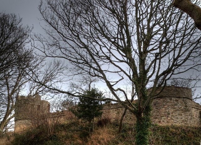
Conwy Town Walls: Defences of Edward I’s Planned Town
Site at a Glance
- Country
- United Kingdom
- Primary era
- Medieval
- Eras represented
- Medieval, Modern
- Civilizations
- British, English
- Site type
- Military
- Remains
- Wall
On this page10 sections
History
Conwy Town Walls are a medieval defensive circuit in Conwy, Wales, United Kingdom, begun in 1283 alongside Edward I’s new castle and planned town. Intended to help establish a county center and protect English settlers, the walls formed part of an English colonial project. Building the town on the site of a prominent Welsh religious community also asserted English power in the region.
Aberconwy before the town
Before the walled settlement, the site was occupied by Aberconwy Abbey, a monastery of the Cistercian order, a medieval Christian monastic community favored by Welsh princes. It controlled an important crossing of the River Conwy between the coast and inland North Wales. Nearby Deganwy Castle had long defended the area. English kings and Welsh princes contested control of the region from the 1070s, and conflict intensified again in the thirteenth century. Edward I, king of England from 1272 to 1307, intervened in North Wales in 1282 and captured Aberconwy in March 1283. The abbey community was moved about eight miles inland, while Deganwy Castle was abandoned and never rebuilt.
Edward I’s town and its walls
Work began in 1283 with defensive ditches and a palisade, a protective fence or barrier, before construction of the stone walls. Master James of Saint George, Edward’s chief architect in North Wales, supervised the wider work on the walls and castle. Laborers were brought from across England and gathered at Chester for each building season. Richard the Engineer oversaw the western section in 1284–1285, Savoyard mason John Francis completed the southern wall in 1286, and Philip of Darley directed the eastern wall beside the quay in 1287. The castle and walls together cost about £15,000, an enormous sum for the period.
Settlement and defence
English settlers, especially from Cheshire and Lancashire, populated the town. In 1312 it had 124 rent-paying urban holdings, more than Caernarfon but fewer than Beaumaris. Welsh residents began settling there in the fourteenth century, though English townspeople regarded them with suspicion. Conwy’s street plan was once linked chiefly to planned towns in France and English-held Gascony. Later research found closer parallels with English planned towns, many arranged around a T-shaped street layout facing a river or coast, with a castle at one corner. Conwy’s plan is a mirror image of Beaumaris’s. The castle constable also served as mayor, while responsibility for the walls probably rested with townspeople rather than the castle garrison. Crossbowmen guarded the defenses, and improved firing positions were added in the early fourteenth century.
Rebellion and declining military importance
In 1401, during Owain Glyndŵr’s rebellion against English rule, two of the Welsh prince’s cousins captured Conwy Castle. Welsh forces occupied and sacked the town for two months despite its defenses. Gates and bridges were destroyed, and the fortifications also suffered damage. Townspeople valued their losses at £5,000, a figure that may have been exaggerated. Repairs to the walls were recorded in the 1520s and 1530s, in preparation for a possible visit by Henry VIII. The accession of the Welsh-origin Tudor dynasty in 1485 eased Anglo-Welsh hostilities and reduced the walls’ military importance. Residents began using the defensive ditches for rubbish and reused wall stone in local buildings.
Roads, railways and conservation
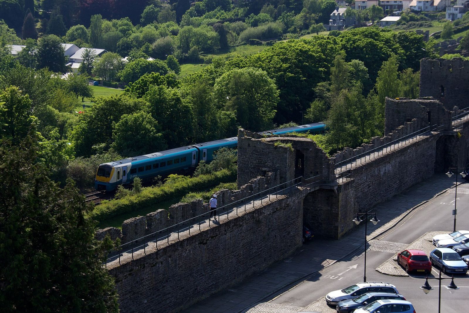
Nineteenth-century transport projects altered the medieval defenses. In 1826 engineer Thomas Telford built two gateways to carry traffic from a new suspension bridge across the river. The Chester-to-Holyhead railway reached Conwy in 1848. Interest in the walls also grew: one tower was restored, and an architectural survey carried out in 1928–1930 was published in 1938. In 1953 the local authority leased the walls to the Ministry of Works, beginning sustained conservation. Buildings that had accumulated against the walls since the fourteenth century were removed to support conservation and archaeological work, and one of Telford’s gateways was demolished in 1958. Historian Arnold J. Taylor researched the walls extensively during the 1950s and 1960s. Cadw, the Welsh government’s historic-environment service, manages the walls. They belong to the UNESCO World Heritage property Castles and Town Walls of King Edward in Gwynedd, inscribed in 1986, and are also a Grade I listed building, a UK category for exceptional architectural or historic interest, and a scheduled monument protected for its archaeological or historic importance. Historians Oliver Creighton and Robert Higham have described the circuit as one of Europe’s most impressive walled circuits.
Remains
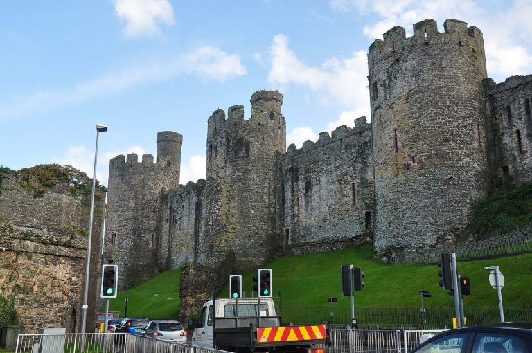
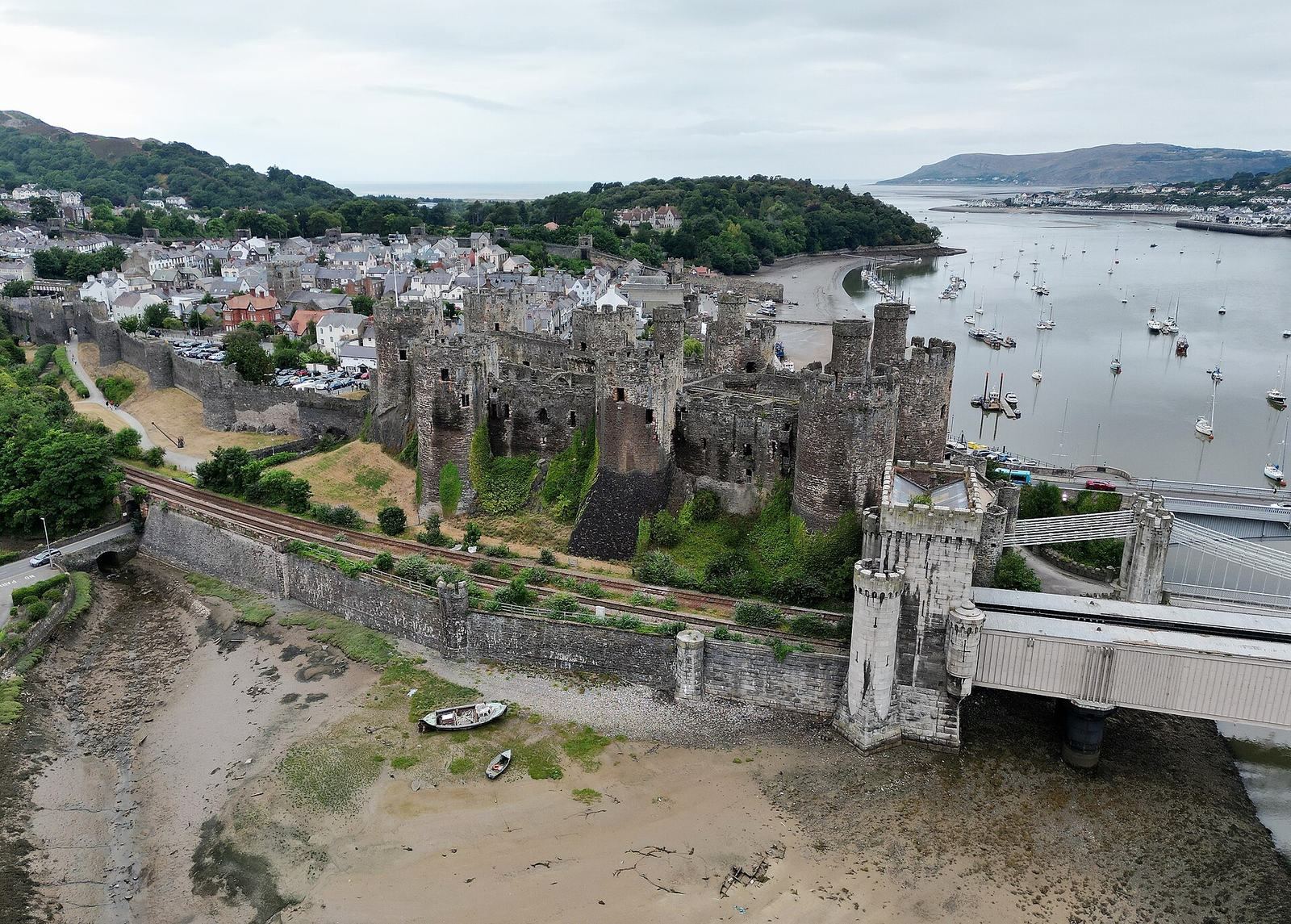
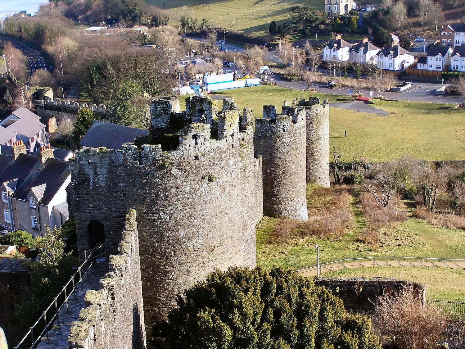
The largely unbroken, triangular circuit runs for about 1.3 kilometres and encloses approximately 10 hectares of the town. It includes 21 surviving towers and three gatehouses. Its unusually good preservation is partly attributed to Conwy’s relatively small size. Most of the masonry is local sandstone and limestone, also used at the castle; volcanic rhyolite was added to the upper eastern wall. Most towers are open at the rear, and removable wooden bridges once helped close sections of the defenses against attackers. Projecting stone supports carry a broad, flat walkway along the top of the wall.
Eastern stretch
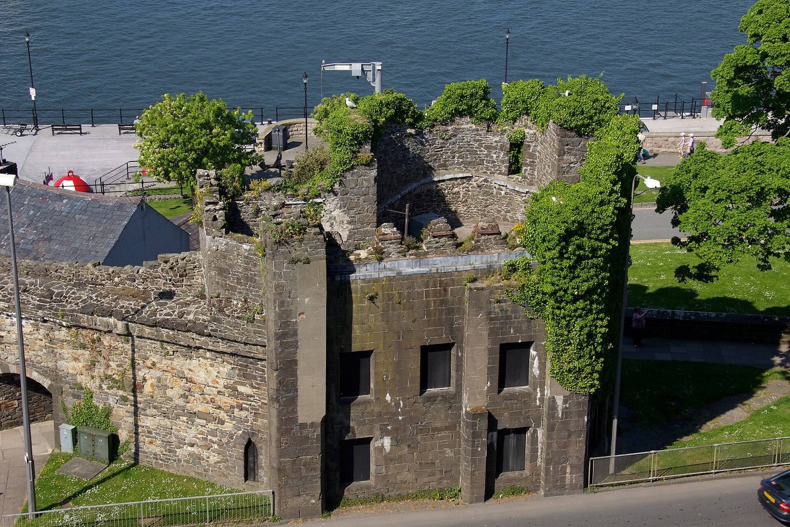
The eastern wall extends from Conwy Castle and is interrupted where the Chester-to-Holyhead road enters the town. This stretch has four towers, a small secondary gate, and the Lower Gate, which gave access to the quay. The Lower Gate has twin towers and a portcullis, a heavy gate lowered vertically into place. It controlled movement to the quay and, before the bridge was built, to the ferry across the Conwy estuary. The eastern wall was originally only about 3.6 metres high in some places; it was later raised to its present height with rhyolite. The gates and quay-side features have been substantially altered since the medieval period.
Western stretch
Nine towers mark the western stretch, which rises toward the southwest corner. In 1827 one tower was converted into an entrance for Bangor Road. Another developed a deep crack after subsidence caused by railway-tunnel excavation in 1845, and was supported from below in 1963. A surviving merlon, the raised section of a battlement, carries a stone finial. This detail was originally used along the full circuit.
Southern wall and railway features
The southern wall has eight towers and two gatehouses. The Upper Gate was the main medieval entrance from inland. Its twin towers protected a stone barbican, an outer defensive structure guarding an entrance; some of the barbican masonry survives, a rare survival for a town defense of this period. A gatekeeper lived above the entrance. A modern road now occupies the approach where the defensive ditch and drawbridge once lay. The twin-towered Mill Gate gave access to the royal watermill outside the town. Between the gates are remains of Llywelyn’s Hall, once incorporated into the walls; the building was dismantled and moved to Caernarfon Castle in 1316. The southern wall also contains a mock-Gothic railway arch built in 1846 and twelve thirteenth-century latrines for royal staff working in nearby buildings. A tunnel beneath the western walls carried the railway out of the town.