Moulin de Laguenay Cave: A Gravettian Painted Cave
Site at a Glance
- Popularity
- Very Low
- Country
- France
- Primary era
- Stone Age
- Eras represented
- Stone Age
- Civilizations
- Unclassified
- Site type
- Civic
- Remains
- Rock Art
On this page12 sections
History
Gravettian occupation
The Moulin de Laguenay cave, in Lissac-sur-Couze, Corrèze, France, preserves hand images and red-point designs dating to the Gravettian, an Upper Paleolithic culture associated with prehistoric art. The paintings include two black negative hand images, made by applying pigment around a hand held against the rock, and a field of red points. They place human activity in the cave within this prehistoric period.
People may have returned during a later stage of the cave’s development and possibly left holes in its sediment fill, though this interpretation remains uncertain. Fragments of decorated rock recovered near a wall have also been taken to suggest that some rock flaking may have occurred in ancient times.
Later use and modern intervention
At an uncertain date, the cave or part of it was used as a barn or adapted shelter. Sand or clay may also have been extracted, but the extent and timing of that activity are unclear.
At the beginning of the twentieth century, the village notary, then the cave’s owner, had its entrance dynamited because he objected to young people gathering there. The entrance had already been altered and enlarged. On 15 June 1994, the cave was listed as a French Historic Monument, a form of legal heritage protection.
Remains
Geological setting and cave development
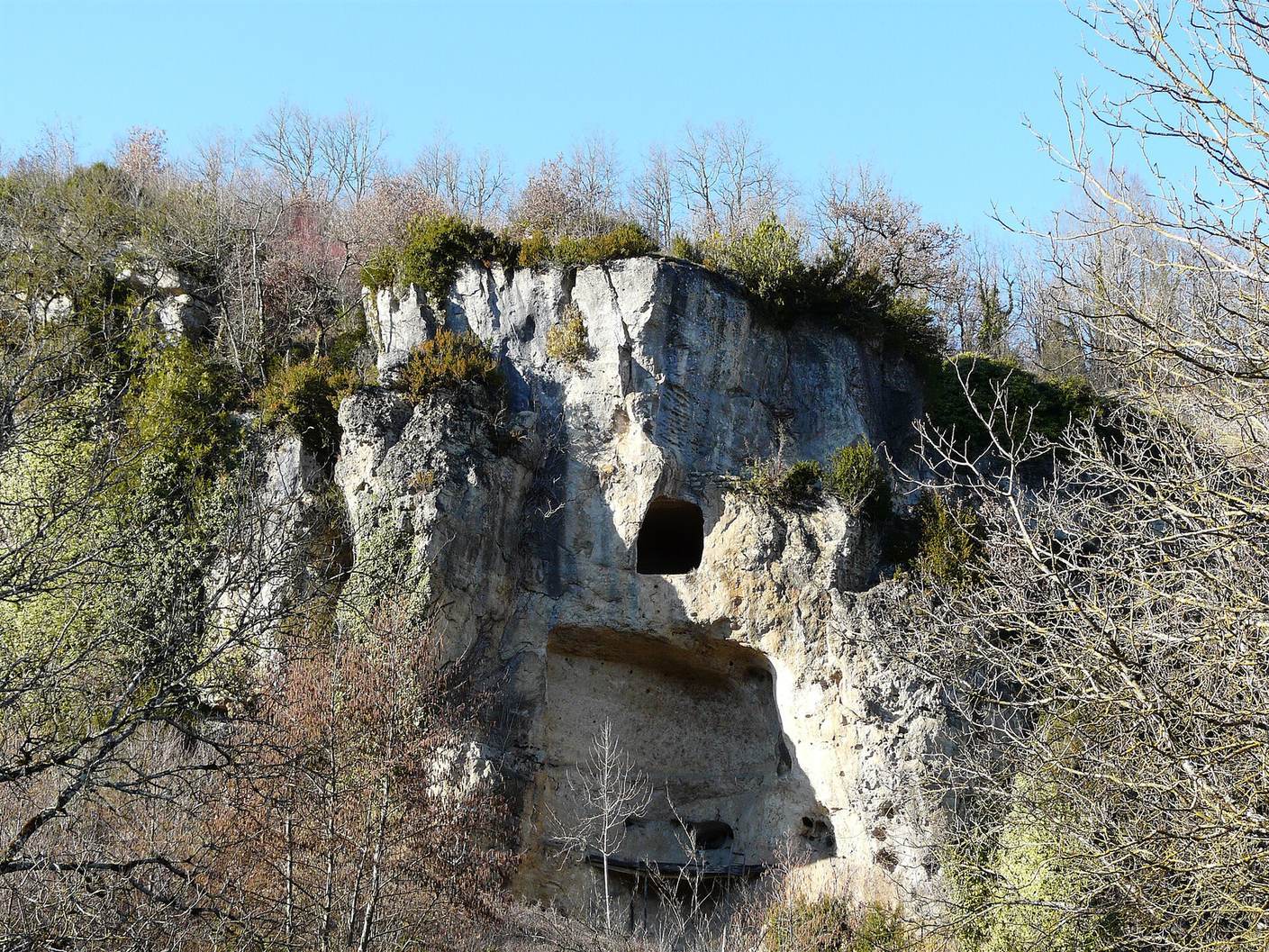
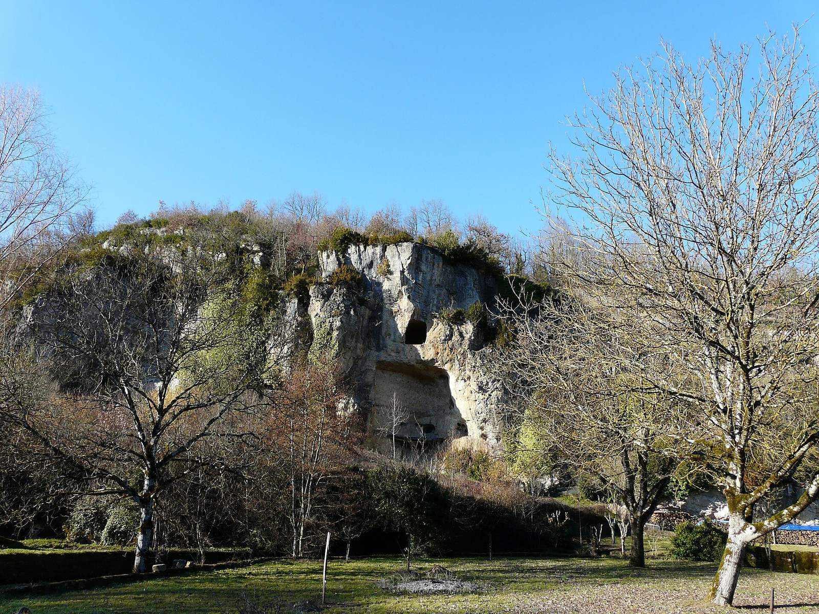
The cave opens on the southeast-facing side of a small valley on the Causse de Martel, a limestone upland south of Brive-la-Gaillarde. It lies in the Puy Gérald hill, above which are prairie and coppice; an orchard and houses at the Moulin de Laguenay locality stand in front of the entrance. The entrance is about 140 metres above sea level. The accessible passage extends roughly 35 metres on a north–south alignment.
The cave is formed in Middle Jurassic limestone, where lower Bajocian rock meets upper Bathonian rock. The Bajocian and Bathonian are stages of the Middle Jurassic, and their boundary here is estimated to be about 175 million years old. The transition is between massive beige limestone, altered near the surface in places, and platy, compact fine-grained limestone above the cave. The surrounding strata are nearly horizontal or dip gently southwest, within blocks bounded by major faults.
The cave lies close to the Moulin de Laguenay spring, which drains an estimated 4.5-square-kilometre underground system. This system receives water both from concentrated surface flows and from seepage through the ground, and is distinct from the nearby Blagour du Soulier system. The cave is now a sediment-choked old drain; water travels through an accessible passage close upstream. The cave may once have been an outlet where underground water emerged.
The cave probably developed during an older phase of karst, underground drainage shaped by the dissolution of limestone, perhaps in the Middle Pleistocene. It was later filled with sediment and intersected by valley incision during the Late Pleistocene. The timing of the present river network and underground drainage remains uncertain. Regional erosion removed iron-rich weathering deposits through a river system, perhaps beginning in the Miocene or Pliocene; closed depressions formed by limestone dissolution now disrupt parts of that older river-shaped landscape.
Features in the cave suggest an extended sequence of water movement and sediment change, although the number and duration of episodes are uncertain. Fine sediment accumulated during an early flooded phase, as indicated by clay-filled hollows in the walls and ceiling and needle-like calcite formations. Later shrinkage of the clay may have opened space above the fill, where calcite layers and a floor only a few millimetres thick formed. Renewed water flow cut channels into the ceiling and interrupted calcite growth.
As the valley deepened, it is thought to have intersected the old drain, allowing some water and sediment to escape. A small calcite floor was left suspended above the fill, with the paintings below it. As the valley widened, drainage may have shifted to the present spring and the downstream part of the cave was removed. A later calcite floor, about 15 centimetres thick, sealed the old drain above its sediment. Deposits on that floor and the partial removal of fill beneath it may reflect a later phase of flooding and renewed flow. A barrier may have held back water, while flow and erosion may have displaced sediment and fractured blocks or the calcite floor; the possible contribution of people is unresolved.
Entrance and interior layout
Entrance and gallery
The entrance zone has collapsed. The present opening is a narrow crawlway about one metre long and 50 centimetres across, descending toward the collapse and opening onto large blocks. Old postcards may show the former entrance porch. Beyond the debris, the gallery is about six metres wide and 3.5 metres high, with fill sloping gently toward the rear. Sections of the ceiling are flat along limestone slabs; elsewhere, channels were cut by water moving over sediment that once filled the drain. Small tubular stalactites and calcite coatings occur locally.
Central sediment depression
Near the centre is a flat-bottomed, muddy depression about 15 metres long and an average of four metres wide. Gravel benches border it, with sand and silt especially evident along the south wall. Water or roughly 20 centimetres of liquid clay is present there almost constantly. The sediment rises over about six metres toward the decorated area, beneath which the cave continues into a small, inaccessible low passage.
The flat floor and persistent water or liquid clay have been considered inconsistent with collapse or sediment piping as the sole explanation for the depression. One possibility is that much of its sandy material was extracted, leaving the benches as part of the original fill. The old entrance may also have connected directly to the depression, and valley incision could have encouraged gradual movement and erosion of the sediment. Trampling or extraction may have contributed as well. The present flooded condition does not rule out earlier erosion, since trampling and exposure can make clay- and loess-rich deposits firm and impermeable.
Painted alcove
The decorated area lies at the rear of the cave in an oval alcove about two metres long and 1.5 metres wide. A central field of red points occupies the overhead rock, facing two hand images. Calcite partly covers the paintings, and comparison with photographs from 1976 indicates that the images have not changed since then.
Negative hand images
The first hand is complete, painted in black, with its thumb pointing right and the beginning of the wrist visible. Its pigment halo measures 29 by 20 centimetres, and the image is 71 to 87 centimetres above the floor. The pigment lies in thin, separate particles, indicating that it was blown or spat onto the rock. A thin, recent white calcite film partly covers it. Nearby rock relief may have framed the image or caught pigment; the hand occupies a right-angled recess that may have helped support it.
The second complete hand has its thumb pointing left, though calcite obscures most of the thumb. Its halo measures 70 by 30 centimetres, and it is 106 to 114 centimetres above the floor. The support is brittle, and much of the pigment has fallen away. A large recent calcite plate covers the image’s left side. As with the first hand, the separated pigment particles indicate application by blowing or spitting. The measured span from index finger to little finger is nine centimetres on the first image and 10.5 centimetres on the second; their palms measure 11 and 14.5 centimetres wide, respectively.
The first image also has later surface marks. A smudge crosses the area between the little and ring fingers, and another mark crosses the bases of the index and middle fingers. Small blows affect the ring and little fingers and may have been made with a stick or knife point, perhaps while someone was indicating the image.
Red points and black strokes
The red-point field covers an oval area about 65 by 40 centimetres and contains at least 24 points, separated into two groups by a gap in the calcite. Thirteen measured circular points average 3.76 centimetres in diameter, ranging from 3.5 to five centimetres. Their arrangements include a straight line, a curved or elliptical grouping, and a semicircle. Several points follow a rocky edge at regular intervals. The pigment was blown or spat onto the surface from different directions, apparently aimed at the recesses in the rock. Its material has not been identified.
Two faint parallel black strokes survive within a roughly 15-by-10-centimetre rectangle to the left of one red point. They indicate that the panel’s use of red and black may have involved more than the contrast between the red marks and the hand images. The panel is interpreted as abstract. Its point groupings have been compared with arrangements in the Combel gallery of Pech-Merle Cave in the Lot.
Rock surfaces and preservation
Near the entrance, the ceiling and interior slope include limestone with spherulites, roughly spherical aggregates of calcite crystals, averaging about five centimetres across. Fragments of decorated rock found at the foot of a wall have been taken to suggest that flaking could be ancient. Periods when the entrance stood widely open may have exposed the cave’s small interior to outside climatic conditions, potentially contributing to flaking near the painted surface. Condensation may also occur within the cave, though its presence remains uncertain.