Radimlja Necropolis: A Medieval Cemetery of Stećci in Bosnia and Herzegovina
Site at a Glance
- Popularity
- Medium
- Country
- Bosnia and Herzegovina
- Primary era
- Medieval
- Eras represented
- Medieval, Early Modern
- Civilizations
- Kingdom of Bosnia, Ottoman
- Site type
- Burial
- Remains
- Necropolis
On this page9 sections
History
The Radimlja Necropolis is a medieval cemetery of stećci, monumental tombstones characteristic of Bosnia and neighboring parts of the western Balkans, near Stolac in Bosnia and Herzegovina. Its earliest tombstones date to the second half of the 12th and first half of the 13th centuries, while most belong to the period from the 1480s through the 16th century. The cemetery became the burial ground of the Miloradović-Stjepanović family, also known as the Hrabren, and its inscriptions and carved stones preserve evidence of the family’s identity and standing.
Early burials and family origins
Nearby Illyrian burial mounds point to earlier funerary activity in the area. They also suggest that people from Batnoge may have continued an older local burial tradition. Radimlja’s central cemetery took shape by the end of the 14th century, as the Hrabren family rose to prominence. The family lived in nearby Ošanići, then known as Batnoge, and followed Orthodox Christianity, the Eastern Christian tradition.
The family’s founder, Milorad, was a Vlach chieftain who lived in the second half of the 14th century. Vlach was a historical term associated with pastoral communities, some of which also had military roles. His son Stipan appears in a Ragusan complaint from 1416, which placed him among those fighting alongside Petar Pavlović against Sandalj Hranić and the Ottomans. Ragusa was the historical name for Dubrovnik. Stipan died between 1470 and 1477. His sons included Radoja, who died between 1475 and 1477; Petar Stjepanović, first mentioned in 1473 and last in 1486; and Vukić Stjepanović, last mentioned in 1496.
Family leadership and Ottoman rule
Members of the Hrabren family held the titles of voivode, a military leader, and knez, a local noble or prince. They commanded Vlach military units and held land between Stolac and Mostar. They also entered the political and social order of the Ottoman Empire, the power expanding into the Balkans. The katun formed by Petar and Vukić Hrabren was a Vlach pastoral community or social grouping within the Lower Vlachs of the Blagaj district. It comprised 127 households and 16 unmarried people, making it the largest of 37 such communities. Together, those 37 had 1,383 households and 177 unmarried people.
Petar and the local nobles Vukac, Pavko, Stipan, and Radivoj Popratović were recorded as citizens of Ragusa and holders of Ottoman timars, revenue assignments linked to service. The cemetery’s final phase included about 20 carefully made tombstones of varied forms, understood as the family’s burial ground.
Decline, damage, and protection
The cemetery’s expansion ended after voivode Radosav Hrabren was buried there in 1505. Conversion to Islam, the dissolution of tribal organization, and wider social change contributed to the decline in burials.
Construction of the Čapljina-Stolac road through the cemetery in 1882 destroyed at least 15 tombstones, with estimates reaching 20. In 1999, business premises were built on communal land beside the necropolis and a potential archaeological site under a regulatory plan later annulled by the National Commission for the Preservation of National Monuments. Continuing deterioration and unlawful construction within or near the protected area led to Radimlja being placed on a list of endangered monuments. It became a National Monument of Bosnia and Herzegovina in 2002. In 2016, it was included among the 28 medieval cemeteries in the UNESCO World Heritage property Stećci Medieval Tombstone Graveyards.
Remains
Layout and tombstone forms
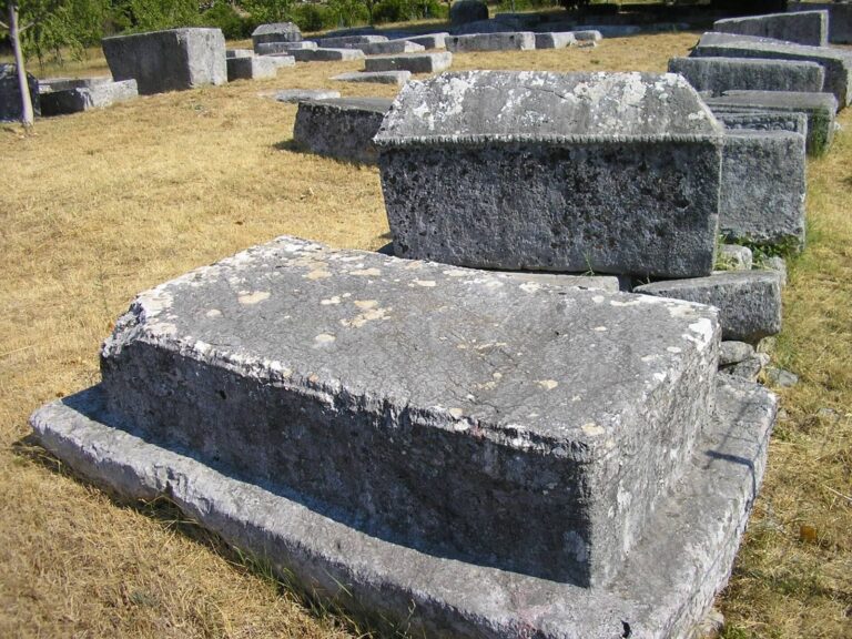
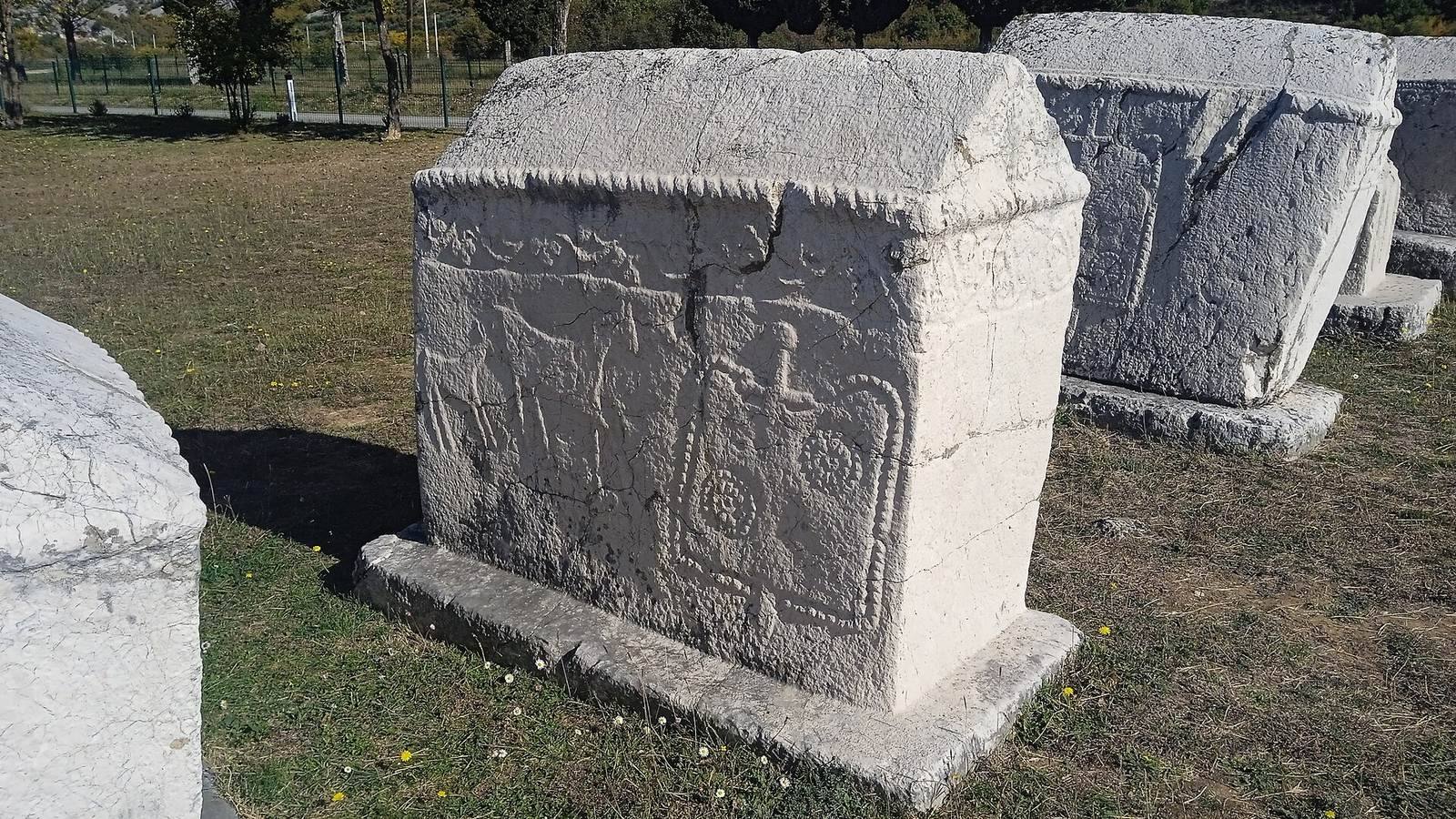
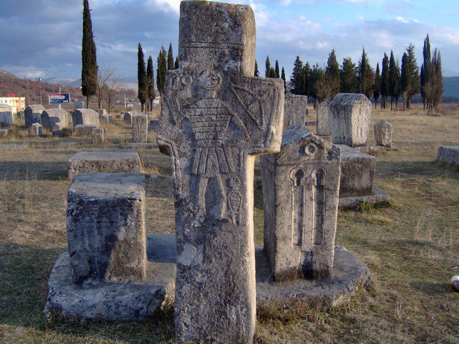
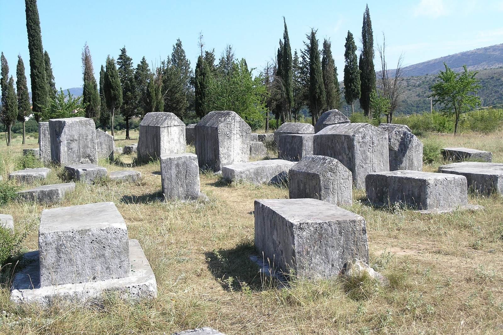
The necropolis lies in Vidovo polje at Ošanići, about three kilometres west of Stolac, beside the Čapljina-Stolac road. Its 133 tombstones were made from limestone quarried on Ošanići hill, roughly shaped there, then transported to the cemetery for finishing and carving. The group comprises 36 slabs, one slab on a pedestal, 27 chest-shaped tombstones, 24 chests on pedestals, four tall chests, five tall chests on pedestals, two tombstones shaped like chests with pitched roofs, 31 of these roof-shaped tombstones on pedestals, and three cross-shaped stones. Three large chest tombstones anchor the central group; two have richly carved scenes raised from the stone surface. Other forms include plain chests and pitched-roof tombstones with floral crosses on their fronts and borders of carved acanthus leaves.
Carved decoration
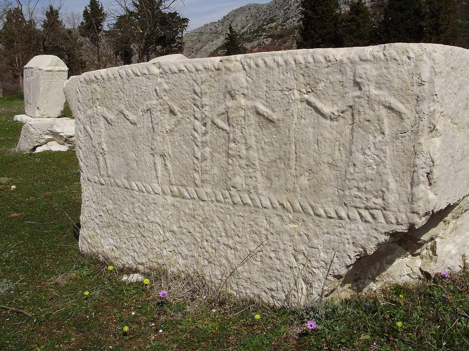
Sixty-three stones carry decoration made by carving, engraving, or both. The most elaborate examples include tall chests and pitched-roof tombstones mounted on pedestals. Their designs include curved lines ending in trefoils, zigzags, circles with radiating lines, rosettes, raised circular forms, clusters, T-shaped rods, and spirals. Bows and arrows on stones associated with voivodes have been interpreted as references to the family’s military role. Figurative scenes show men with raised right hands, hunting, chivalric tournaments, and a kolo, a South Slavic circle dance associated here with the dead. Male figures appear on stones linked to Hrabren voivodes and on stones interpreted as representing St. Vitus. The carvings bring together pagan and Christian ideas.
Inscriptions and stoneworkers
Five inscriptions give the names of Stipan Miloradović and his sons Radoja and Petar, as well as three other inhabitants of Batnoge. One identifies Radoje as the son of voivode Stipan, buried on his family’s land at Batnoge, and says that his brother, voivode Petar, raised the monument. Another names Radoje Vuković as voivode Petar’s nephew. The remaining inscriptions include the names Vukac and Vlah Vlahović. Three stoneworkers are named: Miogost, Bolašin Bogačić, and Ratko. One inscription identifies Miogost as a smith. The form Stipan reflects Ikavian speech, a regional pattern in which the older vowel jat appears as i. The inscriptions also use kami, meaning stone, for a tombstone.
Excavated graves and present condition
Excavations in the 1960s uncovered nine graves at depths of 120 to 135 centimetres. Around 50 other graves had been destroyed earlier during searches for valuables. Analysis of the human remains found that the people buried there were tall and had well-developed chests. The necropolis is unfenced. Its central area is used for parking by visitors and nearby business owners, while the adjacent area has become a waste dump. Trucks carrying waste cross the protective zone, exposing the cemetery to chemical and visual pollution.