Machrie Moor Stone Circles: Prehistoric Ceremonial and Burial Monuments
Site at a Glance
- Popularity
- Medium
- Country
- United Kingdom
- Primary era
- Bronze Age
- Eras represented
- Bronze Age
- Civilizations
- Unclassified
- Site type
- Burial
- Remains
- Necropolis
On this page18 sections
History
Machrie Moor Stone Circles are a prehistoric complex on the Isle of Arran in the United Kingdom. Stone circles 1 and 11 were erected around 1800 BCE, and the other four visible circles probably date to a similar period. Their burial use and possible role as a ceremonial centre have made them an important part of Arran’s prehistoric landscape.
Farming and timber monuments
Machrie Moor was fertile ground during the Neolithic, the prehistoric period before the Bronze Age, and the Bronze Age, attracting early farmers and settlers. Charcoal associated with an early agricultural phase dates to 3550 ± 70 BCE. Oak charcoal connected with this activity has a separate date of 2820 ± 90 BCE.
Wooden circles preceded the stone circles at sites 1 and 11, probably in the same locations. Timber-circle dating broadly falls between 2500 and 2000 BCE. Recorded dates include 2520 ± 50 and 2130 ± 90 BCE for one phase, 2470 ± 50 and 1980 ± 180 BCE for Timber Circle I, 2080 ± 90 BCE for Timber Circle II, and 2030 ± 180 BCE for another timber circle. After the wooden structures fell out of use, the land was ploughed. Later agricultural activity has dates of 1890 ± 110, 1830 ± 50, and 1820 ± 50 BCE.
Stone circles and their uses
Stone circles 1 and 11 were built on the locations of earlier timber circles around 1800 BCE. The other four visible circles probably belong to a comparable period. Circle 11 also has a date of 1690 ± 50 BCE, while a date around 1800 to 1600 BCE has been proposed for circle 5.
The circles are associated with funerary use. One broad interpretation treats every circle except 5 as a burial place, linking cremation with circles 1 and 11 and crouched burials with circles 2 and 4. Excavation also established burials in circles 3 and 4. The complex has been interpreted as a ceremonial centre for Machrie, and perhaps for Arran more widely. One explanation proposes that people whose authority rested on wealth used stone monuments to establish their standing in the landscape, while later generations reinforced the status of the dead through burial at these places.
A possible relationship between the circles and the summer-solstice sunrise remains an interpretation rather than a settled explanation. At the solstice, the sun rises through a notch on the northeastern skyline. One proposal is that circles 1, 2, 4, and 11 were used to observe this event; from circles 3 and 5, the sun could also be seen within about five minutes of sunrise. The reason for making observations from several circles is uncertain.
Environmental change and modern investigation
During the Late Bronze Age, climate change contributed to the formation of peat bog on the moor, while unsuitable farming methods depleted the soil.
In 1861, the Scottish antiquary James Bryce recorded circles 1–5 and numbered five other local monuments 6–10. Excavations that year uncovered burial chambers in circles 2–5. Circle 11, almost entirely buried beneath peat, was discovered in 1978 and excavated in 1978–79. In June 2025, Historic Environment Scotland announced the geophysical discovery of a further prehistoric circle, numbered 12. Historic Environment Scotland owns or manages the circles, which have been protected as a scheduled monument since 1994 under the designation Moss Farm, Machrie Moor stone circles.
Remains
Setting and landscape
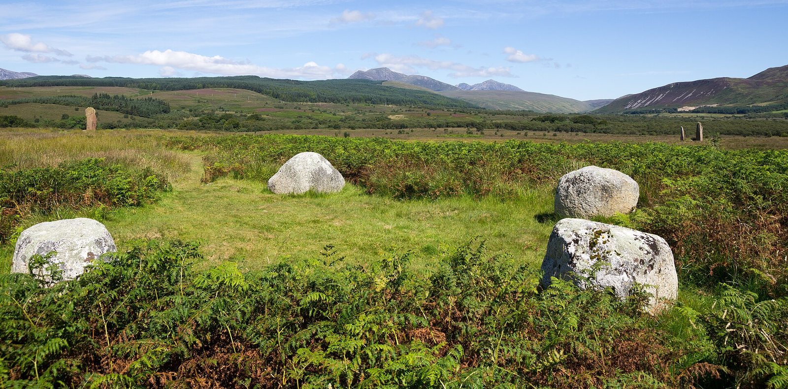
Six visible stone circles, numbered 1–5 and 11, stand immediately east of derelict Moss Farm on western Arran, about 5 km north of Blackwaterfoot and roughly 2 km inland from the coast. They occupy a shallow, gently undulating basin at an elevation of about 89 m. Machrie Water bounds the basin to the north and Shiskine Glen to the east, with higher ground to the north and east. The circles lie below a notch on the northeastern skyline between Beinn Tarsuinn and A’ Chruach, where Machrie Glen divides into two steep-sided valleys. Circle 12 lies buried beneath the ground.
Peat deposits reach about 3 m in parts of the basin, but beneath the stone circles they are generally no more than about 70 cm deep. The underlying Permian Brodick Beds are sandstone, overlain by consolidated glacial-moraine deposits, material left by a glacier, and sand. An iron-rich layer beneath the peat impedes drainage in some places. Red sandstone forms part of circles 1, 2, 3, and 11; granite occurs in circles 1, 2, 4, 5, and 11.
Principal circles
Circle 1
Circle 1 is an elliptical setting about 12.7 by 14.6 m across. Its stones alternate between six granite boulders and five sandstone slabs; four of the granite blocks have fallen. The setting probably originally contained 12 stones. An urn associated with the circle held the cremated remains of a young man, and a stone knife and bone point were also found there.
The timber monument that came before it included a ring about 14.5 m in diameter. Within that ring, 53 posts surrounded a horseshoe arrangement that opened northwest and included five substantial upright timbers, set within an area about 5.5 by 3.5 m. A later ring of thinner posts, about 19.5 m across, enclosed the earlier arrangement.
Circle 2
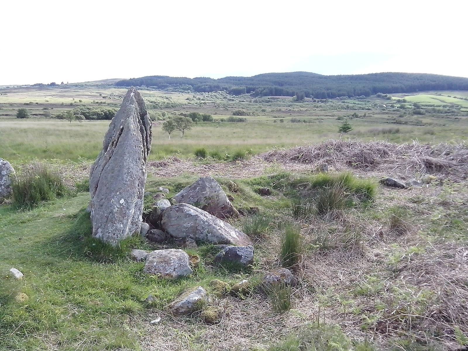
Circle 2 measures 13.7 m in diameter and probably began with seven or eight tall sandstone slabs. Three remain intact, standing between 3.7 and 4.9 m high; other stones survive as stumps or lie fallen. Two large stones within the circle appear to have come from a fallen pillar. One has a central hole that may have been made in an attempt to turn it into a millstone.
A cist, a small stone-built burial chamber, at the centre contained a food vessel, a type of prehistoric pottery found in burials, and stone tools. A shorter cist between the centre and the northeastern standing stone was empty.
Circle 3
Circle 3 originally had nine stones in an egg-shaped arrangement. One stone, 4.3 m high, still stands; three others survive partly as stumps in the peat. A central cist contained a pottery vessel, fragments of burnt bone, and flint flakes. Another cist, 1 m south of the centre, held a crouched burial, in which the body was placed in a flexed position, along with flint flakes.
Circle 4
Circle 4 is about 6 m across and consists of four granite blocks roughly 0.9 m high. It may be a stone setting rather than a true circle. Its central cist contained an inhumation, meaning the burial of an unburned body, a food vessel, a bronze awl, and three flint flakes.
Circle 5
Also known as Suidh Coire Fhionn, or Fingal’s Cauldron Seat, circle 5 has two granite rings. The inner ring contains eight boulders and measures 12 m across. The oval outer ring contains 15 boulders and is about 18 m across; it is not exactly concentric with the inner ring. A damaged cist at the centre had been used in more than one phase. Local folklore says that Fingal tethered his dog Bran to a holed stone in the outer ring while eating within the inner one. Fingal is a hero and giant in Scottish Gaelic tradition.
Circle 11
Circle 11 is a low ring about 13 to 13.6 m in diameter. Its tallest stone, on the west side, is about 1.2 m high. Excavation exposed ten upright stones, with a pit between each that may have served as a post-hole. The stones include sandstone and granite. Its timber predecessor measured about 14.7 m in diameter.
Circle 12
A geophysical survey, which uses measurements of underground physical properties to identify buried features, found 12 pit-like anomalies arranged in a circle. The pits may have held wooden or stone uprights.
Pottery from the prehistoric sequence
Pottery from across the sequence includes Grimston-Lyles Hill Ware from before construction of the monuments. Grooved Ware, a pottery style associated with the Late Neolithic, is linked with the timber circles. Beaker pottery, associated with a later prehistoric cultural tradition, belongs both to the agricultural phase between the timber and stone monuments and to the stone-circle period.
Other monuments in the landscape
Monuments numbered 6–10
Other local monuments recorded by Bryce include circle 6, a possible chambered cairn, or stone mound containing a burial chamber, represented by two upright slabs meeting at right angles. Circle 7 is a standing stone 1.6 m high. Circle 8 is a probable chambered cairn, formed by an oval spread of stones about 16 by 20 m. At its eastern edge, a 1.8 m standing stone is surrounded by smaller stones that may have formed a burial chamber or a front structure. Circle 10, the Moss Farm Road Stone Circle, lies about 1 km west of the principal circles and may instead be a fortified cairn, a stone mound with features interpreted as defensive.
Other prehistoric features
The wider landscape includes standing stones, burial cairns, cists, and low hut circles, the ground-level remains of roundhouses, formed by turf-covered rings of stone. A cairn near the A841 has large granite stones marking its outer edge. Hut foundations lie on both sides of the track toward Moss Farm, with a standing stone and remains of another large-stone structure north of the track. Farther south are two chambered tombs, including a well-preserved Clyde tomb, a type found in western Scotland. About 1.2 km east of the circles, near the B880, a separate setting of three granite boulders may originally have included four.