Alte Burg (Laudert): A Medieval Castle Mound in Germany
Site at a Glance
- Popularity
- Very Low
- Country
- Germany
- Primary era
- Medieval
- Eras represented
- Medieval
- Civilizations
- Holy Roman Empire
- Site type
- Military
- Remains
- Castle
On this page4 sections
History
Alte Burg (Laudert) is a medieval earthwork site in Germany, tentatively dated to between the 11th and 13th centuries. Its identification as a castle remains uncertain, although it has been proposed as the ancestral seat of the Lords of Milwalt.
Medieval claims and records
In 1262, Hermann von Milwalt granted Count Diether V of Katzenelnbogen a castle as a fief, or property held through a feudal grant. That castle has been associated with Alte Burg, but the identification is not secure.
The village of Laudert first appears in a record from 1275 under the name Ludinroit. The document concerns tithes in Laudert and nearby villages held by the Milwalt family. The family also held at least half of nearby Maisborn as allodial land, meaning property held outright rather than as a feudal grant. In 1330, Wepeling Theoderich von Milewald made half of Laudert a fief of the Electorate of Trier, a territory ruled by the archbishop of Trier, who also held the rank of prince-elector. In 1333, he made jurisdiction at Mensborn a fief of the same territory. These family connections underpin the proposed identification of Alte Burg as a Milwalt ancestral castle.
Nineteenth-century description and local tradition
In 1852, German engineer and antiquarian Karl August von Cohausen gave the earliest description of the earthworks. He also recounted a local story about shepherds who, on hot summer days, saw a chest of money and valuables in the moor near Laudert. They did not dare retrieve it because a black dog lay on the chest, baring its teeth.
Remains
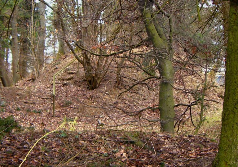
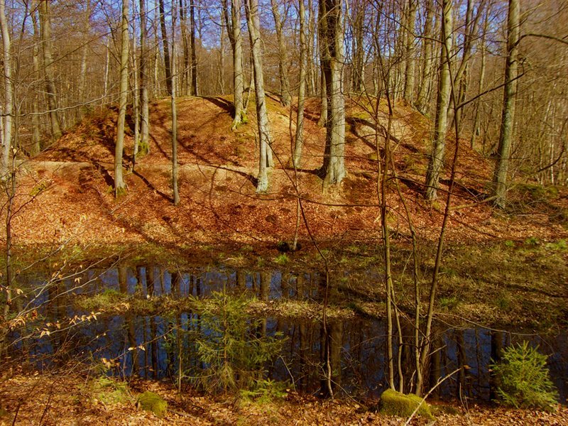
The earthworks follow the form of a lowland motte, a medieval castle arrangement centered on a raised mound, in the headwaters of the Simmerbach. The roughly rectangular mound measures about 18 by 20 m and rises approximately 4 to 5 m, with steep sides. A rectangular hollow in its center may result from later excavation.
A ditch about 6 to 10 m wide encircles the mound. Outside it, a bank around 5 m wide and 1.25 to 1.90 m high encloses an area measuring approximately 50 by 37 m. On the north side, the bank broadens into a plateau about 17 by 39 m, which may have served as an outer ward, a secondary enclosed area beyond the main fortified core. A second ditch, up to 15 m wide and about 2 m deep, surrounds the bank; an outer bank roughly 1.5 m high bounds this water-filled ditch. Perforated slate slabs found on the mound may have served as roofing or side cladding. Pottery sherds collected there date to the 13th or 14th century.