Glanzenberg: Ruins of a Medieval Castle and Town in Switzerland
Site at a Glance
- Rating
- 4.7
- Popularity
- Very Low
- Country
- Switzerland
- Primary era
- Medieval
- Eras represented
- Medieval, Early Modern
- Civilizations
- French, Holy Roman Empire
- Site type
- City
On this page10 sections
History
Glanzenberg, the remains of a medieval castle and town, lies in the canton of Zurich, Switzerland, near Dietikon. The Regensbergs, a medieval noble family, enlarged the castle in the first half of the thirteenth century and founded a town beside it around 1240. They sought to control trade on the Limmat between Zurich and Baden, and the site also offered a suitable place for a bridge near Fahr monastery.
Origins and Regensberg expansion
A wooden castle at Fahr, near the later town and Fahr monastery, probably stood around 1040. It preceded the later Glanzenberg castle. In the first half of the thirteenth century, the Regensbergs expanded the older castle amid territorial competition with the growing city of Zurich. The castle is classified as a lowland castle and was associated with the free nobility.
A bridge at Glanzenberg would have required cooperation from the knights of Schönenwerd, whose castle stood on the opposite bank. Zurich opposed the project and pressured them to pledge in 1257 that they would not sell land on that bank for a bridge. This pledge is the first written mention of Glanzenberg.
After Lütold V died around 1250, his sons Lütold VI and Ulrich divided his inheritance. Ulrich received Neu-Regensberg and property in the Glanzenberg, Fahr, and Weiningen areas. In 1259, an arbitration between Eberhard, the provost (senior cleric overseeing a religious institution) of Fahr, and Count Rudolf of Habsburg settled the question of Glanzenberg’s parish affiliation in favor of Fahr monastery.
Destruction and changing ownership
Late medieval chroniclers blamed the violent destruction of Glanzenberg in September 1267 on Zurich forces led by Rudolf IV of Habsburg, who later became King Rudolf I of Germany. They linked the event to the Regensberg feud of 1267 to 1268. A later legend says armed men hid in cargo boats and drew townspeople away, allowing Rudolf’s forces to enter and burn the settlement. Archaeological evidence has not confirmed that the castle or town was violently destroyed. The castle appears to have been abandoned around 1267, while pottery and other evidence indicate settlement in the area from the twelfth to the fourteenth century. Farms at Glanzenberg are mentioned through 1322.
In 1291, the younger Lütold of Regensberg sold the Glanzenberg area to Wettingen monastery, keeping a ten-year right to buy it back. He was again recorded as its owner in 1301. That year, Fahr monastery acquired the Glanzenberg farm and other holdings from Lütold VIII. On 25 February 1301, Lütold VIII also surrendered his bailiwick, a form of protective or supervisory authority, over Fahr monastery to the abbot of Einsiedeln and asked that it be granted to Zurich citizens Bertold and Jakob Schwenden.
Later use and archaeological recovery
Wettingen monastery unsuccessfully claimed the former town site, then used as farmland, in 1689. During the Second Villmergen War, a 1712 conflict among Swiss cantons, a temporary bridge was built there. In 1799, at the start of the Second Battle of Zurich, part of the French Revolutionary Wars, 24,000 French troops under General Massena crossed the Limmat at Dietikon and broke the Russian line commanded by Korsakow. A floating bridge was replaced by a trestle bridge, and entrenchments secured the bridgehead.
Industrial railway construction removed part of the castle mound in 1909, and a flood embankment destroyed further remains in 1912. The Antiquarian Society of Zurich prevented the remaining site from being quarried for road gravel in 1923. Archaeological probing began in 1924, and remains were uncovered between 1937 and 1940. Further work accompanied construction of the N1 motorway; by 1980–81, the remaining town had been excavated and conserved. Glanzenberg is designated a Class A Swiss cultural property of national significance.
Remains
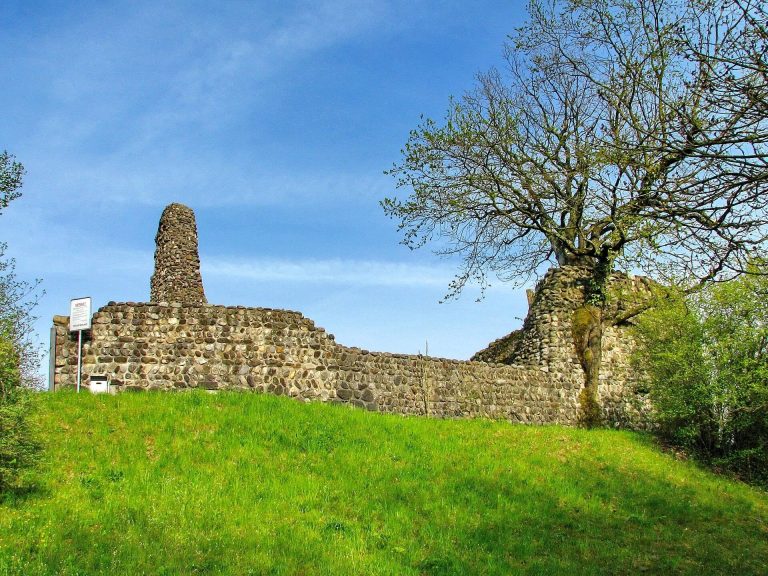
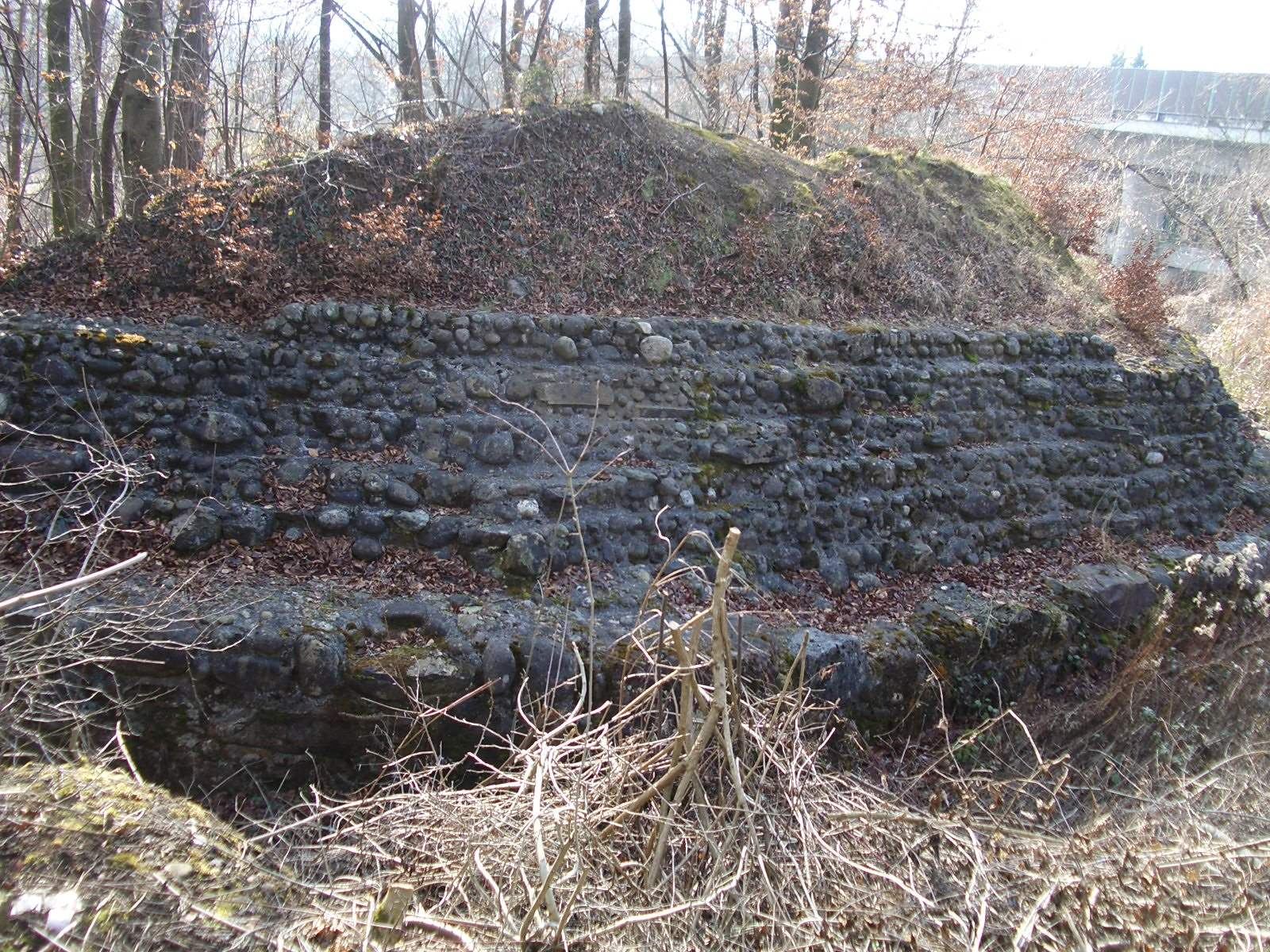
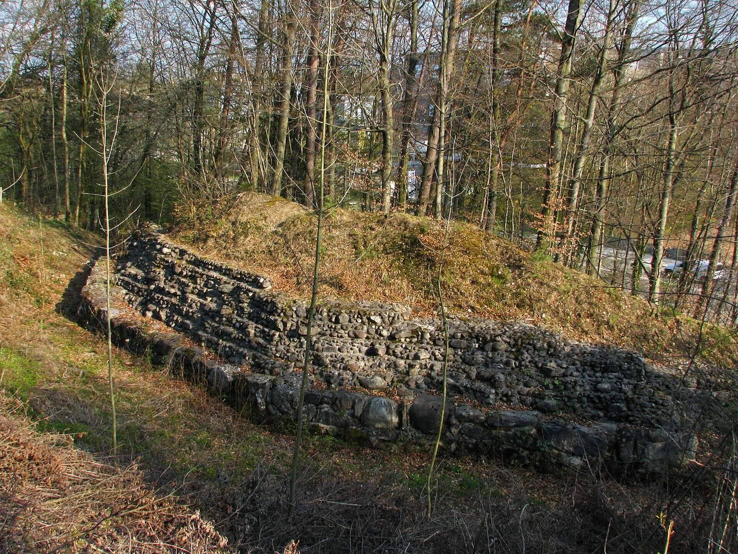
The site is divided between the castle mound and the former town, with the castle ruins about 300 metres west of the town site. The castle stood on a rise above an earlier course of the Limmat, while the town occupied ground beside the river’s former channel. The surviving features include a large-stone castle enclosure, town defenses, building remains, and entrenchments associated with the later bridgehead.
Castle remains
A double ditch and part of a many-sided enclosure wall survive at the castle. The wall, about 2.5 metres thick, was built from massive boulders and enclosed the castle plateau and its residential tower. Over the centuries, erosion by the Limmat removed some of the ground beneath the site.
Former town
Layout and defenses
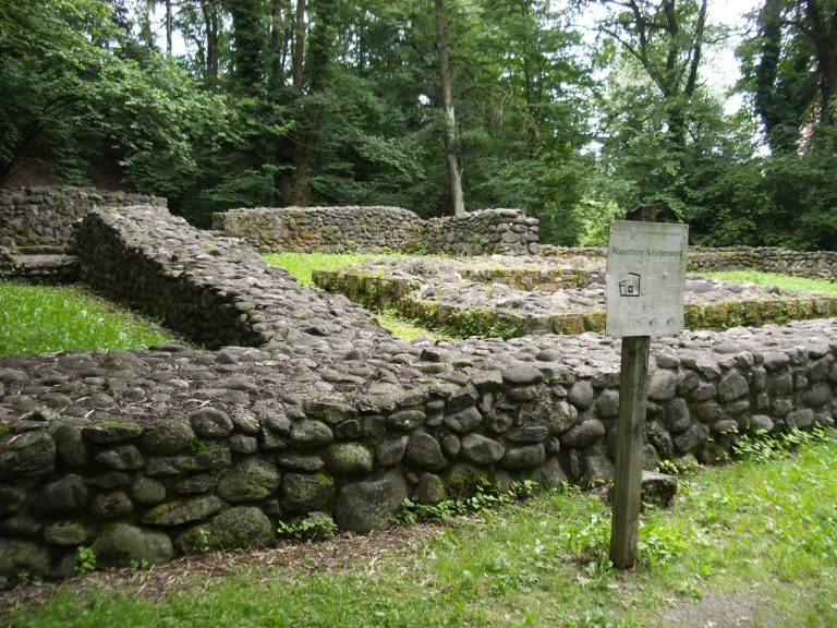
In the thirteenth century, the Limmat ran about 300 metres north of its present course beside the town. The settlement extended about 180 metres in length, with a width of roughly 45 metres at the east end and 110 metres at the west. Its wall was about 1.2 metres thick, with a main gate on the north side and smaller passages toward the river. Sections of the wall rise little above their foundation trenches, and faint traces of the landward water ditch remain, indicating that the settlement was unfinished.
Buildings
Timber and stone buildings stood along the town’s north, east, and south walls. The excavated and conserved remains include sections of the former town and castle.
Bridgehead entrenchments
Some entrenchments built to secure the 1799 bridgehead remain visible. They form a later military element within the remains of the medieval site.