Buckton Castle: A Medieval Stone Castle in England
Site at a Glance
- Popularity
- Medium
- Country
- United Kingdom
- Primary era
- Medieval
- Eras represented
- Medieval, Modern
- Civilizations
- British, English
- Site type
- Military
- Remains
- Castle
On this page8 sections
History
Buckton Castle is a medieval stone castle on Buckton Hill near Mossley, in the United Kingdom, about four kilometres from Stalybridge. Probably built in the 12th century, it was among the earliest stone castles in North West England. Woodland clearance between the 9th and 11th centuries reduced the local timber supply, which may help explain the choice of stone. The hilltop position may also have allowed the garrison to watch the Tame Valley.
Origins and medieval development
The Earls of Chester probably commissioned the castle, since they held authority over castle building in Cheshire. It may instead have been built by William de Neville, a landholder who held the lordship of Longdendale under the earl between 1181 and 1186. He may have lacked the resources to complete it. Buckton could have served as the seat of that lordship. The castle and valley lay within the medieval manor of Tintwistle, a landholding administered for a lord, and the area then formed part of eastern Cheshire.
Archaeological evidence indicates three stages of development: initial construction, further work following a recutting of the ditch, and deliberate demolition. The renewed ditch may reflect continued occupation or repairs after the castle had been abandoned. The relatively plain stonework has also prompted the suggestion that construction was never finished. The cost has been estimated at about £100, close to a baron’s typical yearly income around 1200. That estimate draws on the £184 recorded for work on Peveril Castle’s great tower in 1175–77.
Several possible motives have been proposed for construction. It may have begun during the Anarchy, the civil war over the English succession in King Stephen’s reign (1135–54). During that conflict, David I of Scotland gained control of much of northern England, including parts of Lancashire, and Buckton may have been intended to help protect Cheshire. Another possibility links the building to the Revolt of 1173–74, a rebellion against Henry II. The castle’s demolition may have followed the Anarchy, when fortifications were dismantled to restore conditions from before the war, or may have been punishment for the Earl of Chester’s participation in the revolt.
Dereliction and later uses
The earliest surviving written reference comes from an estate survey of 1360. It names a ruined castle called Buckeden and assigns it no value. Longdendale then belonged to Edward the Black Prince, eldest son and heir of Edward III, and Buckton was already derelict. The timing of its abandonment is uncertain.
The hill may later have served as a beacon site. It could have been used during the Pilgrimage of Grace, a northern uprising against Henry VIII’s religious and political policies in 1536–37, and again during the 1580s, when England feared Spanish invasion, especially the Armada’s attempt to reach the country in 1588. A beacon hut recorded near Mossley in 1803, less than a mile away, may point to another period of signalling. In 1767, treasure hunters found a gold necklace and a silver vessel at the castle; both objects were later lost.
Buckton has been a scheduled monument, a nationally important site protected under English law, since 9 July 1924. The protection was probably intended in part to guard it from the expansion of nearby Buckton Vale Quarry. During the Second World War, a Starfish decoy site designed to draw enemy bombing away from its intended targets operated near the castle as part of a group of nine around Manchester. It remained in use until 1943.
Archaeology and interpretation
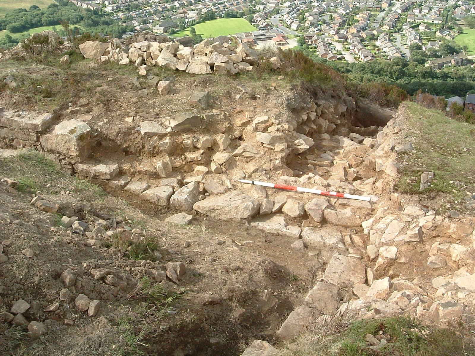
A 20th-century interpretation proposed that Buckton was an Iron Age hillfort. Study of hillforts in Cheshire and Lancashire raised doubts about that reading, and excavation in 1998 established a medieval date. Archaeologists D. J. Cathcart King and Leslie Alcock had earlier classified the site as a ringwork, a fortification whose defensive circuit is formed by earthworks. Later excavation showed that the main defence was a stone wall, while the earthworks visible today formed through structural collapse and soil accumulation.
The Tameside Archaeology Survey began in 1990 under the University of Manchester Archaeological Unit. Topographic surveys and trial excavations followed in 1996 and 1998. Illegal digging in 1999 and 2002 led to remedial work and test-pitting, and larger excavations took place in 2007, 2008 and 2010. After the Manchester unit closed in July 2009, the work passed to the University of Salford’s Centre for Applied Archaeology.
Remains
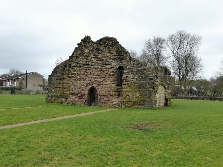
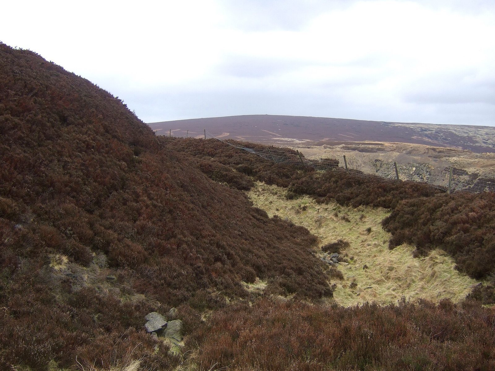
The castle occupies a steep sandstone ridge on Buckton Hill, 335 metres above sea level. Carr Brook valley lies to the south and the River Tame valley to the west; Buckton Vale Quarry is close to the east, while heath and peat moorland extend north and north-east. The enclosure is roughly oval, measuring 35.6 by 26.2 metres and covering about 730 square metres. Its sandstone curtain wall, the defensive wall enclosing a castle, was 2.8 metres thick. A ditch about 10 metres wide and 6 metres deep followed the enclosure except on the south-west, where the steep slope formed the boundary. Material excavated for the ditch raised the interior by about 1.5 metres. Heather and peat cover the buried remains, and vegetation obscured the stone construction until the late 20th century.
North-west gatehouse
The north-west entrance was controlled by a stone gatehouse, a fortified building guarding access to the castle. It measured 9.3 by 7.5 metres and probably stood at least two storeys high. The gate passage occupied the eastern side and was set off-centre, while a chamber lay to the west. The tower walls were 1.2 metres thick. Built in the 12th century, the gatehouse belongs to the early group of stone entrances in North West England.
Interior and archaeological evidence
A report on Longdendale from 1360 may refer to a knight’s hall and chapel at the castle. In the 1770s, antiquarian Thomas Percival described a well near the southern wall and interior walls rising as high as two metres. A plan made in 1842 also showed a ruined building in the south-east of the enclosure. Excavation uncovered a posthole, the trace left by a post set into the ground, indicating activity in the interior. Finds include four sherds of Pennine Gritty Ware, a coarse pottery associated with the Pennine region and broadly dated to the late 12th century. Animal bones and locally made pottery dated to the 12th or 13th century were found beneath the collapsed gatehouse in 2008.
Later alterations and features
A gap in the southern wall, absent from the 1842 plan, may have been made by people digging in the 19th century. Excavators also found a sandstone feature resembling a spoil heap, possibly created during castle construction. A brick hut was built over part of the ditch during the Second World War for use with the nearby bombing decoy. An earthwork once thought to be an outer bailey, an enclosed outer court of a castle, proved to be a 20th-century feature probably connected with quarrying or other mining nearby.