Mamucium: A Roman Fort and Civilian Settlement in Manchester
Site at a Glance
- Popularity
- Very High
- Country
- United Kingdom
- Primary era
- Classical
- Eras represented
- Classical
- Civilizations
- Roman
- Site type
- Military
- Remains
- Fort
On this page13 sections
History
Foundation and Roman occupation
Mamucium was a Roman fort in Castlefield, Manchester, United Kingdom, established around AD 79 during the campaigns of Roman governor and commander Gnaeus Julius Agricola against the Brigantes. It housed a cohort of about 500 auxiliary infantry, soldiers in the Roman army who were not Roman citizens, and guarded important roads through the area.
The region belonged to the Brigantes, a powerful people of northern Britain, and may have been controlled by the Setantii, a group in the northwest. The fort’s name is also recorded as Mancunium, though its ancient form is uncertain. It may derive from a Brittonic word for breast, referring to the sandstone hill, or from a word for mother, perhaps linked to a local river goddess.
Construction took place in three main phases, around AD 79, AD 160, and AD 200. The defenses were strengthened around AD 90. By about AD 120, Mamucium and the fort at Slack appear to have replaced Castleshaw as military installations in the area. Mamucium was dismantled around AD 140. Its first civilian settlement, or vicus, was abandoned sometime between AD 120 and 160, around the period of the fort’s demolition.
The civilian settlement and later Roman use
The settlement outside the fort grew from the late first to early second century. Soldiers’ families lived there alongside merchants and craftspeople, and workshops carried out industrial work. The fort was rebuilt on a larger scale around AD 160 to provide space for additional granaries. The civilian settlement returned after this rebuilding.
Around AD 200, the gatehouses were rebuilt in stone and the defenses gained stone facing. The fort remained in use during the first half of the third century, as indicated by its inclusion in the Antonine Itinerary, a Roman register of roads and places, together with inscriptions and evidence of repairs. Religious activity in the settlement involved Roman and Germanic deities. A possible Christian association rests on an object whose interpretation is disputed.
The civilian settlement may have been abandoned by the middle of the third century. Buildings were dismantled and their materials reused elsewhere. Coins suggest that a small garrison may have continued at the fort into the late third or early fourth century, even as civilian life declined.
After Roman rule and antiquarian interest
Following the Roman withdrawal from Britain around AD 410, the area was used for agriculture. Mamucium has sometimes been identified with Cair Maunguid, one of the 28 British cities named in the History of the Britons, a medieval work traditionally attributed to Nennius.
Antiquarians returned attention to the ruins over several centuries. John Leland discussed them in the sixteenth century, followed by William Camden in the late sixteenth and early seventeenth centuries. In the eighteenth century, William Stukeley, John Horsley, and John Whitaker wrote about the remains. Horsley recorded the local names Giant’s Castle and Tarquin’s Castle, and Whitaker described the site in 1773.
Urban growth and archaeological investigation
Manchester’s expansion during the Industrial Revolution led to the leveling of much of the fort for development. The Rochdale Canal and later railway construction damaged the site. During railway building, antiquary Charles Roeder recorded remains brought to light, including parts of the civilian settlement.
Francis Bruton began archaeological investigation in 1906 with excavations of the western defenses. Smaller investigations continued intermittently from 1912 to 1967, chiefly on the northern side. Barri Jones led the first excavations of the civilian settlement in the 1970s. From 2001 to 2005, the University of Manchester Archaeological Unit excavated there ahead of redevelopment. Investigations of the fort and settlement have yielded about 10,000 artefacts.
In 1982, Mamucium and the wider Castlefield area became the United Kingdom’s first Urban Heritage Park. The fort’s ruins are protected as a Scheduled Ancient Monument, a site or monument given legal protection in England.
Remains
The fort occupied a sandstone bluff above a crossing of the River Medlock. Its timber defenses and later stone-faced walls enclosed a roughly rectangular area, while the associated civilian settlement extended beyond the fort to the west, north, and east, with most of it to the north.
The fort and its defenses
The fort measured about 160 by 130 metres and covered approximately two hectares. Double ditches and timber defenses surrounded it; its later stone defenses were about 2.1 to 2.7 metres thick. Its position placed it near the east-west Roman road between Chester and York and a road north to Ribchester. A less certain route may have run northwest towards Wigan. Deansgate follows the general line of the road to Ribchester near the fort’s eastern side.
Roof-tile stamps point to administrative connections with Castleshaw, Slack, Ebchester, and Ardotalia. The forts probably obtained their tiles from a common source in Grimescar Wood near Huddersfield. Ardotalia, about 19 kilometres away, is described as the nearest fort; Castleshaw lay about 26 kilometres east, while Condate, near modern Northwich, was about 29 kilometres west.
William Whitaker’s 1773 description noted ramparts of uneven height and entrances on several sides, including a northern gate that opened onto the road to Ribchester. He described turf-covered banks, thorn growth, and exposed stonework. The mortar incorporated quarry stone, angular rocks, and rounded river boulders; slopes descended towards the river and nearby marshland.
The civilian settlement
The settlement covered about 26 hectares. Its buildings were generally single-storey structures with timber frames and walls made of woven branches coated with earth. Sheds and workshops with concentrations of furnaces formed an area interpreted as industrial, perhaps Manchester’s earliest. A cemetery may have been situated southeast of the fort.
Religious and inscribed finds
Altars and cult sites
A temple to Mithras, a deity worshipped in Roman mystery cults, in modern Hulme may have been associated with the settlement. An altar dedicated to Fortuna, the Roman goddess of fortune, and bearing the title Conservatrix, meaning Preserver, is probably from the early third century. Another altar, discovered near the settlement in 2008, dates to the late first century and names two unidentified minor Germanic gods. It remains in notably good condition, with a shallow bowl on top that may have been used for offerings of wine or blood, or for burning incense.
Sator square
A second-century fragment of amphora, a large storage vessel, bears a sator square, a Latin word puzzle whose letters can be rearranged to form PATER NOSTER, meaning Our Father, the opening words of the Lord’s Prayer. It was found in the 1970s. Whether it indicates Christian worship remains disputed.
Gold bulla
A D-shaped gold bulla, a pendant or amulet, was dredged from the River Irwell in 1772 during canal-widening work. The object is lost, but detailed drawings survive. Its shape closely resembles that of a late Bronze Age example found in Shropshire in 2018.
Damage and reconstructed remains
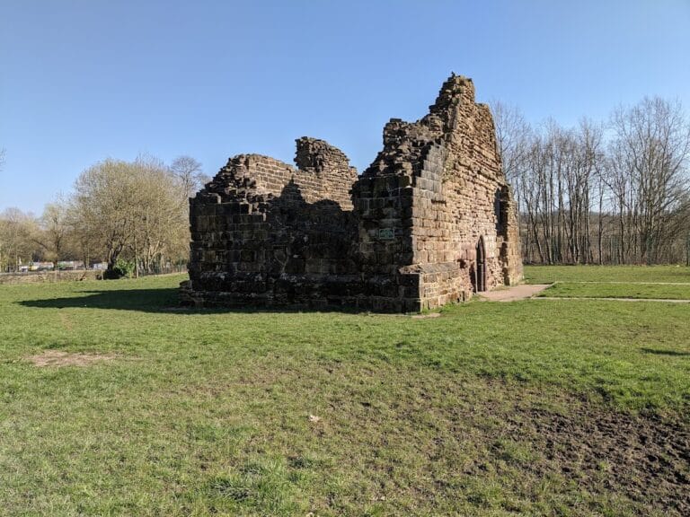
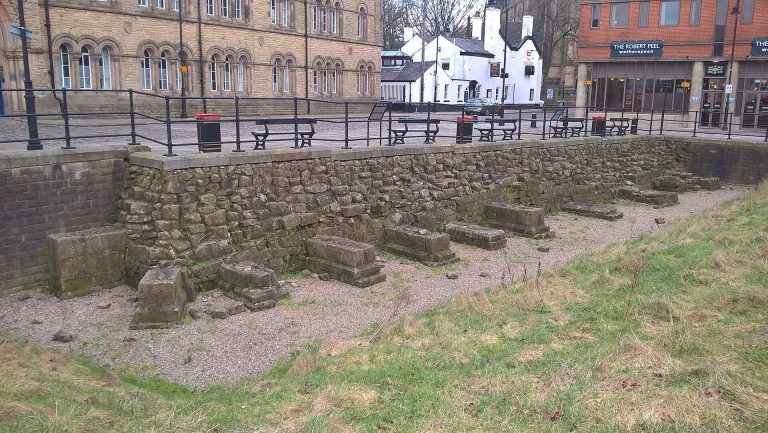
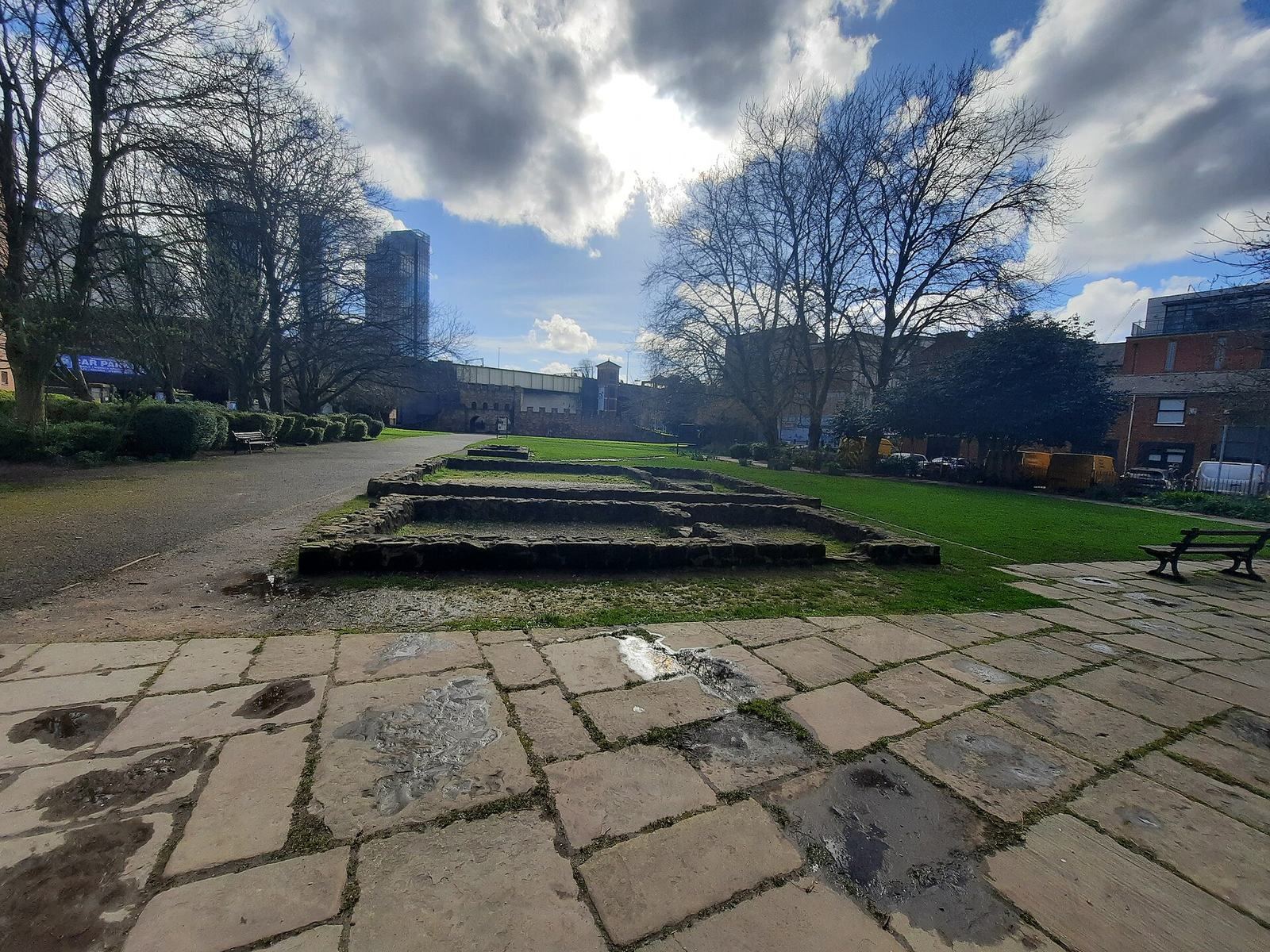
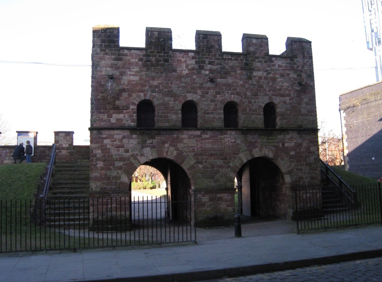
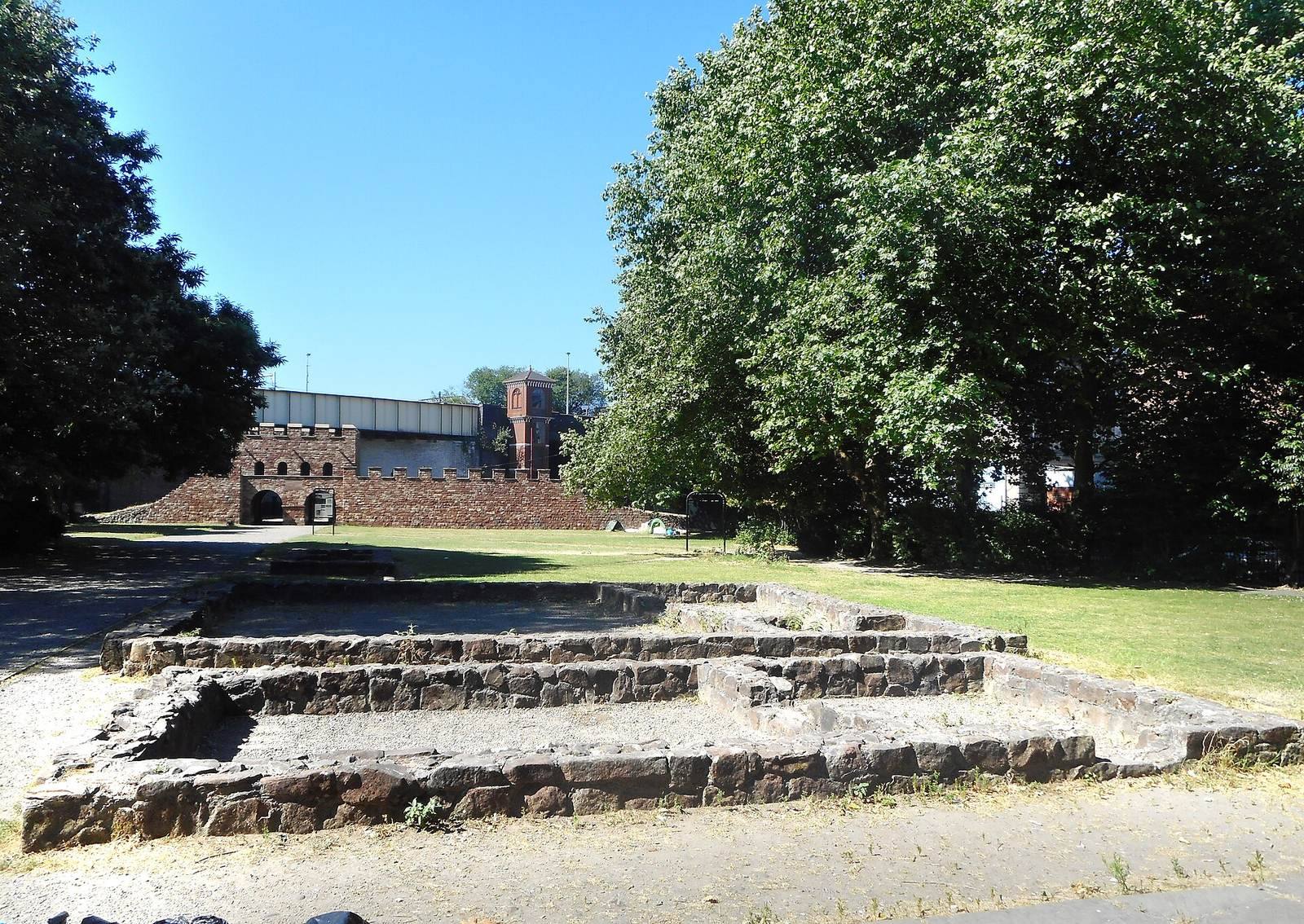
The Rochdale Canal cuts through the fort’s southwest corner, where canal works destroyed a bathhouse in 1760. Railway construction later damaged or removed further remains, including part of the southern half. Partial reconstructions of the fort’s wall, ramparts, and gateways date to 1984. A wall section and gatehouse, granaries, and ancillary buildings of the civilian settlement have also been reconstructed and remain visible at the site.