Fort Cigogne: A Coastal Defense Fort in the Glénan Islands
Site at a Glance
- Popularity
- Medium
- Country
- France
- Primary era
- Early Modern
- Eras represented
- Early Modern, Modern
- Civilizations
- French
- Site type
- Military
- Remains
- Fort
On this page7 sections
History
Fort Cigogne is a French coastal fort on Île Cigogne in Fouesnant, France, begun in 1756 to defend the Glénan Islands from English and Dutch corsairs. The fort was never completed and became known as the “useless fort.”
Plans and military purpose
In 1717, Pierre de Montesquiou d’Artagnan, a Marshal of France and senior military officer in Brittany, proposed fortifying the islands against corsairs, privateers authorized by governments to attack enemy shipping. That plan did not proceed. The Duke of Aiguillon, a French military officer and statesman, later ordered a defensive work, and building began at Cigogne in 1756.
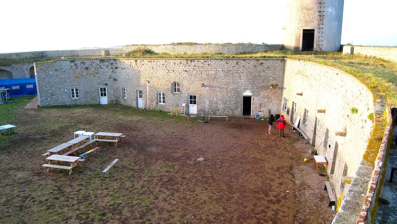
The fort did not stop English corsairs from raiding merchant ships around the islands during the French Revolutionary Wars, which began in 1792, and the Napoleonic Wars associated with Napoleon’s rule. The period also included Napoleon’s Continental Blockade, an effort to restrict British trade with continental Europe. English corsairs eventually stopped anchoring in the sheltered area between Cigogne and Saint-Nicolas, moving instead to positions near Penfret or Île aux Moutons, beyond the fort’s cannon range. The fort could hold up to 80 soldiers. Away from combat, its vaulted, protected casemates served as quarters, and a hospital was added.
Later military and scientific uses
During the nineteenth century, successive building works aimed to finish the fort, adapt it to changes in artillery, strengthen security, and improve conditions for the garrison. The French Navy withdrew the fort from military service in 1899. It was then assigned to the Collège de France, an institution for research and advanced teaching, and used as a weather station and a bird-observation post for the marine biology laboratory at Concarneau. Separately, the laboratory installed a weather observatory on the island that operated from 1891 to 1930.
Wartime and recent stewardship
Residents of Concarneau occupied the fort during the First World War, while a small German garrison was stationed there in the Second World War. Since 1967, the sailing school Les Glénans has leased the site for its trainees; seasonal fishermen also used the fort until 1974. A 20-metre tower built in 1911 served the French Navy in trials measuring steamship speeds as far away as Île de Groix.
The fort remains state-owned. It was listed as a historic monument in 2009 and classified in 2013. In 2016, the Conservatoire du Littoral, a French public body that protects coastal areas, took responsibility for the island and fort and renewed the sailing school’s lease. Selected for France’s annual Heritage Lottery program in 2018, the fort underwent restoration and refurbishment works completed in 2024.
Remains
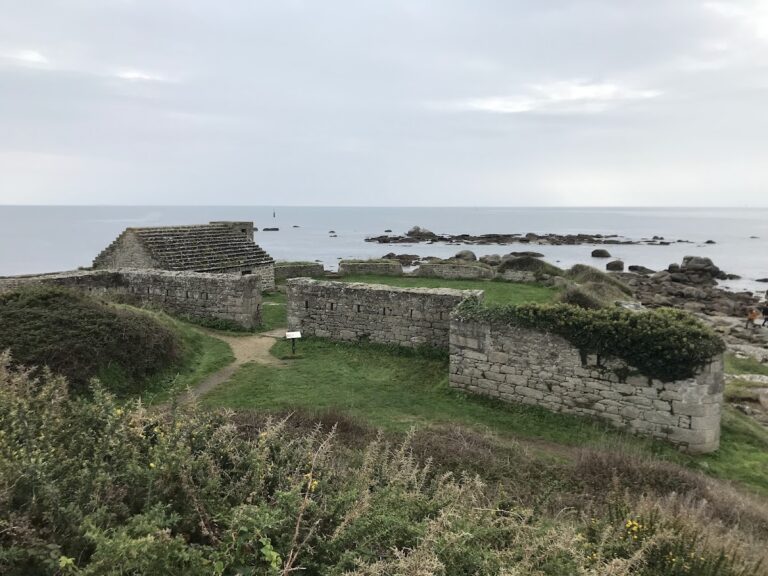
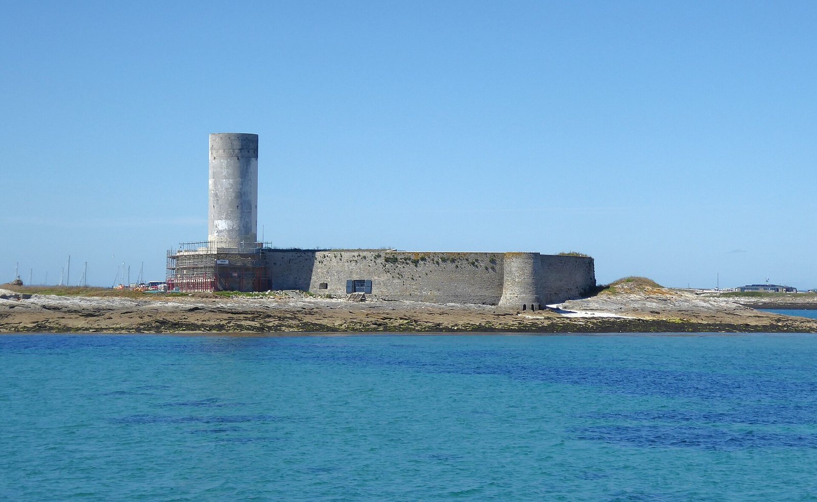
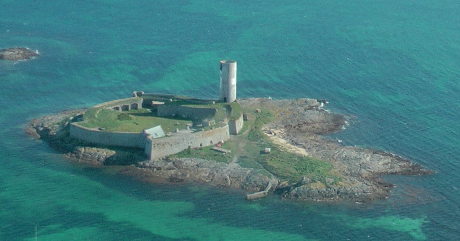
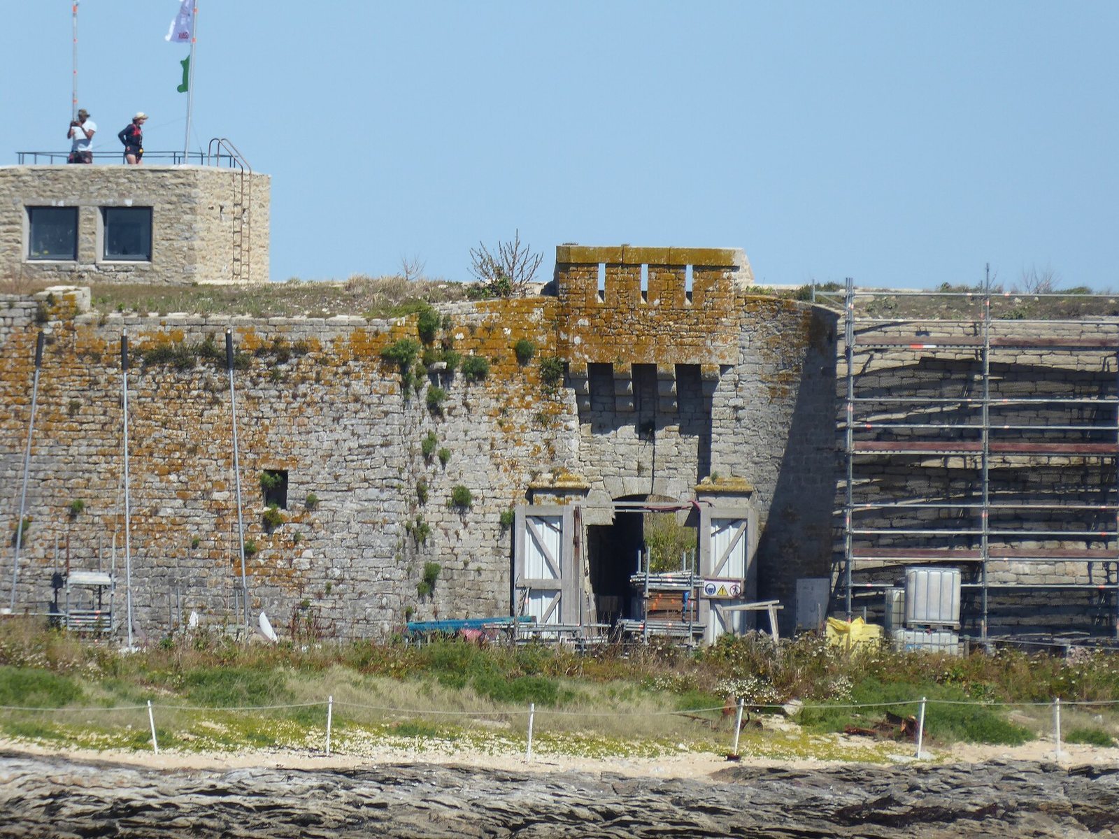
Fort Cigogne occupies a natural rise across the eastern half of Île Cigogne, the highest point in the Glénan archipelago. Its granite-faced defensive walls rise about seven metres. The plan combines western and southern projecting defenses with straight, non-projecting walls on the northern and eastern sides.
Bastions and artillery defenses
The western bastion has a concave face, while the southern one is convex. Both have broad artillery platforms edged by parapets, or protective walls, and vaulted casemates with outward-facing firing openings in most of them. The fort’s artillery was arranged in two batteries.
Entrance and supporting structures
Nineteenth-century works added a ditch and drawbridge at the western entrance, with a projecting defensive structure above the gateway. An artillery terrace occupies natural high ground to the east, and the artillery platforms were paved. Other installations included a bakery, prison cells, a well, an underground vaulted water cistern, and the hospital. A small masonry watch post stands on the western defensive wall. A tower at the southeastern corner housed latrines, while the 20-metre tower at the southwestern end of the southern wall now serves as a navigation mark. The fort’s structural condition is satisfactory.