Badbury Rings: An Iron Age Hillfort near Blandford Forum
Site at a Glance
- Country
- United Kingdom
- Primary era
- Iron Age
- Eras represented
- Iron Age, Classical
- Civilizations
- Roman
- Site type
- Military
- Remains
- Fort
On this page12 sections
History
Badbury Rings is an Iron Age hillfort, a defended enclosure on elevated ground, near Blandford Forum in the United Kingdom. It originated around 800 BC in the territory of the Durotriges, an Iron Age people of Dorset and surrounding parts of southern Britain.
Iron Age origins and decline
The fort does not appear to have been a principal settlement in the Early Iron Age. Excavated pottery belongs almost entirely to the Late Iron Age. The site was probably depopulated toward the end of that period, perhaps as the nearby settlement of Vindocladia developed.
Roman-period activity
A Romano-Celtic temple, combining Roman and local British religious and architectural influences, was in use from the first through the fifth centuries. Roman-period objects found at the hillfort also indicate activity there.
Vindocladia, about 1.5 km southwest of the fort, began as a late Iron Age settlement and continued into the Roman period. It is thought to be the place of that name in the Antonine Itinerary, a Roman list of routes and stopping places. A road through Vindocladia toward Dorchester was built in the later Roman period.
Reoccupation and early medieval conflict
Finds indicate that Badbury Rings was occupied again around AD 480 and around 520, perhaps as security declined. Bokerley Dyke, an ancient bank-and-ditch boundary northeast of the fort, was revived and may have helped keep Saxons out of Dorset during the fifth and sixth centuries.
Badbury Rings is one of three proposed locations for the Battle of Mount Badon, a conflict between Britons and Anglo-Saxons placed around AD 500. Nineteenth-century antiquarian writers advanced the identification. Local historian Roy Carr later suggested that a western army, perhaps based at the fort, might have deterred Saxons from crossing Bokerley Dyke. Carr also speculated that such an army could have contributed to the Arthurian legend, stories associated with King Arthur.
Soon after becoming king in 899, Edward the Elder brought an army to Badbury Rings to confront his cousin Æthelwold, who was based at nearby Wimborne Minster and disputed Edward’s claim to the throne.
Later history and investigation
John Leland, a sixteenth-century English antiquary, visited between 1538 and 1543. He described a castle associated with Saxon kings as entirely demolished, while noting that its ditches, hills, and location were still evident. He also mentioned rabbits inside the enclosure.
The site left private ownership in the early 1980s and is now part of the Kingston Lacy estate, owned by the National Trust. It has been a Scheduled Monument, a site protected by law in England, since 1924. The Royal Commission on the Historical Monuments of England began a survey in 1993. After vegetation was cleared from the summit and the conifer plantation was thinned in 1997, the survey was completed in 1998. Archaeologist Martin Papworth led the first excavations in 2004, when three test trenches were dug.
Remains
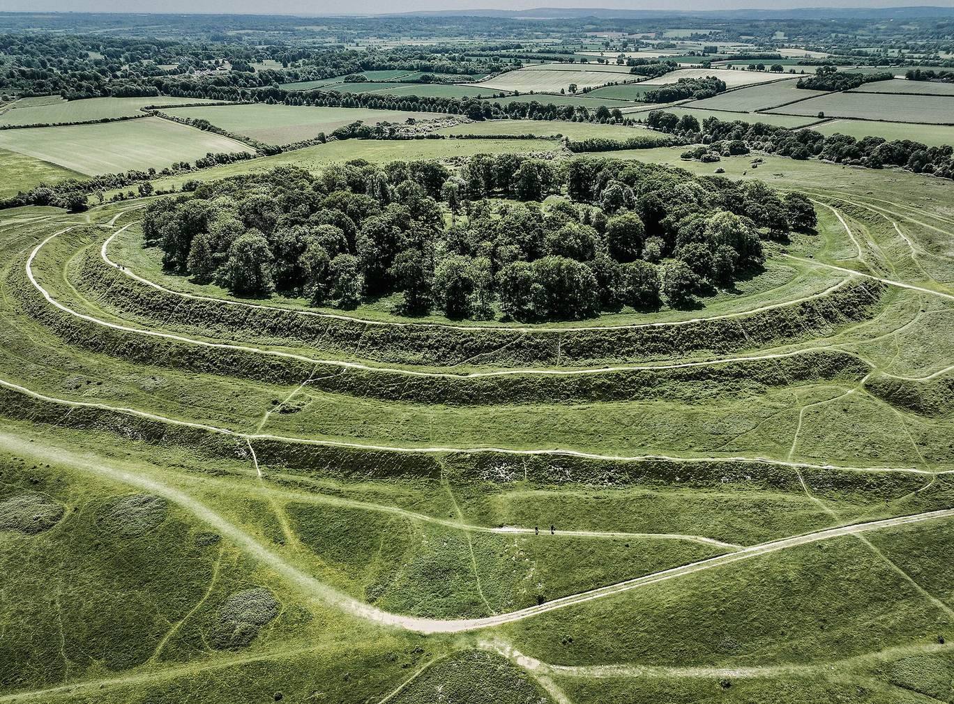
Set about 100 m above sea level on a slope of Cranborne Chase, Badbury Rings is organized around an earthwork enclosure enlarged in two stages. The surrounding archaeological landscape also includes prehistoric burial mounds and Roman-period roads and a temple.
Hillfort and prehistoric features
Earthwork defenses
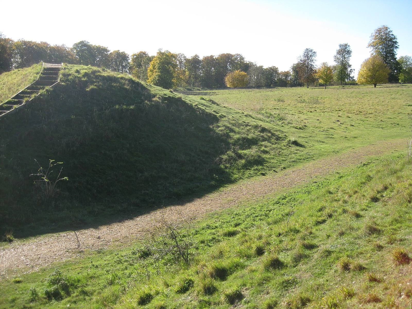
The first enclosure covered 7.3 hectares and was defended by two raised banks with two ditches inside them. In a later stage, the enclosed area expanded to 16.6 hectares, more than twice its original size, with an additional outer bank and ditch. Twenty-eight depressions within the defenses have been considered possible hut sites, although some may instead have formed when trees were uprooted.
Burial mounds and carved stone
Four Bronze Age burial mounds lie near the fort, indicating earlier use of the area. A stone in one mound bears carvings of daggers, inward-curving axe-shaped triangles, and cup-and-ring marks, designs made from hollows and surrounding circles. The carvings resemble those on Stone 53 at Stonehenge.
Roman-period features
Road junction
Five Roman roads met on the north side of the hillfort. A military road from the fort at Lake Farm, about 4 km southeast, passed along the hillfort’s northeast side and continued northwest toward Hod Hill. It joined Ackling Dyke, a Roman road running northeast toward Old Sarum. Other routes led north-northwest toward Bath, south to a small port in Poole Harbour at modern Hamworthy, and southwest through Vindocladia toward Dorchester. The southwestern route remains in use as a track on the west side of Badbury Rings.
Temple west of the fort
The temple site immediately west of the hillfort lies within a many-sided boundary bank visible in aerial photographs. Excavations in 1900 and 1952, followed by further work in 2000, recovered stone roofing slabs and painted wall plaster. Other finds included more than 185 Roman coins, 21 silver and bronze coins of the Durotriges, pottery, glass beads, bronze pins, a bracelet, and a brooch.