Alcazaba of the Alhambra: The Fortress of Granada
Site at a Glance
- Country
- Spain
- Primary era
- Medieval
- Eras represented
- Medieval, Early Modern, Modern
- Civilizations
- Crown of Castile, Nasrid, Spanish, Taifa Kingdoms
- Site type
- Military
- Remains
- Citadel
On this page24 sections
History
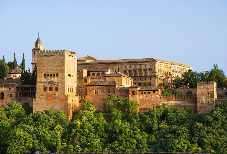
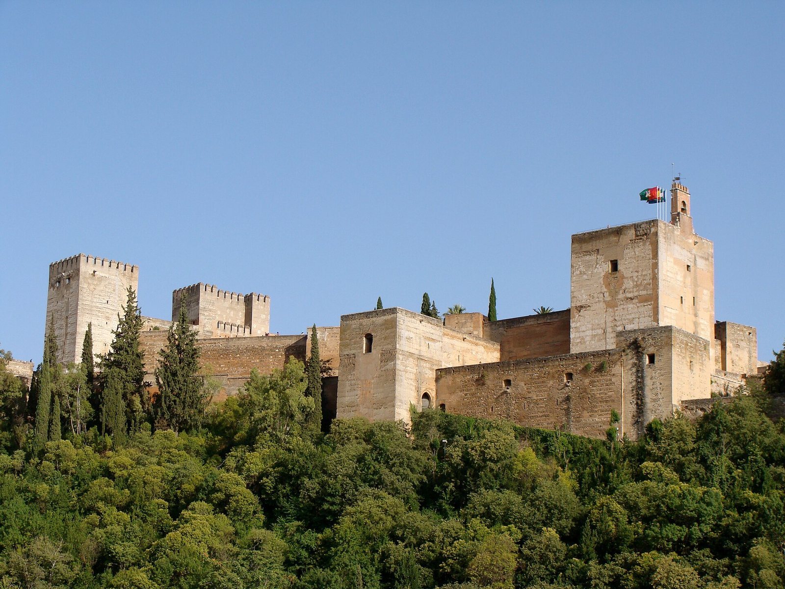
The Alcazaba of the Alhambra is a fortress in Granada, Spain, at the western end of Sabika Hill and the oldest surviving part of the Alhambra. The hill had been fortified since the ninth century. The fortress took its principal form from 1238, when Muhammad I Ibn al-Ahmar began building a new citadel as Granada became the center of his emirate, a state ruled by an emir.
Early hilltop fortifications
Before the present fortress, a smaller citadel stood on Sabika Hill. A cistern supplied water, while a walled route with towers descended to the Darro River, where soldiers could collect it. The citadel on the Albaicín was linked with fortifications on Sabika and Mauror hills. In the eleventh century, Granada became the center of a Zirid kingdom, whose rulers lived in a citadel and palace on the Albaicín. An earlier fortress called Gharnata stood south of the river, in a predominantly Jewish settlement also known as “Gharnata of the Jews.”
The Sabika stronghold became a refuge for forces resisting the Almoravids in 1145 and opponents of the Almohads in 1167. These were successive ruling powers in medieval Iberia. After taking the fortress, the Almohads repaired damage to it.
Nasrid foundation
In 1238, Muhammad I, founder of the Nasrid dynasty, made Granada the capital of a new emirate. He first lived in the old Zirid citadel on the Albaicín, then moved to Sabika Hill a few months later and began establishing the Alhambra. The new Alcazaba reused some foundations from the earlier fortification. A wall enclosed the rest of the hill, and an aqueduct completed that year supplied water for further building.
Muhammad I did not finish a major new palace. He may initially have lived in the building now called the Torre del Homenaje, or Tower of Homage, before moving to a modest house on the site of the present Palace of Charles V.
Conquest and later military use
Tradition holds that Castile’s flag was raised over the Torre de la Vela when Granada and the Alhambra surrendered to the Catholic Monarchs, Ferdinand II of Aragon and Isabella I of Castile, on 2 January 1492. Spanish work to strengthen the fortress against gunpowder artillery began that year and was mostly complete by about 1589. The Alcazaba saw little military action despite these defenses. After the Morisco Rebellion of 1568–1571, an uprising involving Muslims forcibly converted to Christianity and their descendants, and the expulsion of the Morisco population in 1609, Granada and the Alhambra faced few threats.
Since the conquest, the bell on the Torre de la Vela has sounded alarms, marked regular hours by day and night, and announced special occasions. These included the Day of Conquest, commemorating the surrender on 2 January 1492. The bell became a symbol of Granada and entered the city’s coat of arms in 1843. Lightning destroyed its bell housing, which was rebuilt in 1882.
Excavation and conservation
In the early twentieth century, archaeologists cleared rubble from inside the fortress and excavated its former residential district. Repairs and restoration followed, especially during the tenure of Leopoldo Torres Balbás, the site’s architectural conservator from 1923 to 1936. The Alhambra, including the Alcazaba, became a UNESCO World Heritage property in 1984.
Remains
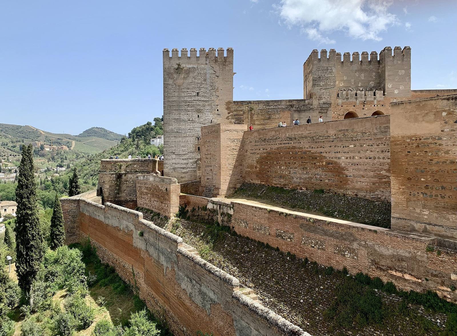
The fortress has an approximately triangular plan. The Torre de la Vela stands at its western point, the Torre del Homenaje at the northeast, and the Torre Hueca at the southeast. Within the enclosure lie the remains of a residential district, while the principal entrance faces east toward the rest of the Alhambra. Most of the walls consist of compacted earth; builders also used lime-based concrete, brick and stone in particular parts of the structure.
The enclosure and its defenses
Northern walls
Up to three lines of defense protected the northern side. The tall inner wall joins the Torre del Homenaje to the Torre de la Vela and includes three small rectangular towers or projecting defenses whose foundations date probably to the Zirid period. Below it, an outer wall encircles the Alcazaba. A further wall belongs to the Alhambra’s perimeter defenses and protects the route from the city toward the interior, which passes through the Puerta de las Armas, or Gate of Arms. A ruined building near that gate once contained stables. The southern and eastern sides of the Alcazaba also stand behind an outer wall.
Inner fortress entrance
The entrance to the inner fortress was concealed at the base of the Torre del Homenaje. A ramp with several turns led to a gate with a bent passage, partly open to the sky. The winding approach restricted views into the fortress and slowed attackers; through its open section, defenders could throw projectiles down at them. A walkway within the outer defenses links the Puerta de las Armas with this entrance.
Wall construction
Compacted earth forms most of the walls, with lime-based concrete used as a binder, particularly at the foot of load-bearing sections. Brick appears in interior areas and decorative details, while stone was used for the inner-fortress gate. The outer bases of defensive walls generally have a sloping reinforcement.
Towers
Torre del Homenaje
At the northeastern corner, the Torre del Homenaje is the Alcazaba’s tallest tower, and its terrace marks the fortress’s highest point. The tower rises 26 metres from a base measuring 12.12 by 10.46 metres. It served as the principal fortified tower and military command post, from which Nasrid commanders coordinated the Alhambra’s defenses. Its terrace could send visual signals to other watchtowers, possibly with mirrors or smoke. Five floors have different arrangements of arched ceilings. One housed the commander of the Alhambra’s guards in a residence organized around a courtyard.
Torre Quebrada and Torre Hueca
The eastern wall runs from the Torre del Homenaje to the Torre Hueca, with the tall, broad, rectangular Torre Quebrada midway along it. Yusuf I, a Nasrid ruler whose reign lasted from 1333 to 1354, added the Torre Quebrada in the fourteenth century. The smaller Torre Hueca stands at the wall’s southern end and is also called the Torre del Adarguero, or Tower of the Shieldmaker.
Torre del Cubo
At the northern foot of the Torre del Homenaje, the Torre del Cubo has a rounded outer profile. Built during the Christian Spanish period to improve protection against gunpowder artillery, it was constructed around the square Nasrid-era Torre de la Tahona, or Flourmill Tower. That earlier tower formed part of the now-vanished Puerta de la Tahona, or Flourmill Gate.
Torre de la Vela
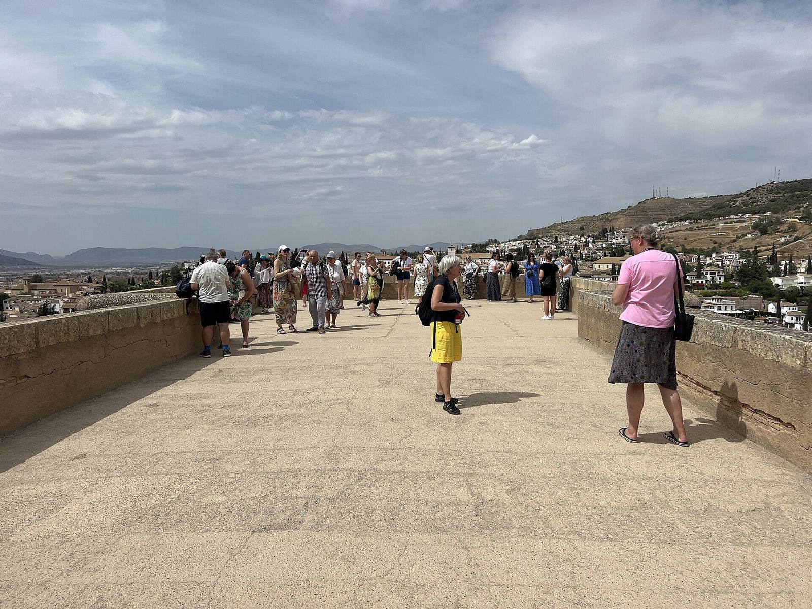
The massive, square Torre de la Vela dominates the fortress’s western end. Once also called the Torre del Sol, or Tower of the Sun, it has a large terrace with extensive views. Inside are four levels of chambers. Each has a central room with an arched ceiling, surrounded by galleries with brick pillars and further arched ceilings. The rooms grow larger higher up, allowing the outer walls to become thinner toward the top and reducing the weight they carry. The Nasrid-period stairway probably occupied a different position from the present stairway.
Bell of the Torre de la Vela
The bell gives the Torre de la Vela its alternative name, Torre de la Campana, or Bell Tower. It stood at the northeastern corner of the terrace before being moved to its present central-western position in 1840. Replacement bells were installed in 1569, 1598, 1624, 1640, 1655 and 1755; the bell from 1755 is described as the one still in use.
Western and southern defenses
Revellín and connections to the city
A broad projecting fortification known as the Revellín, an outlying defensive work, extends from the western foot of the Torre de la Vela toward the city. It existed by at least the fifteenth century, though its earlier history is uncertain. Nearby are traces of a former connection to the city and an earlier Alcazaba entrance. Later extensions of the wall partly cover the entrance’s horseshoe-shaped arch and brick ceiling. Another wall links the Revellín to the Torres Bermejas, an outlying fortification on Mauror Hill south of the Alhambra.
Torre de la Pólvora
The small Torre de la Pólvora, or Gunpowder Tower, stands at the southern foot of the Torre de la Vela. In the sixteenth century, builders strengthened it with a thicker projection that could resist artillery and hold cannon. The tower also watched nearby walls and fortifications and protected the flank of the Torre de la Vela. Its original protected exit for defenders now lies beneath the eastern rampart of the Garden of the Ramparts.
Garden of the Ramparts
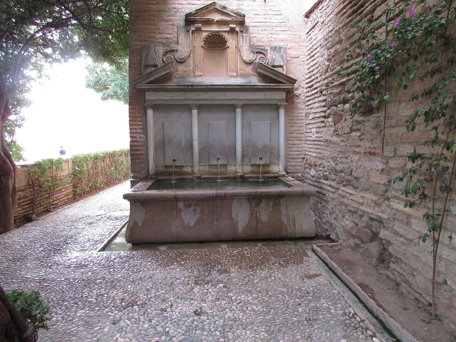
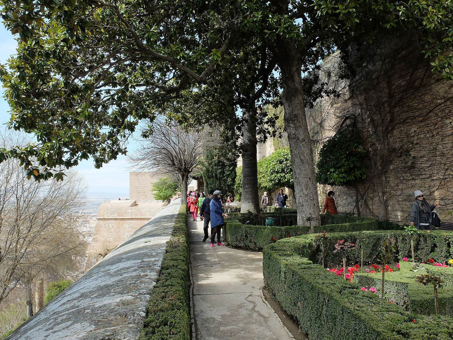
The Garden of the Ramparts occupies the top of the outer southern rampart, along the base of the inner fortress wall. During sixteenth-century defensive work, builders filled the ditch between the rampart and inner wall and constructed a new brick rampart with curved protective wall tops. The work probably took place between 1550 and 1555, and the platform could hold light artillery. The rampart was later converted into a garden, possibly around 1628, when its first wall fountain was built.
A fountain stands at the garden’s western end. At the eastern end, a wall fountain bears figures of genies riding dolphins. The central fountain has arabesque ornament, flowing interlaced designs combining plant-like and geometric forms. It was made in 1624 as an extension to the fountain in the Alhambra’s Court of the Lions. When that fountain was restored to its presumed original form in 1954, the extension was removed and transferred to the garden.
Military Quarter
Houses north of the main street
Excavated foundations mark the small residential district inside the inner fortress, known as the Military Quarter. A long, narrow street runs east to west through its center, dividing the district into two zones. North of the street stood roughly ten to seventeen houses, laid out in similar ways but varying in size. Each had a bent entrance that shielded the interior from direct view, and rooms arranged around a courtyard with a fountain, pool or other water feature. A water-storage cistern supplied each house’s latrine. The homes accommodated the Alhambra’s elite guards and their families.
Buildings south of the street
On the southern side of the street, a more regularly arranged group of buildings may have served as storehouses or housed younger troops and guards. At the district’s western end stood a bathhouse, a large cistern serving the neighborhood, and a communal kitchen for preparing food and rations. The cistern was rebuilt in the sixteenth century.
Underground chambers
Chambers beneath several parts of the military enclosure served as dungeons and storage pits. During Nasrid rule, the dungeons held Christian prisoners of war, including captives of high status. The chambers had domed or bell-shaped interiors and openings at the top through which prisoners were lowered. Brick partitions radiating from the bottom divided the space into sleeping areas.