The Necropolis of Pantalica: A Prehistoric Burial Landscape in Sicily
Site at a Glance
- Country
- Italy
- Primary era
- Iron Age
- Eras represented
- Iron Age, Classical, Medieval, Modern
- Civilizations
- Byzantine, Italian
- Site type
- Burial
- Remains
- Necropolis
On this page29 sections
History
The necropolis of Pantalica is a prehistoric burial and settlement landscape near Sortino in Sicily, Italy. Its archaeological sequence begins around the 13th century BC and continues, with interruptions, into the Middle Ages. Pantalica was a major center in eastern Sicily and is especially important for understanding the island’s transition from the Bronze Age to the Iron Age.
Bronze Age and Iron Age communities
During the first half of the 13th century BC, coastal communities in Sicily moved inland to more defensible places amid disruption and attacks. The arrival of the Sicels, an ancient people of Sicily, and other Italic groups has been proposed as one cause, but the reasons coastal settlements disappeared remain uncertain. Pantalica’s steep, naturally protected position likely made it a refuge.
From about 1250 to 650 BC, Pantalica flourished as a major regional center. Its people farmed and raised animals, while the elevated site gave them access to pasture, woodland, and cultivated land. Archaeologists divide the settlement’s early cultural sequence into Pantalica I, dated to 1200–1000 BC, Pantalica II, dated to 1000–850 BC, and Pantalica III, dated to 850–750 BC. A small number of tombs belong to the later Finocchito culture, dated to 750–700 BC.
Around 1050 BC, many people moved to the Cassibile area, where the Pantalica II phase developed, and few new tombs were made at Pantalica during this interval. The site regained importance in the first half of the ninth century BC. Contact with the coast during this period brought Phoenician influence in trade and style. Around 850 BC, Sicel communities also moved from the coast into Sicily’s more remote interior.
Greek expansion and the end of Pantalica’s prominence
Pantalica has been linked by some archaeologists to ancient Hybla, a Sicel kingdom ruled by Hyblon, but the site’s ancient name is uncertain. Paolo Orsi first identified it with Erbesso; later interpretation favored Hybla. In the foundation tradition for Megara Hyblaea, Hyblon allowed Megarean settlers led by Lamis to establish a city in his territory around 729 BC.
Greek settlement in Sicily brought both contact and conflict over territory. Syracuse expanded inland and founded Akrai in 664 BC, a development that appears to have ended Pantalica’s prominence. Syracuse may also have destroyed the settlement, although this is uncertain. Finds show that some people remained at Pantalica in classical antiquity, including during the fourth and third centuries BC.
Medieval reoccupation
People returned to Pantalica in the early Middle Ages. From the sixth to the ninth centuries AD, communities sought shelter in the area during incursions, adapting caves as homes and places of worship. Three small settlements with churches are associated with this period, along with the installation of a military unit. Cave homes and chapels remained in use during the Arab conquest of Sicily and under Norman rule. The Byzantine period, the medieval era of the Eastern Roman Empire, forms an important part of this later settlement history.
The Norman-era chronicler Goffredo Malaterra described an Arab community at a place called Pantargia in 1092. A papal bull issued by Pope Urban II in 1093 referred to Pentargia and the Diocese of Syracuse. Pantalica was probably largely deserted after the 12th century. Its name may derive from the Arabic word Buntarigah, meaning caves, and may have come into use during the early Middle Ages or the Arab period.
Archaeological investigation and protection
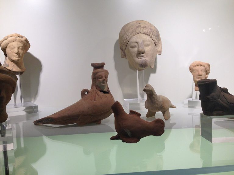
Paolo Orsi carried out systematic archaeological investigations from 1895 to 1910, after many tombs had been looted. Luigi Bernabò Brea continued work in the 1950s, including excavations at the Anaktoron from 1957 to 1971. Finds from the tombs are held at the Paolo Orsi Archaeological Museum in Syracuse. In 2005, Pantalica was inscribed on the UNESCO World Heritage List together with Syracuse. The archaeological area also lies within a nature reserve established in 1997.
Remains
Pantalica occupies a limestone plateau about 424 metres above sea level, covering approximately 205.86 hectares. Its summit is about 1,200 metres long and 600 metres wide. Deep gorges formed by the Anapo River to the south and its tributary, the Calcinara, to the north enclose the plateau; the rivers meet in the area. The archaeological landscape combines separate cemetery areas, settlement remains, and rock-cut features across the plateau and its slopes.
Approach and defenses
The principal approach is through the Filiporto saddle on the southwest side. A fortified entrance and a defensive ditch protected this route. The ditch was cut into the limestone across the promontory at its narrowest point. It probably dates to classical antiquity and reflects Greek military design; a connection with a policy of Dionysius of Syracuse has been proposed. During the Byzantine period, the defenses were enlarged and a tower was added. The Anaktoron stands at the highest point of the archaeological area.
Rock-cut cemeteries
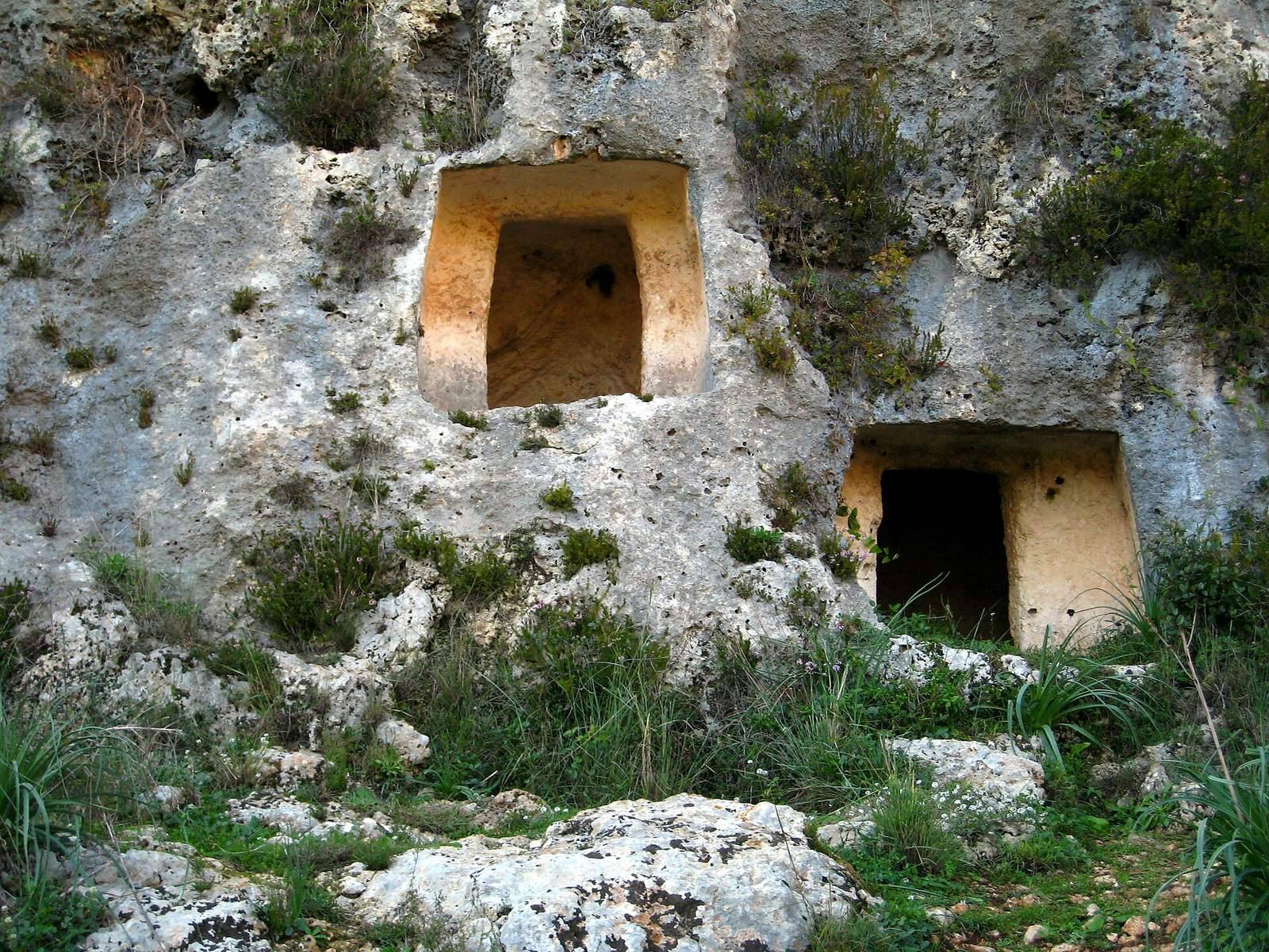
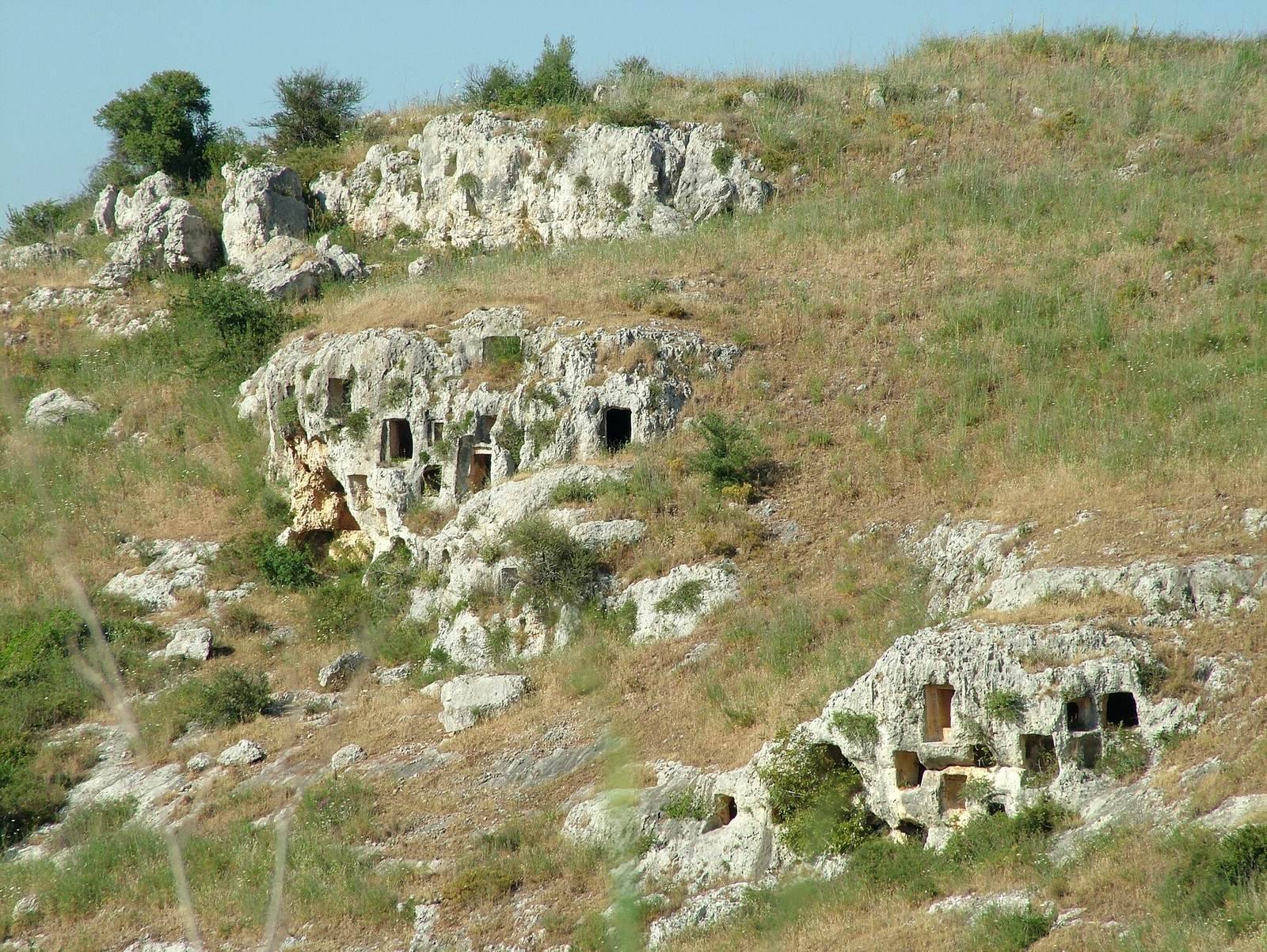
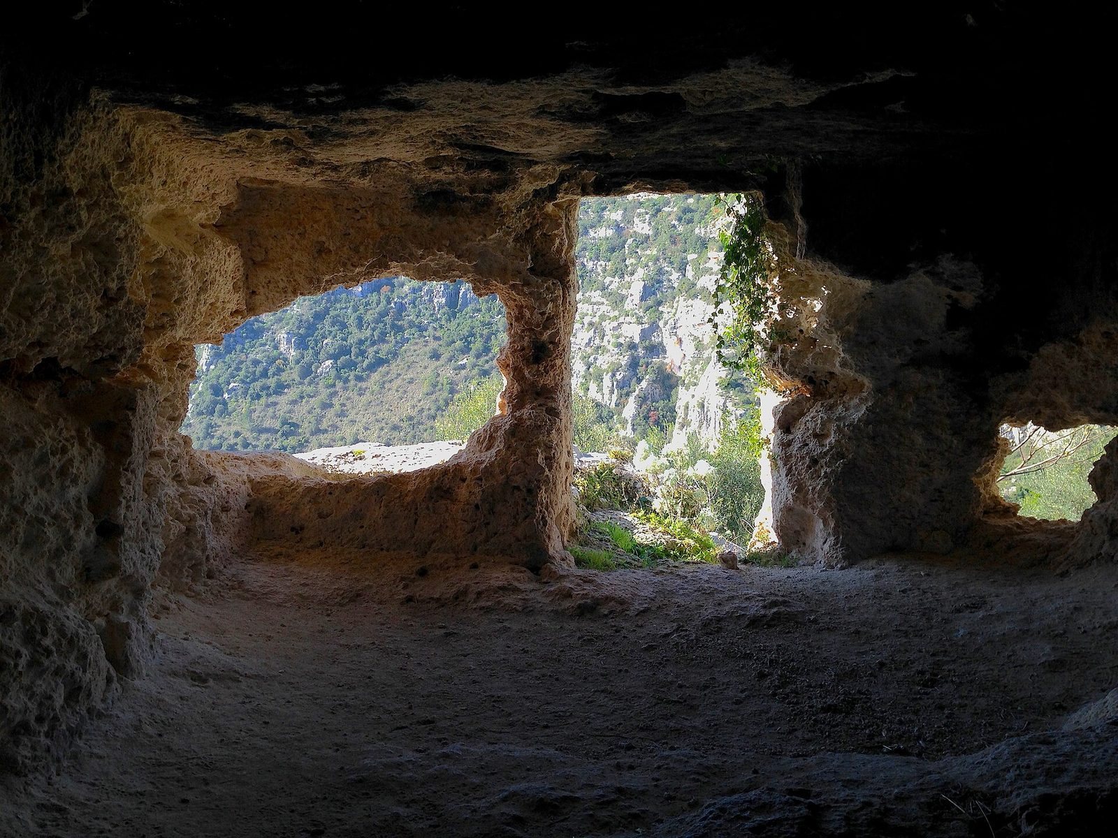
The necropolis consists of several distinct cemetery areas rather than one continuous burial ground. The total number of tombs, once estimated at more than 5,000, is now considered to be just under 4,000. Further tombs lie across the Anapo and Calcinara. Most are underground chambers cut into the plateau’s slopes. Some have a short entrance passage leading through a roughly 1.5-metre rectangular opening, which could be closed with a large stone or dry-stone masonry. Burial chambers sometimes connect to additional rooms cut into their side walls.
North cemetery
The North cemetery is the largest and most densely occupied burial area, with roughly 1,000 tombs. Dating mainly to the 12th and 11th centuries BC, it is associated with Pantalica I.
North-West cemetery
Also among the earliest burial areas, the North-West cemetery belongs to Pantalica I. It extends for about a kilometre and contains approximately 600 tombs arranged in five main groups.
Filiporto cemetery
The Filiporto, or south-western, cemetery is associated mainly with the later settlement phase of the ninth and eighth centuries BC, especially Pantalica III. It spreads across the slopes and into the Anapo basin and contains almost 1,000 tombs.
Cavetta cemetery
The Cavetta burial area, mainly dated to the ninth and eighth centuries BC, includes about 300 tombs on the plateau’s eastern side and another 150 on the slopes opposite. Byzantine dwellings also occupy this part of the site.
South cemetery
The South cemetery extends for about a kilometre and contains roughly 700 tombs in three groups. Most date to the ninth and eighth centuries BC, although some belong to Pantalica I.
San Martino cemetery
San Martino combines prehistoric beehive-shaped vaulted tombs, known as tholos tombs, with Byzantine catacombs. The fourth- or fifth-century AD Hypogeum of Dionysius is an underground burial chamber with an entrance inscription. It identifies Dionysius as a priest who served in a church for 34 years. The nearby Cave of Saint Anne probably dates from the 11th to the 13th centuries and retains partly recognizable fresco figures of Saint Mary, Saint Peter, and Saint Anastasia. Canopy-shaped tombs are also present in the associated burial areas.
Tomb forms and grave goods
Pantalica I
Tombs of Pantalica I generally have round or oval chambers; some of the larger examples include an entrance passage. Finds include red-burnished wheel-made pottery, two-handled jars, water vessels, bowls, and containers with sieve-like mouths. Other objects include basalt axes, bronze mirrors, daggers influenced by Mycenaean styles, clothing brooches, and gold rings and earrings decorated with eye and fish motifs.
Pantalica II
Pantalica II tombs have round chambers. Their associated pottery includes painted vessels, slant-sided buckets, small containers, and large storage jars. Bronze axes and numerous clothing brooches, mainly bow-shaped, are also among the finds.
Pantalica III
Pantalica III tombs have rectangular chambers with flat roofs. Associated pottery is wheel-made and painted or incised, with bowls and bulb-bodied jugs among its forms. Brooches remained common, alongside spiral examples and rings made of bronze and iron.
The Anaktoron
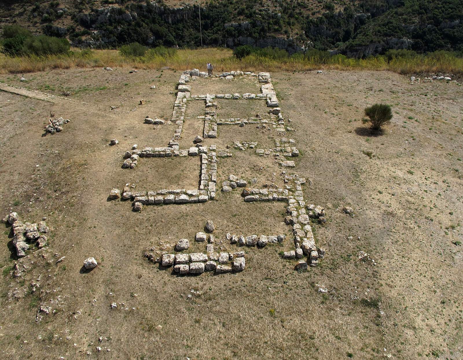
The Anaktoron, also called the Prince’s Palace, is a multi-roomed building of large stone blocks near the plateau’s summit. Its name refers to a ruler’s palace or residence. The structure has a hall-like plan with several rectangular rooms, and its base measures about 37.5 by 11.5 metres. It is the only substantial prehistoric stone building identified on the plateau. Its date and origins remain debated, although it is generally assigned to the early Pantalica I phase. A design influenced by Mycenaean architecture, built by Mycenaean workers for a local ruler, has been proposed.
Bronze weapons and traces of a foundry found inside the building have prompted the suggestion that its ruler controlled metal production. Byzantine roof tiles and pottery show that the building was used again in the medieval period. It was altered, coated with lime, and given a cement floor. In 1903, a bronze vessel containing thousands of gold coins and jewellery was found in the area. The hoard had been buried since the late seventh century BC; most of it was lost because it was not recovered through an official excavation.
Medieval settlements and chapels
Filiporto dwellings
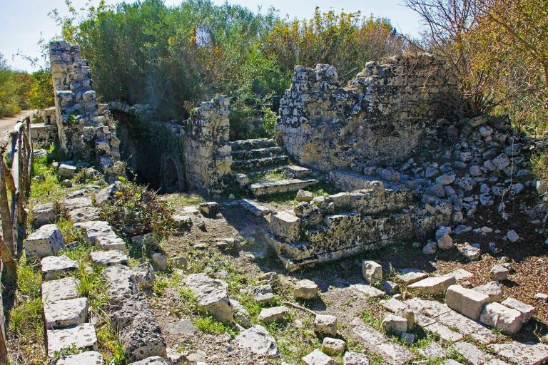
Near Filiporto, a Byzantine settlement consisted of about 150 dwellings. The small houses had one or more rooms, and some were formed by joining caves.
Chapel of San Micidiario
At the edge of a precipice, the chapel of San Micidiario has at least four spaces: a sanctuary, an area for worshippers, and two side rooms for clergy. A faint fresco in the sanctuary shows Christ as ruler of all, between two angels. Paintings on the side walls have largely disappeared. The surviving fresco appears to have a reddish lower layer and a turquoise upper layer, while the ceiling has two slopes. A partly legible inscription may name Saint Mercurius. One side room contains tombs in its floor.
Cavetta settlement and church
The Cavetta settlement includes about 70 dwellings and a two-room chapel dedicated to the Crucifixion. Surviving paintings depict the Crucifixion, Saint Nicholas, and Saint Barbara. The rock-cut church known as the Grotta del Crocifisso has a rectangular apse and remains of a Crucifixion image and a depiction of Saint Nicholas. An image of an unidentified saint from the church is now kept at the Paolo Orsi Museum.
San Nicolicchio settlement
A third settlement lies below the Anaktoron, with the chapel of San Nicolicchio as its religious center. The chapel has a complex plan and damaged frescoes. Fragments depicting Saint Helena and Saint Stephen remain; the paintings date to the seventh century AD.
Giarranauti village
At Giarranauti, a wooded area on the upper plateau, remains include a Byzantine village dated to the sixth through eighth centuries AD, a tannery, and millstones cut into the rock.
Caves and later infrastructure
Bat Cave
The natural Bat Cave lies in the valley beside the Calcinara. A passage about 12 metres long leads from its entrance into a chamber inhabited by bats.
Cave of the Star
The Cave of the Star is near the Cassaro entrance, in rock walls facing the Anapo. Traces of human activity were identified there in 2012. A prehistoric rock-cut temple has been proposed as one possible use.
Anapo valley railway
Built in the early 20th century to connect coastal and inland areas, the Anapo valley railway passed through Pantalica and had a stop named Necropolis of Pantalica. It operated until the 1950s and was dismantled in 1956. Some tunnels and railway buildings survive, including a restored station.