Seoul City Wall: The Defensive Circuit of Joseon’s Capital
Site at a Glance
- Country
- South Korea
- Primary era
- Medieval
- Eras represented
- Medieval, Early Modern, Modern
- Civilizations
- Joseon
- Site type
- Military
- Remains
- Wall
On this page16 sections
History
Seoul City Wall, also known as Hanyangdoseong, is a defensive circuit in Seoul, South Korea, begun in 1394 and completed in its initial form in 1396 by the Joseon dynasty (1392–1897). It enclosed Hanseong, the dynasty’s capital, distinguishing its built-up center from the suburbs beyond. Palaces, government offices, markets, residences, and important ritual sites lay within the capital’s wider area.
Founding and construction
After the capital site was chosen in 1394, construction began on its palaces, government buildings, and wall. The following year, King Taejo established a bureau to direct the work and tasked the statesman Jeong Do-jeon with surveying and measuring the route. Sim Deok-bu oversaw the initial construction. In 1396, about 118,700 laborers built the wall in 98 days. Its route was divided into 97 sections, each identified by a character from the Thousand Character Classic, a text made up of 1,000 distinct characters. Eight gates and a water gate were completed that year.
Repairs and defense under Joseon
In 1422, King Sejong ordered a major repair that replaced earthen stretches with stone. About 322,400 workers and support personnel took part over 38 days. Winter conditions led to injuries and desertions. Four treatment stations were established, while first-time deserters faced 100 strokes and repeat offenders faced execution. Further repairs followed in 1451. The Imjin War, Japan’s invasions of Korea from 1592 to 1598, damaged sections of the wall; repairs were carried out in 1616.
The wall was damaged again during the Qing invasion of 1636–1637, when the Qing dynasty attacked Joseon. The settlement that followed prohibited rebuilding or repairing it, leaving damaged portions unrestored for a time. At the urging of the Minister of Personnel, repair work resumed in 1704. Laborers from the Five Military Commands, Joseon’s central military organizations, continued rebuilding and repairs through 1711. Further work took place in 1743, and partial repairs were ordered under several later kings, including Hyojong, Hyeonjong, Yeongjo, and Sunjo. Much of the wall’s surviving fabric reflects construction or repair during the reigns of Taejo, Sejong, Sukjong, and Sunjo.
The wall formed part of a broader defense system that included beacon mounds. Established in 1394 and operated until 1894, the network relayed warnings across the country with smoke by day and fire at night. Signals reached the beacon on Namsan and were then passed to the royal palace. One fire indicated normal conditions; two meant an enemy had been sighted; three, that it was approaching the border; four, that it had crossed the border; and five, that fighting was taking place there.
The wall also marked a division between the capital’s built-up center and its outer suburbs. Hanseongbu, the government responsible for the capital, administered the suburbs, but their residents could also be required to work for neighboring Gyeonggi Province. Around 1788, their labor obligations were clarified as belonging solely to Hanseongbu. During the Joseon period, people also walked around the wall to take in views inside and outside the capital. This leisure practice, called sunseong, could take a full day, particularly in spring and summer.
Demolition and loss
In 1907, officials including Yi Wan-yong advocated removing the wall, and a committee was formed to oversee demolition. Work began that year, affecting the stretch north of Sungnyemun and including the filling of the South Pond. In 1908, sections beside Heunginjimun were demolished, as were 77 kan of wall around Souimun and Sungnyemun. These removals were associated with tram-line construction. Later tram routes between Seodaemun and Cheongnyangni, and between Gwanghwamun and Yongsan, led to further losses near Seodaemun, Dongdaemun, and Sungnyemun. Colonial-era urban planning and the Korean War brought further damage; most sections on level ground were demolished during the colonial period.
Restoration and modern status
A large-scale restoration campaign began in 1974 after President Park Chung-hee directed that national defense heritage be preserved and repaired. Work included rebuilding damaged wall and parapet sections and restoring Gwanghuimun’s gate tower from 1975. By September 2012, 12,771 metres, or 69 percent of the wall’s total 18,627 metres, had been restored. About 70 percent of the wall remained in 2013.
Seoul City Wall was designated a Historic Site of South Korea in 1963, and its official designation name changed from Seoul City Wall to Hanyangdoseong in 2011. Sungnyemun and Heunginjimun also hold national heritage designations, as National Treasure No. 1 and Treasure No. 1, respectively. The wall entered UNESCO’s World Heritage Tentative List in 2012, a preliminary stage rather than World Heritage inscription; an inscription bid did not proceed in 2017. In July 2024, heavy monsoon rain caused about 30 metres of wall near Baegak Shelter to collapse.
Remains
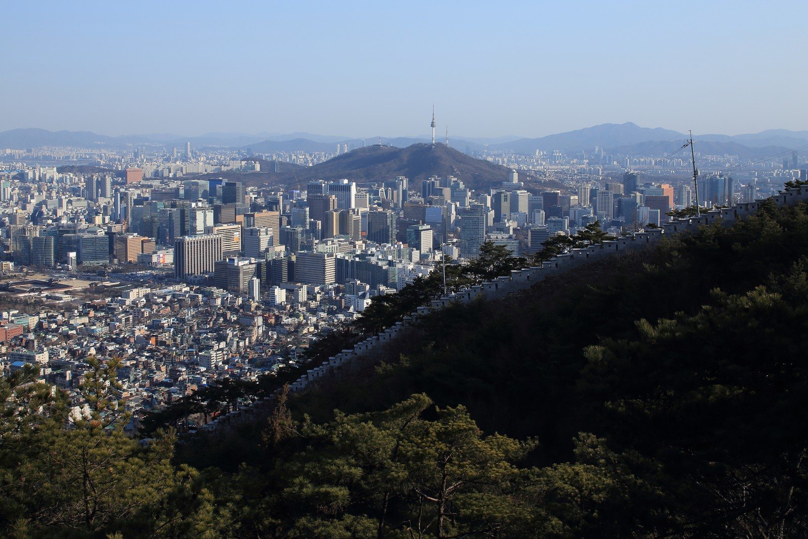
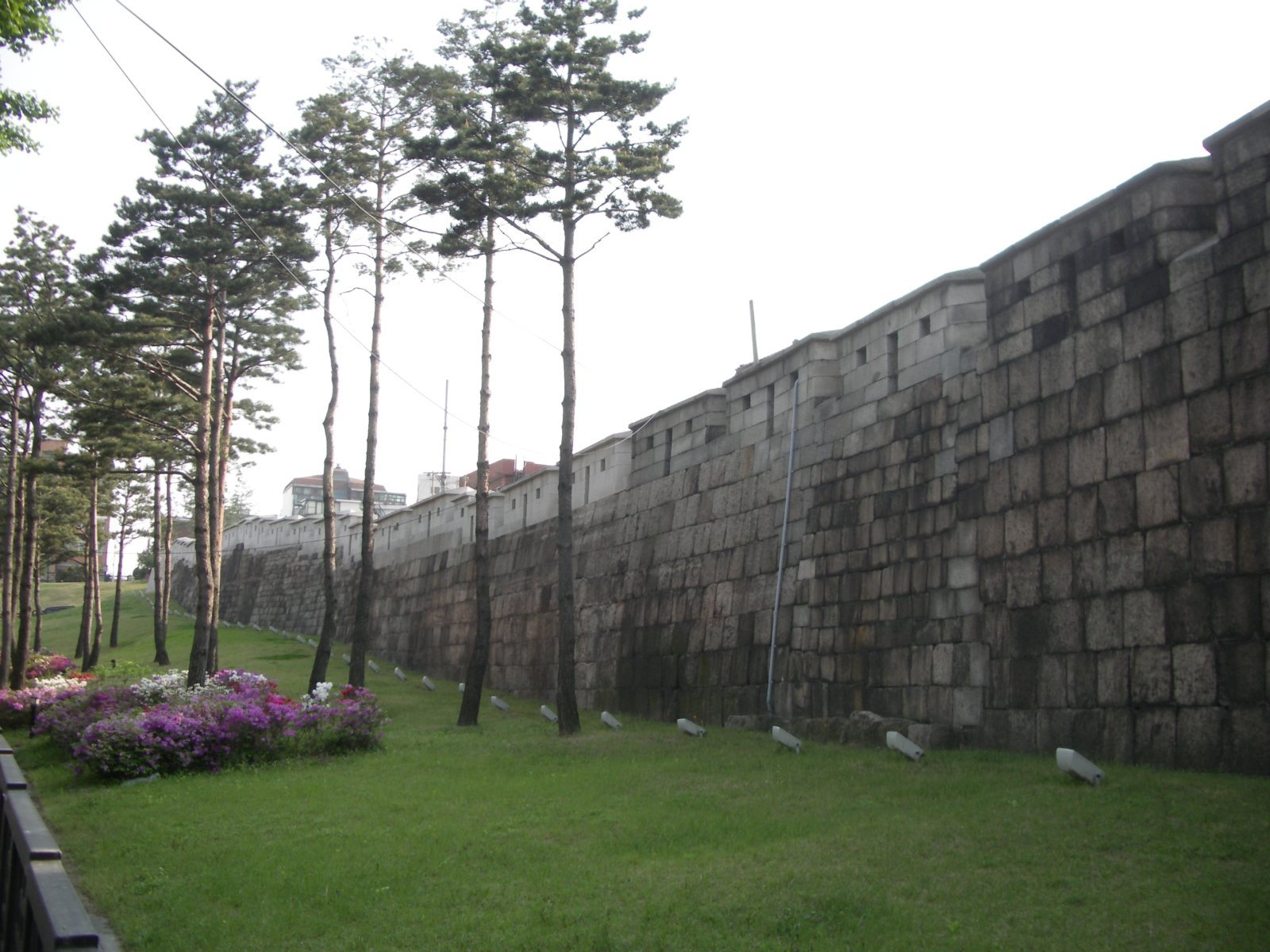
The original circuit extended for 18,627 metres along the ridges of Bukaksan, Naksan, Namsan, and Inwangsan, combining mountain defenses with sections across level ground. Its course followed the terrain. Stonework formed the exterior, with layers of rammed earth, soil compacted in layers, on the inner side. The enclosed area included the capital’s palaces, ancestral shrine, state altar, government facilities, markets, and residential districts.
Wall form and defensive features
Stonework and construction
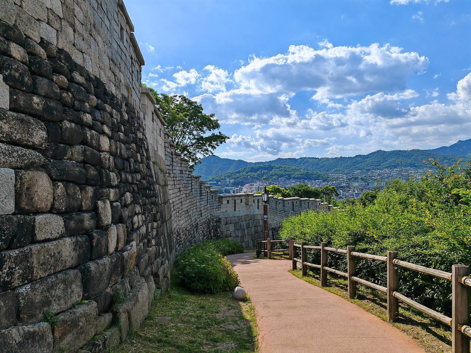
The earliest wall sections used roughly shaped natural stones, with larger blocks at the base and smaller ones higher up. The stones were generally rounded and medium-sized, and mud filled the joints. Later stone sections used rectangular blocks fitted together more closely. Still later repairs employed more regularly cut rectangular stones; broad, uniform slabs are associated with the rebuilding begun in 1704.
Gates, bastions, and water gates
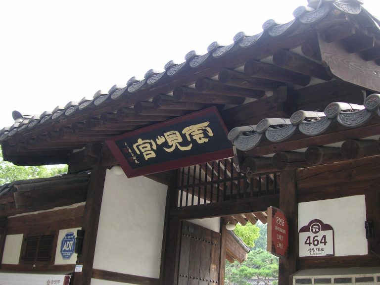
The eight gates were set around the circuit: Sukjeongmun to the north, Hyehwamun to the northeast, Heunginjimun to the east, Gwanghuimun to the southeast, Sungnyemun to the south, Souimun to the southwest, Donuimun to the west, and Changuimun to the northwest. Heunginjimun is also known as Heunginmun, while Donuimun is commonly called Seodaemun and Sungnyemun Namdaemun. The surviving forms of Sungnyemun and Heunginjimun are original or restored. A water gate also formed part of the circuit.
Because the ground east of the city was lower and more exposed to attack, a projecting defensive bastion, a section extending outward from a wall, was added beyond the gate. Between Heunginjimun and Gwanghuimun, the wall took a rectangular outward bend. Five further bastions were planned in 1752 and completed in 1753: four north of Gwanghuimun and one to its south. The northern group included sites between Heunginjimun and Cheonggyecheon, between Cheonggyecheon and the present Dongdaemun Design Plaza site, at the plaza site, and at Hanyang Technical High School. The bastion north of Cheonggyecheon was demolished along with Ogansumun in 1907.
Inscriptions on the wall
Inscribed stones preserve information about how construction and repair work was assigned. Early sections were marked with characters from the Thousand Character Classic. In 1422, work areas were reassigned by province, and some stones named counties or marked the start of a section. From the reign of Sukjong onward, inscriptions increasingly named the people responsible for repairs.
On the Bukaksan ridge, at a point 293 metres above sea level, an inscription on the parapet, the low protective wall along the top of a fortification, gives a date from Sunjo’s reign and names a commander, inspector, and foreman. A stone near Heunginjimun records supervisory and stone-working roles and a rebuilding date from Sukjong’s reign. It was moved to the eastern side of the wall during restoration, then returned to its original position in 2015.
Sixteen inscribed stones along the exterior wall from Jangchung Gymnasium toward the Banyan Tree Club mark work areas by county and include markers for lengths of 600 cheok. Further inscriptions are set into the retaining wall behind the Banyan Tree Club building and the embankment inside the Freedom Center entrance. An inscribed stone marking a 600-cheok section was excavated on the Namsan slope in 2014.
Surviving sections and restoration
Bukaksan and the northern ridge
Between Changuimun and Sukjeongmun, 1,994 metres of wall and 1,403 metres of parapet were dismantled and rebuilt in 1975–1976. From Sukjeongmun toward Hyehwamun, 1,429 metres of wall were repaired in 1976–1978, alongside work to clear or reorganize nearby buildings. About 150 metres of wall now forms the lower part of the eastern boundary wall at Kyungshin Middle and High School.
Two or three courses of stone remain beneath a nearby house wall, but their misalignment suggests they may have been moved during construction. Other fragments survive beside residential steps. A wall at an old Seoul mayoral residence retains its stonework but has lost its parapet.
Naksan and the eastern gates
Between Hyehwamun and the Naksan summit, 1,037 metres of wall and 1,033 metres of parapet were restored in 1979–1980. From the summit toward Heunginjimun, restoration covered 1,051 metres. Work repaired 543 metres of wall in 1980–1981, then restored the remaining 508 metres of wall and 520.5 metres of parapet in 1981–1982. Two concealed gates, small and less conspicuous openings through the fortification, were opened within this stretch.
Near Heunginjimun, the base of Ogansumun was excavated but not rebuilt; a scale model stands beside Ogansum Bridge. Excavations for the Dongdaemun Design Plaza in 2008 uncovered Igansumun and adjoining wall sections thought to have been lost. In October 2009, 142 metres, including Igansumun and a bastion, were reconstructed. Another 123 metres of the former wall line were marked in stone. Fragments also remain beside buildings and in residential boundary walls in the area.
Namsan
Restoration in 1977–1978 covered wall and parapet sections measuring 1,053 metres near Jangchung Gymnasium and 1,639 metres in the Namsan area. At the former Tower Hotel site, wall stones were reused as a retaining wall when architect Kim Swoo-geun designed the Freedom Center. Later work near Children’s Plaza in 2010 and Baekbeom Square in 2012 reinstated sections of the original terrain.
Excavations on Namsan in 2014 uncovered 189 metres of wall, an inscribed stone, and concrete foundations belonging to the offering hall of the former Joseon Shrine.
Sungnyemun and the western sections
Near Sungnyemun, a wall rebuilt in 2005 on the west side of the Korea Chamber of Commerce and Industry stands directly above excavated wall foundations. It has no parapet and resembles a plain boundary wall. The restored line continues beside a building on Sejong-daero, while a small unreconstructed fragment remains at the Samsung Mutual Aid Association building. Wall stones are also visible beneath the open-air theater at Ewha Girls’ High School.
Foundations once thought lost were found behind a marker for the former Seodaemun wall. Stones beneath a churchyard wall on Jeongdong-gil do not follow the old wall’s course and appear to have been repositioned after demolition.
Inwangsan
On Inwangsan, wall fabric without a parapet survives beneath a wall west of the Seoul Welfare Foundation. A 140-metre stretch near Woram Neighborhood Park was restored in 2011. Elsewhere, surviving sections can be seen behind residential parking areas and incorporated into retaining walls.
Between the former Donuimun site and Changuimun, restoration from 1977 to 1980 rebuilt stretches measuring 203.5 metres, 1,242.5 metres, and 120 metres. Further repairs treated 56 metres and then 45 metres in 1996–1997. Later work restored about 300 metres in 2007, 283 metres west of the Inwangsan summit in 2008, and part of the eastern side in 2009. Bastions around Beombawi were restored in 2010.