Fortifications of Kotor: A Multi-Period Defensive System in Montenegro
Site at a Glance
- Country
- Montenegro
- Primary era
- Early Modern
- Eras represented
- Medieval, Early Modern, Modern
- Civilizations
- Austria-Hungary, Byzantine, Habsburg, Illyrian, Venetian
- Site type
- Military
- Remains
- Wall
On this page17 sections
History
The Fortifications of Kotor defend the medieval town in Montenegro, extending from its walls to a summit stronghold on St. John Mountain fortified in Illyrian times. Most surviving works took shape under Venetian rule, when major fortification building began in 1420. The system reflects Illyrian, Byzantine, Venetian, and Austrian periods, and Kotor became an important military and maritime stronghold.
Early fortification and changing rule
Illyrians, ancient peoples of the western Balkans, fortified the summit of St. John Mountain. In the sixth century, Byzantine emperor Justinian I rebuilt the fortress. The Byzantine Empire, the eastern continuation of the Roman Empire centered on Constantinople, later withdrew from the area. Incursions followed, along with a period of relative independence that brought no lasting change to the defenses.
A Venetian fleet led by admiral Vettor Pisani captured Kotor in 1378 and forced its surrender. Paštrovići, a historical coastal community, supported the Venetian side. Venice held the city for three years, then returned Kotor and its fortress to Hungary under the 1381 Peace of Turin. The Bosnian king protected the city from 1385 to 1391, after which Kotor was independent until 1420.
Venetian rule and the Bay’s defensive network
Facing Ottoman threats during its independent period, Kotor repeatedly sought the protection of the Venetian Republic, a maritime state based in Venice. Venetian rule began in 1420, bringing major work on the fortifications, and continued until 1797. Kotor developed as a Venetian administrative, military, and maritime center. As Ottoman attacks threatened Venetian coastal possessions, the city’s military function grew in importance relative to its economic and administrative roles.
Venice changed the city’s administration in 1480, replacing the city count, a municipal governor, with a rector and a provveditore, a Venetian official with administrative or military responsibilities. From 1492, Venice also appointed an extraordinary provveditore. These officials made the principal decisions on building and modernizing Kotor’s defenses.
The Ottoman capture of Risan and Herceg Novi in 1482 placed the northern Bay of Kotor under Ottoman control. Venetian and Ottoman holdings remained close together in the confined bay for about two centuries, until 1687. Kotor’s defenses formed part of a wider network. Perast guarded the navigable approach to the city and remained a Venetian stronghold surrounded by Ottoman territory. Its castle and about ten towers in the town and at Verige formed its defenses; from 1684 to 1687, its people led efforts to free the bay’s northern shore from Ottoman control. A fortified position on St. George Island, a fortress at Risan controlling routes from Old Montenegro and Herzegovina to its harbor and market, and a military camp on Stradioti Island also supported the system. The camp could supply Kotor during a blockade at Verige. Chains across the narrow passage controlled ships entering the inner bay, while Venice maintained a fortified complex on its side and prevented the Ottomans from building a fortress opposite it. The Vrbanj fortress at Kumbor may have served as a strategic military position from antiquity through Ottoman times and into the late twentieth century. Herceg Novi, taken by Venice and fortified in the second half of the seventeenth century, controlled the entrance to the bay from a position not directly exposed to the open sea.
Ottoman pressure, earthquake, and repairs
Kotor faced two periods of Ottoman siege and occupation, dated to 1538–1571 and 1657–1699. Earthquakes damaged the defenses in 1563 and again on 6 April 1667. The latter devastated the city and caused many deaths. Fearing an Ottoman attack on the damaged town, the general provveditore decided to surrender it in the hope of securing a benefit for Venice. The Ottomans did not attack, as Venetian agents were active among their senior commanders.
More extensive repairs followed in the middle of the eighteenth century and especially in its second half. An old powder store exploded in 1730, and a replacement magazine was built the following year. Major repairs also included work on a defensive passage at Gurdić.
From Habsburg and French rule to the modern period
The Treaty of Campo Formio transferred the fortifications to the Habsburg monarchy, the dynastic state ruled by the House of Habsburg, in 1797. The 1805 Treaty of Pressburg assigned Kotor, then also called Cattaro, to the Napoleonic Kingdom of Italy, a French client kingdom. Russian troops under admiral Dmitry Senyavin occupied the city until withdrawing after the 1807 Treaty of Tilsit. In 1810, the area became part of the French Empire’s Illyrian Provinces along the eastern Adriatic.
British naval captain William Hoste attacked the French-held fortifications with HMS Bacchante, armed with 38 guns. He used block and tackle to haul the ship’s cannon into positions above the fort and began a bombardment. After a ten-day siege, the French garrison surrendered on 5 January 1814. The Congress of Vienna returned Kotor to the Austrian Empire.
Austrian forces left in 1918 after Austria’s defeat in the First World War, and the fortress was no longer manned. Axis forces occupied Kotor during the Second World War. German troops took the city in September 1943, and it was liberated on 21 November 1944; that date is commemorated above the Sea Gate.
An earthquake on 15 April 1979 damaged buildings throughout Kotor, including the defenses. That year, the fortifications, old town, and natural surroundings became part of the Natural and Culturo-Historical Region of Kotor World Heritage property. The property remained on the World Heritage in Danger list until 2003, after rehabilitation work, most of it in the old town. In 2001, the International Council on Monuments and Sites called for the fortress’s revitalization after decades without maintenance; erosion, earthquakes, and vegetation had contributed to its deterioration. In 2017, the fortified city of Kotor also joined the transnational World Heritage property Venetian Works of Defence between the 16th and 17th Centuries.
Remains
The fortifications combine walls, towers, gates, projecting bastions, strongholds, cisterns, and supporting buildings. Their layout follows the steep and varied terrain around the town, linking the waterfront defenses with the ramparts that climb St. John Mountain. Most of the surviving structures belong to the Venetian period.
Town plan and outer walls
Town setting and wall circuit
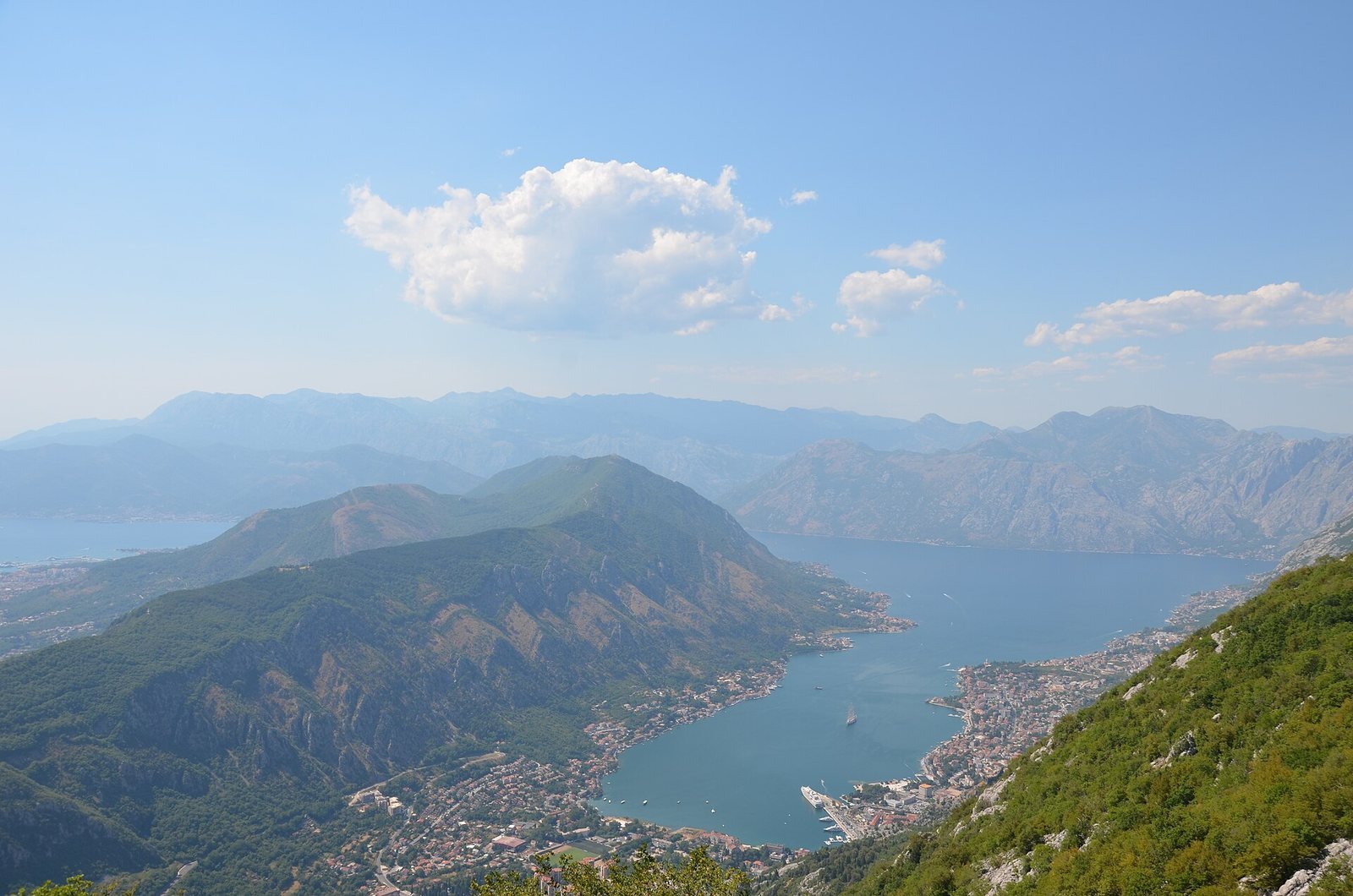
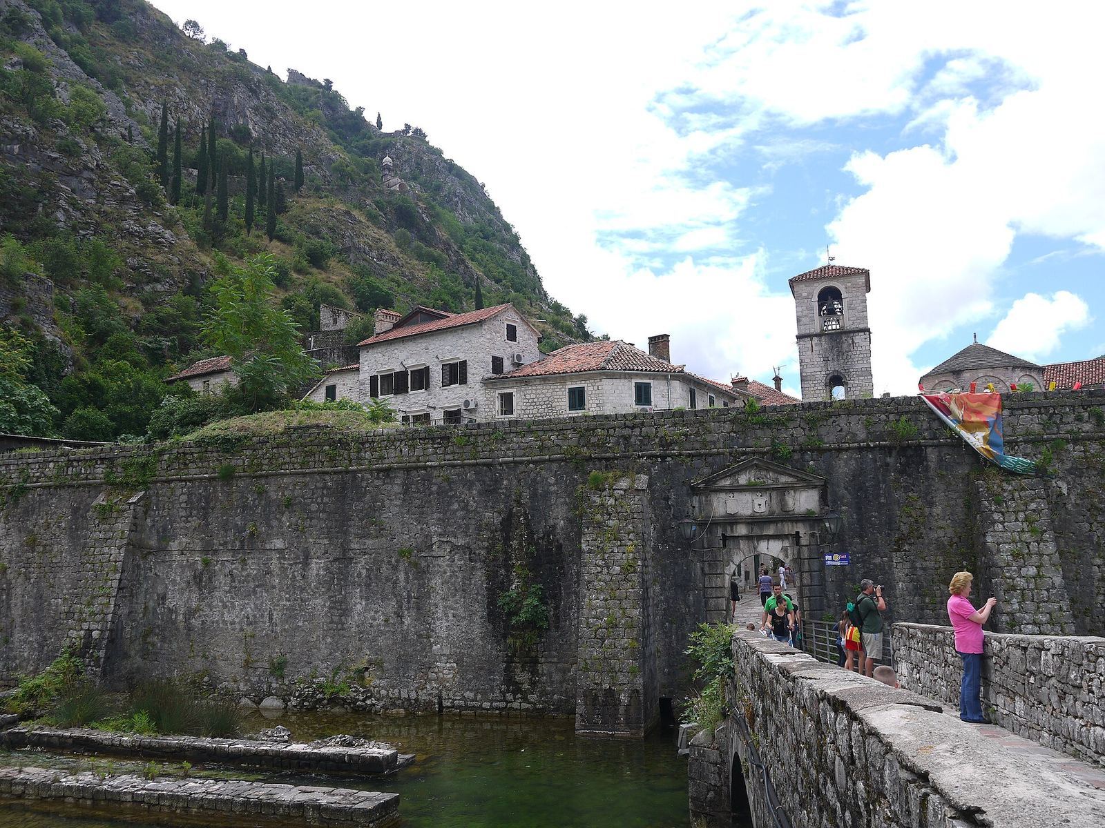
The medieval town occupies a roughly triangular area between the innermost Bay of Kotor to the southwest, the Škurda River to the north, and St. John Mountain to the east. Its irregular plan follows the landform. The walls protect the northern and southwestern sides, facing the river and bay. The outer circuit is about 4.5 kilometres long, 2 to 16 metres thick, and up to 20 metres high. Towers and projecting bastions, structures that extend from a wall to help defend it, reinforce the continuous line.
Gates
The entrances occupy positions connected with defense and communication, near the river, a spring, the sea, or the hillside. The Sea Gate, also called the Main Gate, dates to 1555 and opens onto the bay. The River Gate, or North Gate, was built in 1540 near the Bembo Bastion, also dated to 1540. The Gurdić Gate, or South Gate, underwent repeated alterations and is defended by the Gurdić Bastion, built from 1470. Two further entrances are identified: one south of the Sea Gate, now walled up, and the Spiljarskia Gate in the hillside ramparts, toward the old road to Cetinje.
River and waterfront defenses
Citadela or Kampana
The Citadela, also called the Kampana bastion, stands at the mouth of the Škurda. Built in the early sixteenth century under Venetian provveditore Vettota Diedo, it soon suffered foundation damage from the swollen river. Two large vaulted chambers in a French design gave soldiers room to drill and had openings facing the river. Later, artillery chambers were filled in and earth parapets were added. In 1990, an adaptation of the complex permanently removed parts of the earliest city defenses, including sections of ramparts, barracks, and supporting buildings.
Bembo tower and bastion
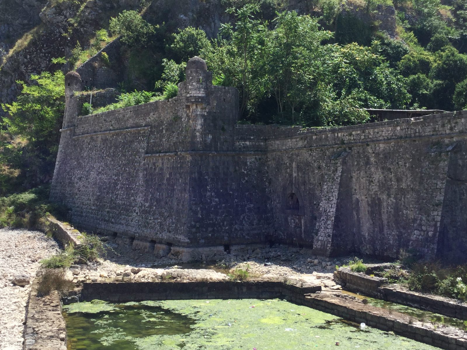
The Bembo tower, also known as Vendramin, is near the mills, St. Nicholas Monastery, and the River Gate. Venetian provveditore Giovanni Matteo Bembo oversaw its construction. A plaque dated 1539, bearing the official’s initials and coat of arms, was installed during construction after the unsuccessful siege by Ottoman admiral Barbarossa. The nearby bastion is dated to 1540 and was later converted into an open-air theater.
Riva Bastion
Near St. Nicholas Monastery, the Riva Bastion marks the end of the city bastions and the beginning of the hillside defenses. Named for Alojz Riva, provveditore from 1540 to 1542, it was completed to its projecting horizontal masonry band by 1542. Its large blocks have deliberately roughened faces. Channels and outlets in its carefully planned foundations managed floods and river flow, while a small, domed watchtower on supports projects from its northwest corner.
Southern and hillside defenses
Gurdić gate, towers, and bastion
The Gurdić tower is circular, with a sloping lower face and a level band at parapet height, separated by a projecting horizontal band of masonry. Precisely cut blocks form regular courses set in lime mortar. Its strong foundations helped it withstand the cavernous limestone site, exposed to the sea and a powerful nearby spring. Inside are fortified chambers, corridors, and a gun position. The tower is dated to 1470 by a record of an inscription, since removed, that stood above a relief of St. Mark at the gate. Its dating is also linked to the arms of the Venetian Gabriel family. On the spring-facing side, a large Gothic-Renaissance coat of arms sits above the masonry band. Late-Gothic foliage surrounds a plaque framed by early-Renaissance moldings, with a checkerboard shield and the archangel Gabriel above a fragmentary ribbon inscription.
A smaller tower stands above the Gurdić city gate. Its footprint is very small, while its height is relatively great; it has no sloping lower face, apparently because it occupies a cramped cliff directly above the entrance it protects. Its embedded arms, identified with the Michiel family, bear 15 small circular figures. The tower may have been rebuilt under a Michiel provveditore and may date from before Venetian rule. It forms a functional, and possibly constructional, unit with the older gate in the Romanesque architectural style, a medieval form of building. The Gurdić Bastion covered approaches from Trojica and Škaljari. It and the Citadela also protected the town from ships’ guns, a role shown in a 1584 drawing; low gun positions were built just above the waterline.
St. John Castle and hillside ramparts
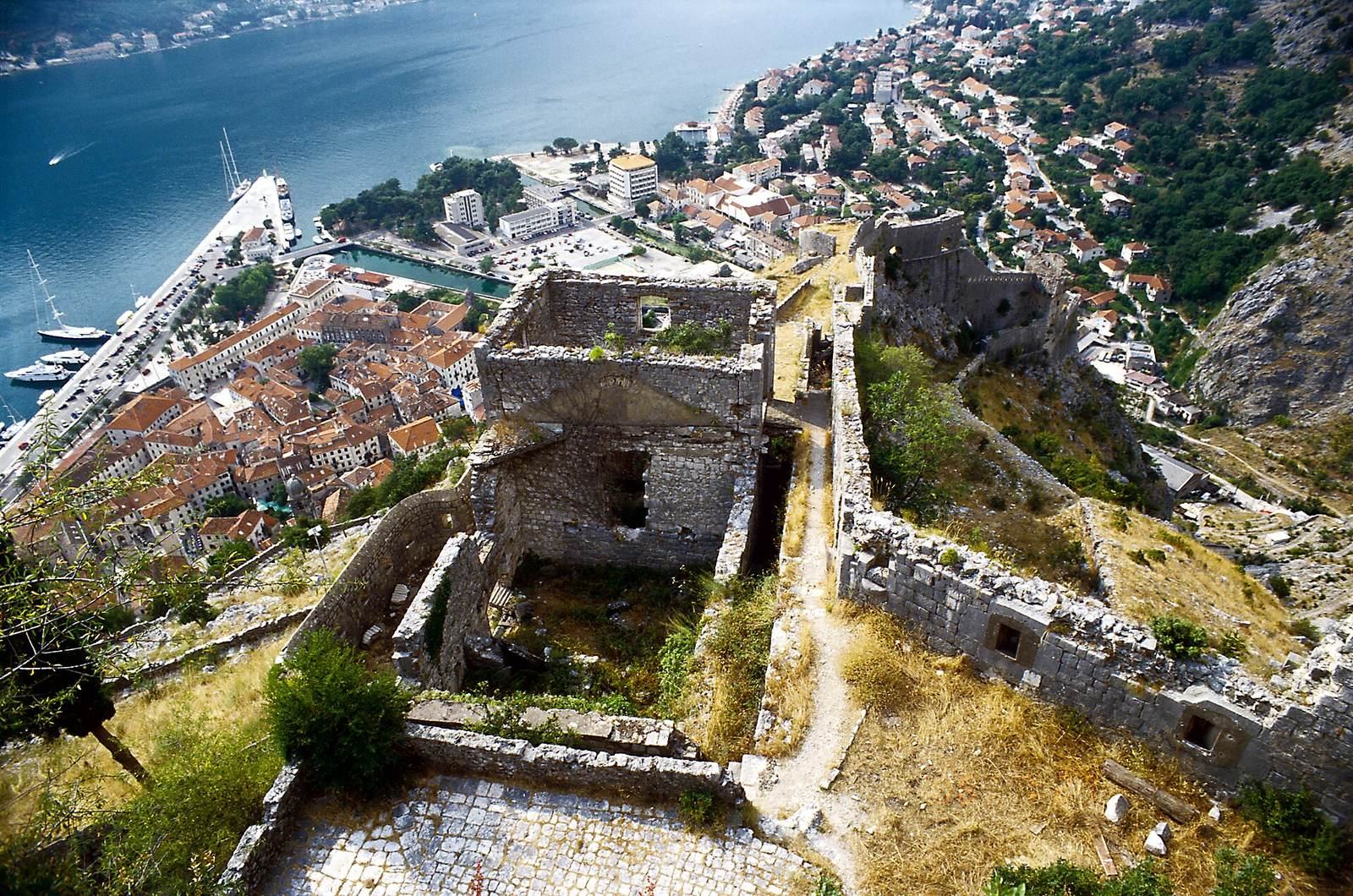
St. John Castle stands at the summit of the mountain, 280 metres above sea level. Built as an independent stronghold within the town’s defenses, it provided a last line of defense. Construction began before 1485 and continued until 1491. Stone was quarried by cutting into the mountain, which also made the approach more difficult. The castle’s sharp northeastern corner is distinctive, and its outer form has remained substantially unchanged since construction, while its interior was altered during the Austro-Hungarian period, when Austria and Hungary formed a dual monarchy from 1867 to 1918. As the highest-ranking stronghold in the city’s defensive system, it could serve as a final refuge and a base for retaking occupied parts of the town. A strong wall, gate, and movable bridge separated it from the rest of the city.
The ramparts climb from the Bembo and Gurdić bastions to the summit. They include defensive positions, communications links, and other buildings. Artillery positions at the castle controlled approaches from Lovćen; as cannon range increased, they could also reach targets at sea.
Churches within the defenses
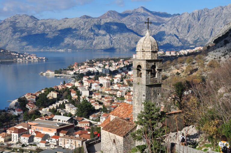
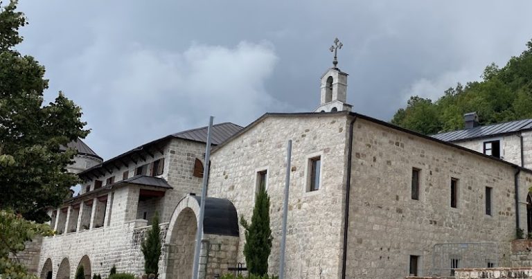
The Church of Our Lady of Remedy, dated to 1518, stands among the buildings on the hillside ramparts. The Church of St. Mary of the Bridge, also called St. Mary of Gurdić, was incorporated into the city defenses in the late seventeenth century, when war machines were installed on it.