Castra of Schirenhof: A Roman Frontier Fort in Germany
Site at a Glance
- Popularity
- Medium
- Country
- Germany
- Primary era
- Classical
- Eras represented
- Classical
- Civilizations
- Roman
- Site type
- Military
- Remains
- Fort
On this page23 sections
History
Foundation and frontier setting
The Castra of Schirenhof was a Roman auxiliary fort at Schwäbisch Gmünd in Germany, established around AD 150 in the province of Raetia during the reign of Emperor Antoninus Pius. Its garrison, the Cohors I Flavia Raetorum, was an auxiliary infantry unit. The fort belonged to the Limes, the Roman frontier system, in a closely defended border zone between the neighbouring provinces of Raetia and Germania Superior. The post was under the command of the Ala II Flavia milliaria p. f., an auxiliary cavalry unit at Aalen.
Other military posts stood nearby. The auxiliary fort at Lorch, in Germania Superior, was about seven kilometres away. Across the valley, the small fort at Freimühle lay roughly one kilometre northwest of Schirenhof. Kleindeinbach was about another kilometre farther northwest, in Germania Superior and close to the timber palisade of the Limes; the Raetian stone frontier began a few metres to its east. Hintere Orthalde, another small fort, lay northeast of Schirenhof. The proximity of these posts has been linked to possible independent initiatives by provincial authorities. The expansion of the Raetian frontier in stone, unlike that in Germania Superior, has been proposed as supporting evidence. Timber found in the valley was cut in the winter of AD 163/164 and used in AD 164, although it is unclear whether it belonged to the palisade or a nearby bridge.
Withdrawal and later memory
The fort remained occupied until shortly after AD 244–247, when its last soldiers withdrew. The cohort may have been lost during the Alamannic invasions, attacks by the Alamanni that began in AD 233. The bath and civilian settlement are thought to have been destroyed during the first major incursion in that year. Roman life in this forward frontier area did not fully recover, and the bath later fell into ruin without violent destruction.
From the late fourteenth century, the fort was known as Etzelsburg. People associated its standing walls with Attila, the fifth-century ruler of the Huns, remembered as Etzel in the medieval German epic Nibelungenlied. By the time of seventeenth-century chronicler and councillor Friedrich Vogt, the walls had been quarried down to their foundations, and apparently only parts of the ditches remained visible. In 1847, antiquarian Carl Gok proposed that the supposed castle had been a Roman fort. Excavations directed by Eduard von Kallee and Heinrich Steimle in 1886–1888 found no evidence of medieval occupation. A test excavation of the bath in 1893 was followed by its demolition for building stone by a local farmer.
Excavation and protection
After the Second World War, later building increasingly covered the civilian settlement, limiting investigation mainly to occasional rescue excavations. Baden-Württemberg’s monument-protection law, effective from 1972, enabled broader archaeological surveys and the safeguarding of important areas. Under provincial Roman archaeologist Hans Ulrich Nuber, the bath was fully excavated in 1972–1973 and restored. Its exposed ancient masonry was extensively replaced with matching new masonry during a thorough renovation in 1999. The burial ground was investigated in 1977, and a geomagnetic survey using magnetic measurements covered almost the entire fort area in 2005.
Since 2005, the fort and associated archaeological remains have belonged to the UNESCO World Heritage property of the Upper German-Raetian Limes. They are also protected as archaeological monuments under Baden-Württemberg law.
Remains
Fort enclosure and defences
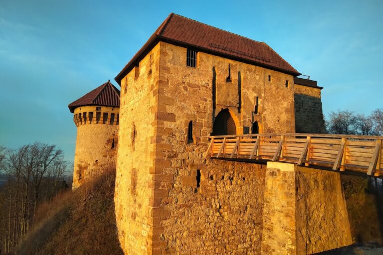
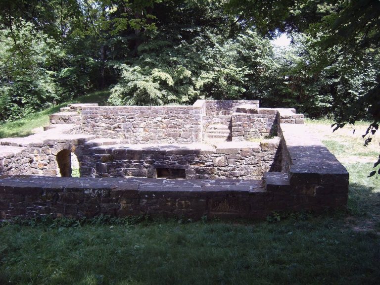
The stone fort occupied a spur aligned southeast to northwest, partway up its slope above the Rems valley and the Limes beyond. Its enclosure covered about two hectares and measured approximately 157 by 130 metres. Much of the fort area remains free of later buildings, while the bathhouse has been conserved.
Walls, ditches, and rampart
Three V-shaped ditches enclosed the fort, ending at its four entrances. The outer and middle ditches stood farther apart than the middle and inner ones. Excavation found a perimeter wall about 1.2 metres wide; in the excavated areas, its lowest foundation course was the part that survived. Between towers and gates, an earth rampart about four metres wide ran along the inner side of the wall, providing a platform for guard duty.
Entrances and perimeter road
The northwest-facing front looked across the valley toward the Limes and the territory beyond it. Aerial archaeological evidence indicates that all four entrances had two gates, that towers stood at each rounded corner, and that further towers occupied the stretches between corners and entrances. The western gate had a two-lane approach flanked by rectangular towers. At the rear gate, two passages were flanked by semicircular towers that projected beyond the gate line. An inner perimeter road, about eleven metres wide, followed the enclosure, with a small water channel along its inner edge.
A separate runoff channel began almost crosswise in front of the western gate and descended the slope. It was filled during the Roman period, apparently when the road linking the gate to the bath was laid. Pottery in the channel’s lowest fill included fine Roman tableware from the mid-second century, among it decorated bowls attributed to workshops at Rheinzabern.
Headquarters and inscriptions
Headquarters building
Only the rear part of the fort’s headquarters building is well understood. It followed a standard plan, with a large rectangular hall set across the building in front of a shrine for the unit’s standards. The shrine ended in an apse, a semicircular recess. This form was used in forts in the German provinces from the middle of the second century. Crucibles found inside the fort provide evidence of bronze-working.
Inscribed stones and metal letters
A badly damaged red sandstone slab, dated no earlier than the mid-second century, may have named a librarius, or military clerk, of the Cohors I Raetorum. The proposed reading remains uncertain. Fragments of another inscription came from a gate. Its shallow-cut grey sandstone surface held gilt bronze letters, about one millimetre thick, secured with iron pins. The surviving pieces preserve several letters, including A, I, N, T, and X. They may belong to an honorific inscription connected with a visit by Emperor Caracalla, although that identification is uncertain. Steimle proposed that some of the larger letters could form the name Antoninus.
Bathhouse
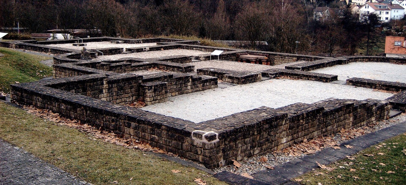
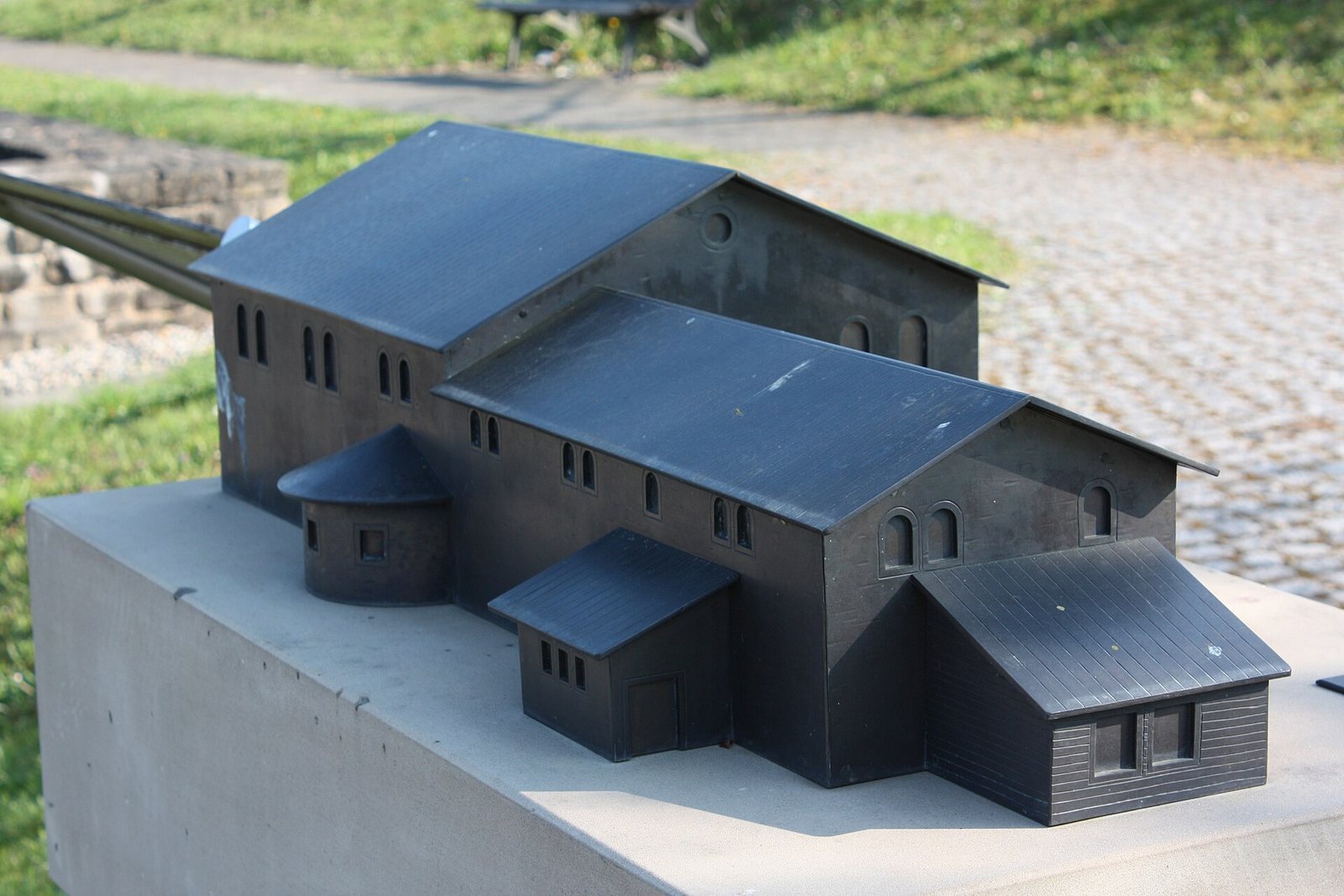
The bath stood about 100 metres west of the fort, directly above a steep slope. It measured 48 by 25 metres and was arranged as a row of bathing rooms in sequence. Excavation identified three building phases.
First phase
Built around the middle of the second century, the first bath included a timber-framed assembly hall on its north side. This led to a changing room, then a cold room and a second cold room containing a tub. A warm room followed, then the hot-bath rooms. The second cold room may initially have served as a sweating room. A furnace room and hot-water tanks stood beyond the bathing rooms.
Second phase
The changing room was enlarged eastward, and a semicircular recess was added to the smaller cold room. The larger cold room received a hypocaust, a Roman underfloor heating system, and became a warm room. A sweating room may have occupied the angle between it and the changing room. The other warm room gained a heated recess, and the hot-bath area was extended substantially southward, although its precise form is unclear. A tub was apparently installed in room C2.
Reduced rebuilding
After the third-century incursions, the bath was rebuilt on a smaller scale. The timber assembly hall was not replaced; a drain for hillside water crossed its former area. The changing room was reduced by half, with its eastern section filled in, and a toilet was installed in the adjoining disused cold room F1. The possible sweating room and both warm rooms ceased to be heated, and room S may also have been filled. A cold-water tub was placed in warm room T2. Only the underfloor heating in the old hot bath at the southern end continued to operate. Western additions to the bath also appear to have gone out of use.
Finds and brick stamps
Finds from the bath included toiletries, jewellery, clothing fasteners such as brooches, weapons, and military equipment. Pottery included tableware and drinking vessels, with material from workshops at Rheinzabern, Heiligenberg, and other production centres. A clay brick carried instructions for the local military brickworks. Stamps on bricks named the Cohors I Raetorum and Secundius; one fragment bore both names. The stamps belong to the bath’s early phase, and their reuse as building material suggests that Secundius worked for the military brickworks.
Statue and coins
A provincial Roman statue of a spring nymph, carved from Lias sandstone and dated to the second or third century, was found inside the bath during its demolition after 1893. Its original room is unknown. More than 50 coins recovered from bath rubble in 1972–1973 ranged from Republican issues to the mid-third century. They included a small hoard, a sestertius of Didia Clara dated to AD 193, and a final coin minted during the reign of Philip the Arab, in AD 244–247. The statue and coins are held at the Museum im Prediger in Schwäbisch Gmünd.
Civilian settlement and burial ground
Civilian settlement
The civilian settlement extended north, west, and south of the fort. Later construction and erosion on the slope have left its remains poorly understood. About 150 metres southeast of the fort, excavators found small rectangular rooms with underfloor heating, probably part of timber-built row houses. Metalworking workshops were identified both in the settlement and inside the fort.
Large building complex
About 50 metres west of the fort and north of the bath lay a poorly preserved large building complex. Two rooms at its southern end had underfloor heating. In the northern of these, the floor rested on columns made of Stubensandstein, a regional sandstone; the furnace room was on the north side. Nuber proposed, with uncertainty, that the complex might have been the commandant’s villa. A dedication to Silvanus, a Roman deity associated with woods and pastoral life, was found in the area.
Road and stone building
In the area southeast of the fort, investigators traced a road running southwest to northeast that almost certainly met the rear gate. They also found the remains of a stone building. Pottery places these building remains around AD 190–210.
Cremation cemetery
The cemetery lay farther southeast, on both sides of an ancient road passing south of the military site. Excavation uncovered 310 burials, mostly cremations, across 0.35 hectares, an area thought to represent about half the cemetery. Grave goods included decorated Raetian pottery, fine Roman tableware, glass, jewellery, metal objects, and an unusually large number of oil lamps. The burial assemblage dates to the second or third century.
Monument of Grave 148
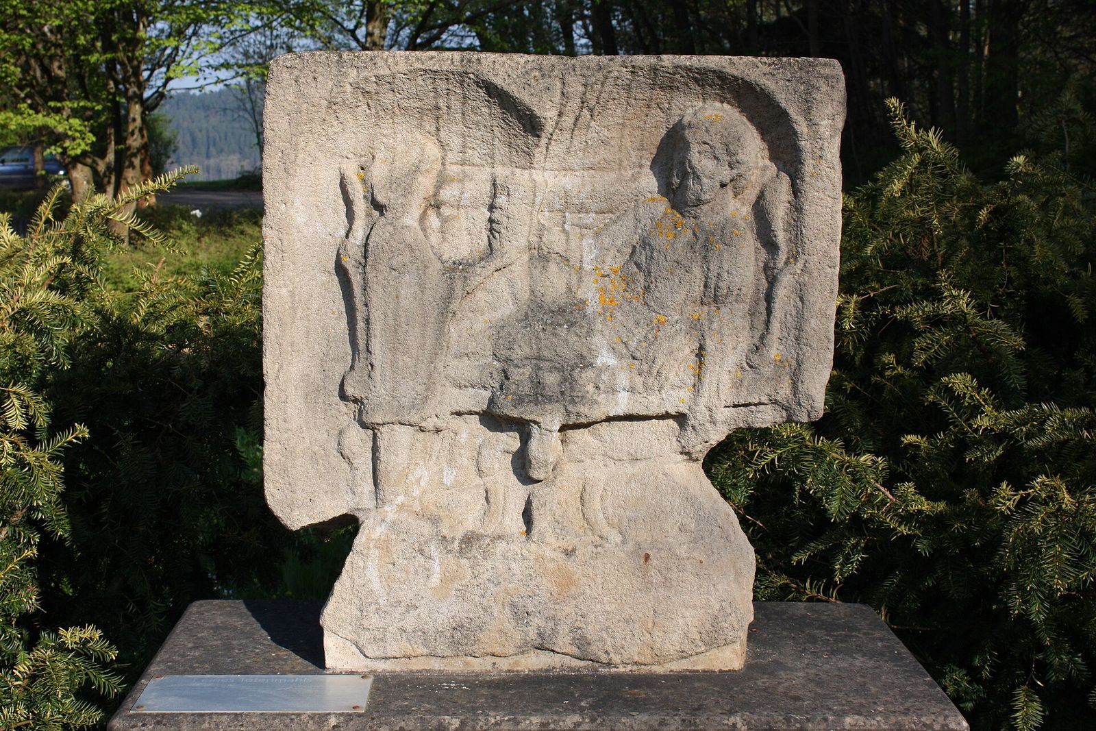
Grave 148 belonged to a particularly wealthy local resident and was built as a chamber from Stubensandstein slabs. On its north side stood a small pillar-like tomb monument found in 1977. Its 80-centimetre-high pedestal bears a difficult-to-read inscription and a relief of the deceased reclining on a couch as a slave offers a cup of wine. A cast of the tombstone is preserved at the site, while the relief is in the Limes Museum in Aalen.