Oppidum of Manching: A Celtic Fortified Settlement in Germany
Site at a Glance
- Popularity
- High
- Country
- Germany
- Primary era
- Iron Age
- Eras represented
- Iron Age, Classical
- Civilizations
- Celtic, Roman
- Site type
- City
On this page20 sections
History
The Oppidum of Manching is an Iron Age Celtic settlement in Germany. An oppidum was a large settlement, often fortified, of Celtic communities. Founded in the third century BC, Manching remained occupied until roughly 50 to 30 BC. It reached its greatest extent in the second half of the second century BC, when about 5,000 to 10,000 people lived within an enclosure covering roughly 380 hectares. Its ancient name is unknown, but it is thought to have been the central settlement of the Vindelici, a Celtic people of the Alpine and upper Danube region. Manching was one of the largest settlements north of the Alps.
Growth and economic life
In the late La Tène period, a later Iron Age culture in much of Europe, Manching developed into an important centre of trade and production. North-south and east-west routes met near the settlement, close to the junction of the Paar and Danube. Access to river transport supported long-distance exchange, and a former Danube channel to the northeast served as a harbour. Nearby iron ore and gold added to the resources available to the community.
Food came from both the surrounding countryside and cultivation within the settlement. Barley and spelt were the main crops, alongside millet, several other kinds of grain, lentils, broad beans, poppy, hazelnuts and fruit. Large quantities of animal bones point to extensive livestock raising, and the settlement may have supplied a regional livestock market. Pigs and cattle were especially common. Cattle also provided draft power, sheep supplied wool, and goats provided milk and cheese. Poultry contributed little to the diet; people ate horses and dogs, though they were not raised specifically for meat. Fish remains, including traces of garum, a fermented fish sauce, indicate fish consumption. Imported wine containers show that wine was also drunk.
Metalworking and other crafts served local needs as well as exchange. Iron goods were made from ore obtained in the Danube region and at Feilenmoos, about three kilometres southeast of the settlement. Specialized tools, glass beads and bracelets, pottery, jewellery and textiles reflect a varied craft economy. Baltic amber, wine containers from the Mediterranean, fine Campanian pottery, bronze vessels and imported jewellery connect Manching to trade networks extending across Europe. The harbour also handled building supplies such as stone and timber.
Manching issued its own coins. Small silver coins called quinarii and low-grade copper-alloy pieces were used mainly in local exchange. Gold coins, and silver issues from the early first century BC onward, served longer-distance trade. Manching’s gold coins were typically concave and cup-shaped. Counterfeit money also circulated, including bronze pieces covered with a thin layer of gold. Fine scales helped users judge a coin’s weight and value.
Ritual and burial
A cult complex in the settlement’s centre may have been established near the community’s beginning. It was in use from the fourth century into the second, or possibly the first, century BC. Three other groups of special-purpose buildings elsewhere in the settlement have also been interpreted as possible sanctuaries.
Human bones were scattered across the inhabited area. Earlier interpretations connected them with a violent end to the settlement, but they are now generally understood in relation to funerary or ancestral practices; their exact meaning remains uncertain. Secondary burial also took place. Long bones and other body parts could be removed before decomposition was complete, cleaned of soft tissue and kept, perhaps as relics, or placed separately. Some deposits of skulls are known as skull nests.
Two cemeteries associated with Manching began to be used in the late fourth century BC and remained in use into the second century BC. The graves appear to represent social elites, and the relatively small number of people buried there, compared with the estimated population, suggests that only a portion of the community received a burial recognizable in the archaeological record.
Walls, decline and Roman-era activity
The first enclosure wall was built around 150 BC. A second followed around 104 BC, with a third phase using the same building method as the second. The walls and their large gates may have expressed prestige as well as provided defence, though the reasons for their construction are uncertain. A stream that had crossed the settlement was redirected beside the southwest wall and into the Paar, forming an external, water-filled ditch there.
Fire destroyed the eastern gate around 80 BC. Its debris remained in place, suggesting that the road through it may already have fallen out of use. An armed conflict connected with the migrations of the Cimbri and Teutones, peoples who came into conflict with communities in parts of Europe in the late second century BC, is possible but not established. A Roman assault or complete destruction of Manching is considered unlikely. The settlement’s decline is more plausibly linked to weakening Celtic economic systems and wider political and economic change, including the upheaval after Julius Caesar’s conquest of Gaul. As the population dwindled, parts of the settlement were abandoned and the walls deteriorated without maintenance.
By the time the Romans arrived around 15 BC, little remained of the thriving settlement apart from imposing wall ruins. In the Roman period, the place recorded as Vallatum has traditionally been associated with Manching, but its location is uncertain. A first-century AD road station near the former settlement is possible. If Vallatum was at Manching, the place may also have had a late Roman military presence. The Romans built a fort at nearby Oberstimm in the mid-first century AD, probably because a shift in the Danube channel had moved the river away from Manching.
Rediscovery and archaeological investigation
The ring-shaped earthwork remained a visible landmark from Roman times onward and later served as a boundary marker for parishes and bishoprics. In 1831, teacher Andreas (J. A.) Buchner described it, mistakenly identifying the site as Vallatum. Joseph Fink directed the first excavations in 1892 and 1893. In 1903, Paul Reinecke recognized Manching as a Celtic oppidum. Karl-Heinz Wagner began work on the northeastern enclosure in 1938 and identified the wall remains there as a timber-and-stone construction strengthened with iron fastenings.
Between 1936 and 1938, the Luftwaffe built an airfield at Manching as part of Nazi-era rearmament. This destroyed large areas before systematic investigation could take place, and construction yielded only a few finds. The airfield was repeatedly bombed during the Second World War, causing further damage to archaeological evidence.
Extensive archaeological work began in 1955, led by the Romano-Germanic Commission of the German Archaeological Institute and Bavarian archaeological authorities. Excavations examined the central area, eastern gate and routes for southern and northern bypasses. By 1987, about 12 hectares had been investigated. Work at Altenfeld followed in 1996 to 1999, while excavation across the southern area continued from 1990 to 2008 under Susanne Sievers’s overall direction. By the end of 2002, the explored area had reached 26 hectares, making Manching the most extensively investigated oppidum in Central Europe at that time. Some later excavations were rescue work ahead of construction, recording evidence as parts of the site were progressively lost. Before an Airbus development, excavation companies investigated about 7.3 hectares in the south in 2017 and 2018. In spring 2022, a dig commissioned for a planned federal road was looted.
Finds from Manching have been displayed at the Kelten Römer Museum Manching since 2006. A gold-coin hoard discovered near the harbour in 1999 was among its exhibits. The hoard was stolen in November 2022. Four suspects were apprehended in 2023, and gold recovered from one suspect was believed to represent a smaller part of the stolen hoard.
Remains
Manching occupied a river plain rather than a hilltop. Its remains include a planned settlement of rectangular plots, a long circuit of defensive walls, gates, a former river harbour and evidence of buildings devoted to homes, storage and crafts. The layout and surviving features reflect both the settlement’s position on alluvial ground and its successive phases of construction.
Settlement plan and buildings
Plots and routes
The settlement was laid out along north-south and east-west lines, with rectangular plots enclosed within the plan. These may have been individual farmsteads, though separate zones for farming, craftwork and ritual activity are also considered likely. The central area, on relatively dry alluvial ground between the eastern and a proposed western gate, was the most densely settled. Buildings became less frequent toward the edges. A belt as wide as 500 metres inside the wall may have been used for cultivation or grazing.
An east-west road connected the eastern gate with a proposed western entrance. Small huts beside the road are thought to have served as stalls for goods. A north-south route probably extended north from the southern gate. The harbour occupied a former Danube meander northeast of the settlement, linked to the main river. Excavation at Altenfeld revealed a craft quarter.
Homes, workshops and storage
Many houses were single-storey buildings supported by posts, with one or more rooms and floor areas of about 40 to 100 square metres. Some may have used half-timbered walls. Other building forms included longhouses, partly sunken houses, cellars, workshops, wells, storage pits and raised storehouses standing on stilts. The range of structures provides a picture of domestic activity, craft production and storage within the settlement.
Many building plans used repeated measures based on half a Celtic foot, equal to about 15.45 centimetres. Archaeologist Franz Schubert excavated a rod with bronze rings marking that length, interpreted as a measuring instrument. Finds of keys and locks represent several mechanisms: sliding bolts and hooked keys for doors and gates, drop bolts for smaller doors, and spring locks for boxes and chests.
Enclosure and waterworks
Defensive walls
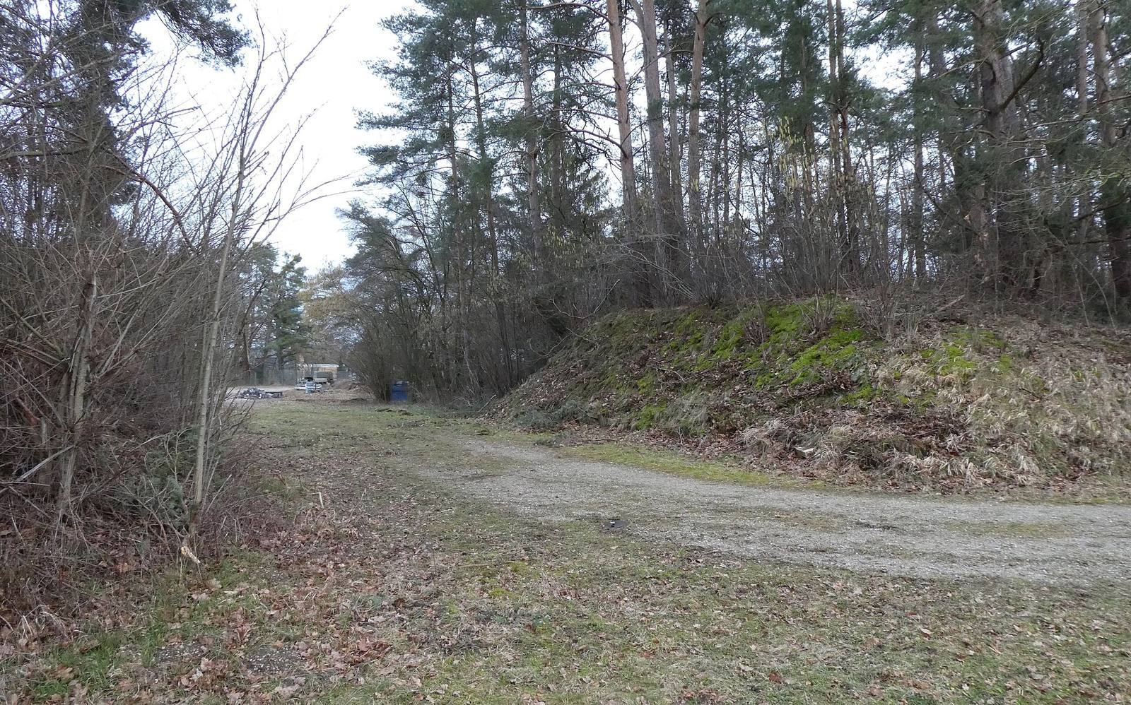
The enclosure extended about 7.2 kilometres. Its earliest wall used the murus gallicus method, a Celtic construction of timber and stone secured with iron fastenings. Building it is estimated to have required more than eight tonnes of nails. An earthen ramp about nine metres wide reinforced the inner side. A later wall incorporated the earlier structure and used stonework strengthened by vertical timber posts set into slots. A third building phase followed the same method. Before excavation, portions of the rampart remained visible, rising as much as four metres above the surrounding ground.
Eastern gate
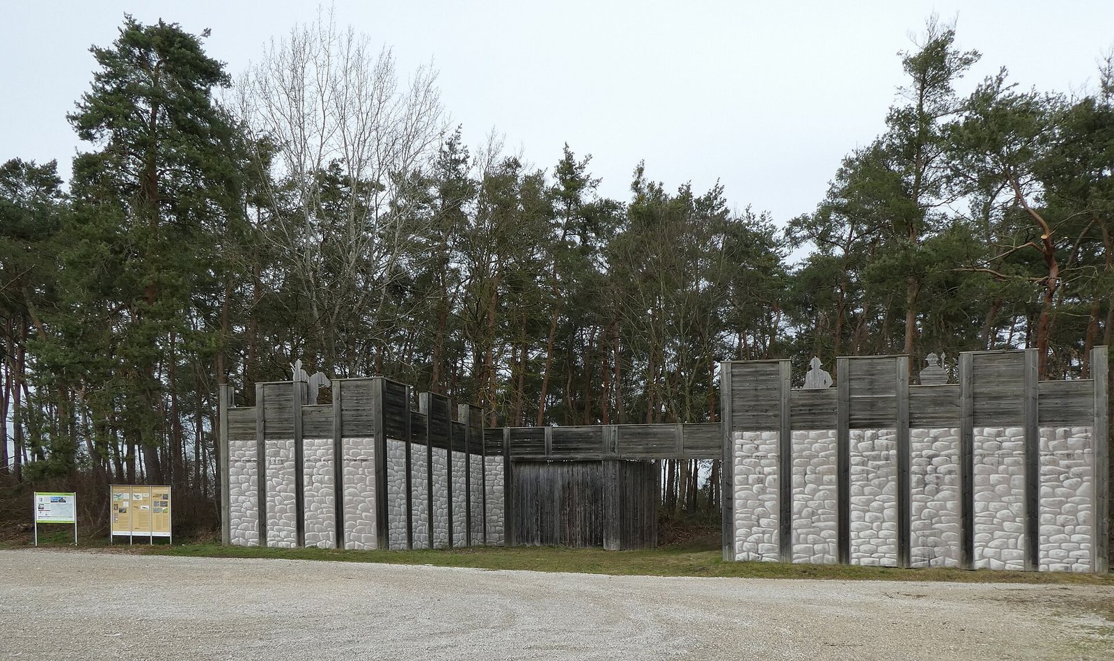
The eastern gate had projecting walls on either side of its entrance, creating a pincer-shaped approach. Its opening was divided into two lanes, reached through an open passage bordered by walls. A guard position above the entrance has been proposed, although the form of the upper structure cannot be securely reconstructed. The excavated remains and a reconstruction farther south represent this major entrance.
Diverted stream
The Igelsbach stream once ran through the settlement from the southwest. It was redirected alongside the wall before joining the Paar, leaving an external water-filled ditch beside the southwestern fortification.
Cult places and burial grounds
Central cult complex
A temple or shrine occupied the centre of the settlement. Its remains include a paved area and deposits of weapons, horse equipment and cauldron fragments. Numerous bones of infants and children were also associated with cult activity at the complex.
Other ritual areas and cemeteries
Three further groups of special-purpose buildings have been interpreted as possible sanctuaries. The Hundsrucken cemetery, northeast of the settlement, contained 22 graves within the line later enclosed by the walls. Across the Paar, Steinbichel contained 43 graves. Both cemeteries included weapon burials, while graves of women held rich accompanying objects.
Cult objects
A gold-covered cult tree found during the northern bypass excavations dates to the third century BC. Its wooden trunk had a side branch and was decorated with gold leaf, bronze ivy leaves, gilded buds and acorns. It was recovered from a wooden box also finished with gold leaf and is usually interpreted as a young oak entwined with ivy.
A possible cult image in the form of a horse dates to the second century BC. Made from sheet iron rather than bronze, it was recovered in fragments near a buried weapons hoard. Only the head without its ears and parts of the legs survived. Their association has led to the suggestion that fighting in the late second century BC brought the looting and destruction of buildings interpreted as cult structures.
Trade, writing and archaeological finds
Harbour hoard
The gold hoard found near the harbour comprised 483 shell-shaped staters of the Boii, a Celtic people, together with a lump of gold weighing 217 grams. Three small bronze rings suggest the coins and gold had been kept in a container made from organic material.
Inscriptions and measures
Finds include writing tools, a pot marked with its owner’s name, and inscriptions and graffiti on pottery fragments. One ceramic piece bears the Greek letter theta. The scripts on other fragments cannot be securely identified as Greek or Latin.