Oxkintok: A Maya Archaeological Site in Yucatán, Mexico
Site at a Glance
- Popularity
- Medium
- Country
- Mexico
- Primary era
- Medieval
- Eras represented
- Classical, Medieval
- Civilizations
- Maya
- Site type
- City
On this page25 sections
History
Settlement and southern Maya connections
Oxkintok is a Maya archaeological site in the Puuc, the hill region of northwestern Yucatán, Mexico. Settlement began around 600 BCE, and monumental construction started near the end of the Preclassic, the period before the Maya Classic. The city’s architecture later included Classic Puuc styles. Oxkintok became a major political and economic center during the Classic period.
The earliest settlers came from the southern Usumacinta basin and Petén, and Oxkintok maintained strong ties with southern Maya centers through much of its history. The meaning of the site’s name is uncertain. Suggested readings include stone of three suns and three days of flint, among other interpretations that depend on how the name’s final element is understood.
Classic-period power
By the sixth century CE, Oxkintok was the center of an independent polity. Its territory included western parts of the Puuc and extended south to Ah-Kin-Pech, on the border of the kingdom of Edzna. Routes linking the Puuc, Campeche, and ports on the northern Yucatán plains passed through its sphere of influence, helping the city control movement and draw in goods.
Oxkintok’s power grew between the fifth and seventh centuries as Teotihuacan and older Petén centers declined. From the late seventh century, southern Maya influence strengthened again, increasingly through ties with the Usumacinta basin rather than central Petén. Economic and cultural connections with southern kingdoms continued into the late eighth century. Calendar inscriptions date to 475 and 487 CE, while stone inscriptions show a marked interruption from the middle of the sixth century to the middle of the seventh.
Ah Canul and renewed authority
A new dynasty rose around 750, and the Ah Canul group became the city’s political center. Relationships among local groups shifted from relative equality toward a hierarchy in which authority rested increasingly with the Ah Canul lineage. The group’s buildings and monuments expressed this rise in political standing.
After the first half of the ninth century, Oxkintok experienced another period of growth. Stela 3, erected around 849, and other ninth-century monuments mark renewed inscription after the earlier interruption. The city also formed an alliance with Uxmal, joined to Oxkintok by a paved road.
Archaeologist Miguel Rivera Dorado interpreted the city’s buildings as places for ancestors within a cosmic order, linking rulers’ authority to ancestral and religious traditions. He associated eastern buildings with the sun, royal power, war deities, and ancestors, and western buildings with initiation and funerary practices connected to the Moon and Venus. These are interpretations of the buildings’ ritual and political meaning.
Decline and later occupation
Foreign invaders took control in the late ninth or early tenth century, an event associated with the beginning of Oxkintok’s decline. Active construction had largely ended by the eleventh century. Later residents repaired older buildings, erected small, roughly built dwellings, and made ritual offerings at buildings MA-1 and SA-6. As Chichen Itza and Mayapan rose to prominence, Oxkintok’s political entity eventually disappeared, although people continued to live at the site intermittently until about 1500.
Exploration and archaeological work
The Franciscan Antonio de Ciudad Real provided the earliest known archaeological description of Oxkintok in the sixteenth century and also described Satunsat. John Lloyd Stephens and Frederick Catherwood explored the site in 1842. H. E. Mercer led the first excavations in 1895, focusing on Satunsat, and Edwin M. Shook conducted further research from 1901 to 1903.
H. E. D. Pollock, Shook, and G. W. Brainerd surveyed Oxkintok between 1932 and 1940, concentrating on its architecture and pottery. The Oxkintok Project began in 1986. Led by Miguel Rivera Dorado, the Spanish Archaeological Mission in Mexico excavated mainly in the southwestern sector over four field seasons from 1986 to 1989, and the project continued into 1991. More recent excavation and reconstruction have been undertaken through Mexico’s National Institute of Anthropology and History under Ricardo Velazquez Valadez.
Remains
Layout and architectural development
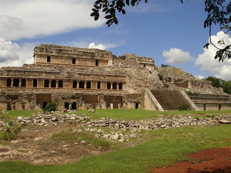
The principal architectural groups are May, Dzib, and Ah Canul. Paved Maya roads, known as sacbe, connect them, including a main road between Dzib and Ah Canul and a branch running north from May. The Encil group lies beyond the main settlement core. Architectural complexes and sculpture are especially concentrated in the southwestern part of the city.
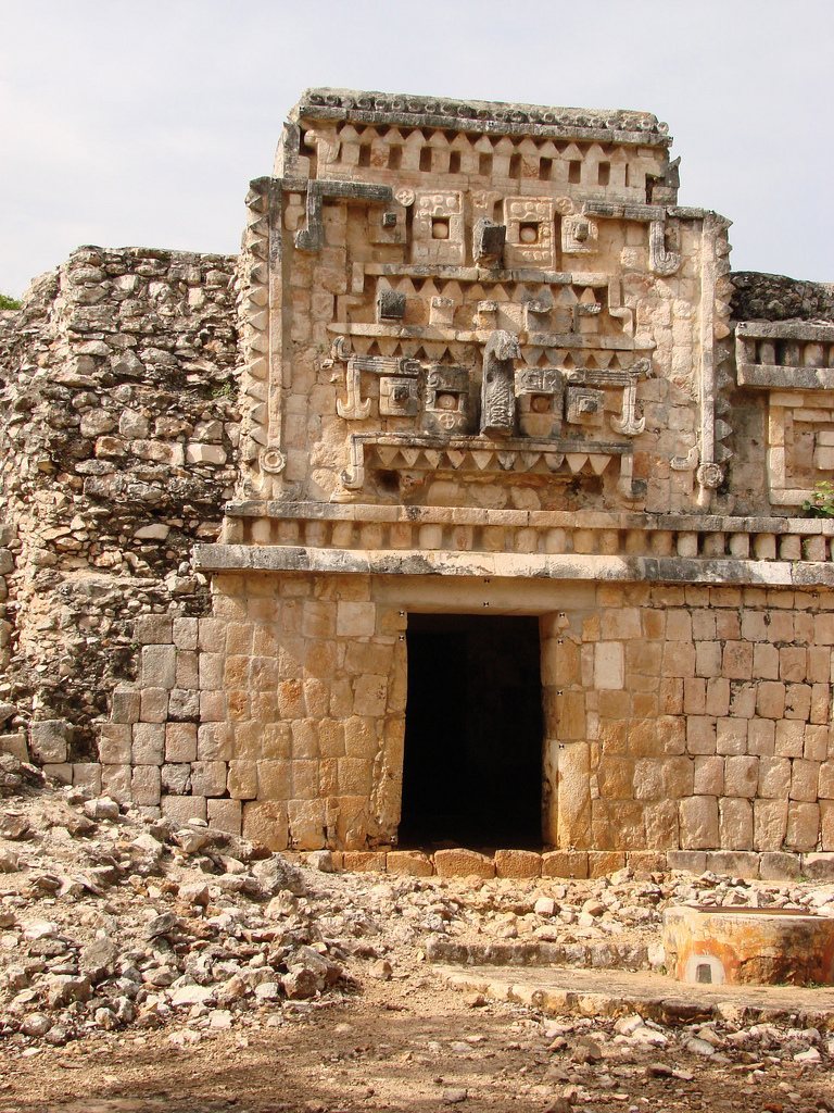
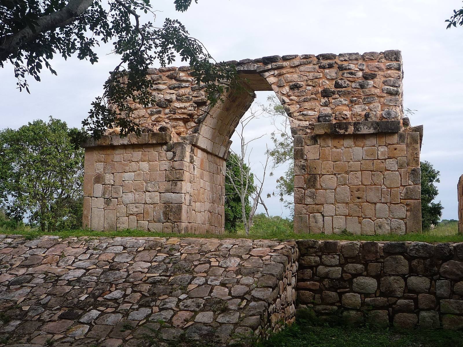
Oxkintok’s architectural sequence includes Early Oxkintok, Proto-Puuc, Early Puuc, and Classic Puuc styles. Proto-Puuc combines features of Early Oxkintok with those of Classic Puuc. Early Oxkintok forms are especially associated with May, while Proto-Puuc features are concentrated in Ah Canul. The sequence moves from irregular arrangements toward more geometrically planned designs with stucco and carved-stone decoration. Slab-vaulted roofs use stone slabs to form a vault; veneer masonry has a dressed-stone surface over a structural core. The site also has talud-tablero construction, in which a sloping wall section supports a vertical panel. Domes and arches are characteristic features across the architectural sequence.
The earliest platforms were square and aligned with the cardinal directions. Platforms built in the first centuries CE covered as much as about 2,000 square metres and probably supported wooden buildings. Builders also used natural rises and uneven ground as foundations. These platforms may have served as settings for communal ceremonies honoring ancestors and reinforcing local groups. From the middle of the sixth century, the main groups underwent extensive rebuilding: structures were enlarged, reorganized, or replaced, and construction using plant materials gave way in some areas to adobe, or sun-dried earthen brick, and stone.
May group
May follows an ancestor-plaza arrangement, with pyramid temples south of the plaza and rulers’ palaces to its north. Its buildings show different uses and phases of construction around this central space.
MA-7 platform
The two-tier MA-7 platform stands on the plaza’s south side. Its corners are rounded, and its plastered surface was painted red. It probably supported a sanctuary and is interpreted as an ancestor temple.
MA-1sub and MA-1
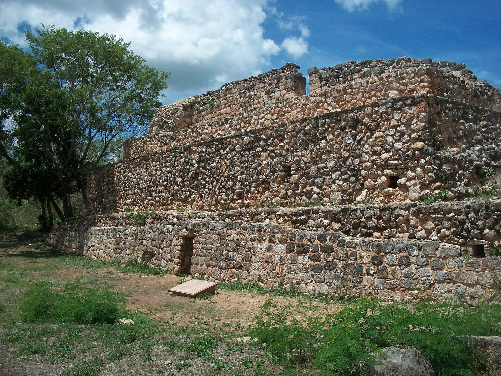
On the plaza’s north side, MA-1sub was a two-storey palace with five corridors running east to west on its lower floor. The upper floor had two corridors in each direction and openings on its east and west sides. The building has been interpreted as a setting for initiation and purification rites. In the middle of the sixth century, it was enlarged and rebuilt as the MA-1 temple-pyramid, expanding May’s base platform. The pyramid has a north-facing staircase and façade directed toward the plaza. Its widened rooms had stone-slab vaults, and its walls were more uniform than those of the earlier palace.
MA-5
South of the plaza, MA-5 extended May’s enclosed ceremonial space westward. Much of its walls and roof were made from perishable materials. It may have provided temporary accommodation for priests.
MA-6
From the seventh century, MA-6 extended the group eastward. Its courtyard contained numerous storage buildings and dwellings. Abundant pottery of the Kehpech horizon, an archaeological grouping used to classify Maya pottery and date contexts, indicates that the May group remained in use for roughly a millennium.
Satunsat
Satunsat, also called SA-1, is a three-level building partly above ground and partly cut below it. Probably built during the Early Oxkintok phase, it contains narrow rooms and galleries with irregular outlines, forming a labyrinth-like plan. Its lowest level was cut into rock and has uneven surfaces, sharp turns, irregular walls, and little light. A ceiling opening admits a shaft of sunlight, while nine openings on the west side were used to observe the sun. The building’s east-west orientation and solar alignments have been linked to observations of the equinoxes and the agricultural calendar.
The labyrinth has been interpreted as a symbolic underworld and as a route through cosmic levels, possibly used in initiation ceremonies for people preparing for high office. Its function remains uncertain. In the sixth century, a lower-floor room was turned into a burial chamber, reducing the labyrinth’s area. The north staircase to the third level was blocked, the north, east, and south façades were repainted, and a staircase was added on the east side. A ruler, probably from the early sixth century, was buried there with a jade-mosaic mask and three stone axes on the belt. The mask has been linked to a sign meaning lord; the axes have been interpreted as maize bundles and as symbols of a world tree.
Ah Canul group
Ah Canul also follows an ancestor-plaza arrangement, with pyramid temples south of the plaza and rulers’ palaces to the north. Its buildings and inscriptions associate the group with elite lineages and the city’s political life.
SA-3
SA-3 has two corridors running east to west and stands on the north side of a plaza. Three pyramids close the opposite end. Its lineage signs, along with those on MA-1sub, have led to the interpretation of both buildings as elite residences.
SA-5 and SA-6
Built in the middle Classic period, the Ah Canul palaces SA-5 and SA-6 reused at least four lintels carved in the Late Preclassic. A lintel is the horizontal structural element spanning a doorway. A fifth, whose inscription continued the others, was found near SA-3. On SA-5’s north façade, a frieze includes the Maya sun deity Ah Kin. A hieroglyphic lintel in the building carries an early inscription dated to 475 CE.
SA-7, the Ch’ich palace
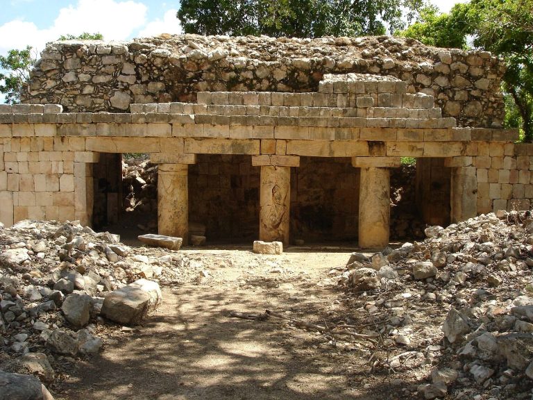
SA-7, also known as the Ch’ich palace, measures 30 metres long and 11 metres wide. Its 11 rooms are arranged in three north-south galleries and two east-west galleries. It is the most lavish palace discovered at Oxkintok. The west façade is later than the east one and has stone-mosaic decoration and four columns carved as human figures. This façade represents a transition between Early and Classic Puuc styles. Interior lintels show figures associated with ruling families of the eighth and ninth centuries. The columns have been attributed to the foreign invaders associated with the city’s decline, and have also been interpreted as elites, warriors, or deities.
Dzib group
Dzib has a more complex arrangement than May and Ah Canul, with four plazas oriented toward the cardinal directions. A temple-pyramid occupies the southwestern plaza, while a ballcourt occupies the northeastern one. The pyramid predates the ballcourt, which runs north to south.
Ballcourt
The ballcourt ring bears a date of 713–714 CE, probably the date of construction. A Maya ballcourt was built for the Mesoamerican ballgame, which also had ritual and political meaning. A calendar wheel, a diagram relating calendar cycles or dates, appears to be connected to the ring, although its meaning is not fully understood.
Staircases and monuments
Two staircases and 18 stelae are associated with Dzib. The second staircase mentions the Walas, a governing group whose organization is poorly understood, and may have been dedicated to them. An emblem glyph, a sign associated with a polity and its ruler, occurs in each of the three principal groups. A ruler’s name glyph appears on a panel at the Ch’ich palace and on Dzib’s monumental staircase.
Encil group
North of the settlement, a pyramid in the Encil group crowns a rocky escarpment. Resembling a watchtower, it is visible for many kilometres and overlooks a route between Ah-Kin-Pech and Tiho. The old Spanish Royal Road later followed this route.
Sculpture, pottery, and burials
Oxkintok’s stelae are heavily eroded, making their inscriptions difficult to interpret. Anthropomorphic columns, carved to represent human figures, are another notable form of sculpture at the site. The four columns on the Ch’ich palace’s west façade are one surviving example.
Pottery
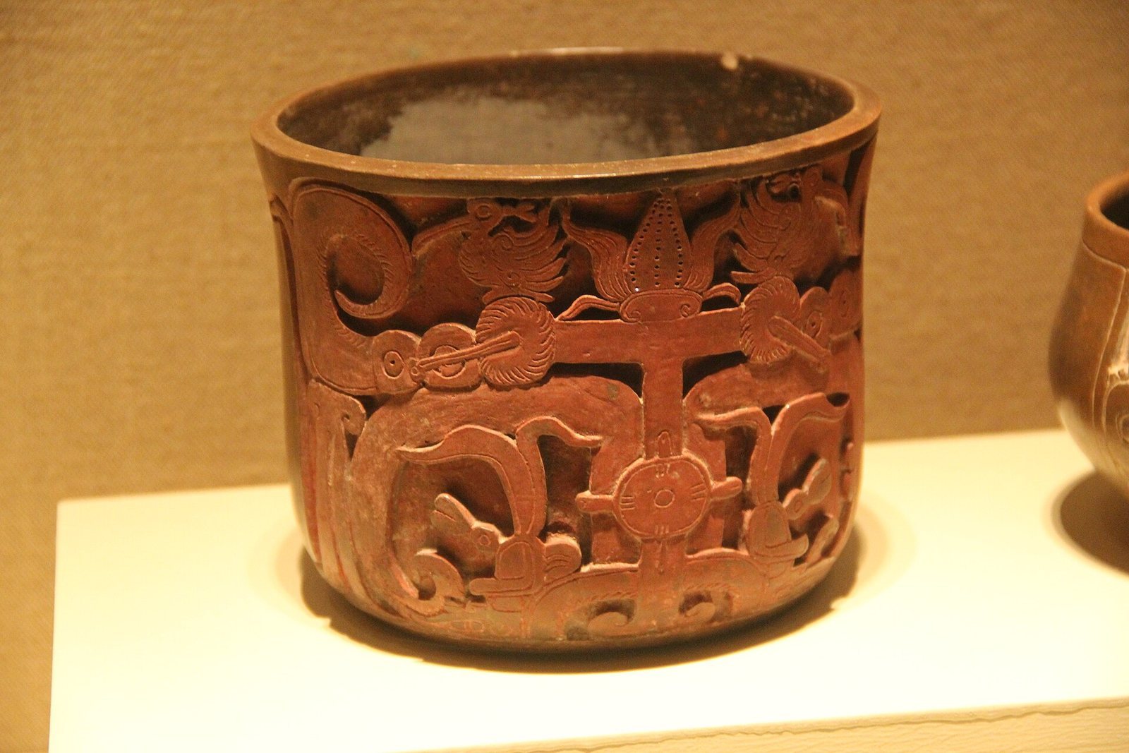
Excavations yielded about 70,000 pottery sherds and 38 complete polychrome vessels, meaning vessels decorated in several colors. Chicanel pottery, a Preclassic ceramic classification, was found in plaza fill in the southern May group, the northwestern Dzib group, the northeastern part of May’s earliest platform, and at SA-3. Much Kehpech pottery came from MA-1 and its surroundings. Ceramic production flourished around 400–550 CE and again from about 710 CE.
Tombs and other human remains
Estimates place the number of undisturbed tombs between five and eleven, a range shaped by looting. The tombs are burial chambers within monumental architecture and were generally used for people of high status. Tombs 1–5 are assigned to the Middle Classic, tombs 6–7 to the transition between the Middle and Late Classic, tombs 8–10 to the Late Classic, and tomb 11 provisionally to the Terminal Classic. All but one burial was individual, and all but two were secondary burials, in which remains had been moved after an earlier interment. Common grave goods include shell ornaments or fragments, pieces of jade masks or pendants, a small number of obsidian tools, and tripod vessels with three supporting feet.
Human and animal bones also occur outside the tombs, apparently as offerings or deliberate deposits. Most of these remains are human. Some show arthritis or osteomyelitis, a bone infection, and many teeth have severely worn enamel. A restored pyramid has wall paintings and decorative features supplemented by blocks added later.