Monte Molião: An Archaeological Settlement in Lagos, Portugal
Site at a Glance
- Popularity
- Low
- Country
- Portugal
- Primary era
- Classical
- Eras represented
- Iron Age, Classical
- Civilizations
- Celtic, Roman
- Site type
- City
On this page16 sections
History
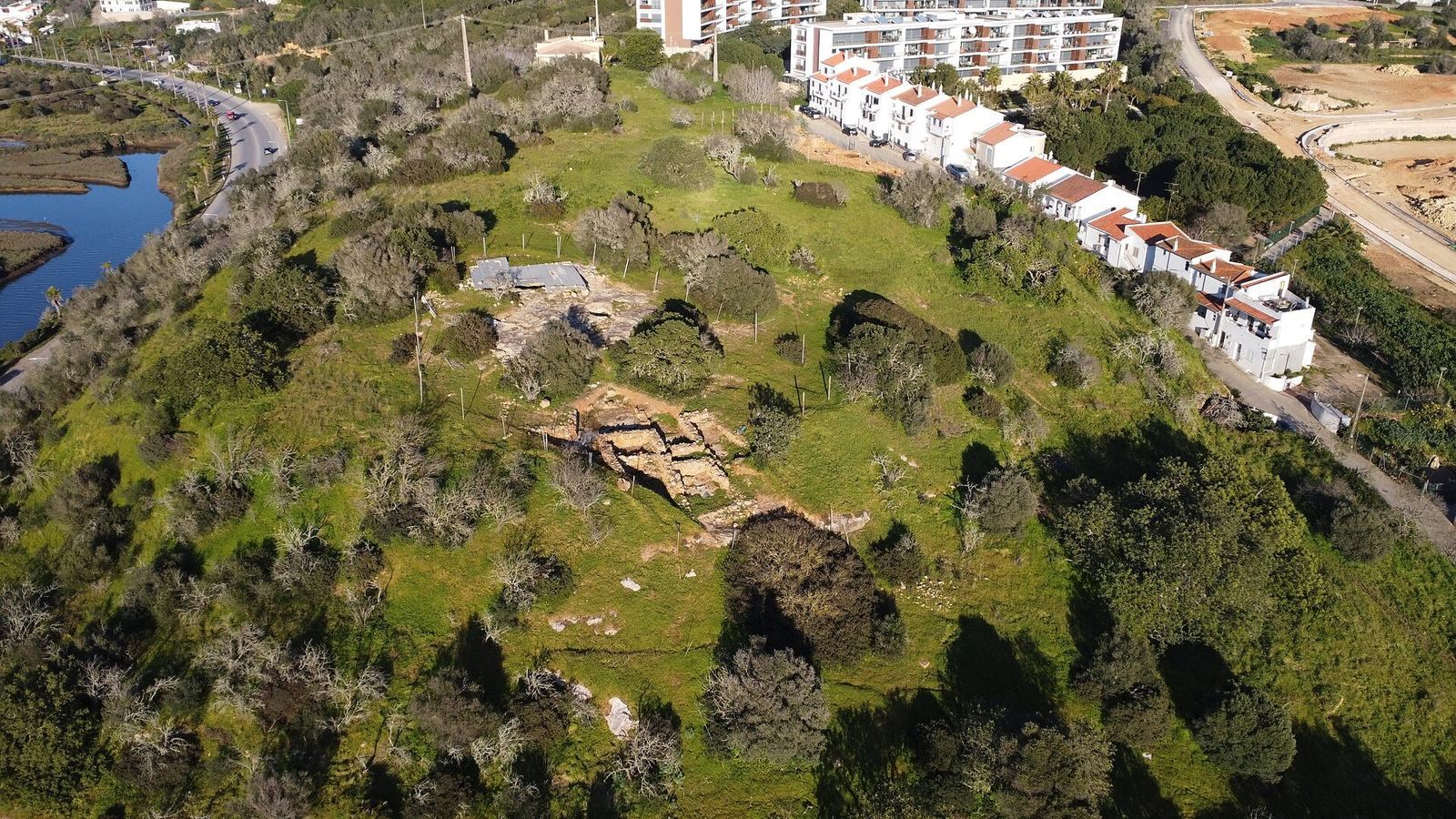
Monte Molião is an archaeological settlement on a hill beside the Ribeira de Bensafrim in Lagos, Portugal. Occupation began by the late fourth to late third centuries BC, during the Second Iron Age, a later phase of the Iron Age before Roman rule in Iberia. The settlement has also been described as Celtic in origin. Monte Molião is considered the likeliest location of Lacóbriga, a city named by the Roman geographer Pomponius Mela in AD 45.
Iron Age and Lacóbriga
A much earlier proposed foundation date of 1899 BC for Lacóbriga, attributed to the Conii, an ancient people of southwestern Iberia, is separate from the archaeological evidence for occupation at Monte Molião. The hill’s elevated position offered views over the coast and inland territory. Its location beside an estuary also provided access to the river, ocean, and resources such as shellfish. Finds from Cádiz and elsewhere in the Mediterranean point to the settlement’s participation in wider trading networks.
One uncertain reconstruction places Lacóbriga under the control of Carthage, a North African power in the ancient Mediterranean, led by its commander Hamilcar Barca. It proposes that an earthquake destroyed an earlier settlement in the fourth century BC, followed by the transfer of the urban center across the river around 250 BC by the Carthaginian commander Boodes. This reconstruction associates the move with closer access to the ocean. The sequence remains uncertain, and the growth of a new center across the river is also linked to Monte Molião’s later decline.
Roman rule and later occupation
The city identified as Lacóbriga was conquered by the Roman Republic, Rome’s pre-imperial state, in the second century BC. This occurred as people from the Italian Peninsula increasingly settled in the Algarve. Monte Molião then experienced intensive Roman occupation, with homes, industrial activity, and trade within the region and across the Mediterranean. Its role as an urban center diminished from the second century AD as a settlement on the opposite bank developed into modern Lagos.
Activity continued at the hill on a smaller scale in Late Antiquity, the transition between the ancient and medieval worlds, including during the fourth century. There was also activity during the Islamic period of Muslim rule and influence in the region. The land was later used for farming and rural habitation. Nearby Ponte D. Maria may have Roman origins.
Investigation and preservation
In the second half of the nineteenth century, Portuguese archaeologist Estácio da Veiga examined Monte Molião while preparing an archaeological map of the Algarve. In 1900, priest and investigator José Joaquim Nunes published observations on a Roman cemetery discovered during vineyard planting. António dos Santos Rocha and Joaquim Pereira Jardim investigated the cemetery that December, after vineyard preparation had already destroyed much of its evidence. Archaeologist José Leite de Vasconcelos also studied it.
Road construction damaged the archaeological area, including the cemetery; an extension of National Road 125 destroyed part of Monte Molião in 1992. Surveys in 1990 and 1991 identified remains at Monte Molião and a Roman dam at Fonte Coberta, while drilling and geophysical surveys followed at the hill in 2005. In 2006, the Municipality of Lagos and the University of Lisbon began recurring excavations, which confirmed occupation before Roman rule. Later research examined building techniques from pre-Roman and Roman phases to inform conservation. Monte Molião received Portugal’s Property of Public Interest designation in 1992.
Remains
Settlement layout and buildings
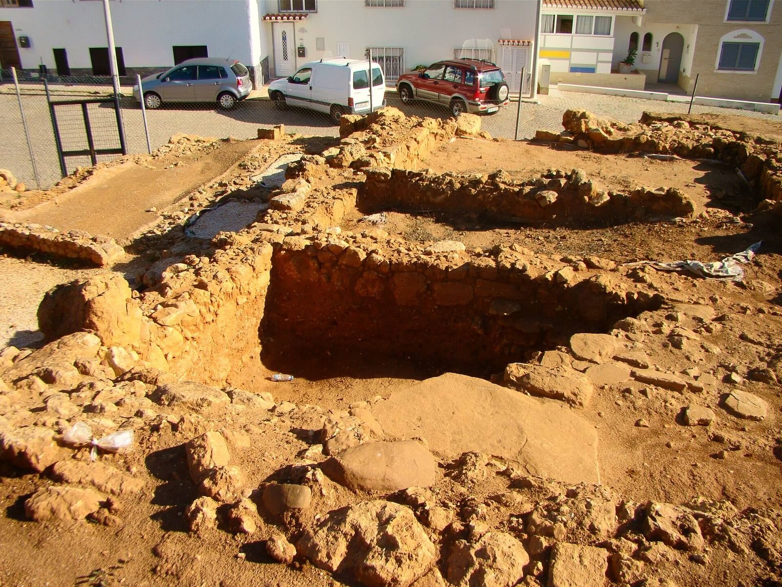
The remains occupy a hill about 30 m high beside the Ribeira de Bensafrim. The estuary once extended around most of the hill, leaving a strip of land to the north. A substantial wall, streets, homes, and work areas form the remains of a fortified settlement. Excavations have identified three areas: walls and buildings that may relate to defenses or a public structure, with streets and organized buildings of the first and early second centuries AD; older structures cut into bedrock southwest of the summit, near the cistern, from the second and first centuries BC; and summit remains of Iron Age habitation from the fourth and third centuries BC alongside Roman Republican structures, from the period before rule by emperors.
Defensive wall
Estácio da Veiga described a section of wall that ended at an acute angle. He thought it might have formed part of a defensive feature. The surviving wall is part of the evidence for the settlement’s fortified character.
Cistern
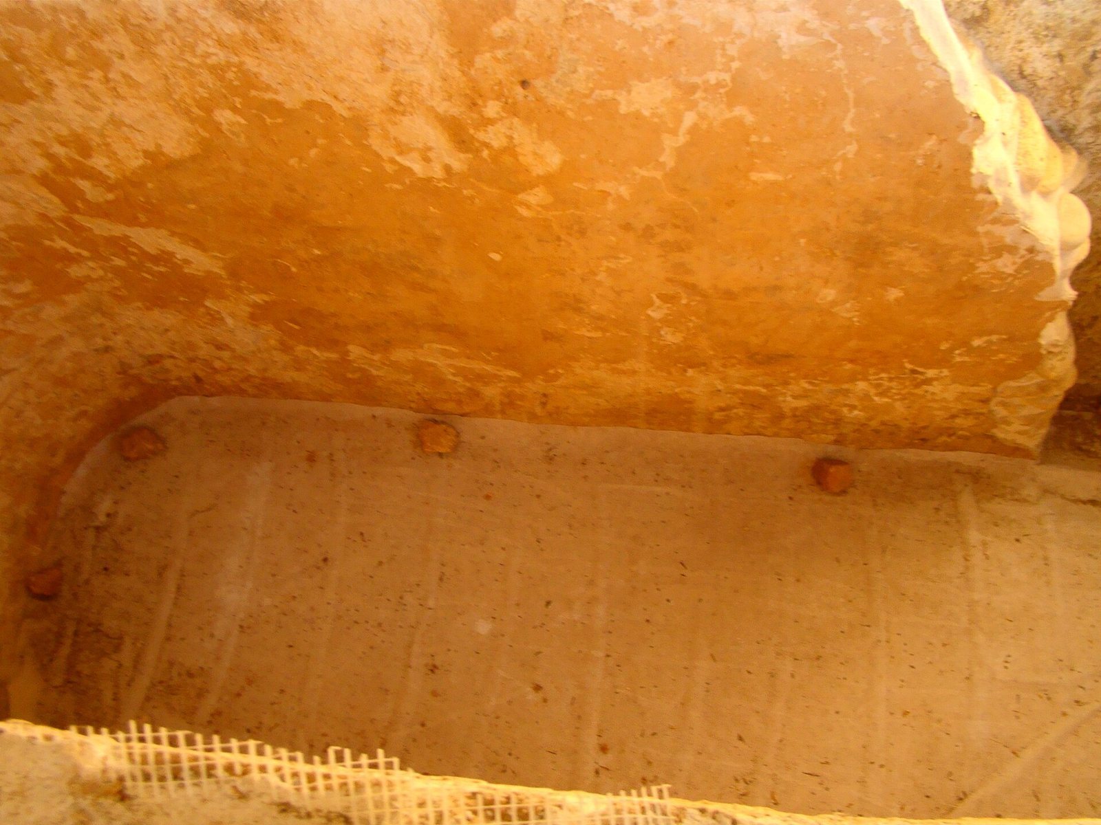
An elliptical cistern, a structure for storing water, measured 6.8 m long, 1.76 m wide, and 4.35 m deep in Estácio da Veiga’s description. It may have been built during the Roman period and lies near the older structures southwest of the summit.
Homes and working areas
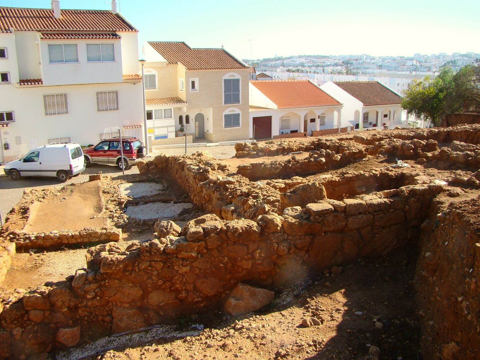
Roman-period streets connected residential and industrial structures. Work areas included ceramic kilns, metalworking spaces, and tanks for preparing fish products. In 2019, excavations in Sector A, beside Rua do Molião, revealed rooms with well-preserved domestic features and materials from the Roman Imperial period, when emperors ruled Rome. Deposits inside some rooms exceeded 1.5 m in depth. Finds included pottery, metal, glass, bone, and marine-animal remains inside large storage and transport vessels. Domestic finds from the rooms date to the Julio-Claudian and Flavian dynasties, successive ruling families of the early Roman Empire.
Roman cemetery
The Roman cemetery contained graves built in several ways. Early investigators described its graves and burial objects, but the cemetery itself was later destroyed and its location is now unknown.
Grave examined by Nunes
The grave investigated by Nunes was about 1 m deep and oriented north to south. Upright Roman roof tiles lined its walls; pressure from the soil had bent them, and tiles beside them suggested a tiled cover. The grave contained a poorly preserved skull and other bone fragments.
Graves examined by Santos Rocha and Jardim
One rectangular grave measured 1.8 m by 0.5 m. Its walls were made from earth and clay mixed with fragments of roof tiles and Roman bricks, with an inner coating of lime-and-sand mortar. Three tiles lined its base. The grave ran northwest to southeast, with the deceased’s head to the northwest. An adult skeleton lay beneath a thin plate of fine red clay, with a small vessel and bronze coin at the feet. The remains were sent to Mexilhoeira Grande for study and were damaged during subsequent handling. Another ruined grave had Roman tiles arranged as a pitched roof with two slopes.
Burial objects and practices
Burial objects included glass and ceramic vessels used for perfumed oil, as well as vessels containing cremation ash and bone fragments. Other finds included mostly funnel-shaped glass vessels, two broad-bodied vessels with narrow necks that may have served as strainers, a perforated clay plaque, an iron tool resembling a hammer, nails that retained pieces of wood, an object resembling a spear point, and a gold ring that may have been an earring. A fine-clay plate bore EX inside a circle and the scratched word MAVRI on its reverse. Nunes considered it a possible lid for a funerary vessel and suggested the inscription might identify the deceased.
A coin placed with the adult burial has been associated with the belief that the dead paid for passage in the boat of the dead. The bronze coin was described as bearing an image of Julia Avita Mamaea, but its assigned date in the 330s or 340s AD conflicts with that identification, leaving the grave’s date uncertain. A separate silver coin from the cemetery bore the letters MFAIC and images of a chariot drawn by four horses with Victory and a crown, and of a helmeted Pallas. Nunes proposed that some cremations took place at the cemetery, based on patches of black earth near graves. The combination of grave construction and Roman burial customs has been interpreted as evidence that an older local practice continued under Roman rule.
Finds and collections
Coins, personal objects, and sculpture
Finds from Monte Molião include a bronze statue of Mercury, the Roman god associated with commerce and travel, dated to the second century AD, and two gold earrings dated to the fourth century AD. Other discoveries include Republican coins, pottery, glass and metal objects, human bone, marine-animal remains, and cylindrical beads. Recorded coins include a silver denarius, a Roman coin, bearing the name of the Titurius family, a bronze coin of the Lusitanian group, and coins associated with Salacia, Claudius, and Faustina. Most of the site’s archaeological material is held at the Lagos Municipal Museum. The bronze statue of Mercury is at the National Museum of Archaeology in Lisbon.
Pottery and trade
Marked fine Roman pottery points to production in North Africa, Asia, Greece, and the Italian Peninsula. Other discoveries include plain and decorated pottery from Sagunto and pottery with a dark, polished surface. Together with finds from Cádiz and the wider Mediterranean, these objects reflect connections extending beyond the settlement’s immediate surroundings.