Alalakh: A Bronze Age Regional Center in Hatay, Türkiye
Site at a Glance
- Popularity
- High
- Country
- Turkey
- Primary era
- Bronze Age
- Eras represented
- Stone Age, Bronze Age
- Civilizations
- Hittite
- Site type
- City
On this page23 sections
History
Alalakh was a Bronze Age city at Aççana Höyük in Hatay, southern Türkiye. A regional center by about 3400 BC, it developed into a major urban settlement during the second millennium BC. The fertile Amuq Plain connected routes from Aleppo, Mesopotamia, and Palestine with Anatolia and the Mediterranean, while the Orontes River linked the city to the sea. Trade with Cyprus is reflected in both archaeological finds and written records, and ivory was an important source of wealth in a region known for its elephant herds. Some dates remain uncertain because Alalakh’s chronology depends partly on comparisons with Egyptian and Hittite history.
Early urban growth and destruction
Alalakh may have been attacked and destroyed around 2300 BC. Archaeologist Leonard Woolley connected this destruction with Sargon of Akkad, ruler of the Akkadian Empire in Mesopotamia, and assigned the end of Layer XII to his campaign. Naram-Sin, another Akkadian ruler, recorded a campaign near the “Upper Sea,” but it is not known whether he attacked Alalakh.
Yamhad, Mari, and the local dynasty
By about 1750 BC, Alalakh belonged to Yamhad, an Amorite kingdom centered on Aleppo, although its political ties sometimes included Mari, an ancient city-state on the Euphrates. Mari’s texts call the city Alakhtum. They describe Yamhad’s king Sumu-Epuh transferring its territory to his son-in-law Zimri-Lim, king of Mari, while keeping his overlordship. After Mari fell in 1765 BC, Alalakh appears to have returned to Yamhad’s direct control.
A branch of Yamhad’s royal family governed Alalakh as a vassal city. Yarim-Lim, identified as a son of Hammurapi I and younger brother of Abban of Yamhad, was the first local prince; he may have commissioned the palace in Layer VII. In the Late Bronze Age, Alalakh was the capital of the local kingdom of Mukiš. The city was destroyed during the 17th century BC, probably in a campaign by Hattusili I, a Hittite king. Written evidence becomes sparse after this destruction and resumes around 1500 BC, when a new local dynasty ruled.
Idrimi and Mitanni rule
Idrimi, son of Ili-ilimma I, left Aleppo and became ruler of Alalakh under Mitanni overlordship. Mitanni was a kingdom that held power across parts of northern Mesopotamia and Syria. Idrimi’s inscribed statue recounts his flight, travels through the Levant, and return with followers gathered among groups called the Habiru, a term that does not by itself identify a single people. Parts of the statue’s account have uncertain historical reliability. Barattarna, king of Mitanni, recognized or installed Idrimi as ruler, and Idrimi reigned for more than 30 years.
Alalakh was probably a Mitanni vassal through much of the 15th century BC. Idrimi’s successor Niqmepa is especially well represented in the city’s texts. An adoption document describes Ili-ilimma II adopting a man as his father, thereby acquiring the right to inherit his property. Itur-Addu was probably Mitanni’s last vassal ruler at Alalakh. Egyptian pharaohs Thutmose I and Thutmose III campaigned in northern Syria; the later campaigns may have aimed to weaken Mitanni, but they did not establish lasting Egyptian control of Alalakh.
Hittite rule and the end of the city
In the second half of the 14th century BC, Suppiluliuma I of the Hittite state based in Anatolia conquered Mitanni and brought Alalakh into the Hittite sphere as a vassal. The name Mukiš was also used for the city and its local territory. Hittite records describe unrest involving Mukiš, Nuhassa, and Niye. One text says that the king of Ugarit, a coastal city-state, alerted the Hittite ruler to a revolt and received much of Mukiš’s territory in return.
Alalakh remained prosperous under Hittite rule, and imported Mycenaean pottery reflects its connections beyond the region. The city was destroyed shortly after 1200 BC. This destruction is commonly linked to the upheavals associated with the Sea Peoples, a modern term for groups mentioned in Egyptian texts during the eastern Mediterranean crises at the end of the Bronze Age, but that explanation is uncertain. Alalakh did not recover its former scale. Efforts to restore its temple and citadel were abandoned, although later graves and a proposed Iron Age reoccupation, broadly dated to about 1200–600 BC, indicate continued activity. The inhabitants established a new city at Tell Tayinat. The area’s commercial role later shifted to Al Mina and then Seleucia Pieria.
Excavations and written evidence
Woolley led excavations for the British Museum in 1935–1939 and 1946–1949. He identified 17 building levels, or successive archaeological layers, and excavated large areas mainly in Layers VII–I. The lower levels are known chiefly through smaller exposures, with the deepest investigation concentrated at the city temple. Later work revised his dating of the upper sequence, especially Layer VII.
More than 500 clay tablets inscribed in cuneiform, a script made by pressing wedge-shaped marks into a surface, were recovered, especially from Layers VII and IV. About 175 are assigned to Layer VII and roughly 300 to Layer IV. Most are in Akkadian, with Hurrian influence, while the wider collection also includes Hurrian, Hittite, and Sumerian texts. They record legal decisions, landholding, palace management, goods, inventories, rations, and individuals; in legal cases, Alalakh’s king served as the highest magistrate. The Layer IV texts describe a small landholding elite close to the king, a middle group that included craftspeople and merchants, and poorer farmers and people without homes. Some free men served as spearmen or archers in wartime and could be required to work in peacetime. Hurrian personal names, rare in Layer VII texts, are widespread in Layer IV.
University of Chicago surveys began in 1995, followed by excavation seasons from 2003. Work resumed in 2006 under archaeologist Aslihan Yener with Turkish institutional partners. The combined surveys and excavations refined the site chronology and examined households as well as palaces.
Remains
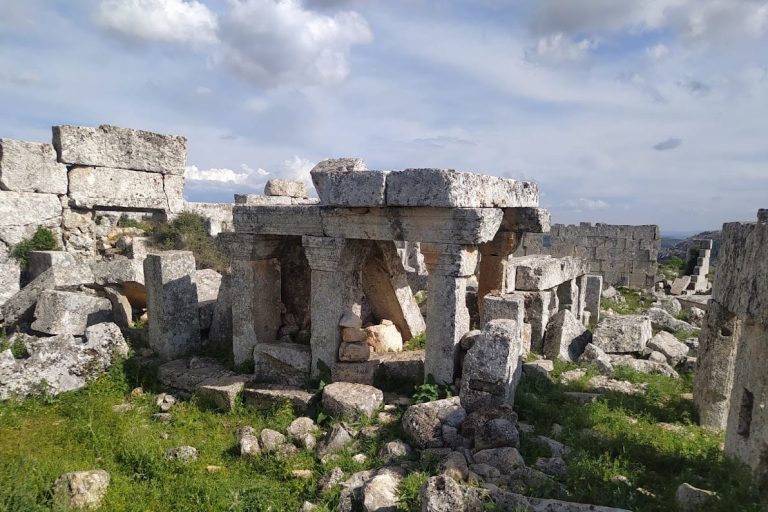
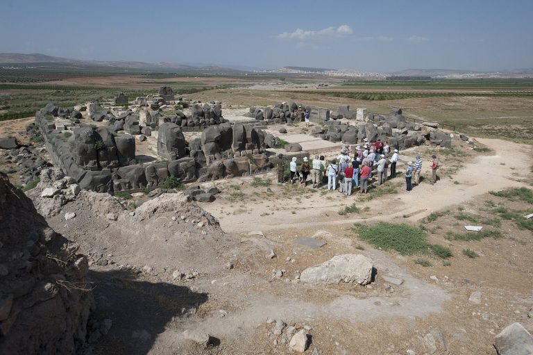
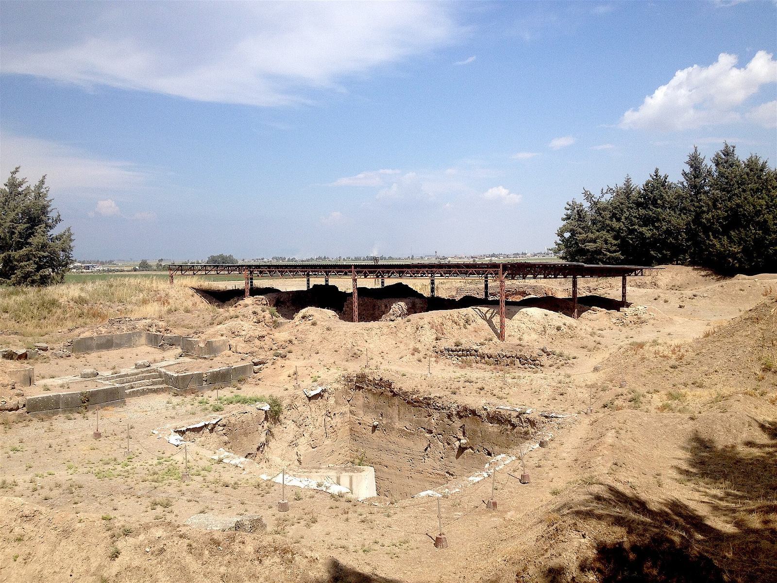
The settlement mound covers about 22 hectares, measures approximately 750 by 300 metres, and rises about 9 metres above the plain along a northwest–southeast axis. Its higher northern sector contains palaces, a fortified citadel, and the city temple; residential areas extend to the south. A city wall enclosed the settlement, and both inner and outer walls belonged to Layers II and I. A gate from Layer VII was also excavated. The temple occupied the same location for more than 2,000 years.
Early temples and palaces
Temples from Layers XVII to XI
Layer XVII, dated to about 3400–3300 BC, includes a deep block-like feature that may have served a ritual purpose, along with wheel-made pottery, some of it painted. Around 3200 BC, a monumental temple courtyard in Layer XVI measured about 20 by 7 metres. A block from the earlier level stood as an altar in the courtyard’s centre, with another massive block to the north. Brick paving covered the courtyard, and its walls were coated in white plaster. In Layer XIV, the temple stood on a platform and comprised an open forecourt, an entrance hall lined with benches, and a sanctuary. An earlier block projected above the sanctuary floor and may have retained special reverence. Strengthened walls and a similar plan continued into Layer XIII; the temple was later renewed in Layers XII and XI, where a massive platform survives.
Homes and palaces from Layers XV to XI
In Layer XV, houses appear to have been repaired repeatedly rather than replaced. Layer XIII brought more substantial houses and a reorganization of the residential area; one house had a large interior room. A monumental palace was built in Layer XII on ground previously occupied by houses. Its excavated remains include four mud-brick columns in a row, a wall about a metre thick that may have bounded a courtyard, and smaller rooms. The palace was renovated at least twice. Layer XI had a new palace with six excavated rooms, very thick mud-brick walls, and fired-brick floors. Later, in Layer X, the palace was renewed and isolated rooms with vaulted, curved ceilings were found; a platform marks the temple in that layer.
The Layer VII palace and temple
Palace and wall paintings
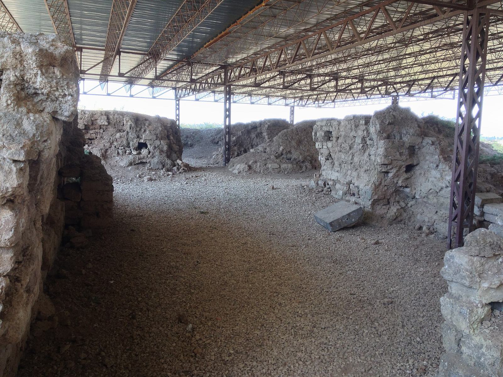
The Layer VII palace stood in the northeast beside the city wall, with some of its own walls also forming part of the city boundary. The elongated mud-brick building measured about 20 by 60 metres and had two courtyards surrounded by rooms. Its northern section probably served representational functions and its southern section economic ones. Basalt slabs lined the lower walls in the north; the ruler’s private rooms and those of his family were probably upstairs. A basement reached by stairs had walls lined with large stone slabs.
At least two upper-storey rooms had frescoes, paintings made by applying pigment to wet plaster. Their technique is associated with Minoan painting, a Bronze Age tradition centered on Crete, while secco painting is applied to dry plaster. More than 70 fragments from Layer VII were recovered during excavations in 2015–2019 and radiocarbon-dated to about 1780–1680 BC. The fragments are poorly preserved. One room had a white ground with purple and yellow-brown bands near the top of its walls; another had a red ground and may have shown figures, with traces of a tree, a bull’s horn, and possibly a griffin. It has been suggested that traveling artists produced the paintings.
Temple and gate
Beside the palace, the Layer VII temple had massive walls, a large central hall, and a narrow entrance hall. Sculptural finds include a head showing Egyptian influence and a locally made head traditionally called the “head of Yarim-Lim,” probably representing a palace attendant. An open space lay in front of the temple and also bordered the palace. The palace burned before the end of Layer VII; residential construction later occupied the area in Layer IV.
Citadels, temples, and houses in Layers VI to IV
Layers VI and V
Layer VI has a temple wall and modest remains of a citadel. Its finds include pottery decorated with red and black animals and geometric designs on a beige ground, Cypriot imports, and glazed vases with raised images of women. A core-formed glass vessel, made by shaping glass around a removable core, is among the early examples of this technique, although it may postdate the layer. The transition from Layer VI to V shows no destruction horizon. New buildings were erected, the citadel was renewed, and a temple courtyard was surrounded by rooms. Excavated features also include a city gate and part of the residential area. Finds from Layer V include two roughly made basalt figures and fragments of an Egyptian faience vase, a glazed silica-based material, bearing an inscription and a depiction of an official whose name is lost.
Layer IV palace, citadel, temple, and houses
The Layer IV palace, about 20 by 40 metres, stood south of the Layer VII palace. From a courtyard, an entrance decorated with two columns led through an entrance room to a second hall, which connected to a staircase and the palace’s inner courtyard. Most rooms were arranged around that court. A side wing, probably added later, also had rooms grouped around a courtyard; thick walls and two staircases indicate at least two storeys. The citadel lay west of the palace and was partly overlain by it; its surviving plan suggests two courtyards surrounded by rooms. The approximately square temple had two elongated entrance rooms and a sanctuary with a broad niche in its rear wall.
Layer IV houses were mud-brick buildings, generally two storeys high, with rooms around courtyards. One had a broad entrance decorated with polished basalt and a room with wall paintings. Numerous burials lay beneath the floors of poorer houses, unlike in the wealthy residences. The dead were usually placed on their sides with their hands before their faces, and simple ornaments were common grave goods. Finds include Nuzi-style pottery, a painted style associated with the Mitanni period, with dark surfaces and white geometric designs, as well as a tripod, a cosmetic vessel from the palace, and an imported Mycenaean vessel.
Hittite-period citadel and later buildings
Citadel
A large citadel built during the Hittite period occupied the northwest of the city. It measures more than 80 by 80 metres, making it the largest building identified at Alalakh, and remained in use in Layer II. Its foundations, below door-sill level, preserve a plan of many rooms.
Temples in Layers III and II
The Layer III temple had an open forecourt and an altar. Pillars framed the entrance to the temple proper, which led through two entrance rooms to the sanctuary. Its very thick walls and a staircase indicate at least one upper storey. The Layer II temple stood on the same site, with two sanctuaries instead of one. It shows no clear Hittite architectural influence.
Layer II houses
Excavated Layer II houses stood near the city wall, separated from it by a street, and were mostly arranged around courtyards. Staircases and thick walls indicate that many had at least two storeys. Drains from some rooms ran partly beyond the houses; other features include hearths, rooms with cement floors interpreted as bathrooms, and refuse pits. Burials within houses became more common than in the earlier wealthy residential buildings. Pottery includes Atchana ware, a local form of Nuzi ware with painted motifs, particularly floral designs influenced by Minoan vase painting.
The Layer I temple and finds
Temple
The Layer I temple had two building phases. The first included a courtyard, a columned entrance, a broad entrance hall, and a sanctuary reached through another columned entrance. Three niches were set into the sanctuary’s rear wall. After a fire, the temple was rebuilt: the entrance columns were removed and two cross-walls divided the hall. A low stone platform stood in front of the entrance, flanked by two monumental lion sculptures. One block in the platform reused a relief depicting the Hittite king Tudhaliya IV.
Idrimi statue and treaty tablet
Rooms of uncertain function near the temple courtyard contained floor pits. One held a statue of Idrimi, perhaps concealed shortly before the city’s destruction. The statue shows him seated on a throne in a Syrian wraparound robe, with lions beside the throne, and bears an autobiographical inscription. Its archaeological context and the date of the inscription have been debated. The statue is now in the British Museum. A separate cuneiform treaty tablet associated with Idrimi and Pillia, ruler of Kizzuwatna in southeastern Anatolia, measures 12 by 6.4 centimetres and is also held by the British Museum.