Bagras: A Medieval Frontier Castle in Turkey


Site at a Glance
- Rating
- 4.1
- Popularity
- Low
- Country
- Turkey
- Primary era
- Medieval
- External website
- Open
- Eras represented
- Medieval
- Civilizations
- Byzantine, Crusader, Kingdom of Cilicia, Knights Templar
- Site type
- Military
- Remains
- Castle
On this page12 sections
History
Bagras is a ruined medieval castle in Turkey, built and developed through Byzantine, Crusader, Armenian, and Muslim phases in the Amanus Mountains. It controlled the eastern approach to the Syrian Gates, the major mountain pass linking northern Syria with the Mediterranean coast, and overlooked part of the Plain of Antioch and the route between Syria and the Cilician Plain.
Ancient and Byzantine Foundations
The ancient site was known as Pagrae. Strabo described it as a natural fortress near Gindarus, at the head of the pass leading over the Amanus Mountains into Syria. Pliny the Elder listed Pagrae among the tetrarchies of Syria, territorial divisions governed by subordinate rulers, within the broader region of Cyrrhestice and the Syrian interior.
Around 638, the Arab historian Al-Baladhuri described an attack at this location on approximately 30,000 Ghassanid Arabs and their families as they fled the Muslim invasion of Syria. The number was probably exaggerated. Many Ghassanid tribesmen later served in the Byzantine army.
Byzantine fortifications were erected in late 968 by Emperor Nikephoros II Phokas on earlier foundations. Phokas pursued the restoration of Byzantine control in parts of Syria and Anatolia. He stationed 1,000 infantry and 500 cavalry at Bagras under the commander Michael Bourtzes. The castle served as a base for raids around Antioch and helped obstruct communications between Antioch and the Hamdanid emirate, a Muslim principality ruled by the Hamdanid dynasty in northern Syria and Upper Mesopotamia.
Crusader and Armenian Contention
The fortress fell to the Seljuks and was captured by the Crusaders in 1098 during the First Crusade. In the twelfth and thirteenth centuries, it became a key stronghold on the frontier between the Principality of Antioch, a Crusader state centered on Antioch, and the Armenian Kingdom of Cilicia on the northeastern Mediterranean coast.
Around 1153, the Knights Templar, a medieval military-religious order that held castles and defended Crusader territories, rebuilt Bagras over Byzantine remains. They held it intermittently with the Principality of Antioch until surrendering it to Saladin on 26 August 1189. Saladin, founder of the Ayyubid dynasty, had defeated or absorbed several Crusader strongholds during the late twelfth century.
Muslim forces abandoned Bagras in 1191 as the army of Frederick Barbarossa approached during the Third Crusade, destroying as much of the fortress as they could. Levon I, also known as Leo I, then captured it for the Armenian Kingdom of Cilicia. His refusal to return the castle created prolonged conflict among the Armenians, the Antiochenes, and the Templars.
After negotiations and papal intervention, Bagras returned to the Templars around 1215 or 1216. It became their northern headquarters in the Crusader East. An Armenian chronicle records that the castle withstood a siege around 1229 by Al-Aziz, emir of Aleppo, and his cavalry.
Destruction and Abandonment
After Baibars conquered Antioch in 1268, the Templar garrison at Bagras lost heart. One brother deserted and handed the castle keys to Baibars, a Mamluk sultan whose campaigns brought major Crusader strongholds under Muslim control. The remaining defenders destroyed what they could before surrendering. The Templars then withdrew, and the castle was abandoned by them.
Bagras nevertheless remained connected with Armenian military activity. In 1305, Hethum II and Leo IV of Armenia defeated a Mamluk raiding force in a nearby pass. The fortress was not incorporated into the larger defensive system that the Armenians developed along the Taurus and Anti-Taurus Mountains of Cilicia between the twelfth and fourteenth centuries.
Ottoman control of the region and Syria from the beginning of the sixteenth century reduced Bagras’s strategic importance. The fortress remained abandoned and gradually fell into ruin. A. W. Lawrence surveyed the site in 1938 and updated his study in the field in 1951 with historical documentation, photographs, and plans. His work was published in 1978. Robert W. Edwards carried out a comprehensive historical and archaeological investigation in 1979 and produced an architectural plan of the three levels.
Remains
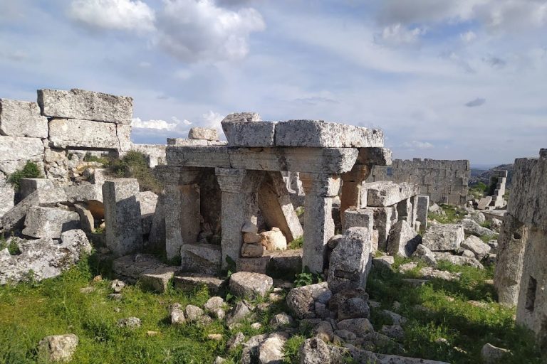
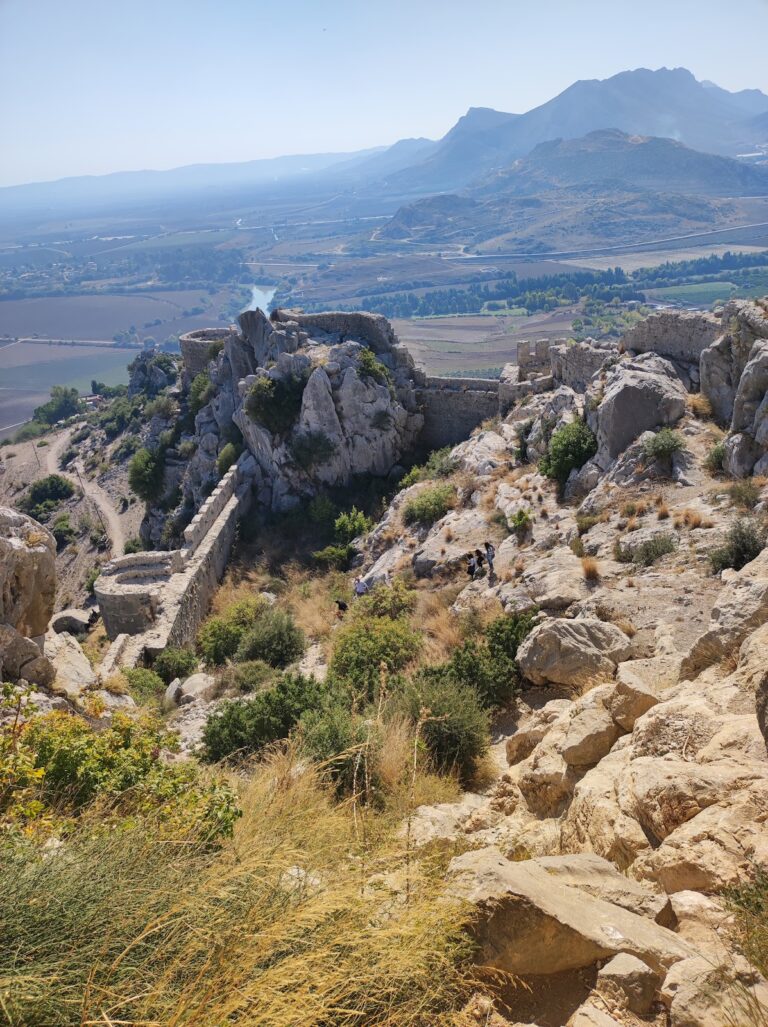
Bagras occupies a rocky summit at approximately 350 metres above sea level, with steep slopes protecting it particularly on the west and southwest. The ground determined the fortress perimeter, while the surviving complex is arranged across three primary levels. Built mainly of limestone, it contains more than thirty chambers. Early Byzantine defenses occupied two levels around a rocky knoll, but most exposed buildings belong to the Armenian and Templar construction phases of the twelfth and thirteenth centuries.
Defenses and Access
Entrance and Keep
The former approach came from the east along a ramp beside the edge of a steep cliff. Earthquakes destroyed this access route. A rectangular keep protected the entrance and formed part of the fortress’s defensive organization.
Lower Defensive Line
A second defensive line survives at a lower level on the eastern and southwestern sides of the fortress. The exterior masonry largely belongs to the Frankish occupations, while Armenians repaired towers and walls during their brief periods of control. The construction resembles contemporary Armenian fortifications, using relatively small, irregular stones with rounded projections extending beyond the wall face. This treatment is especially comparable to the Armenian fortress of Sis, built by Leo I, and has led to the interpretation that the Templars employed Armenian architects and builders.
Buildings and Water Supply
Assembly Hall and Chapel
The surviving complex includes an assembly hall with large damaged windows and a chapel whose eastern end terminates in a flat wall. These buildings form part of the internal structures distributed across the fortress levels.
Halls and Aqueduct
Large halls, including partly subterranean rooms, are supported by massive columns. Their size indicates that the fortress could accommodate a large garrison. Remains of an aqueduct, a raised structure carrying water across uneven ground, supplied Bagras from mountain springs to the west. It crossed the intervening ravine approximately 18 metres above its floor. A spring at the foot of the castle was known during the Middle Ages as the Fountain of Gastin.
Associated Religious Remains
An Armenian monastic community known as the “Community of Jesus” was probably located near the castle. It may have been destroyed by the earthquake at Marash in 1114.
Nearby sites